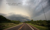
 The weather pattern continued to improve for chasing on the Plains following the extended slow period during most of May. On the 21st, chasers pondered a very large slight risk area as painted by the SPC in their 13Z outlook. This risk area extended from ne NE southward to central TX. The 5 percent tornado risk extended from about Kansas City to Waco. Our group (including Tempest guides Chris Gullikson and Chad Cowan) began the day in Wichita, and I heavily favored a target in e KS given proximity, very favorable upper flow and more than adequate instability. Skies here were mostly clear, also, compared to the cloudier (and morning MCS-ravaged) OK/TX region. Around 1 p.m. CDT I posted some forecast thinking to the CFDG chase folks:
—-
Upper flow looks very good today across E KS, and we have a weak surface low near Greensburg and decent southerlies from the surface to 850 east of I-35/1-135 in KS. I will be playing the eastern 1/3 of KS today — not really sure where yet, but the latest RUC paints a bit of a focus in terms of convergence and CAPE up towards Topeka and Holton. We are in Wichita and I think we’ll drift NE towards Emporia. That should be a good staging area. The satellite image shows some cu or stratocu around there, too.
—-
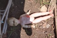
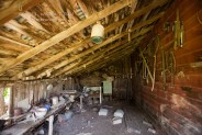
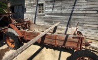
Convection was not anticipated until mid-to-late afternoon, so we weren’t rushed for lunch and we had time to browse an abandoned home near Americus, just north of Emporia. I felt very comfortable position-wise in terms of longitude, but was still rather unsure as to where storms would initiate from se KS to ne KS. Some promising storm towers in our vicinity near Emporia lost out against the cap, and, towards 4 p.m., there were indications that we needed to be about 40 miles farther north, where a couple of lines of cumulus were showing up on satellite. My NOW post at 3:45 p.m. CDT:
—-
We are just north of EMP and will head north to about I-70. SPC mesoanalysis page shows better mixing ratios E-W up along I-70 and better effective bulk shear towards Manhattan. Satellite shows two possible boundaries intersecting not too far WSW of Manhattan.
—-
On our way north towards I-70 via Council Grove, a couple of healthy cumulonimbus clouds quickly developed. One of these wound up to our southeast when we reached the Interstate, (south of Manhattan), so we blasted east in order to get into position. The storm organized fairly quickly, was moving northeast at perhaps 25-30 mph, and it was obvious that it was the one to be on. And, as it matured into a supercell that was looking tornadic, it was moving into a very dense road network —- Topeka, Kansas! This is a good place to paste my chase account that was written shortly after the chase:
—-
Quite an amazing supercell and chase around Topeka today. This version will be somewhat short as we just got into the motel in Emporia at 1 a.m. —- we had to wait for tornadic storms to clear out of the way this evening. Our target area of I-70 in the eastern 1/3 of KS around Topeka worked out well, and we were just SW of TOP as a cell organized and approached the city. Structure improved markedly as it moved towards Topeka’s south side, and a persistent and low wall cloud teased the ground. We watched from the east side of Forbes Field (AFB). The action area shifted to our NW, and a funnel cloud or two came and went. We repositioned to the northeast side of Topeka, and observed (during repositioning) what looked to be a tornado to our NW about 5 miles during this leg, but apparently there was no official report of one. I really thought that part of Topeka was getting hit. But, we had only intermittent views due to trees and terrain and buildings.
A very persistent and violently rotating wall cloud continued over the city, and we came up to its south edge just east of Tecumseh. Rotation and motion was wild and tornadic funnel clouds would make brief appearances, and quickly disappear. This seemed to be the theme of the day for this cell —- awesome structure and low-level rotation in the wall cloud, with funnel after funnel, but it refused to bring violent rotation to the surface. The Kansas River was in the way, and we finally found a crossing to the north side at Lecompton. We went east to Perry and north again, with a great look at the storm structure and wall cloud, which always seemed to be hovering more than half of the way down from cloud base to ground. The RFD became quite wet, blocked our view of the wall cloud, and that’s when tornado reports started to come in. I never witnessed a circulation on the ground on this chase day. We watched the supercell drift off to the northeast at sunset, south of Oskaloosa. Another supercell or two skirted by just to our north while I made room reservations —– Topeka was full, Ottawa was full, finally Emporia had 12 rooms for our group, barely.
An intense tornadic supercell plowed eastward just north of I-35 from Emporia to Reading after sunset, hitting Reading and causing great damage, apparently. When we got south to view the storm southwest of Ottawa, it had weakened considerably. Other new tail-end cells towards Emporia distracted us and we had to get out of the way of one, by diving south to Waverly.
Saturday was a crazy, crazy chase day!
—-
And now for the pics! But first, a couple of links to video shot by the other two Tempest Tours guides with us today—
Chris Gullikson’s fabulous time lapse video of the supercell and chase through the eastern side of Topeka
Chad Cowan’s fabulous time lapse video of the storm
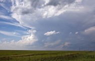
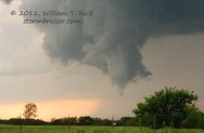
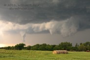
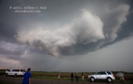
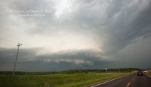
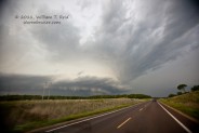
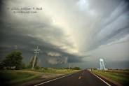
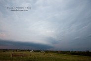
The first four images above are from an abandoned homestead near Americus, followed by one of the developing CBs west of Topeka, and then the organizing storm base of our target cell as it neared the southwest edge of Topeka. The eight below are all from the east side of Forbes Field, looking west and then northwest at the updraft and wall cloud and funnel clouds.
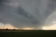
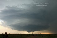
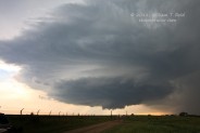
The first three below are from east of Tecumseh, with the fast-rotating wall cloud just to our north. The final images are of the supercell well northeast of Topeka, north of Perry, to Oskaloosa.







Leave a Reply
You must be logged in to post a comment.