This was a big day for us in Missouri, in the Ozarks, of all places! After coming up empty on the big high risk day yesterday in OK/KS, the chase gods smiled on us today. For some reason my infrequent forays into the Show Me state wind up paying off. Of course, I don’t bother going into Missouri unless there is a good tornado chance and there are no other options, so that explains a lot!
This was the final day of this very productive late-May chase pattern and the 9th day of 10-day Tour 3, and a chance to make up for the foibles and frustrations of May 24th. Unfortunately, Dallas and Indra had to go back to Los Angeles and Channel 7, and they headed back south to Dallas for their flight. We left the Apple Tree Motel in Independence, KS, and headed for the hills and forests of southern Missouri —– GAD.
SPC painted a large (and hatched) HIGH RISK area in their morning outlooks from southeastern MO eastward into KY/TN/IN/IL. The wording in the discussion was a bit intimidating:
FARTHER EAST...SEVERAL MODEL SOLUTIONS INDICATE THE DEVELOPMENT OF
   CONVECTION IN THE WARM SECTOR OVER PORTIONS OF NORTHEAST
   AR/SOUTHEAST MO/SOUTHERN IL/WESTERN KY...SPREADING INTO WEST TN AND
   SOUTHERN IND.  0-3KM SRH VALUES OF 250-400 M2/S2 COUPLED WITH LONG
   HODOGRAPHS AND HIGH INSTABILITY SUGGEST THESE STORMS WOULD LIKELY BE
   DISCRETE SUPERCELLS WITH AN INCREASING RISK OF MULTIPLE
   STRONG/VIOLENT TORNADOES AND VERY LARGE HAIL.
That is precisely what I like to see when leading 15 people into the hilly jungles! Well, maybe not so much. If the storms are wet and the action areas are rain-wrapped, then chasing in Missouri is not fun at all, and can be very dangerous.
I didn’t really have a specific target area in mind when we crossed into Missouri from Kansas late morning. I basically just wanted to get into the high risk area of southeastern Missouri and then figure things out as the day progressed. Some chasers were favoring northeastern Arkansas and/or western Tennessee. Well, we had to get east first and then fine tune. We hopped onto I-44 near Joplin and continued to Springfield, and continued east on U.S. 60 towards Willow Springs, Van Buren, and Poplar Bluff. I had never been through this part of Missouri, and I was concerned that the road might be a bit slow and curvy since it cuts right through the Ozark Mountains. I was delighted to find that the road was a nice divided highway with normal highway speeds, and light traffic!
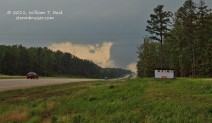
Some 50 miles or so east of Springfield, a cumulonimbus updraft was exploding and “anvilling” out quickly not too far to the northeast. It was only 2:15 p.m. CDT! This storm moved quickly to the northeast and dumped one-inch hail on Houston, in Texas County, MO. From Willow Springs, fifteen minutes later, another impressive young updraft was easily visible well to our southeast. The visibility was excellent and the sky was blue and the terrain and trees were not too much of a nuisance, thank goodness. This developing cell was perhaps 50 miles distant, just south of the MO/AR border, and would be one that we might be able to intercept somewhere down U.S. 60. It was moving into the High Risk area, so the chase was on! Here is a pic of the hailer north of U.S. 60:
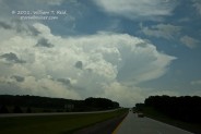
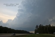
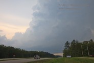
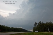
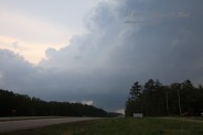
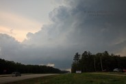
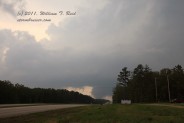
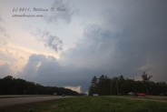
We arrived in Van Buren, MO, at 3:20 p.m. CDT, and our target cell was tornado-warned and about 20 miles to our south. (The storm produced an EF-1 tornado near Myrtle, on the MO/AR border, SSW of Van Buren, just before 3 p.m. CDT.). It was moving northeastward at around 40 mph, so we continued east on U.S. 60 to Ellsinore, a tiny town in extreme eastern Carter County. The map shows the Mark Twain National Forest here, and we were unable to get a decent look at the lower portion of the storm due to the hills and trees. With the supercell approaching from the southwest, we were under the anvil and had some rain to deal with, but generally the conditions were not bad at all. In fact, I don’t recall any lightning or hail or heavy rain as we cut in front of the updraft between Van Buren and Ellsinore. I elected to stop at a roadside convenience store at Ellsinore, as this put us pretty much directly in the path of the storm’s impressive “couplet” —- the radar signature which shows where strong rotation is evident. Chris Gullikson suggested that this spot was likely a little too risky to stay at, given that we didn’t have a good view of the approaching updraft base and we might have a quick and unpleasant surprise. I agreed, so we went a few more miles ESE on 60 and looked for a good high point. We found one (where a convenience store was) and looked back to the southwest, where a splendid and tilted supercell updraft dominated the view! Still, a little hill and its tall trees obstructed our view of the base of the updraft. Given recent reports, we figured that there was a good chance that a tornado was in progress with the cell. Chad was along U.S. 60 and waving frantically to westbound vehicles to alert them to the danger ahead! Our group gathered along the shoulder and peered towards the west, along the highway’s right-of-way where trees had been cleared and a low-level view was afforded. What would we see when the storm base crossed the road?! Check out the images:
Obviously, a good-sized and highly visible tornado was in progress as the storm crossed U.S. 60 from left to right. These images were taken from 3:54 to 3:57 p.m. CDT. It is a shame that the terrain and trees allowed only a momentary glimpse for us, as this was a very long-track and potentially violent tornado. We were on a classic supercell with a large tornado without any pesky rain-wrapping, but how were we going to be able to actually SEE what was going on?! We were in a large pull-out area that was cleared of trees, and we could barely see the upper part of the tornado as it moved to our northwest. This was exciting, but very frustrating, too! I estimated that the tornado was about two or three miles distant and sent out a spotter report. The following day we determined that it was slightly more than five miles away where it crossed U.S. 60. At least one home was destroyed there.
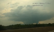
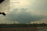
As the storm and tornado moved away to our northwest and north, I decided that we may as well make an attempt at another intercept. I was definitely not optimistic that we would ever see the tornado again, though, given the trees and hills, and because we first had to drive about 12 miles to the east-southeast to catch a road north. We made our way north on U.S. 67 (not too far northwest of Poplar Bluff) and entered Wayne County. Fortunately, this road was similar to U.S. 60, a wide and fast swath through the forest. As we neared Greenville, the storm and tornado again came into view! And this time, the tornado looked to be a massive wedge! Chad commented on how the tornadic updraft was literally sucking in small updrafts and nearby cloud material. And, as earlier, the updraft was just one big tornado-making machine, with zero precipitation issues in and around it! Our route was a curvy and up-and-down trek through the forest, and we only had occasional decent glimpses of the large tornado, unfortunately. We didn’t come upon a good place to turn off and watch, so we kept on heading north. Near Greenville, it appeared that the tornado had already cleared U.S. 67 north of town. There were some trees down, but I’m not certain if these were due directly to the tornado, or perhaps to strong inflow winds or RFD. It looked like the tornado had ended at least momentarily, though the survey map for the storm shows that it continued another 15 miles or so to near Buckhorn. It seemed futile to try to stay with the fast-moving storm, so we turned around and headed south to Poplar Bluff. A couple of stills of the wedge while heading north on U.S. 60, south of Greenville, near 4:32 p.m. CDT:
There was still plenty of daylight remaining, so we felt that additional tornadic supercells could be sampled. We headed east again on U.S. 60 through Poplar Bluff and came upon some dark and menacing storm clouds, but these were not well organized. About halfway to Kentucky from Poplar Bluff, I decided to come back to the west where new storms were going up. These were pretty around sunset south of Poplar Bluff, but were not very strong. At Poplar Bluff we celebrated with a steak dinner and met up with Jim Cantore, in town to cover the severe weather in the nation’s midsection.
TORNADO WRAP-UP
The NWS office in Paducah, KY, surveyed the May 25 tornado in southeastern Missouri. The official path length was estimated to be 48 miles (from Grandin to Buckhorn) , the greatest width at one mile, and the rating at EF-3.
This storm produced a tornado near the MO/AR border (3N Myrtle) around 3 p.m., and 45 to 50 minutes later considerable tornado damage occurred at Grandin, 32 miles or so to the northeast. Apparently there were no tornado reports between Myrtle and Grandin. The area between the two small towns is forested and undeveloped, though the supercell did cross U.S. 160 in Oregon County. The large tornado did EF-3 damage near Ellsinore around 3:55 p.m., and had a wedge tornado with it near Greenville and Silva at 4:30 p.m. CDT. It apparently persisted for another 15 to 20 minutes on the way towards Buckhorn.
It is uncertain whether a tornado was with the storm between Myrtle and Grandin. Given that “90-100 mph winds” and EF-1 damage occurred 3N of Myrtle, and given “major” tornado damage in Grandin, it is possible that a tornado was in progress with the supercell for a good chunk of time (if not the entire time!) during its trek from the MO/AR border to U.S. 60 at Ellsinore. (Clip g below shows a new tornado developing near Grandin…this might have been a second or third tornado cycle for the supercell.) The storm was tornadic or nearly tornadic for approximately two hours over a distance of about 80 miles, from Myrtle to Buckhorn. Fortunately, there were no deaths or injuries with it, as it missed the small towns in the area. (A similar long-track tornado did not miss towns back on May 21, 1957.) There were very few other chasers on this storm, and pictures and video of the tornado are surprisingly few. (Surprising given the highly visible/non rain-wrapped nature of a long-track tornado in mid-afternoon during the height of chase season.) Of course, the horrible terrain and landscape (from a chaser’s perspective) kept tornado images to a minimum!
Tempest Clip A by Bill Reid and Chad Cowan
Tempest Clip B by a guest in Chris’ van
Some youtube clips:
clip a near Ellsinore
clip b from chaser Nick Nolte
clip c from chaser Nick Nolte (long version)
clip d near Ellsinore (some language and hyper-ventilating, looks like the same location as clip a
clip e by chaser Mike Brady along U.S. 60
clip f from Silva, MO
clip g from Grandin, MO



Leave a Reply
You must be logged in to post a comment.