 This was the second full chase day for Tour 4, with drivers Danny and Chad. We left West Point, NE, and targeted the middle of NE, near Albion. Some severe storms went up quickly southeast of Brewster and raced northeastward through a sparse road network. This was no fun at all. At the end of the day we went after some tail-end storms near I-80, and wound up on some very interesting storms with forward-flank gustnadoes or weak tornadoes.
My morning forecast thoughts:
Our group is in West Point, NE. I had been thinking that we would be targeting the warm front and the area with E/SE winds to its north somewhere in extreme E ND today, but after a look at the models, that appears to be ill-advised. Assuming that convection will fire initially in central NE and then work its way northward through the MDT RISK axis, I would prefer to play the south end where cells might find themselves less involved with upstream anvils and whatnot.
The models have a surface low near Broken Bow late this afternoon, and I’d like to think that there may be some slightly backed winds on its northeast side. The HRRR suggests a giant tail-end monster storm in the vicinity of Ord and Burwell by dinnertime. It will be nice to have a non-croaking severe storm to observe in Big Red country.
My chase account for CFDG:
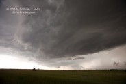
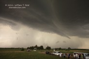
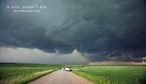
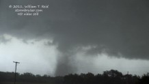
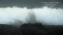
Our group endured a somewhat frustrating chase day as fast-moving cells moved through a sparse road network in central NE. The target area of Burwell, NE, worked out fairly well (northeast of a surface low and just in front of a cold front) as the initial activity went up in northern Custer County and moved NNE towards Brewster. We watched a couple of strong cells pass us on 91, just southeast of Brewster. The first one strengthened considerably as it continued to Atkinson at 45-50 mph. There was zero chance of staying close to it. We went back to Taylor and Burwell, then back to Taylor and north 25 miles to briefly see another storm and its meso blast by. Back to Burwell again, and we elected to go southwest to the tail-end storms in Custer County. As we approached Broken Bow, the tail-end had jumped south all the way to I-80. We were dealing with a primarily linear situation now, but the convection was a little behind the cold front and the strong south winds were not getting underneath the updraft bases at the surface. However, there were plenty of strong embedded and elevated mesos in the line. One of these prompted a tornado warning down at Cozad, and a tornado there continued to Oconto, reportedly. We placed ourselved east of Oconto and allowed the precip cores to get close. As the rain neared, a dusty spin-up was observed nearby to the south. A little later, on 40 from Miller to Kearney, we were just behind the gustfront and numerous funnels and dusty “tornadoes” were observed, primarily from just southeast of Amherst to a little northeast of Kearney. Were these really tornadoes or not — I don’t know —- they were briefly strong with dust-filled tubes which were beneath tight rotations at cloud base or beneath fairly-obvious funnel clouds. I think I’ll call them “gustnado/tornado hybrid tornados”. They were definitely not products of a classic supercell with an RFD, but were near the leading edge of the convection, on the interface of the storm outflow against the very strong and moist southerlies. At one point North Platte had sustained winds of 50 knots from the west while the station to its east was south at 30 knots. The convergence along the front was tremendous.
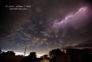
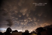
We ended the chase at Kearney, where spider lightning streaked through the mammatus clouds in the waning light of dusk.

Leave a Reply
You must be logged in to post a comment.