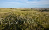
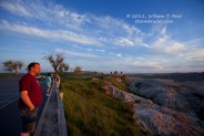
May 31—There was little or no risk of storms in the Plains, and the next day’s target looked to be up towards Cherry County near the SD border. We drove from Cozad north and northwest and had a leisurely tour of the Badlands during the last couple hours before sunset, and it was quite pretty! We found rooms in Kadoka.
June 1—Well, the original thinking for the SD/NE border was obviously not going to work when we looked at data this morning. We had to be back down south along I-80…maybe even farther south! So, we hurried down 61 to Ogallala. Here is my chase account for June 1:
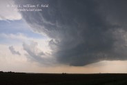
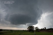
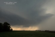
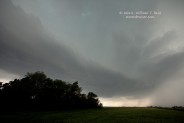
On Wednesday (June 1) my group (with Chad Cowan and Danny Gonzales) targetted the I-80 corridor around LBF (North Platte, NE). We got out of Kadoka, SD, at 10:30 a.m. and hurried down 61. By the time we reached Roscoe, NE, around 3:00 p.m., convective initiation was just beginning to the northeast of McCook. A cell managed to break through the cap and go severe near Eustis, in Frontier County, and we were able to easily get right in front of it. The base wrapped up very nicely and threw some 1.5-inch hail at us. A tight rotation produced a brief funnel cloud just north of Eustis, but the storm then gave up on that idea and weakened considerably.
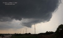
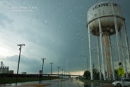
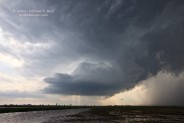
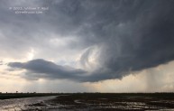
Stronger convection beckoned to our SSE, in NC KS, and some chasers were lured towards that. We went east through Elwood thinking that we should be on the KS stuff, but then turned around as our original supercell was perking up considerably once again. I figured that tornado chances should be a bit higher along the warm front, near I-80. Our storm’s updraft base was stationary, very close to Cozad. We drove west from Lexington a few miles and had a perfect view of the classic supercell structure and wall cloud. The storm did the “big suck” with ESE winds racing past us at 35 mph, and the wall cloud spun a little and it looked like a funnel was dangling diagonally for a time behind some precip curtains. A small cell crashed into ours and rained on us, and obliterated our view of the base. We went east into Lexington and then west of Lexington again as the precip cleared and the base emerged again, but the cell looked worse for the wear and went downhill. Another strong updraft went up a little east of Lexington, near Overton, but the low-level air was coolish and worked over and it did not appear to be surface-based.
We called it a chase around 7:30 p.m. and headed to BBW for dinner, and then to VTN for the night.
Images of the Eustis supercell, looking west
Images of the Lexington cell, looking west




Leave a Reply
You must be logged in to post a comment.