We managed to get on a mildly interesting storm today ESE of Bismarck, ND. It looked like the best tornado prospects were from around Grand Forks, ND, eastward into northern MN. But, a strong cap up there coupled with the distance involved had me looking at other target areas. This was my thinking late in the morning:
—
The 15Z RUC has the surface low near Fargo at 21Z and a little east of Grand Forks at 00Z. We got out of Mobridge an hour or so ago and are battling road closures already—-we were unable to go north on 83 from Selby —- road closed.
The highest CAPE is forecast to be east and northeast of the surface low today, in northern MN, and that is also where the cap is stronger with 700 temps above 10C. Forecast indicates a lobe of good instability bent back a little north and northwest of the surface low this afternoon, in east-central ND. Instead of killing ourselves trying to get to Grand Forks and east and northeast of there, I am looking at the area a county or two north of Jamestown/county or two west of Grand Forks. The turning in the lowest two kilometers should be quite pronounced. Also, cap issues will be lower here, with the 5C line at 700 nearby at 00Z. The HRRR suggests a strong cell or two northwest of Jamestown by 00Z.
I have never purposefully played the “just northwest of or behind the surface low” game before, but it seems that a good number of tornado reports materialize in these meteorological situations. Target town today is Carrington, ND.
—
Our group stopped in Ashley, ND, for a bit, and continued up 30 to I-94. I think we stopped for a meal in Dawson, which is between Bismarck and Jamestown. After poking around an abandoned home here and drifting west to Steele and Driscoll, some convection was noted about 25 miles south of Bismarck. This perked up fairly quickly, and we blasted down Highway 83 in a race to beat the cell to Hazelton. The cell barely beat us there, and in heavy rain we dashed east on 34 towards Napolean to try to get in front of this thing. We finally got towards the front of the storm around Napolean, where strong outflow winds were driving dust plumes eastward. We had to jump north a bit to Highway 46 in order to continue east on paved roads. Our cell had outflow issues but exhibited some nice structure from time to time. Around 6 p.m. CDT I sent out a NOW post:
—
We are on the leading cell of the three in southern ND, south of Jamestown. It has been charging east at 40 mph and has yet to be warned. The radar strongly suggests that we should go back west to the middle cell, which has a healthy core and maybe a couplet, while our cell is strung out and struggling. However, the wx map says stick with the lead cell as it is getting into better air sooner, and the trailing cell will be working on worked-over air from the lead cell.
We’ll stick with this lead cell near Adrian for now. Visually, it is showing some signs of perking up on the south end.
That third cell well west of Bismarck produced a tornado, apparently.
—
Well, to make a long story short, our lead cell failed to do much as it continued to I-94 north of Wahpeton. Here is the final account, written the following morning:
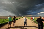
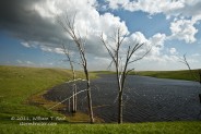
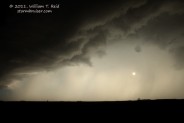
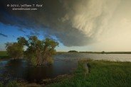
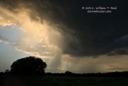
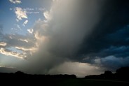
Our group chased a strong cell/marginal supercell east along Hwy 34 in southern ND, from Hazleton to Napoleon and all of the way east to I-29 at sunset, where it pooped out. The storm was relatively low-topped and non-severe, and was never warned on by the NWS. Highlights were strong winds, blowing dust and heavy rain between Hazelton and Napoleon, and some moderately interesting structure with the updraft base on the south end, especially around Marion. It was outflowish by the time we got on it at Hazelton. The storm was moving east along 34 at 40 mph and was kicking up large plumes of dust off of the bare fields. A tiny “gustnado” was kicking up spray on one of the many lakes in the area.
I elected to disregard the better tornado prospects (east of Fargo and Grand Forks) on the northeast side of the (E ND) surface low, as dew points there were less than impressive and models indicated a capola bustola in N MN. They were correct. We wound up along a E-W boundary across southern ND, behind the low, which separated west winds on its south side from N and NE winds on its north side. Our cell was the lead cell of three—the middle cell had a couple of tornado warnings, but no tornado reports, apparently. A tornado was observed with the trailing cell, between Dickinson and Bismarck.
—



Leave a Reply
You must be logged in to post a comment.