We began this chase day in Valentine, and remained in town for lunch as it appeared that the northern Sand Hills area was a decent area to target for severe weather later on. We moseyed a little west after lunch, according to my NOW post:
We are leaving VTN currently. VTN and vicinity may well be where we want to be towards sunset, but for now we are being pulled west and perhaps north a little, towards an apparent mesolow near the Black Hills. The RUC shows a nice tongue of high CAPE along the SD/NE border to our west. Shear and instability look very good later this afternoon between VTN and the southwestern edge of the Badlands area. The latest satellite pic shows a cu field near CDR.
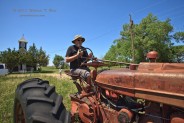
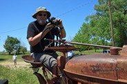
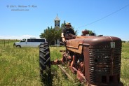
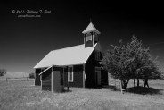
With plenty of time to kill, we roamed off of the beaten path (U.S. 20) and checked out the little hamlet of Eli, Nebraska. There isn’t much there except for a few houses and a church. I photographed Chuck driving his tractor back home from midday mass.
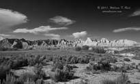
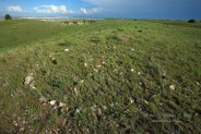
From Eli we drifted towards the northwest and into the Badlands of SD. A handful of cloud towers tried to go up around Batesland and Wounded Knee, but the cap held strong, to our chagrin. We killed some more time on the southern fringe of the Badlands, near a dinky place called Rocksprings. Some activity to the west, near the Black Hills, looked good briefly but then shriveled. I led some of the tour guests to a hilltop, where a circle of rocks marked an alien spaceship landing site. Storm clouds percolated in the distance to the southeast, near Valentine. Super.
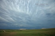
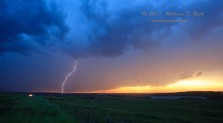
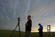
Well, it was getting a little too late to go on a wild goose chase back to VTN. We waited near Sharps Corner for some new activity that was approaching from northwest Nebraska. These cells threw a big anvil and some mammatus overhead, but the general trend was weakening and blah-blah-blah. I managed to get a lightning image and a few other so-so pics, including the “kiss of death” cloud. Our beds for the night awaited in Kadoka.


Leave a Reply
You must be logged in to post a comment.