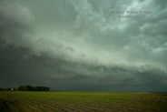
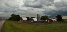
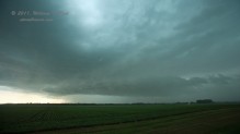
A beast of a severe storm left a swath of wind and hail damage from Flandreau in se SD all of the way northeast to the Duluth area and Lake Superior. Seven tornado reports are in the SPC log along the storm’s track. We were on the storm relatively early, then scooted several miles south to a second supercell near Colton, SD, only to have that one sucked into the growing beast to its north. We tried to stay with the storm, but it was fruitless due to the northeast movement at more than 40 mph.
Below are my posts to CFDG on this day, beginning with the forecast post made around 11 a.m. CDT:
—–
A fairly compact and potent upper-level cyclone is migrating from the Sand Hills and into sc SD late this morning. A line of convection with some strong to severe cells extends from near Ainsworth to near Pierre. Skies are mostly clear east of this line. A surface low is southeast of the convection, in ne NE. SPC’s slight risk today is near and northeast of the surface low into MN, along a boundary marked by high dew points and high forecast CAPE values. Very nice upper flow at 500 mb spreads over the surface low and surface trough this afternoon, providing an environment favorable for severe storms and probably supercells. There may be an area of slightly backed surface flow n or ne of the surface low in the vicinity of Sioux Falls this afternoon, so that is where we are headed for now. I think that tornado prospects are a bit better than SPC has outlined in its 13Z forecast (just 2%). The wild card today is all of that stuff happening back to our west along Hwy 183. We are in Mitchell now and will have lunch in Sioux Falls. The cap will not be an issue as it was yesterday in western MN and the eastern Dakotas (we played in w SD yesterday).
——- at about 5 p.m. I posted the following:
We were on the beast(s) near Colman and Colton in se SD for a little bit. These were generally big outflowing HP cells. We dropped south to the southern cell, and the northern one took over. It left us in the dust and charged ENE to NE at 45-50 mph. We waved goodbye to it at Pipestone. This cell had a tornado warning for an hour or so, and one had to be looking into the notch from the east or ne side to see anything, I suspect.
Apparently Flandreau, SD, was hard hit, and EMS folks are advising no travel into Flandreau. It is not apparent whether a tornado hit the town or not.
New tornado warning now with a tornado observed by spotters near Redwood Falls.
——- and my chase account written the following morning:
On this day a compact but potent upper-level cyclone swept northeastward through eastern SD and spawned an intense supercell/convective hybrid thingie. This large storm left a path of wind damage with occasional very large hail from se SD to near Duluth.
My target was Sioux Falls, which was northeast of the surface low in ne NE and which had backed winds with a dew point in the mid-70s midday. Skies were mostly clear here, but the cyclone to the west was already causing heavy storms in central SD all morning long. I was hoping that new activity would form during the afternoon to the east of the primarily elevated morning stuff. After lunch in Sioux Falls, a cu field had formed a little north and west of town. We headed towards the northeast side of the cu field at Pipestone, MN, in order to make sure that we would be ahead of any development. With CAPE values of 5000-plus, it seemed likely that storms would go up very fast once the cap was breached. Well, that plan wound up somewhat ill-founded as two big storms formed on the southwest side of the cu field (some 50 miles distant), near Spencer, SD (and just one county east of the “morning” convection, which continued). We headed west on 34 towards I-29 and Colman, SD, for an intercept. When we reached SD, the road went to rough and unpaved for 16 miles thanks to one of those famous SD road destruction projects. During this grueling ordeal, we watched on radar as the McCook County storm blossomed significantly and became warned. We finally reached the east side of the supercell on the N-S road from Chester to Colton. It was a massive thing, green and dark, but quite HP-ish without much structure evident.
So, we had managed to get in position on the beast-of-the-day storm here between Colman and Chester…but there was a second severe storm just to its south, along I-90. This one was not quite as strong, but it had a good shape on radar and was tail-end Charlie, so we scooted south just past Colton to take a look. Bad move. The southern storm had a top of 50k feet, the northern one was up at 60k feet, and the southern one was no match for the northern one. It basically became a non-entity as it approached us. We were instantaneously out of position, on the south side of the big beast. It proceeded to gobble up towns to its northeast at a fast pace. We didn’t stand a chance to get back on its east or northeast side to look into the notch area. The cell became tornado-warned on its approach to Flandreau and it continued into sw MN, moving about 45 mph. The cell turned a bit to the right and moved ENE—Marshall and Redwood Falls were in the path and suffered damage due to wind and hail.
We stayed somewhat close to it up to Pipestone, but there wasn’t much to see on its south side except a dark and menacing precip blob. Some new stuff went up near or along the big storm’s outflow boundary and we played with that until about 7 p.m. around Fulda to Windom. There was some so-so structure on the leading edge for a while, but this was also moving quickly northeast and was wet and outflowish, so we let it go.
——
some pics of the southern cell west of Colton as it was beginning to croak:
and a look at the cell near Fulda later in the afternoon:
We threw in the towel relatively early, had a leisurely dinner in Sioux Falls, and drove west on I-90 to Plankinton for the night. At dusk, Marcia spotted some noctilucent clouds along the horizon to the northwest, from the Mitchell area. See the other July 1 post for the rare cloud photos!


Leave a Reply
You must be logged in to post a comment.