 After yesterday’s chase in sw MN, we overnighted in Plankinton (west of Mitchell, SD) and headed west for some upslope severe weather. Here is the forecast blurb that I wrote late morning:
Today offers good upslope chase prospects from about Weld County to Lusk and into se MT and nw SD. The question is WHERE exactly along this axis?? I wish I knew. We are headed west along I-90 towards the Black Hills. There are plenty of pros and cons favoring the south, middle, and north plays today.
After a look at the 12Z NAM, I liked the area from about Lusk to Crawford in the nw NE PH (the middle option). It shows a little wave at 500mb moving through that area. 500 winds are west at about 35 knots, above moist southeasterly surface winds. It isn’t difficult to image a nicely sculpted supercell moving southeast through this area around 00Z.
I checked the HRRR, and its 13Z run has a nice big blob down by CYS, moving slowly south into Weld County. This certainly could be a beast, perhaps tornadic. The HRRR kept this thing going while diminishing the cells in western SD and around the Black Hills, which seemed weird. This southern target is somewhat out of reach and is south of the 588 line at 500 mb), which scares me a bit. I would prefer to be on a storm north of that line! However, the latest RUC shows the highest forecast CAPE values around here, over 4000.
The 15Z RUC paints a very nice picture for extreme se MT and nw SD from 00Z to 03Z. Instability would appear to be excellent, and surface winds are forecast to be nicely backed as the RUC has a minor surface trough/lobe extending northeastward towards ne WY/se MT. 500 flow and 700 flow look just as good here as the NE PH vicinity, too. Some junky debris cloudiness in that area, though, will have to move out in order to make me giddy. This area is north of the hot air and that 588 line—yeah!
We will continue to RAP, and I’ll have to decide which side of the Black Hills to camp out on. At this point in time, I am favoring Harding County and vicinity in extreme nw SD.
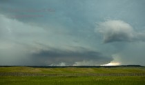
After lunch in Wall, we continued west, and were lured into ne WY as storms were getting strong. One very strong cell appeared to be a “left-mover”, as it was quickly moving north into Crook County. I decided to try to intercept it along I-90. This storm was moving north so quickly that we barely got to it by the time it reached I-90, and at that time it was crashing into another strong storm just north of the Interstate. As this “merger” transpired, the low-level organization seemed to strengthen and a tornado warning was issued. Lightning activity picked up suddenly, and we had some very suspicious lowerings just to our northwest. Unfortunately, we were stopped along I-90 at a mediocre viewing spot, without a good view beneath the storm base. We had no place to turn around, and had just exited a construction zone to boot, so we were lucky that we didn’t have to continue on the one lane into the core of the left-mover! Anyhow, it looked on one or two occasions that funnel clouds were getting close to the ground some 5 to 8 miles to our northwest, and we were unsure whether a tornado had touched down or not. Video and some of my still images (below) show some suspicious stuff! We were about 8 to 10 miles wsw of Sundance. SPC storm reports shows a 1.50-inch hail report ten miles west of Sundance, and no tornado reports.
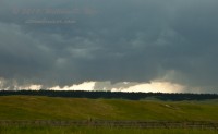
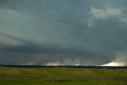
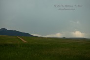
This activity weakened some and was moving north into a poor road network, so we set our sights on a new supercell just east of Upton, some 25 miles to our south-southwest. We headed south from Sundance on 585, thinking that the storm would move east or northeast. While still 15 miles or so from the storm, we observed a pronounced wall cloud and funnel cloud with the storm base, and a spotter near the storm reported as much. We tried to get closer after stopping for a few minutes, but the road tracked sse into a hilly area and we were unable to see what was going on to our southwest for a while. Worse yet, the storm was moving little, and then sputtered and died once we found a hilltop to its east. I really do not like chasing around the Black Hills. Here is a shot of the Upton storm base to our south, a little bit after it looked its best:
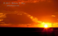
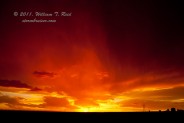
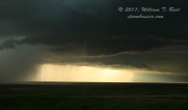
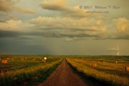
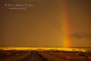
With plenty of daylight remaining, we sprinted east toward some new stuff near and east of Rapid City. This looked good briefly, but never got its act together. We stopped near New Underwood to watch the storm move from our north to northeast, and then went into photo mode as the light and colors on the back of the storm were insane!
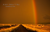

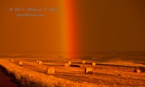
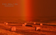

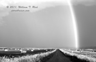
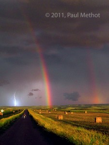
 Finally, a brilliant shot of me, a lonely figure down the road with my tripods, and the double rainbow, CG, and awesome sunset colors, courtesy of Tempest Tours guest Paul Methot!


Leave a Reply
You must be logged in to post a comment.