This was a great way to wrap up the final tour of the year! We observed three significant supercells in northeastern Wyoming. The first one was in southwestern Weston County (wsw of Newcastle), and it moved south into the Thunder Basin National Grassland area of northeastern Converse County. With very limited paved road options, we were never able to get into position on this supercell. We wound up behind it along Route 450 between Clareton and Wright, and this positioned us favorably for the two supercells near Wright, WY. Below is my write-up for the day and the images.
—-
This is/was the final full chase day for me with the tour company this year. We began in Pierre, SD, and needed to be back in Denver midday the next day, so we were heavily favoring a High Plains target versus the low Plains (se NE) target. The forecast was definitely NOT clear cut, and lots and lots of mid and high clouds were overspreading the NE PH, w SD and e WY. Low-level moisture was very good, though, on easterly upslope winds through much of the NE PH and e WY by late afternoon. 500 flow was marginal, 25-30 knots or so from the west. NE Colorado was a possible chase target, but I preferred a target farther north of the hot upper high that was over NM. So, I kind of settled on the nw NE PH near CDR, where some high CAPE was forecast. Since I was floundering to some extent, I elected not to post a forecast to CFDG!
We had lunch in Wall, SD, and a supercell was drifting slowly south over the Black Hills shortly thereafter. Enough sunshine had gotten through to the hills and allowed some strong convection. The Black Hills storm didn’t last too long and we didn’t get there in time, but its deviant motion to the south was a harbinger of future storm behavior.
Another cell went up on the nw side of the Black Hills, but I elected to head around the south side of the hills to Edgewater given likely south movement of any future strong storms. We spent an hour or so waiting in Edgemont for something to get strong in the patches of blue sky to the west or northwest. Finally, a couple of healthy storm towers went up to our nw, in western Weston County, west of Newcastle. The road network here is quite limited, and I needed to see if the lead storm nw of Clareton was going to move se towards us, in which case we could sit tight and watch it approach. Well, we could see a large wall cloud and perhaps a funnel or two with the supercell to our nw or wnw, but it was about 40 miles away! I wanted to be on it NOW! After a few radar scans, it was obvious that the storm was barely moving. We blasted n to Newcastle and then w on 450. The front/south end of the cell exhibited fine sculpted structure and a lowered area, but we observed no tornado. The storm was now moving s or even ssw at about 20 mph, a little west of 116. The hail core was just clearing the e-w road 450 as we came up on the east side, and we continued west. I thought that we now needed to get west and then south on 59 in order to get a good look at the action area with this thing. In lt-mod rain behind the main core area, we stopped and sorted through two-to-three-inch size hailstones which were littering the side of the road.
After another 5-10 miles west, we had a splendid view of the updraft from its nw side, with some front-end flanged structure visible. But, the follow storm to our nw was sporting increasingly great organization and low-level structure, with a pronounced lowering! This supercell was drifting south to SWW on the east side of Wright, WY. We scooted from its south side (where structure was fantastic!) to its west side at Wright (with the massive storm tower looming just to our east). A large wall cloud had that look that it was going to produce, but it did not. The RFD was rather wet and cool. A third supercell updraft was just nw of Wright. It had a wall cloud and was more LP-like. We drifted south of Wright on 59, with eyes on both nearby updrafts and the fast cloud motions at the bases. A slender and slinky funnel emerged from the east-side cell, but never threatened to get large or to touch down. At sunset the east cell started to wind down, and the west cell perked up a little. We had a continuous hail roar with it, just to our west. This cell then weakened quickly as it got dark, and we lumbered south to Torrington for the night. It was great to get on a few beautiful and slow-moving High Plains supercells on this day, and somewhat of a surprise, too, given all of the clouds during the day and my uncertainty with regard to the forecast.
—-
And now it is happy image time!
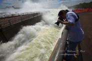
The main street through, Pierre, SD, has suffered through some major flooding problems this spring, thanks to record flows on the nearby Missouri River. Most of the businesses along Sioux Avenue were still “sandbagged” in early July. We visited nearby Oahe Dam to experience the water releases, and then visited Tatiana at the Cactus Cafe in Wall.
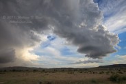
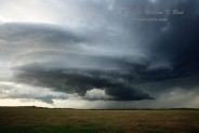
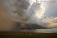
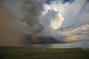
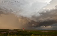
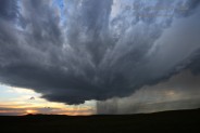
The first of this series shows the west side of the leading edge of the first/southern-most supercell, looking sse, from 450 near the Weston/Campbell county line. We were able to see the front of this storm from a great distance, while near Edgemont, but by the time we got near the storm, it had moved south of 450 and not much more than a precip core was visible. Just behind the large storm (which dropped hail up to three inches in diameter along 450) was a small but strongly rotating updraft.
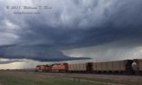
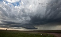
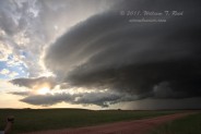
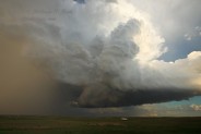
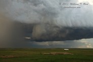
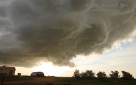
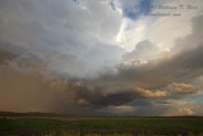
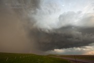
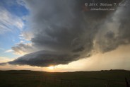
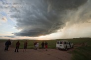
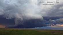
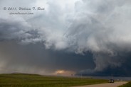
A second and third supercell were just north of Route 450, in southern Campbell County. A supercell to the east of Wright, WY, was not too far to our northwest in these views. The base of the third supercell, which was just northwest of Wright, is visible in the distance in the third and fourth images here.
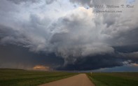
The nearby supercell that was east of Wright was drifting south, so I needed to scoot west towards Wright to avoid any nastiness. We were safely west of the updraft base when we reached Hwy 59, and I needed to find a high spot to stop at to photograph the magnificent structure now to my east! We found someone’s driveway in Wright with a decent view without telephone poles and wires. The sculpted updraft base here is south of the precip core, and the storm tower is leaning over nicely towards the east.
The first of these four images is a look to the northwest, towards the base of the LP supercell that was near or just northwest of Wright. Both cells were moving slowly to the south, and we moved south of Wright a few miles to maintain good position on both storms. The action area of the supercell to our east (2nd, 3rd, and 4th images) appeared set to produce a tornado, but it did not.
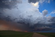
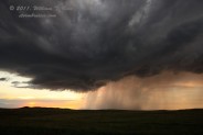
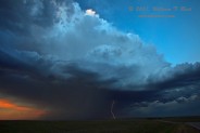
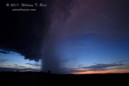
Three views of the Wright “LP” supercell, and another look at the wetter storm that was east of Wright.
At about sunset time, the supercell that was east of Hwy 59 began to slowly weaken, but still maintained some nice low-level features.
After sunset I took about 200 photographs, hoping to catch one of the few bright lightning flashes in the two storms. I missed them all, except for one faint repeater flash in the eastern cell.







Leave a Reply
You must be logged in to post a comment.