 A strong upper-level storm system was diving south through Nevada on November 30, and cut off near Needles on December 1st. Strong high pressure at the surface built in behind a cold front which moved south through Southern California on the evening of the 30th. Strong north winds on the west side of the upper low, a strong surface gradient from central California to southern California, strong cold air advection, strong subsidence behind the cold front, and mountain “wave” flow over the San Gabriel Mountains (which helped to drive strong winds aloft towards the surface) all combined to produce the high wind event in Pasadena, Arcadia, and adjacent areas of the San Gabriel Valley late on the 30th and early on the 1st. This area is generally protected from wind during typical Santa Ana wind events. However, when an abnormally strong “offshore” wind event matures and a mountain wave condition sets up, then this area can really get blasted, with gusts of 60-80 mph or more. (The San Gabriel Valley seems to be an “all-or-nothing” type of locale when it comes to offshore/north wind events). These wind storms might only occur a couple of times every ten or twenty years, so plenty of old and weak trees tend to topple. The weather pattern which was responsible for the strong offshore winds in the San Gabriel Valley did not produce very strong winds in many sections of Southern California which usually get strong winds during more “classic” Santa Ana wind events.
I saw this strong wind event unfolding several days ahead of time, and arranged my work schedule so I would have December 1st off from work. I wasn’t really interested in “chasing” a Santa Ana wind locally. I was thinking about heading up into the Owens Valley and perhaps even a little farther north of Bishop to chase a “Mono wind” event. A Mono wind event is associated with very strong east to northeast winds through Mono County and downstream from there towards the Sierra Nevada and Central Valley. Sometimes spectacular (lenticular) wave clouds develop in these situations. I yearn to photograph a massive standing lenticular cloud in the lee of the White Mountains, or Inyo Mountains, or anywhere in and around the Owens Valley or Mono County!
Charlie Bustamante elected to join me for the one-day jaunt, and I picked him up in Pacoima before sunrise on the 1st. The news radio stations were all over the local wind storm damage and consternation some 10-20 miles to our east. The winds had subsided substantially, though. There was little reason to mosey on over to Pasadena and to fight morning rush hour traffic, unless we wanted to see a lot of horizontal tree stumps and slow-moving vehicles. We headed up Highway 14 to the Antelope Valley and beyond.
With the upper low deepening a little and remaining near Needles today, flow aloft on the north and northwest side of the low would continue strong in and around the Owens Valley and the southern Sierra Nevada. There was enough moisture near the center of the low to cause snow in the Big Bear area, but skies north of the Tehachapis were mostly clear, except for the lenticulars! The wind through the Antelope Valley and western Mojave Desert was moderate, with gusts perhaps to 40 mph. Skies to our east looked rather dusty as we chugged northward past Lancaster and Mojave. The NOAA weather radio forecast for the Owens Valley mentioned wind gusts to 70 mph, and as high as 85 or 90 mph for the Eastern Sierra! That’s what we wanted! The Mono wind event seemed to have peaked the night before, when northeast winds on the top of Mammoth Mountain reached at least 150 mph! (Several peak gusts of 150 mph were recorded there—if Mammoth’s wind instrument was subject to an even higher gust, the measurements were not shared. Steve Johnson found that gusts of greater than 150 mph here are reported as 150 mph.) Anyway, we could monitor satellite pics and weather obs on Charlie’s phone to see if it might be worth heading as far north as Bishop and Mono County.
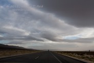
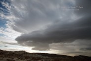
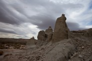
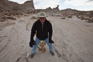
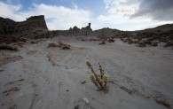
We stopped at Red Rock Canyon (about 30 minutes north of Mojave) for about 30 minutes to stretch and to admire some of the bleak and stark landscapes. The light was fabulous when I was here near sunset in March of 2010, but it was not fabulous on this morning. Some messy lenticulars were overhead and to the east, but the sun was behind clouds and the light was poor for photography.
It looks like a little wall cloud was protruding from the base of one of the clouds near Red Rock Canyon. We didn’t stick around to monitor for rotation.
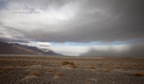
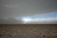
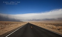
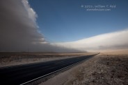
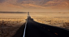
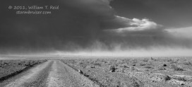
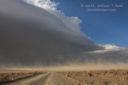
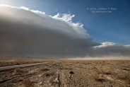
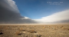
After a stop at an Olancha convenience store to stock up on junk food, we headed northeast on 190 towards Keeler. Ah, yes, it was great to be in the Owens Valley and its wide open, empty, desolate spaces, sandwiched between the steep slopes of the Inyo Mountains and Eastern Sierra! And, something was definitely afoot weatherwise over Owens Lake. Parts of the lake are covered with water now to help reduce the airborne dust during windstorms, but a large plume of dust was obvious towards our northeast, towards Keeler. And, a massive low-to-mid-level cloud was hanging right over the “dry” lake. It wasn’t really going anywhere, so it was a standing wave cloud. Strong northeasterly winds were barreling down the east slopes of the Inyos, were kicking up dust along the east side of Owens Lake, and were causing this thick, black beast of a cloud to hover right over much of Owens Lake. The cloud was perhaps more of a SCSL (stratocumulus standing lenticular) rather than an ACSL (altocumulus standing lenticular).
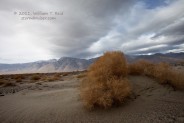
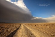
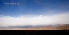
Charlie and I stopped about halfway from Olancha to Keeler to shoot the scenery. It was quite chilly and the wind was blowing, but wasn’t too bad. The gusts here were no more than 35 mph.
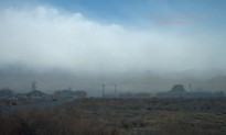
The view is to the north and NNE in the last two images above. Below the dark base of the low-level lenticular is the plume of blowing dust.
We motored northeast to the 190/136 junction, and then went a mile or two or three northwest on 136 towards Keeler. From here, we had a good look at the eastern side of the lenticular cloud, and a long-range view of the dust that was blowing beneath it on its eastern edge, very near Keeler.
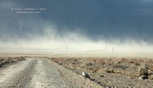
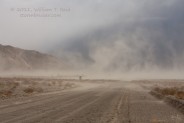
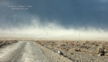
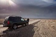
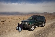
We drove a few more miles towards the dust plume, and found a dirt road up an alluvial fan, east of Keeler. The wind was quite strong here and we had a front row seat to the impressive dust plume and the rather strange cloud that was stationary over the lake, now to our west. It was unpleasant outside—-in the low 40s with wind gusts over 50 mph with occasional dust. Charlie and I braved the elements and documented the unusual scene!
The sun was just above the lenticular to our south, so we were bathed in nice bright sunshine. I measured a gust to 56 mph with the hand-held Kestrel, and decided that was high enough! Towards the northeast, a low layer of clouds appeared to be snowing on the Inyos…or at least was providing a massive snow virga display.
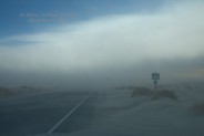
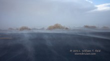
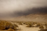
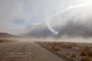
The next stop was Keeler, and that meant driving into the dust plume! Keeler is known for its problems with dust and irritating particulates off of the nearby playa, but today the dirt and dust was getting whipped up off of the gentle alluvial fan slopes to the east and northeast. One nasty dust-filled plume was blasting through a “lakeside” mineral business south of Keeler. We drove around Keeler a bit to enjoy the wind and dust, and then north a few miles to Swansea. I resisted rolling down the windows as much as possible…but couldn’t help myself from time to time. I still have Keeler dust in my ears.
The wind and dust in the face became a tad tiresome, so Charlie and I headed into Lone Pine for lunch and a washroom. After lunch we headed for more hospitable environs: the Mount Whitney and Alabama Hills area west of Lone Pine. A separate Stormbruiser page is devoted to the afternoon edition of December 1, 2011!

Leave a Reply
You must be logged in to post a comment.