Our tour group was up and on the road at the ridiculously early hour of 8 a.m. out of Ulysses, KS. A strong upper system was finally making its way onto the Great Plains after sitting west of California for days. The upper-level cyclone was a still a little too far west to help out much on the day prior, though we did manage a severe storm in Baca County, CO. After midnight, early on the 27th, was when storm activity really started to strengthen and organize. Southeastern Colorado was on the receiving end of several tornadic storms around 2 a.m.! We were sound asleep a few counties to the east while areas around Lamar and Chivington in Colorado were under the gun. A system this strong typically doesn’t care what time of day it is…when it is time to make tornadoes, it makes tornadoes! We had to get east into the moist air asap. If and when the sun came out later on, the atmosphere would probably be in a foul mood somewhere over central or eastern Kansas. By late morning there was convection along a sharp frontal system which stretched from a little east of Dodge northward. The individual cells were moving northward rather rapidly. I wanted to get a couple of counties east of the front, find some sunshine, and wait for a strong cell to come my way. SPC had a moderate risk and 15 percent hatched tornado area outlined, centered around Salina, if I recall correctly.
We hung out near Newton, and then Marion, for much of the early-to-mid afternoon. We waited and waited for something to get strong and that wasn’t going to immediately blast north into murk north of I-70. It looked like another case of ill-timed upper-level support, as the early morning upwards motions were now replaced by subsiding air. The storms that did go up on the boundary to our west and southwest were not impressive. And, a perusal of the SPC mesoscale page showed that any storm that did go up would not have much time to improve in quality air. Hmmmph.
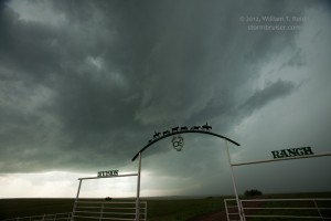
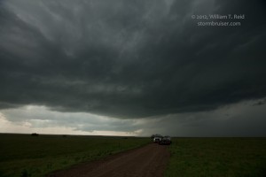
Finally, around 5 p.m. we committed to a couple of developing storms coming towards Marion and Strong City from the El Dorado area. One was a bit east of 177, and the other one a tad west of 177. These had relatively decent rain-free bases and were fed by nice and strong easterly inflow. Organization seemed strange, though, and I had problems figuring out just what the heck was happening. South of Council Grove, we observed a funnel cloud with the west cell (some five miles distant). It persisted for a couple of minutes and quit. We lost sight of this base as we maneuvered through Council Grove and continued north on 177. When we emerged out of the trees and river-bottom areas a few miles north of town, the base to our east several miles looked promising. But, lo and behold, nice low-level circulation was quickly developing VERY near to our east. A funnel developed, came halfway down, and a tight ground rotation was observed in the trees beneath it for about 30 seconds. It dissipated somewhat quickly. Our location was about halfway between Alta Vista and Council Grove, and I put the tornado at 6:00 p.m., maybe a mile-and-a-half east of 177.
We tried to keep up thereafter and slowly fell behind. We found ourselves at Burlingame in time to watch a different storm get tornado-warned and scream off towards Topeka. It showed an “area of interest” on its back end, and some dangly stuff was teasing the ground, but rotation was non-evident.
There was little to nothing worth pursuing 45 minutes prior to sunset, and we headed to Emporia for dinner. We were a bit lucky to be so close to one of the few tornadoes that did occur in Kansas today. Given the expectations, the chase was a bit underwhelming and disappointing.
A youtube clip of the Council Grove tornado is here.
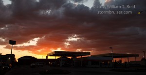
The first two images below were taken south of Council Grove along 177. The third one (6344) was about a minute after the tornado dissipated, looking east from 177.
Photographer Kelly Delay was with our group, and he managed an excellent shot of the tornado. Kelly’s images from the tour can be found on his Clouds 365 page, his Facebook page, twitter, Kellydelay.com, etc.


Leave a Reply
You must be logged in to post a comment.