Starting out of Sweetwater on May 7, the target area was not immediately obvious by late morning. Here is my CFDG forecast post at that time:
—-
Not too shabby a setup today along Interstate 10 from about Saragosa to Sonora. SW to WSW 500 flow ramps up to 30-40 knots during the afternoon, and easterly flow at 850 really starts to crank after 00Z. Forecast CAPE values along I-10 this afternoon are above 2500.
The chase problem —- where to set up along or near I-10? Better instability is towards Sonora, better flow aloft towards Ft. Stockton. Moisture screams westward into the Pecos/Kermit area late and my gut tells me I need to favor the west play. I’m not sure what I am going to do yet. We will be in San Angelo shortly, and will then likely go west on 67 to Big Lake and ???.
Current surface map suggests a mesolow not too far west of SJT, but, again, this feature seems to weaken and is replaced by the nice low-level easterly flow towards late afternoon.
—-
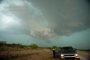
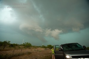
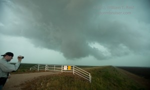
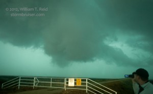
Yes, there was uncertainty, but a starting point near San Angelo looked good. We stopped in town shortly after noon for lunch, and, horror of horrors, storm towers were already exploding nearby! UGH. We hastily headed wsw on 67 towards the best development, and soon had a severe-warned storm in view. It was wet and messy, with occasional items of interest at low levels. As is often the case with early convection, though, other storms went up in the vicinity because the cap was weak. The end result is a bunch of worthless junk. Cells west and southwest of San Angelo were not entirely uninteresting on occasion:
As the storms near San Angelo sucked the life out of the troposphere, it was time to look elsewhere for some pristine air and hopefully a decent storm. Plenty of daylight hours remained, but it was at this time that I misplaced my new cell phone. There was no obnoxious alarm ring when I had others dial my number. Where in the health and human services was it? It must have dropped to the ground at one of our previous 2 or 3 stops, I figured. We headed back west and northwest from Knickerbocker Road to look — and these locales were naturally now getting soaked, with CGs striking now and then! Well, to make a medium-length story not excruciatingly long, after about 20 wasted minutes of poking around and looking along the highway in the rain, my driver Jennifer found my i-phone hidden between my seat and the middle console of the van. Why had it not sounded when we called it? How should I know? I barely know how to turn it on. The great news is that my i-phone was dry, it worked, it was in my hand, and there was an isolated cell way out west of Orla in some decent air! West we went!
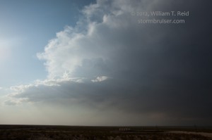
We caught I-10 west and moseyed northwestward towards the cell, now near Mentone. The updraft was a horrible puny piece of garbage.
Sunset was near, and we stopped in Kermit for food. At this point there was nothing within reach worth chasing, and I had to book rooms for the night. I found enough in Fort Stockton, where storms were forecast overnight.
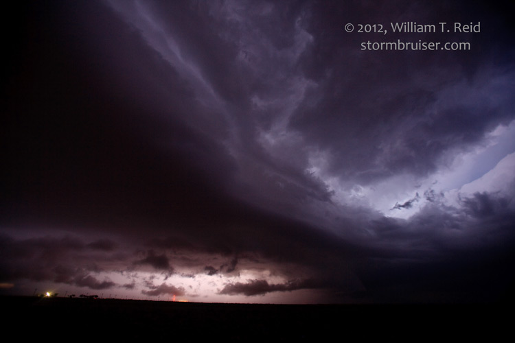
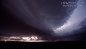
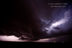
Our fast-food meal was cut short a bit as a new severe storm exploded to our north, along the TX/NM border near Hobbs. It was moving ESE and not too quickly, which gave us a chance to intercept it in about 80 minutes, north of Andrews. It was now dark, but lightning was frequent enough to give us a look at its structure. It passed left to right to our north, and dumped a lot of hail near Seminole. We allowed the core to pass and played in the cold outflow, hail-covered highway, and blowing hail fog. It must have been after midnight when we dragged in to the motel in Fort Stockton. This tour had had three VERY long days of driving, and it was nice to salvage May 7 with the supercell between Andrews and Seminole.
If you just can’t get enough of these chase accounts, here is the brief summary for May 7 that I wrote for the May 10 chase update for the Bruiser:
—–
May 7 was looking quite volatile, but was overall a lot of driving and dissapointment. We got to San Angelo in time for lunch and, unfortunately, very early convection. Some severe stuff teased us near Knickerbocker, but there was too much too early and it was, unsurprisingly, messy and ugly. We then blasted west for a long-lived cell approaching Mentone. We killed it upon arrival. After a bite to eat in Kermit and reserving rooms in Fort Stockton, a supercell got strong and turned right/southeast 50 miles to our north. It approached Seminole, and we got south of it via Andrews. It had impressive structure and occasional lightning. This was around 9:30 p.m., with little or no light remaining. After the core passed the N-S road, we moseyed on up to find a lot of small hail on the road, strong cold winds, and blowing hail fog not too far south of Seminole. We got back late to Fort Stockton, with a nice CG show to our west between Kermit and Fort Stockton. Another loud t-storm came through town around 3 a.m.

Leave a Reply
You must be logged in to post a comment.