Timelapse video by Chris Gullikson
Our tour group had an amazing chase this Monday. We began in Lubbock, washed the vans and had lunch in town midday, and headed northwest to Clovis, NM. This put us in the middle of the south end of SPC’s slight risk area. Flow at 500 mb today was marginal, NW at about 25-30 knots, and looked to be slightly anticyclonic. Surface flow was S to SSE and fairly moist for northeast NM and the western TX Panhandle, with dew points roughly from 54F to 59F in the region. CAPE numbers were near 2000 J/kg from about Tucumcari to Vega, TX. Given the strong turning of the wind with height and the adequate instability, a decent supercell was quite possible. I wasn’t sure exactly which area to focus on, though. Some boundaries from morning storms were in the western part of the TX Panhandle, so the area along 385 from Hereford to Dalhart was considered.
Here is SPC’s thinking and analysis at 1630Z and 20Z:
   ...ERN NM/WRN TX...
   CURRENT STORMS OVER PARTS OF NWRN TX ARE EXPECTED TO MOVE SLOWLY
   SEWD THIS AFTERNOON.  THIS ACTIVITY HAS GENERATED COLD OUTFLOW OVER
   THE PANHANDLE WHICH HAS TEMPORARILY STABILIZED THE ENVIRONMENT OVER
   THIS AREA.  IT HAS ALSO HELPED TO MAINTAIN A MOIST ELY LOW LEVEL
   WIND COMPONENT INTO EAST CENTRAL NM...AND SURFACE DEW POINTS IN THE
   LOW/MID 50S ARE EVIDENT ATTM OVER MUCH OF ERN NM.  THE MOISTURE IS
   LIKELY TO MIX OUT OVER CENTRAL NM AS HEATING OCCURS THIS AFTERNOON
   BUT DEW POINTS IN THE UPPER 40S-LOWER 50S WILL LIKELY REMAIN OVER
   PARTS OF ERN NM WHERE MOISTURE IS DEEPER /AS EVIDENCED BY LOW CLOUDS
   PER VISIBLE IMAGERY/.

   12Z REGIONAL SOUNDINGS EXHIBITED STEEP MID LEVEL LAPSE RATES...AND
   WHEN COMBINED WITH STRONG HEATING WILL CONTRIBUTE TO MUCAPE AROUND
   1500 J/KG THIS AFTERNOON.  ALTHOUGH DYNAMIC SUPPORT FOR LARGE SCALE
   ASCENT APPEARS LIMITED BASED ON SATELLITE IMAGERY...HEATING OVER THE
   HIGHER TERRAIN SHOULD RESULT IN NEW CONVECTIVE DEVELOPMENT LATER
   THIS AFTERNOON...ESPECIALLY OVER PARTS OF NERN AND EAST CENTRAL NM.
   WIND PROFILES ARE EXPECTED TO EXHIBIT CONSIDERABLE DIRECTIONAL SHEAR
   AS SSELY LOW LEVEL WINDS VEER TO 30-40 KT NWLY FLOW IN THE MID
   LEVELS.  THIS WILL PROVIDE SUFFICIENT SHEAR TO ENHANCE STORM
   ORGANIZATION AND INTENSITY INCLUDING SUPERCELL DEVELOPMENT.  THE
   ACTIVITY WILL SPREAD SEWD THROUGH THE EVENING HOURS WITH STRONGER
   CELLS CAPABLE OF PRODUCING LARGE HAIL AND DAMAGING WIND
   GUSTS...ALTHOUGH AN ISOLATED TORNADO MAY ALSO BE POSSIBLE.
SPC showed a 2 percent tornado risk oval stretching from about Lamar to Hobbs, so a big tornado day was not expected. While I have the chance, allow me to nitpick the wording in SPC’s final statement above. It reads:
...ALTHOUGH AN ISOLATED TORNADO MAY ALSO BE POSSIBLE.
Why don’t they just say “…although an isolated tornado is possible”? What SPC writes here is tantamount to saying that a tornado may or may not be possible. A lot of good that does! Anyway, I realize that most readers understand what the forecaster is trying to say. My point is that when you combine words like “may” and “chance” and “perhaps” and “possible” together in the same sentence, then you come off sounding wishy-washy and noncommittal. I also have issues with the word “isolated”… does the statement above imply that “non-isolated” tornadoes are NOT possible, or not expected? What if a single cell spawns a half dozen “landspout” tornadoes on this day? Wouldn’t these be non-isolated?!
(On another side note, many of the hardcore chasers on this day, May 21, were headed to North Dakota. The tornado risk for ND on the 22nd was somewhat promising, and seemingly better than the tornado prospects along the NM/TX border on the 21st. The Day 2 outlook on the 21st showed a 30 percent-hatched area (for any and all severe wx) outlined over ND, but there were admitted moisture issues. I looked at next-day forecasts for ND on the morning of the 21st, of course, and was not impressed enough to make the drive north. I had to choose between chasing the 21st in the NM/TX area and ND on the 22nd. It was not a difficult decision — we would chase the southern High Plains on the 21st and hope that we would not miss a big show in ND the next day. Of course, our starting point of Lubbock on the 21st made my decision easy! If I had started the 21st north of I-70, I suspect that I would have been lured north on the 21st. As it turned out, the severe weather event on the 22nd in ND was a dud for most chasers.)
Back to the chase account…
We continued north from Clovis to San Jon, on I-40, and looked at radar, satellite, surface obs, the SPC meso-analysis pages, etc. Given that strong cells were going up to our northwest (along I-25) and the best air looked to be in and around Tucumcari, I elected to head west and northwest. A cell with a cloud top near 50,000 feet beckoned. It was a little east of Las Vegas, NM, nearly 100 miles distant. If it would move southeast in the northwest flow, then good supercellular stuff would ensue…I figured.
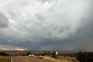
We went west on I-40 beyond Tucumcari and north on 129 towards Conchas State Park. Our Las Vegas storm still looked good on radar, but a new storm had quickly gone up between us and it. Okay —- now we didn’t have to drive as far! We set up on a hill along Hwy 104, a few miles west of 129. Our new cell, west of Trementina, looked to have decent structure, but it was a bit distant and contrast was so-so. Lightning was active in a cell to our south, and a new strong updraft was going up almost overhead. We would have to leave soon in order to stay east of the new nearby activity, but low-levels were looking more interesting with the Trementina storm. In fact, a good-sized lowering, or wall cloud had a funnel cloud sticking out of it that was about 3/4 of the way to the ground! It didn’t persist, unfortunately, and we bailed east and south quickly thereafter. Our Tempest Tours guide and driver, Chris Gullikson, has reviewed his video of the storm and it shows that the funnel cloud was in fact a tornado briefly. I managed to miss getting images of the brief funnel cloud/tornado, but here are a couple shot around that time (around 5:20 p.m. Mountain Daylight Time).
I called NWS Albuquerque to let them know that we had just observed what may have been a tornado near Trementina, and the forecaster said that he was not surprised based on the radar depiction. We headed back towards Tucumcari and monitored the new convection that was just north of I-40.It was not organized well at all, and it disappointed the heck out of me. Why couldn’t this stuff get its act together? There wasn’t anything to the south or southeast to interfere with it! I called Brian Morganti, who was looking at some new storms in Oldham County, TX, west of Amarillo. He wasn’t too upbeat about the look of the storm cells yet, but there was one that he couldn’t see too well that was looming behind the weak one that he could see. This new cell was in western Oldham County, north of I-40, not too far from the NM/TX border, and it quickly had a good look on radar. I decided to head east for it —- there was little reason to stick with the junk nearby.
It was about 6:20 p.m. MDT/7:20 p.m. CDT when we began blasting east for the “Adrian” storm. We were close to Tucumcari, and were more than 60 miles away. The southward motion of the storm towards Adrian was crucial in allowing us to intercept the thing, as was the high speed limit on the Interstate! But would we get to Adrian before the storm did?! Road options were few.
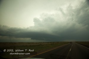
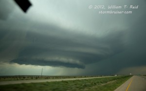
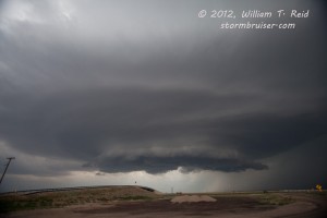
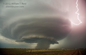
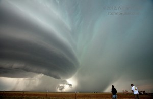
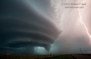
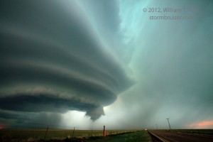
The back end of this new “Adrian” supercell came into view for us near San Jon. The mid and upper part of the storm tower looked good, but not exactly atomic. The storm was dropping slowly S to SSE, which meant that it was propagating to the right (compared to the mid-level flow) and which meant that it was spinning nicely. We just had to beat it to Adrian, where there was a paved road south. On the approach to Adrian the sculpted low levels of the supercell came into view.
Well, we made it to the first Adrian exit in time, around 8:15 p.m. CDT, and the rapidly intensifying storm was just to our north! We stopped along the exit frontage road just west of Adrian.
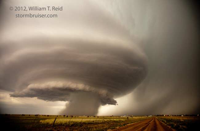
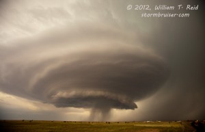
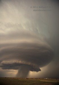
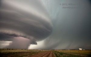
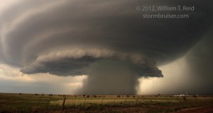
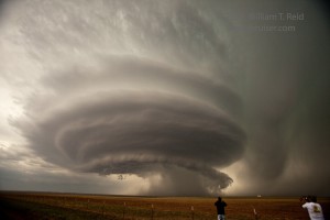
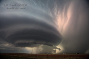
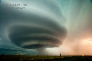
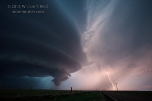
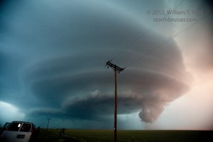
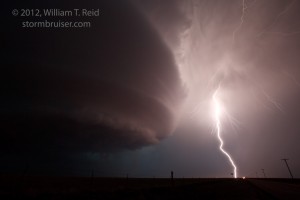
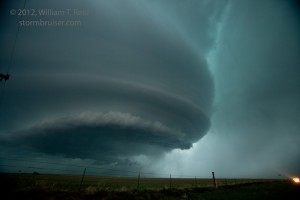
This was a relatively brief stop as we were a little too close for decent structure shots. We went south a couple of miles and then east a little, stopping twice. The storm’s updraft base was primarily to our NNW, and a developing precip core was not too far away to our north. The low and mid-levels of this supercell were going into full “Mothership” mode by this time! I needed all of my 16mm wide-angle lens, for sure.
A wicked precip core developed, and intriguing shapes were barely visible inside or behind the core. The time was about 8:35 p.m. CDT. We thought that there might be a tornado inside there, but it was impossible to tell for certain. The storm became tornado warned, with confirmed tornado sightings! I guess we did see a tornado—-we just weren’t certain at the time—-and a review of our stills and video suggest that one indeed was back in there behind the heavy rain curtain. Chaser Jason Persoff reported that a large cone tornado was on the north side of the meso and it quickly became rain-wrapped. This explains why we had little luck seeing it, as we were on the south side.
(During this time frame I had the Canon 5D on the tripod and was running its HD video — see the link at the top of this page to get a glimpe of the tornado.)
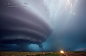
The structure and lightning with the storm were extremely impressive, tornado or no tornado. We stopped a couple of more times farther south along FM 214 for more great photography.
Soon, the NM storms came rushing towards us and the supercell. We were chased east towards Canyon, and the tornadic supercell was ingested and weakened considerably by the outflowing NM stuff. Amarillo was our home for the night.
Link to chaser Niccolo Ubalducci’s awesome time lapse video of this storm on youtube. Our tour group is in his shot at the 4-minute mark.
Link to a write-up concerning antecedent precipitation in the area and relationship to convection on May 21.

Brandon Brown says
This is some of the best storm imagery I’ve seen this year. What a beauty! Thanks for sharing!
Brandon