A very busy few days for us and the Tour 3 folks…
On the 21st we were in northeast NM and wound up on the Adrian, TX supercell. On Tuesday, the 22nd, we headed from Amarillo up to Boise City, OK, and had some strong updrafts go up overhead. These apparently rotated anti-cyclonically, moved ENE into extreme southwest KS, and fizzled. We blew through Dodge City and wound up in Wakeeney for the night. The cable system in town did not carry the channel with the Kings/Coyotes Game 5, unfortunately. I listened to the game on Internet Radio. The Kings won the game in overtime, and advanced to the Stanley Cup finals for the second time in team history (since about 1967)! The other time the Kings advanced to the finals was when they beat Toronto in late May, 1993, in Game 7 of round 3. I watched the end of that game after a chase in eastern CO and western KS, at a motel in Ness City, Kansas. It so happened that I was in Ness City, KS, briefly on May 22nd, 2012, when the Kings advanced to the finals for the second time. We drove through the town during the 1st period on our way north to Wakeeney.
Not exactly mind-boggling information or coincidence, but it is rather funny that I have been in Ness City on the only two days in Kings history when they have won games that put them in the Stanley Cup finals. Enough with the tiresome chit chat —- this post is about the entertaining supercell in Colorado on Wednesday, May 23. My post for the chaser world is below. Images will come later.
—–
Brian Morganti, Chris Gullikson, Bob Smith (from Yreka, CA) and I were teamed up on Wednesday. We began in Wakeeney, and had the luxury of choosing the front to our east and northeast in sc NE and nc KS, or upslope storms in e CO. Moisture with the front was on the lame side for this late in the spring, with dew points generally in the upper 50s. Surface winds were not progged to be nicely backed on the east side of the front, either. It looked like a low-end severe threat along the front with a minimal chance for tornadoes. So, we turned our attention to eastern CO. Models indicated a handful of beefy supercells charging eastbound through east-central CO towards sunset and thereafter. The north to northeast winds in ne CO and nw KS would be going a bit more upslope by dark, especially a little south of I-70, where the front was hung up and where dew points were higher. Upper flow was very nice, with 500 winds about 50 knots from the WSW. As has been the case for most of May, moisture was the big issue today in CO —– dew points were only in the upper 30s north of I-70 and in the mid 40s at Lamar and La Junta.
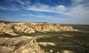
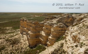
We visited Castle Rock (sw of Wakeeney), had lunch in Oakley, and continued west to Seibert on I-70. Not much was happening towards 23Z or so, except for the usual junky stuff along the foothills between COS and DEN. Anvil clouds were spreading towards Seibert and shading much of ne CO. SPC’s meso page showed that the best air and theta-e axis was situated east-west roughly along U.S. 50 —– to our south a couple of counties. As a storm quickly blew up near Colorado Springs, we motored south to Kit Carson and west to Aroya to watch it approach. This one was high-based with a nice laminar look at low-levels. Strong east winds were feeding it, but the dew point at our location was no more than 40F. The base on the cell was fairly large, but it was kind of dead looking, there were no CGs, no lowerings, and not a whole lot of precip being generated. The storm neared and we raced east about 8 miles to maintain position, but by this time the storm was weakening rapidly. A second and newer cell was not too far behind it, near Punkin Center, so we figured that we would watch this one approach us at Aroya.
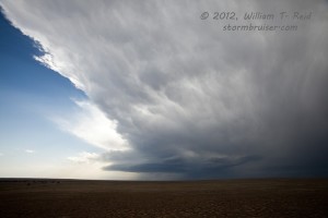
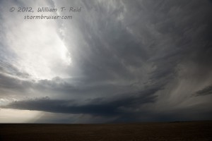
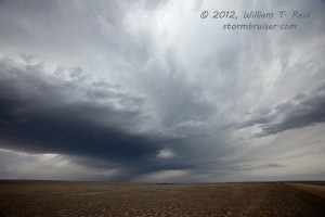
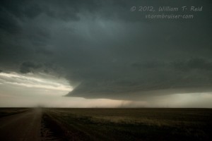
However, we spotted a new, solid storm base to our west-southwest, towards Pueblo. This thing came up very quickly on radar and was moving east at a good clip. It was severe-warned right off the bat, where-as the other cells that were tracking along Route 94 from Punkin Center to Aroya were not getting warned for. Best of all, it was chugging right down the axis of richer moisture between U.S. 50 and Highway 96. Its base looked quite a bit lower than those along 94. We needed to get in front of it, but we had limited paved south options. I first decided to head east from Wild Horse to Eads and go south from there. Then, I looked at the clock and saw that we only had an hour or so of good light remaining. It would be dark by the time we were near the storm if we backtracked. We turned around and headed towards Punkin Center and a south option, Hwy 71. But, that would likely put us on a collision course with the core and little to no chance of getting in front of the supercell. My road atlases showed an unpaved south option from Boyero to Haswell, so I gambled that the road would be good and that precip would remain to the west as we dashed south. It worked out quite nicely! As we approached Haswell from the north, we had a great look at the base and the structure of the supercell some 10-15 miles to our southwest. There was generally no lowered area or wall cloud, but dust-filled low-level winds were surging towards the base and lightning was all around. This was quite a difference compared to the fuddy-duddy cells not too far to the north.
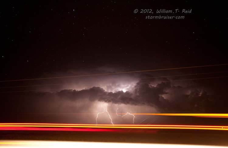
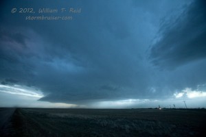
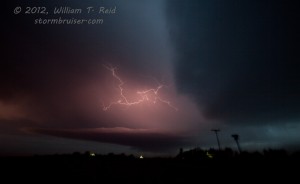
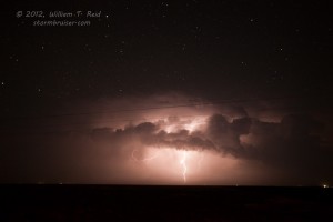
We made several stops along 96 from Haswell to Eads to Tribune to enjoy the storm, the structure, and especially the nearly continuous lightning show —- both in-cloud and CGs. We were beneath the anvil and in light rain for the most part, and NNE winds were blowing 25 to 40 mph the entire time. The updraft was mostly to our south, and I managed some okay stills in the fading light and lightning. A couple of fires burned near Hwy 96 due to CGs out of the anvil east of Eads. We didn’t see any other chasers after leaving the Aroya storm(s).
As we neared Towner and Tribune, radar for the supercell showed a strong couplet and occasional TVS markers. The action area was along U.S. 50, about 25-30 miles to our south. We dropped south out of Tribune and got behind the storm about 10 miles north of Syracuse. Here we stepped out into the chilly north winds and tried some photography of the retreating lightning-filled updraft tower beneath the dark, star-filled skies of western Kansas. It was almost midnight CDT, and now the storm was weakening and we headed to Garden City for the night.






Leave a Reply
You must be logged in to post a comment.