SPC painted a slight risk across much of KS today, but there were a handful of “issues” both meteorologically and logistically. We headed east from Garden City, and I shared my thinking with CFDG:
—-
Regarding the eastern KS target—-
We have to be back in OKC by noon tomorrow and are headed east towards Wichita. We are looking at developments in southeast KS, as that area is reachable today and close enough to OKC.
Satellite shows a nice comma-shaped pattern to the cu field not too far east of ICT at 20Z. I’m not really sure what is causing this, but the sweet spot looks to be in Butler County or western Greenwood County. Instability and effective bulk shear values are excellent in this area, so anything that can blast through the cap should be big and bad. The RAP model from the Twisterdata site insists on a storm near Chanute by around 00Z to 01Z. The HRRR is much less enthusiastic, as Matt noted. We may as well continue east from Wichita to see if something can go up. The 20Z MLCAPE chart shows little to no MLCIN remaining along the boundary east of ICT.
—-
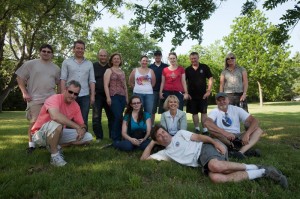
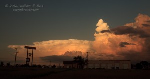
We killed some time at a local park in Eureka, and then headed north towards some developing storm towers. We got some cool photos of sun rays and silver linings, but the convection was unable to organize into strong and discrete cells. At Emporia near sunset, I opted for food and a shorter drive back to OKC instead of staying with the unimpressive activity to the east.







Leave a Reply
You must be logged in to post a comment.