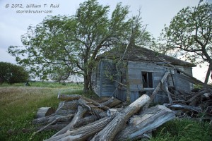
Our new group (Tour 4, with Keith and Brian and Woody) started midday out of Oklahoma City on the previous day, the 26th, and observed some very marginal convection near Dodge City and Garden City in western KS. The highlight may have been a lightning-started brush fire on the southeast side of Dodge —- law enforcement had the main highway into town closed due to smoke and poor visibilities. Here are some pics of the small evening stuff near Garden City.
The 27th setup from about Hays north-northeastward into eastern NE looked pretty decent as a potent upper wave moved onto the Plains. SPC had a moderate risk in place, and a 5 percent tornado area outlined north of I-70. I wrote the following in the early afternoon:
—-
We drifted north from Hays to Plainville after lunch…without much of a reason.
19Z surface data map shows lowest pressures at MCK and HLC. Latest RUC/RAP or whatever it is called suggests some backed low-level flow around I-80 at EAR by around 22-23Z. These two indications, plus more of a cu field centered near Arapahoe and Holdredge now have me leaning northward into SC NE.
—-
We eventually wound up near Red Cloud, NE and Lebanon, KS. From here we watched a cluster of cells develop well to our southwest around Hays. The individual cells moved quickly NNE — to our west — and did not impress. I tried to be patient, hoping that something would emerge from the junk and start to clean up the mess. Nothing was worth targeting.
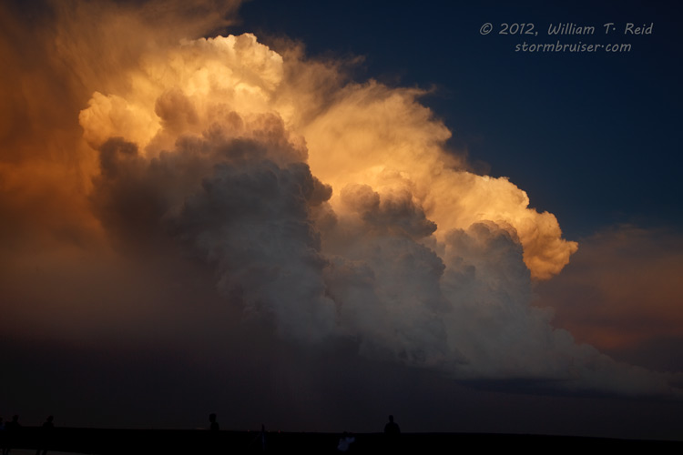
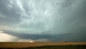
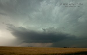
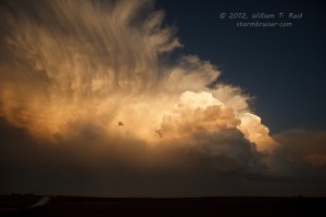
With sunset an hour or two away, I had to get us on something. We went south to Lebanon and west to Smith Center, and found a storm with some supercell characteristics. It looked decent at low levels and had some nice lightning in the storm tower. This one had a chance to please, but another cell slammed into it from the south and ruined the show. Additional cells to our south and southwest were somewhat photogenic after sunset. Here is a longer account which I wrote shortly after the chase:
—-
Our group (Brian Morganti, Keith Brown, and Woody Watson) began the day in Hays. We had a marginally vague idea as to where we should be during the afternoon along the boundary. Strike that —– I had no clue where we should be along the moderate risk zone from about Hays to west of Grand Island. Surface winds east of the front were southerly during the early afternoon everywhere, and dew points were disappointing low —- around 60F to 63F. Models indicated some backing up towards Kearney by 00Z. Models also were predicting a bunch of medium-sized cells all along the front from about Hays to Smith County and into NE, and that is what we were dealing with by 6 p.m. We were up along Hwy 136 between Franklin and Red Cloud and watching fairly junky stuff zoom northward at about 50 mph to our west. The plan was to be patient, stay a little bit east of the development, and wait to jump on a cell which was worth intercepting and which wasn’t blasting NNE.
Along 281 between Red Cloud and Lebanon we waited, with a false start or two towards cells with large hail markers. Nothing was able to get really big and beefy and lumbering, though. Closer to 00Z or a little thereafter we decided to play the somewhat more isolated tail-end stuff that was down south near Hays. We should have stayed in Hays all along, I suppose. On our way south, a decent supercell updraft took shape a little west of Smith Center. It showed some interesting low-level structure and had a shallow wall cloud and a bunch of in-cloud lightning in the updraft. Best of all, it wasn’t moving north at break-neck speed—–we were able to get out of the vans and watch it for ten minutes! But, it was soon decimated by a (left-split?) cell that was screaming northward—-it was a direct hit. Pity.
We scooted west and south to get a look at the backside of the LP-ish cell that was southeast of Stockton. It provided a pretty picture or two at sunset, but it sounds like we should have stayed east to get in front of the Hays-Russell supercell at dusk.
—-




Leave a Reply
You must be logged in to post a comment.