We had a fantastic chase in central Oklahoma on the 29th, and on the 30th my target area of northwest OK did not work out, and we missed some very nice supercells from about Childress to Seymour. On the bust day of the 30th we spent some time around Canadian, TX, looking at weak cells, which seemed to have moisture or cap issues. A Vortex/Doppler/research group was flailing along with us, so at least I didn’t feel like the only dufus on the Plains. Here is my account for the 30th:
—-
Well, I may as well get this out of my system. We bit too hard on SPC’s mod risk and 10 percent tornado area in NW OK (and north into KS a little). The early day CFDG posts by Bruce and Rich and others were spot-on, and I didn’t consider the area from Shamrock to CDS carefully enough. NW OK looked good on paper late in the morning, with dews in the low 60s well into the E OK PH on SE winds below great westerly 500 flow right in front of that upper wave. Lots of midday strato-cu was a concern, but it was warm and humid and partly sunny in Woodward at 2 p.m. I figured that tornado chances would be a bit better with a storm (if one could form) somewhere around Liberal to Woodward compared to the outflow boundary area of the SE TX PH as cloud bases would be lower. It was quite hot just south of the mid-afternoon CBs that went up south of I-40, and I thought HIGH BASE would equal OUTFLOWISH stuff like two days ago near Seymour. CAPE and shear looked great west and NW of Woodward by mid-afternoon.
So, near Laverne around 4 p.m., we gave up on our target area and went SSW to the Pampa area storm, the northern-most one of the N-S line of 4 or 5 supercells. When we got to Wheeler, the northern storms were croaking and the southern one near CDS was looking beastly. There was no way to catch it as it was diving SSE. We wasted time and gas looking at a couple of other goofy storm towers and then went to CDS for the night.
I’m not quite sure why little to nothing developed where I wanted it to —- maybe poor timing with the upper-level support, and/or too stable at low levels. Congrats to those who managed to get in front of the beasts south of CDS.
—-
This post is about the good and not the bad, so let’s get to May 31st. We needed to go to the ends of the Earth, south of Marfa, TX, for a good storm. Here is the story, written shortly after the chase:
—-
Our group was left with little to show for the chase on the 30th, and I was eager to get that sour taste out my mouth by finding a good storm for them the following day. We began in Childress, and SPC had a long E-W swath of slight risk generally along I-10 in south TX. The western edge of the slight was near McCamey and Sanderson, but forecast models were not showing much in the way of storminess from Fort Stockton to San Antonio due to a strong cap. They were, however, breaking out storms at the western edge of the good low-level moisture, from about Pecos to Marfa. The 500 flow was rather strange, with light north flow in West TX north of I-20, and marginal west flow (about 20-25 knots) along and south of I-10. Flow from the surface to 850 was forecast to be from the east at 15-25 knots during the evening, so there was pretty good shear south of I-10. Flow at 700 was light and from the east. I wasn’t expecting any tornadoes or a drop-dead gorgeous supercell, but just something pretty and entertaining in desert mountains.
We headed to Monahans and Pecos after lunch in Big Spring. A large cu field surrounded us, and towers developed primarily to our south. Good —– this was where the better flow aloft was. CAPE was quite decent, over 2000 J/kg, too. Dew points were near 60F as far west as Monahans and Fort Stockton, but fell off rapidly to the 40s towards Van Horn and Marfa, where winds were out of the NNE. Juicy air with dews in the mid 60s was lurking at Dryden, and I was hoping that this low-level moisture could make it farther west on those low-level easterlies. Our only real issue now was the marginal road network. A CB was a little south of Pecos, and I had to decide whether to take 385 southeast to Fort Stockton or 17 south to Saragosa. If I made the wrong choice, then it might mean a 50-mile long backtrack. Given the easterly flow at 700 and the generally light flow at 500 mb, I figured that any really good storm today would track to the south, or maybe even the SSW. We headed to Saragosa and Balmorhea.
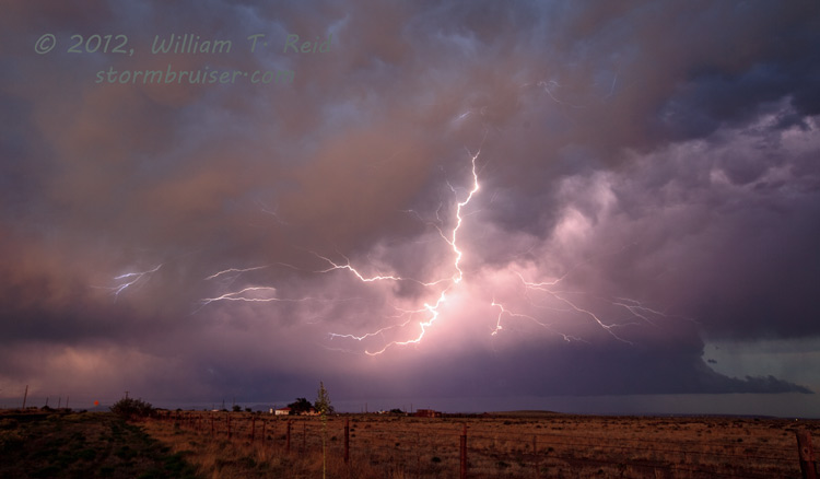
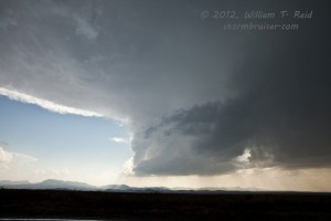
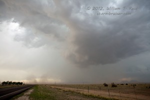
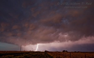
We were near or a little south of the Balmorhea area for at least an hour, watching strong, high-based CBs spit out lightning, some heavy rain, and small hail. Finally, a beefy and nicely tilted updraft tower beckoned to our south. Its top hit 50,000 feet and above, its base had a good roundish look and it was drifting south. Highway 17 led right underneath it! We wanted to get south of it, but were delayed a bit by large hail. We measured one stone at 2.75″ and phoned the report into NWS Midland. This was in the “mountains” about five miles northeast of Fort Davis. The landscape flattens out nicely south of Fort Davis, and we were able to get a little southwest of the updraft base. Unfortunately, it didn’t look as nice and round and sculpted as it had on the north side of the Davis Mountains. The storm struggled as it continued ssw-ward towards Marfa. The dew point at Marfa was only 43F, so I figure that the updraft was gasping for moisture as it drifted away from the good low-level air.
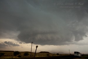
There was another big cell to our west, near the border, and another one to the east, near Alpine. The Alpine storm looked to have a big area of precip with it, AND it was presumably closer to the really good moisture that was headed west along U.S. 90. We drove from Marfa towards Alpine about 6 miles, and tried to figure out which side of the storm we should be on for the best structure. The cell was moving southwest to almost WSW! The precip core descended upon us and chased us back to Marfa. A nice, black and round storm base was southeast of Marfa and we stayed with that for 20 minutes or so south of town. Great close CGs hit a mile or two away and more small hail fell. I thought that there might be a chance for a lucky tornado out of this base, as it was quite a bit lower than the previous storm bases, but it didn’t wrap up nearly enough.
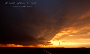
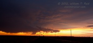
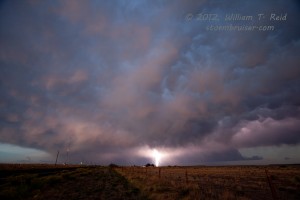
We headed back north to Marfa and then west of town a couple of miles for the very nice mammatus/rainbow/lightning crawler/deep sky color sunset. The storms were decreasing quickly in strength by this time. It was well worth the long drive to the Ends of the Earth.




Leave a Reply
You must be logged in to post a comment.