Lot’s to catch up on, but no time, as usual. The Kings won the Stanley Cup, so all is well and good, regardless of how the chasing is! Tour 6 began on the 10th, and we blasted east from Denver before noon and caught an interesting severe storm near Green, KS (north of Manhattan, KS) at sunset. There were plenty of scary hanging downy things, but it was kind of an outflowish elongated mess. On the 11th we caught a very strong and pretty CB just west of Bowie, TX at dusk.
Today, the 12th, we had another long drive from Wichita Falls to eastern NM. I thought I had today figured out on the 11th, when I posted a forecast to CFDG at noon:
—-
I am favoring the upslope play on the southern end, perhaps around Lubbock to Fort Sumner, NM. The NAM shows 60-plus dews getting shoved westward on impressive E to SE winds. Instability and low-level shear are looking good in this area. I am concerned about all of the daytime precip that the models are showing in the Panhandle area, though. The 500 flow is forecast to be 30 knots from the west, just a little weaker than that up in NE. This setup is looking good for a big beast or two moving SE on the high terrain near the NM/TX border, probably south of U.S. 84.
—-
My thinking had not changed too much when we began our trek west from Wichita Falls. The east-central NM area still looked good, though there was some thought given to southeast NM, also. We drove through some weak storms in the first hour or two. These were leftovers from a fairly healthy morning MCS over the Panhandles.
SPC’s 1630Z outlook had this to say:
OVER THE HIGH PLAINS...OUTFLOW IN THE WAKE OF NWRN TX TSTMS WILL
   ENHANCE LOW-LEVEL UPSLOPE FLOW COMPONENT...WHICH WHEN COUPLED WITH
   THE POTENTIAL INFLUENCE OF WEAK FOUR CORNERS IMPULSE...WILL FOSTER
   WIDELY SCATTERED TSTMS ACROSS PORTIONS OF NERN/E-CNTRL NM INTO WRN
   TX BY MID-LATE AFTERNOON.  AMBIENT ENVIRONMENT WILL BE CHARACTERIZED
   BY MLCAPE OF 1500-2500 J/KG AND 40-50 KT OF DEEP WLY SHEAR WHICH
   WILL FAVOR SUPERCELLS AS THE INITIAL STORM MODE WITH AN ASSOCIATED
   RISK FOR A FEW TORNADOES.
After lunch in Lubbock, we started southwestward on U.S. 82/62. There were indications of good convergence and better moisture along an outflow boundary in the Hobbs, NM area. We drove about 8 miles from Lubbock and then I decided to stop. Should I really be heading this direction? What was I doing?! The area west and west-northwest of Lubbock still looked good —- as long as a storm was going to go up there! My thoughts in my summary post to CFDG are of some help here:
—-
We targeted east-central NM after wavering some near Lubbock. The outflow boundary and juicier air down towards Hobbs and vicinity were enticing, but I didn’t like the high 500 mb heights and the warmer 700 temps. And, perhaps most of all, I didn’t think that the tornado prospects were good enough in that southern target area (roughly Andrews area to Hobbs) to warrant the extra 2 hours drive south, given that we would be heading back north to the KS/NE/CO area the following day. So, I crossed my fingers and hoped that the RAP model had half a clue with its unwavering insistence on storminess not too far from Clovis by late afternoon.
—-
We reversed course and headed to Clovis — to the northwest of Lubbock. Our target area was going to be Clovis!
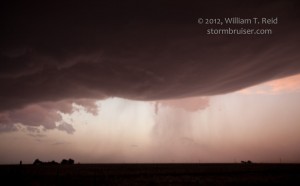
We arrived in Portales around 21Z (3 p.m. local MDT) and a little later at Clovis and stopped for a break. There was little reason for high hopes yet —- the sky did not have a good look to it and the radar showed nothing south of the Raton Mesa-area storms. I decided to start heading north and northwest from Clovis in order to try to salvage something. The satellite pic was finally showing a cu field some 80 miles to our WNW, so I hedged a little towards the west. A radar blip or two showed up inside of the cu field, and a cell slowly matured south of Santa Rosa. We vectored towards the eastward-moving “storm” and watched it from the edge of the caprock, about 8 miles WNW of House, NM. House is in southwestern Quay County, between Santa Rosa and Clovis. Our elevated vantage point was quite nice, as the terrain fell off sharply to the west, towards the updraft. Time was about 5:55 p.m. MDT.
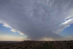
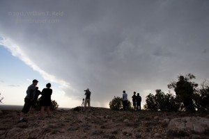
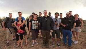
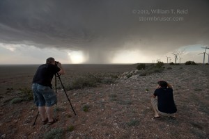
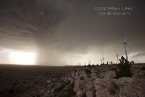
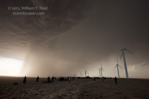
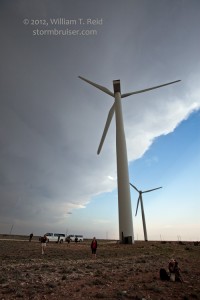
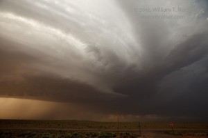
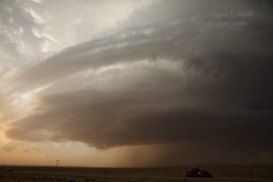
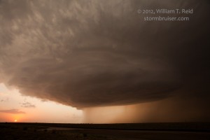
The cell split a couple of times and slowly approached. It was a bit high-based, elongated, and scrawny early on, and it was definitely in no hurry to strengthen. The precip core was aimed right at us, so we went south about ten miles on Road 252. We scooted west a mile or so to the edge of the caprock, and shared the view with a long string of eyesores. Time for the images below: 6:53 to 7:07 p.m. MDT.
The nearby updraft base was increasing in size and the overall trend was excellent. As the updraft moved to our north, it was time to get better position on the thing. I considered heading back north and east towards House on 252, but that would mean getting involved with the core and perhaps some large hail. After another stop a few miles south, we continued all of the way to U.S. 60/84 at Taiban, in De Baca County, NM. This was about 10 miles farther south than I wanted to be, but we had to get east!
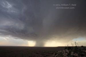
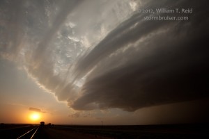
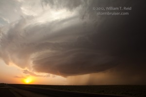
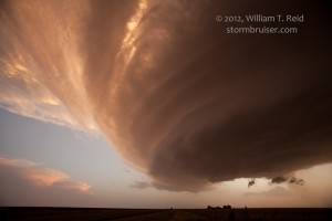
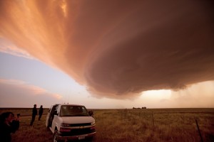
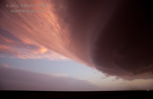
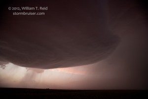
We flew east about ten miles, past the ghost town of Talor, into Roosevelt County, and stopped to take a look — my, things really changed in 20 minutes! We were along a stretch of U.S. 60/84 which angled WNW/ESE, and the highway and railroad tracks pointed towards the sunset and the southern fringe of the newly developing laminar side of the updraft base. We weren’t too far south at all —- the storm was turning sharply to the right and was quickly morphing into a spectacular supercell with a quasi-mothership updraft base! Yippie! The images below are from 7:46 to 8:03 p.m. MDT, about 13 miles west of Melrose.
I can’t recall ever seeing these bands or “ring strands” take shape around the updraft base as they did with this supercell. Before heading east again, we looked up to see a wicked “knuckle” protruding from the storm’s anvil. This thing was the real thing!
The storm’s fabulous rounded structure continued as it approached Melrose. A funnel descended perhaps 1/5 of the way down from the high base WNW of Melrose, and then dissipated. The storm was really wound up with a great RFD cut, but it never sported much of a wall cloud.
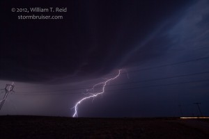
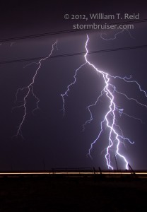
Large hail chased us south of Melrose a bit after sunset. The supercell was tornado-warned for the next hour or two as it propagated quite hard to the southeast, towards Dora. We shot some lightning and let it go before Dora and headed back to Melrose and Tucumcari for the night. Apparently 4.5 inch hail was observed with the storm in Melrose, where trees were heavily shredded and windows shattered.









Leave a Reply
You must be logged in to post a comment.