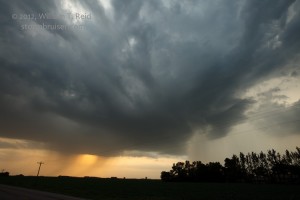
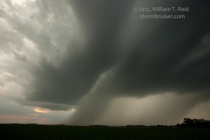
Our group had relatively high hopes for something big and bad in the troposphere today, near the SD/MN border. The atmosphere dashed those hopes. My detailed notes state that we began the day in Faulkton, SD. Lunch was at the China Buffet in Watertown, and we waited and waited in and around Madison, MN, during the afternoon. The cap held until 8 p.m., when impressive storm towers finally exploded near Dawson, MN (a little south of Madison). We caught up to these in short order, but they did not appear surface-based, they were not well-organized, and they quickly struggled. Shortly after sunset, west of Willmar, there was little to nothing worth chasing. We had dinner in Willmar and stayed the night in Redwood Falls.
My late morning forecast post was optimistic…of course, everything hinged on whether the cap could be breached or not:
____
Today, on paper, looks to be one of the best setups of the chase season for me. We need to get a little east or northeast of the eastern SD surface low, perhaps near Milbank, SD, this afternoon. Instability and low-level shear along the warm front into MN are more than adequate for a strongly rotating updraft and a pretty good tornado chance. I like the progged strong southerly 850 winds pointed right up against the warm front. I can’t see many negatives today —- mid-upper 60 dew points, CAPE values above 3000, nice boundary, great flow at 700 and 500. What could possibly go wrong?
____
Yep —- the cap was what was wrong with today. A NOW post by me made around 7:50 p.m. CDT sums up our plight:
—-
Nothing so far —- the cap won out (so far) over the strong moisture convergence region near the surface low between Huron and Watertown late in the afternoon. We are headed back east into western MN, at Madison currently. Strong towers are going up just to out ESE, towards Montevideo. This is in an area with very strong “deep” moisture convergence, according to the SPC mesoanalysis site. I suppose there is still hope before sunset. The low-level easterlies have dissipated for the most part north of the warm front, though.
—-
We were excited for a half hour or so as a very impressive storm tower blasted through the cap and became severe-warned. But, it sputtered, other nuisance cells interfered, and then everything went totally blah. Game over. Below these pics is my summary for CFDG.
By late afternoon we were still waiting for development along the warm front in west-central MN, near Appleton. Convergence was strong back to the WSW, between Huron and Watertown (near the surface low), and near our immediate vicinity. Instability and low-level shear were great, but the cap was strong and the sky showed no inclination at all to make a storm. Towards 6 p.m. or so we made our way west towards Watertown and the surface low, thinking that our best chance for surface-based storm development would be there. Haze and local cloudiness prevented a view of any decent updrafts, but the satellite picture offered some hope. As we neared Watertown, we stopped and waited a bit —- nothing was developing near the surface low. Some elevated junk was going up north of the warm front some 25-50 miles to our north, but I wasn’t interested in those. Much of the low-level cloudiness was disappearing and a handful of storm towers were showing some promise just to our south and southeast now. We scurried back east again from SD (east of Watertwon) through Madison, MN. Several skinny towers croaked, but finally one broke through and was very impressive, near Watson. We thought that we were in business, but the thing sputtered and another storm tower or two went up to its south. The storm bases were rather small and showed little organization. It seemed that these cells were not strongly surface based. Also, these were in the humid south winds south of the warm front, which seemed to be weakening and shifting north. The nice east winds that had been blowing on the north side of the warm front were gone, and just weak north winds were blowing on the north side of the front. At sunset our little cluster of cells was weakening further. We were treated to a little lightning and thunder, a brief hail shaft and a hint at low-level structure on this chase, but overall it was a disappointing day given the tornado watch and what-could-have-been setup.


Leave a Reply
You must be logged in to post a comment.