This looked to be the last chase day with good potential for the Tour 7 group. Our last full chase day tomorrow was going to be a dud. We began the day in Valentine, NE, with a somewhat wide area of the High Plains to consider. One good area was west of Chadron, around the WY/NE/SD meeting point. Winds would be backed quite nicely through there by 00Z. Heights were higher and 700mb temps were a toasty and scary 17C farther south, into northeast CO and along the Cheyenne Ridge around Kimball. But, when dew points are up around 60F at Akron and Sidney, as they were this afternoon, a chaser takes notice.
Here is my late morning thinking as we headed out of Valentine:
—-
Our group is in Valentine. A quick first look at models and real data this morning is causing me some consternation. 700 temps include 14C at RAP and 17C at DEN at 12Z, and the NAM suggests little change through this evening. Of course, initiation over the high terrain out west (Laramie Mtns and the Black Hills) is not as problematic versus farther east with these toasty mid-level temps. Current dew points favor the ne CO area over the sw SD area a little, and the NAM suggests low 60 dews by 00Z Sat for the entire tongue from about GLD to RAP. Not much difference in 500 and 700 flow from I-70 in CO to I-90 in w SD…but low-level flow is progged to be backed more just north of the Black Hills versus areas to the south. The NAM blows up a biggie late this afternoon from about Greeley to Akron, a smaller one north of Sidney, NE, and is very apologetic with any storms around the Black Hills through this evening. The NAM’s projected precip picture goes against the cap picture —- with the heavier storms in the hotter mid-level air.
The HRRR and RAP models are of little help yet. My gut tells me to play the north end, somewhere around the Black Hills, where low-level flow will be backed nicely and here the cap is not as strong. But, ne CO and the Cheyenne Ridge have a magic to it. This region laughs at the cap and beautifully sculpted supercells are often the result.
Should we drift down 385 to Sidney and play on the 588 line at 500 mb and the 17C line at 700?? Or, play it a little safer, seemingly, and stick to PLAN A around RAP…or PLAN B at Lusk?? I really don’t know at this point. We’ll head on over to Chadron and delay the decision.
—-
By early afternoon I kind of had a plan:
—-
We turned south at Hay Springs, NE, and are headed to Alliance…and very likely south from there into ne CO. The nice, deep surface moisture with dew points as high as 63F at Holyoke, Burlington, and Colby are impossible to blow off. The juice has not reached sw SD yet, though it probably will by sunset. The HRRR is insistent on a good-sized storm in or near Washington County, CO, by around 23Z. The base will likely be on the high side, at least starting out. Shear and instability are more than enough for a great supercell —– but those 700 temps are awfully scary.
Another option would be to hang out around Crawford and Harrison, NE. The good juice is headed right up into the nw NE PH. It is a tough call —- and I’ll probably be going for the ne CO target after our quick lunch in Alliance.
—-
On our way south from Alliance to Bridgeport I had my eye on northeast CO, due south to Sterling. The axis of expected development was angled somewhat NNW-SSE, and if I were going to target northeastern CO, then I needed to keep going south without delay. Updated forecasts were consistent with big storm development around Morgan and Washington counties, but they were also now adamant about storm development (commencing about two hours later) not too far from Lusk—-and a biggie would be moving into extreme southwest SD or the extreme northwestern Nebraska Panhandle. Not much was expected in between. Tornado prospects appeared a bit better for the northern target area, but overall shear and instability were excellent everywhere, especially towards sunset.
At Bridgeport, by around 3 p.m., after much consternation and inner turmoil, I had Danny and Justin turn the vans westward towards Scottsbluff. We were now targeting the area from Lusk to Harrison and vicinity —– up near the WY/NE/SD triple point.
My primary concerns were
a) the strong cap —- could I trust the models which showed development there despite the very warm air at mid-levels?
and
b) the meager road network up in the extreme northern Nebraska Panhandle and extreme southwest SD. The only decent east-west road up there is U.S. 20. If a cell is chugging along at 25-30 mph and isn’t close to U.S. 20, then a chaser won’t be able to stay close to it for very long. Also, if a cell is moving into the Black Hills, the terrain and forests and windy roads cause heartburn.
I wrote another blurb to CFDG to rationalize my decision:
—-
Effective bulk shear, backed low-level flow, and moisture convergence favor the Goshen County WY and western NE PH region at 20Z versus northeast CO. The 60F dew point at Sidney is hanging tough, and the moisture feed into the roadless area between Lingle and Harrison looks great. We have diverted WNW-ward from Bridgeport towards Scottsbluff. The CO target area around Akron to Yuma still looks good, but the western NE PH play looks just as good or a little better now.
—-
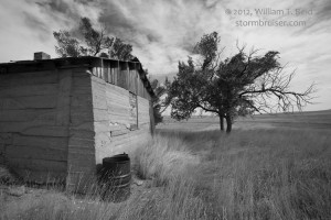
We motored westward past the National Monument, stopped in Mitchell for a pit stop, and headed north on Route 29 towards the northern Panhandle. After about 20 miles we stopped (near Murphy Road) to watch some promising towers well to the west. These struggled against the cap. In the meantime, a good-looking storm had developed near Sterling. It was difficult to be patient. We looked for skeletal remains around an abandoned house.
I returned to the van and checked radar. The first CO cell was sputtering. It was WAY down to our SSE and too far to consider at this point, and I was a little relieved that I had not blasted into CO. Our sky continued “blah”—an orphan anvil and some altocu—while the towers to the WNW did not raise enthusiasm levels.
Patience, patience, patience…patience was needed. Patience was required. Stick to the plan, Bill! It was close to 5 p.m. MDT, with four good hours of light remaining. The radar now showed a strong storm developing northwest of the cruddy storm in northeastern CO. This new one was southwest of Kimball, along the Cheyenne Ridge. It was due south some 75 miles distant, and I couldn’t see it visually. It air was kind of murky and un-High-Plains-like. Well, I needed to get this group on a storm, so we blasted south. It would take almost 90 minutes to get to it if it kept moving ENE. I was basically abandoning the target area that I had decided upon, and patience went out the door. Writing this after the fact, it was a bit of a dumb move. You gotta stick to your guns! Well, that is difficult to do when you are sitting there under fair skies while a big red and purple blob is within reach. So, south we went, and we could always come back north if those towers to the west exploded…soon…
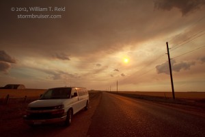
It took an agonizing 75 minutes or so (south on 29, east-southeast on U.S. 26 through Scottsbluff, and south on U.S. 385) to get close to the “Kimball” storm. Thankfully, it was continuing east to east-northeast at a fairly slow pace. We didn’t get to see it until we were about halfway between Bridgeport and Sidney. Smoke from a fire near Fort Collins was obscuring the sky! There were actually two cells now. The south one was the original one, and it had a scrawny and high updraft base and was a disappointment. A second cell was wetter and uglier, in a good sense, and practically right above us as we stopped south of Gurley, NE. This second cell looked like a left split, though, and its base was quite high. Chase prospects looked kind of bleak at this point, but we would try to make some lemonade.
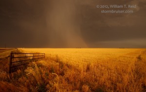
The Gurley cell hit us with some hail, and had an appealing black and nasty look as it moved to our east. We followed it east out of Gurley and stopped in the nice soft light.
Our little Gurley cell weakened as it drifted northeast, and our attention turned back to the south-southwest, towards the cyclonic and still scrawny LP-ish updraft. It was now spinning a little east of Sidney along I-80. We went east on a gravel road and then south towards Lodgepole in order to get in front of it. During these 10 to 15 minutes, the base seemed to grow a bit. Was it just because we were getting closer?
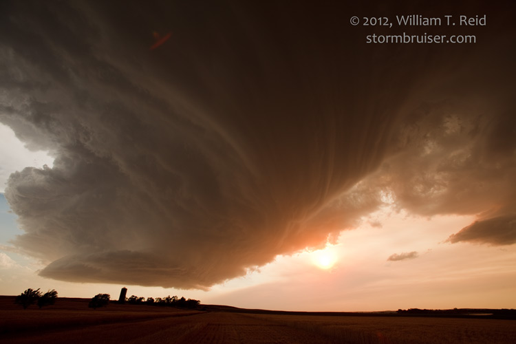
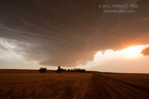
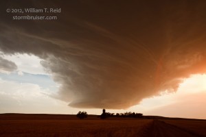
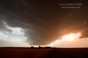
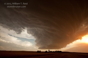
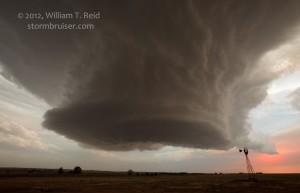
In part, sure, but something in the atmosphere had just clicked, and this “Lodgepole” updraft was strengthening very quickly. We easily got in front of it a mile or two south of Lodgepole, between U.S. 30 and I-80. Within minutes, we had a very impressive, uh, Lodgepole Barberpole (?!) supercell updraft staring us in the face!
The eight images above were taken from 7:13 to 7:26 p.m. MDT. The base was lowering some but was still on the high side. Tornado potential appeared low with this LP, so we scooted east on U.S. 30 a few miles, and then several miles further, to get a good look at the storm structure.
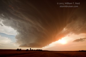
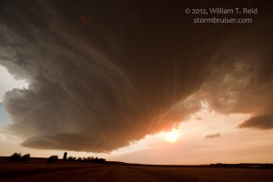
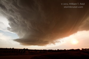
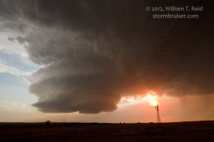
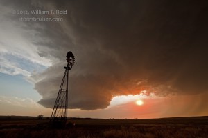
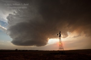
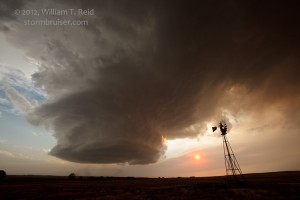
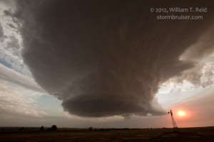
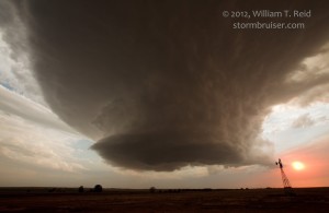
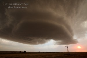
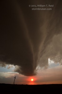
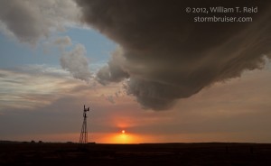
The fifteen images shown here during our “windmill” stop were from 7:34 to 8:04 p.m. MDT. The location was about 2 to 3 miles WNW of Chappell. As the updraft base approaches, the clear slot/RFD area becomes obvious, and is nearly overhead at image 9207.
RFD dust plumes and dust whirls are faintly visible beneath the updraft base in some of the earlier images. A short stubby funnel or two was also observed. We figured that that was enough evidence to call the whirl a tornado. Another chaser agreed and reported it as such.
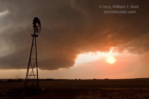
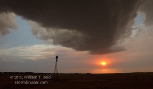
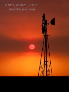
With the updraft overhead and the storm updraft too close for structure shots, I grabbed my long lens for some smoky sunset shots.
I doubt that this Nebraska windmill has had its picture taken more often than on this day by myself and our group of 16.
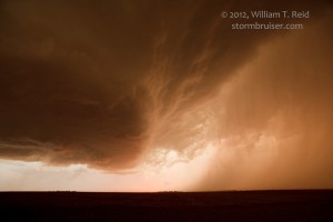
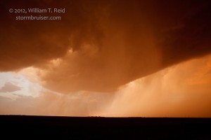
We headed through Chappell and caught up with the action area. Precip was wrapping around the updraft base now, and we were clearly inside of a developing hook echo! CG lightning strikes commenced at very close range, and it was too dangerous to step outside of the van. A blob of precip descended from the base near the RFD area. This sometimes occurs just before tornado formation, but this storm was unable to make one.
This exciting phase did not persist. We scooted a little farther east, towards Big Springs, and set up one final time just after sunset to watch the supercell move to our north and northeast, with plenty of in-cloud lightning and occasional CGs.

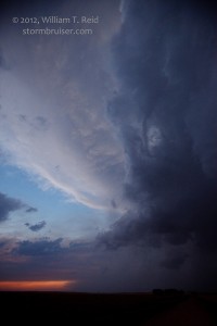
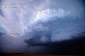
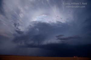
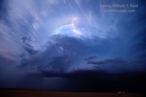
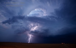

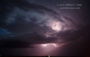
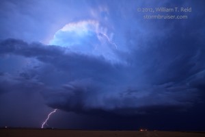 The supercell shrank as darkness fell over western Nebraska, and our group stopped in Ogallala for food. I learned of the fantastic tornadic supercell near Ardmore, SD, which occurred while the Lodgepole/Chappell storm was at its best. Yes—-this was smack dab in the target area I had in mind while sitting north of Mitchell at 5 p.m. You gotta stick to your guns. Fortunately, our storm was no small potatoes!










Leave a Reply
You must be logged in to post a comment.