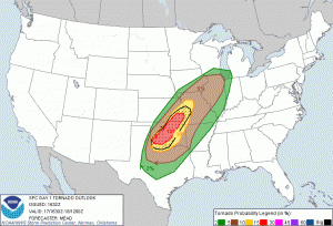
Wednesday, April 17, was shaping up to be a big chase day in OK and northwest TX, as a strong spring storm system moved eastward out of the Desert Southwest. Winds aloft were strong and from the southwest, and surface winds were moist and from the SE to SSE into northwest TX and southwest OK. Dew points were near 65F. This air was crashing into and over a front which stretched from the southeastern TX Panhandle northeastward towards northeast OK. Late in the morning (1630Z), SPC indicated a chance for large tornadoes:
FARTHER SWWD ALONG THE FRONT FROM N-CNTRL OK INTO NWRN TX… STRONGER CAPPING
IS EXPECTED TO DELAY STORM INITIATION UNTIL LATER THIS AFTERNOON INTO EVENING
WITH THE HIGHEST PROBABILITY OF DEVELOPMENT OCCURRING NEAR THE DRYLINE-FRONT
TRIPLE POINT. DESPITE AN INITIAL WEAKNESS IN FORECAST HODOGRAPHS IN THE 2.5-4 KM
AGL LAYER…THE ENVIRONMENT WILL BE VERY SUPPORTIVE OF INTENSE SUPERCELLS CAPABLE
OF VERY LARGE HAIL AND TORNADOES /SOME POTENTIALLY SIGNIFICANT AND LONG-TRACKED/.
AN ENHANCED TORNADO THREAT IS EXPECTED TO PERSIST INTO TONIGHT ALONG THE I-44
CORRIDOR OF OK WHERE HODOGRAPHS WILL GROW INCREASINGLY LARGE AND THE BOUNDARY
LAYER WILL REMAIN VERY MOIST AND MODERATELY UNSTABLE.
Here is the 1630Z tornado graphic:
My chase tour work was scheduled to begin on Saturday, April 20, and I had five days free to make my way from home in Southern California to the Plains. I picked up Rob Petitt at Burbank Airport on Monday evening, and by Wednesday morning we were motoring eastward on U.S. 70 out of Roswell, NM. I had a couple of chase targets in mind. The primary one was the triple-point area mentioned by SPC, where development was most likely. There were concerns with this area and northeastward into OK, though — the nearby front and cold air, and the hordes of chasers expected if there was only one or two big storms. My other possible target area was south of the triple point along the dry line. Chasers would be much fewer here, but the cap was strong, meaning that big and nasty supercell formation was questionable.
We made our way eastward through Lubbock and by noon were already observing some storm towers to our east, along the dry line, near Crowell. These moved quickly to the NNE, and one or two were warned for hail. I was not very happy to see such early convection. These storms that form very early in the afternoon rarely wind up being particularly interesting.
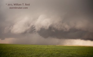
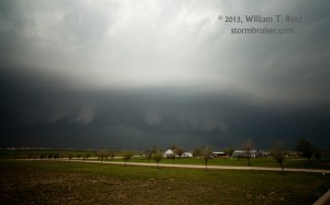
U.S. 70 took us nicely up towards Vernon, where a cell west of town struggled to organize. It was stretched out and mushy for an hour or so, it seemed, but tightened up and strengthened as it drifted west and northwest of Davidson, OK. We got a little west of the updraft base — here is the look to the east—
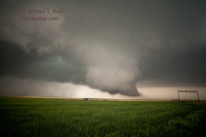
A large clear slot had cut into the updraft base, and we had a supercell in western Tillman County, OK. Rob and I got east of the storm via Route 5 through Frederick. More and more chasers were along the road, and even getting through Frederick took about twice as long as it should have. A big storm to the north of this one had recently croaked, so now nearly all of the chasers in the area had one big storm to attach themselves to —- this one. Fortunately, the Tillman County supercell was not moving very quickly — perhaps 25 – 30 mph to the NE or ENE.
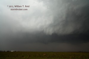
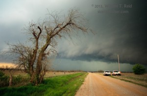
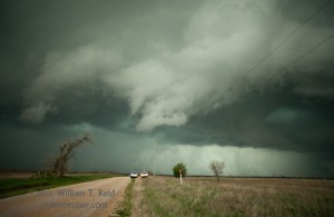
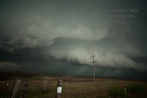
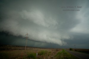
We went east of Frederick a ways to get a look at the storm structure. The storm had some menacing lowerings and a nice roundish look, and occasional bursts of CG lightning to our north and northwest. We utilized some unpaved section roads to stay with the cell east-northeast of Frederick. These were clogged with chasers. Here are some views of the leading edge of the supercell—
The supercell became tornado-warned somewhere between Frederick and Lawton. We were able to maintain good position a few miles east of the action area for quite a while, but there was a lot of precip around the updraft base, cold air was undercutting the storm a bit, and the occasional strongly rotating wall clouds were unable to “produce”. Rob was surprised that tornadoes refused to form. Me—-I am not surprised at anything that does or does not happen anymore!
Well, my fears regarding chasing a lone big supercell in southwest OK near the front were coming to fruition. The chaser numbers, even out here in the boonies on the dirt roads, were crazy, crazy, crazy. It wasn’t fun battling the traffic and trying to maintain some sort of safe and sane distance from the action area. (I was able to get decent radar updates on my iphone/Radarscope —- Verizon worked exceptionally well out here given the large chaser numbers.) The other fear was the cool air that was undercutting the cell and reducing the tornado chances. The storm was HP-ish and ugly, making it more difficult and problematic to chase. We had had enough of the unpaved roads. We were on a few that had been rained on a little and were occasionally “dubious”, but were generally okay for my X-terra. I didn’t have my good gazatteer with me, either, so I was flying blind and hoping that other chasers knew where they were going. We made our way to a paved road south of Cache by two miles, wsw of Lawton.
The storm cranked up a bit here. A wet RFD surged around to our southwest, and a blast of wind and rain hit us. We continued east into Lawton on a street called “Lee”. Were we in the lee of the storm? Some chatter on the radio suggested some power flashes nearby and maybe a rain-wrapped tornado —- not surprising! We made our way east through Lawton, stopping at plenty of traffic signals, with the sirens blaring. This isn’t exactly why I chase storms. At the east side of Lawton we found a hill with a view of the cell—
This storm was ugly and had become tiresome, so we went south a little and west to a follow-up supercell which was also tornado-warned. This one, a little north of Chatanooga, OK, looked much the same as the first one, with a lot of crazy low-level cloud motion and cool outflow:
There was little reason to stay with this supercell, so we set our sights upon some younger storms to our southwest, near the triple point. Maybe those would have fewer issues with cool low-level air. A storm was approaching Vernon from the southwest, and we made our way south to Grandfield, along U.S. 70. We stopped for gas and a slice of pizza. I waited for about three minutes behind one person in line to give the clerk 30 bucks. The clerk was going back and forth checking something and trying to figure something out. I finally asked her if she could take my money so I could pump the gas, and she took it. After filling the tank, I came back in for a slice of pizza. There were a few other people in line. The clerk wasn’t helping anyone, it seemed. She was fiddling with some payment machine or something. After three more minutes, I told Rob to forget about buying anything here — we GOTTA GO!
The storm south of the Red River, nearing Vernon, looked okay but not great on radar. It was looking like it would cross the river right between the two roads over the river, which are about 30 miles apart. We could backtrack to Burkburnett and try to come back west to intercept it, but by then it might be in Oklahoma and we would be way behind it! Or we could go west to Davidson and south to Vernon, but then we would be involved with the core, and we might again wind up watching the cell cross the river, with no easy way to catch up again. So, we sat right between Davidson and Grandfield on U.S. 70 and waited. There was no one else around — that was kind of nice! We had some rain and lightning, and we watched the radar. It showed the cell less organized, but then another cell quickly went up a little southwest of the original one —- not what we wanted. This meant that we would have to wait even longer for something to make its way up to us on the north side of the river. And, the sun was about to set, so we had maybe 30-40 minutes of decent light remaining. I drove west to Davidson in an effort to see something, and/or to sneak down 183 to 287 to get into position —- but a new heavy hail core had just developed and was just down the road —- UGH!
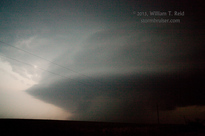
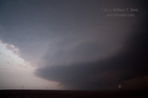
Well, back to Plan A — sit and wait. We went back east to about halfway between Davidson and Grandfield, with occasional nickel hail, and slowly the base came into view. A nice circular spaceship updraft loomed to our south-southwest, and I managed to get some shots in the last decent light of the day. What was nice was that no one else was around on U.S. 70! (It was kind of neat that we had started the day on U.S. 70 at Roswell, and ended the chase with a big supercell along U.S. 70, more than 500 miles later.) The base featured no prominent lowerings, though ten minutes earlier it had produced a brief tornado northeast of Harrold, TX. So, we had the right idea about waiting for the storm, but the tornado timing was just off a little. The cell hailed on us a bit more and chased us towards Grandfield. We stopped for some additional wide-angle photos—
There was a lot of nice in-cloud lightning in the anvil above, but CGs were absent. A continuous roar was in the vault area just to our north —- nice! I think it was a thunder roar and not a hail roar — not sure. We stopped again east of Grandfield to try a little more photography, but it was very dark now, and bright lightning was not illuminating the storm features. These two tired chasers headed farther east to Burkburnett, and word came of a tornado observed by chasers near Grandfield (in progress at the time this last image was taken!). I wonder if that clerk saw it. Or if she ever figured out what she was doing.




Leave a Reply
You must be logged in to post a comment.