
Following the long chase day in Kansas on the 19th, we awoke in Independence, KS, to a moderate risk with a 10 percent “hatched” tornado risk. SPC’s outlines favored the area from about Ardmore, OK, northeastward to northwestern Arkansas. Oklahoma City was along the northernwestern fringe of the moderate and hatched areas. It was clear that we needed to be in central to south-central OK, so we high-tailed it to OKC. We reached OKC around 1 p.m., with enough time for a fast-food lunch. The skies were mostly clear, it was getting hot and humid, and the wind shear was great. SPC issued a mesoscale discussion early (before 1 p.m.), as convection appeared likely by 21Z. Here is their blurb for south-central OK and vicinity:
TO THE S...AN EXTREMELY VOLATILE AIR MASS EXISTS WITH AN INCREASING
   CU FIELD FROM NWRN TX INTO SWRN OK WHERE STRONG HEATING PERSISTS.
   WIND FIELDS ALOFT ARE MORE THAN FAVORABLE FOR SUPERCELLS...WITH VERY
   LARGE HAIL LIKELY. ALTHOUGH SHEAR IN THE LOWEST 1-2 KM IS NOT
   PARTICULARLY STRONG...VERY LARGE VERTICAL ACCELERATIONS...AS WELL AS
   HODOGRAPH AUGMENTATION NEAR THE SFC FRONT WILL AID IN TORNADO
   POTENTIAL. HP SUPERCELLS ARE EXPECTED WITH STRONG MESOCYCLONES AND
   POSSIBLE RAIN-WRAPPED TORNADOES.
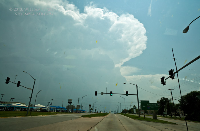
As we wrapped up lunch, we noticed that the cumulus field to our southwest was getting quite perky. My thinking was that we needed to get into position on this development quickly! We headed southwest on I-44 to Chickasha, and a strong updraft was nearby. Another stronger and more impressive updraft was another 20 miles or so to our south. This is when the critical decision of the day was made. The severe-weather parameter indicators on the SPC mesoscale maps seemed to slightly favor the area to the south versus the area from Chickasha to the OKC metro area. The SPC risk outlines also supported this thinking. I, and most chasers, elected to focus on the slightly older and more robust southern updraft in Grady County. Even if severe parameters had shown little difference between the two, I probably would have chosen the southern storm, simply because it would not be moving into a densely populated metro area.
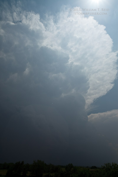
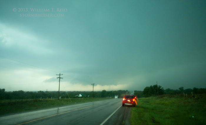
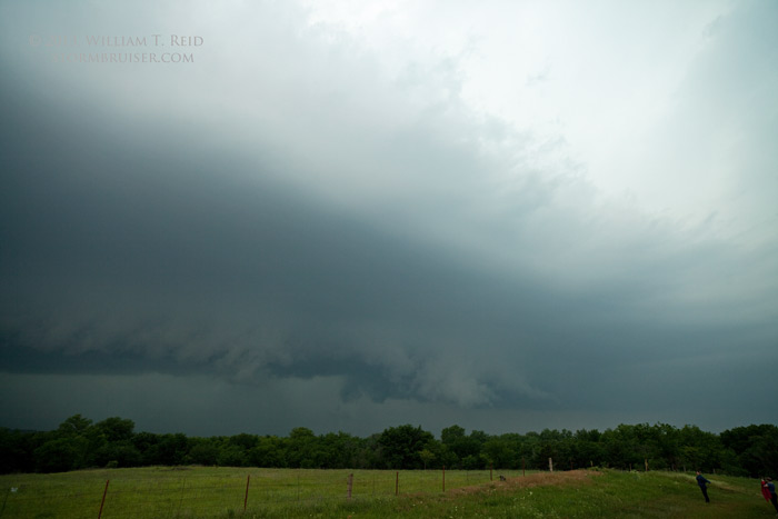
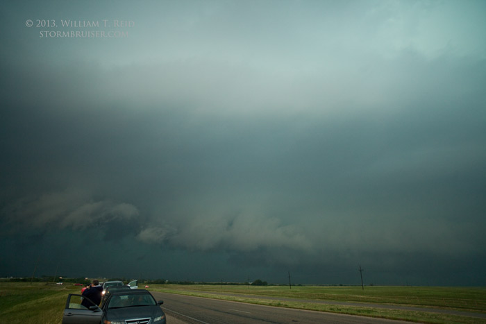
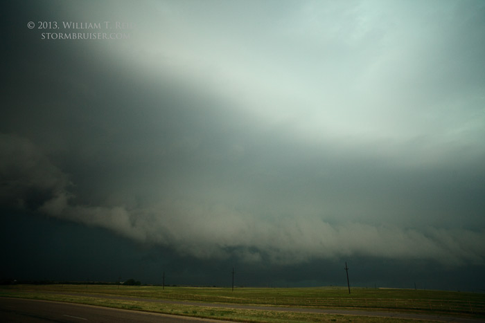
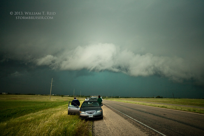
Well, as it turns out, we wound up watching a highly electrified but HP-ish mess of a supercell, in the Lindsay area, while that northern cell which we passed by near Chickasha went on to produce a long-track, highly visible and violent tornado which ravaged Moore, OK. Here are some views of the southern cell, which reportedly produced a brief tornado which we could not see.
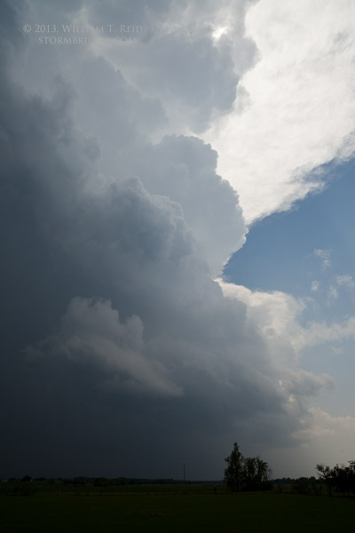
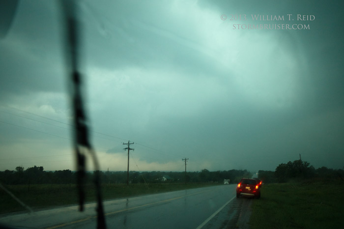
We were east of this updraft area for quite a while, and the CG lightning was so frequent in our area that we had to remain in the vehicles. Eventually our supercell was so messy and rain-filled that it was time to find something new. We blasted south to the Red River and Saint Jo, TX, and got in front of another rather wet and messy storm. It provided some interesting lowerings and fast cloud motions along U.S. 287, but it was a bit outflow dominant and did not produce. There was, however, some damage due to wind at Nocona. We gave up before reaching I-35, and headed back west to Wichita Falls for the night.
Leave a Reply
You must be logged in to post a comment.