
Another day, another moderate risk in May…and a 10-percent-hatched tornado risk in north-central KS, too! We abandoned Cozad, NE, and went south to Phillipsburg, KS. It looked like this area was the most likely for mid-late afternoon storm development and discrete supercells. This is the discussion from SPC at 1630Z regarding the moderate risk area along the NE/KS border:
...CNTRL PLAINS THIS AFTERNOON INTO TONIGHT...

   12Z REGIONAL SOUNDINGS SHOW THE POTENTIAL FOR STRONG AIR MASS
   DESTABILIZATION /I.E. AFTERNOON MLCAPE VALUES APPROACHING 3000-4000
   J PER KG/ WITHIN THE WARM SECTOR OWING TO VERY STEEP MIDLEVEL LAPSE
   RATES ATOP A MOIST BOUNDARY LAYER CHARACTERIZED BY LOWEST-100-MB
   MEAN MIXING RATIOS OF 13.5-14.5 G/KG.  EXPLOSIVE TSTM DEVELOPMENT IS
   ANTICIPATED BY MID TO LATE AFTERNOON OVER N-CNTRL KS/S-CNTRL
   NEB...NEAR THE SURFACE TRIPLE POINT WHERE LOW-LEVEL CONVERGENCE IS
   MAXIMIZED.  HERE...FORECAST HODOGRAPHS SHOW PRONOUNCED VEERING OF
   WINDS WITH HEIGHT WITH 40-50 KT OF DEEP-LAYER SHEAR AND EFFECTIVE
   SRH OF 200-300+ M2/S2 BY THIS EVENING.  INTENSE SUPERCELLS APPEAR
   LIKELY WITH THE THREAT FOR TORNADOES /SOME POTENTIALLY SIGNIFICANT/
   AND VERY LARGE HAIL.
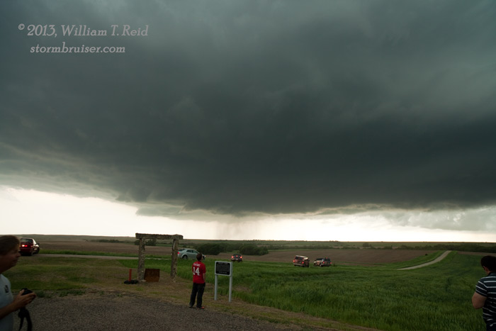
We found some shade at a park in Phillipsburg, KS, and monitored a developing cumulus field to our northwest. Some towers finally got strong, and we were quickly in position on a developing supercell just ten miles north of Phillipsburg. That was easy! Now all we had to do was to maintain position as the big tornado formed, and take pictures, right?!
Well, it didn’t work out that way. We utilized a nice unpaved east-west road through northern Phillips County to stay right in front of the updraft base. The supercell was high-based for the first hour or so as it moved east and east-southeast towards Smith County. It wrapped up a time or two, with the nice rotating precip curtains, hook echo, RFD, etc., but it never attained that serious “I’m gonna make a tornado” look. There was a two-mile jog to the north on our decent unpaved road as we entered Smith County, and this put us perilously close to the hail core in the forward flank precip area. A few stones fell which might have been an inch or a little large, but we made it to highway 8 without any problem. The action area was now to our southwest some 6 to 8 miles, so we scooted south on 8 to get back in front.
The best route east to stay with the storm was U.S. 36. We headed east from Athol, with the cell just to our northwest and north. The base had come down quite a bit by now, and, just short of Smith Center, a weak and brief tornado spun up not too far to our NNW.
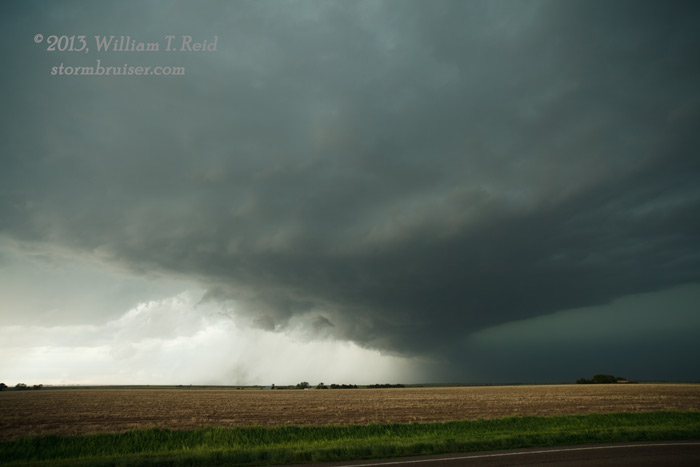
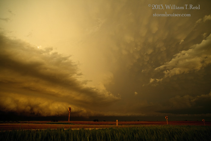
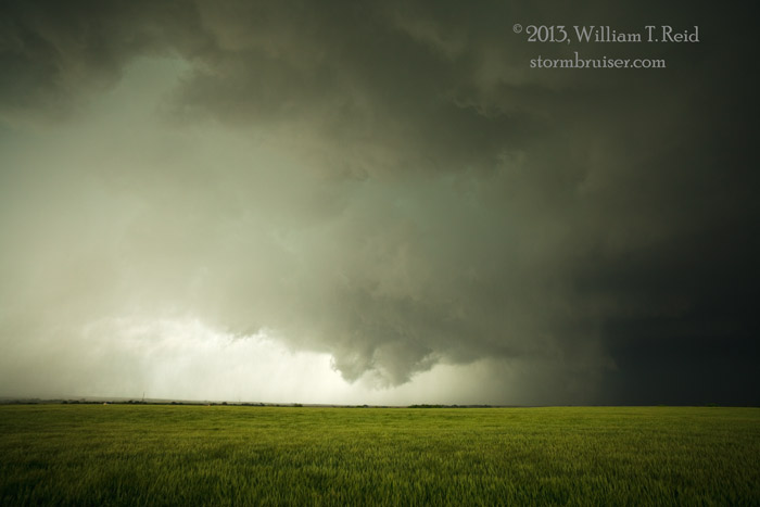
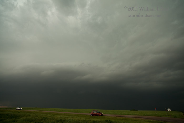
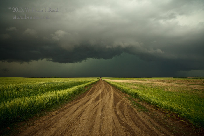
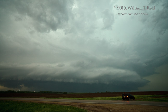
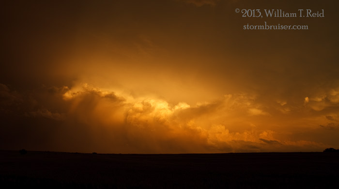
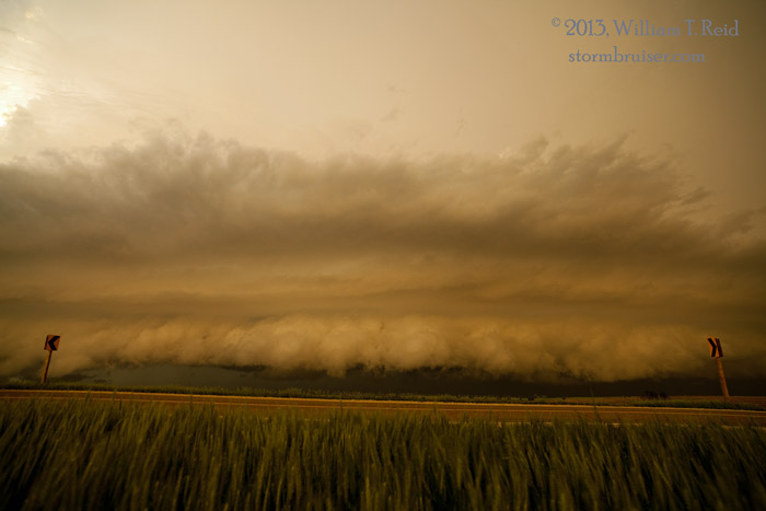
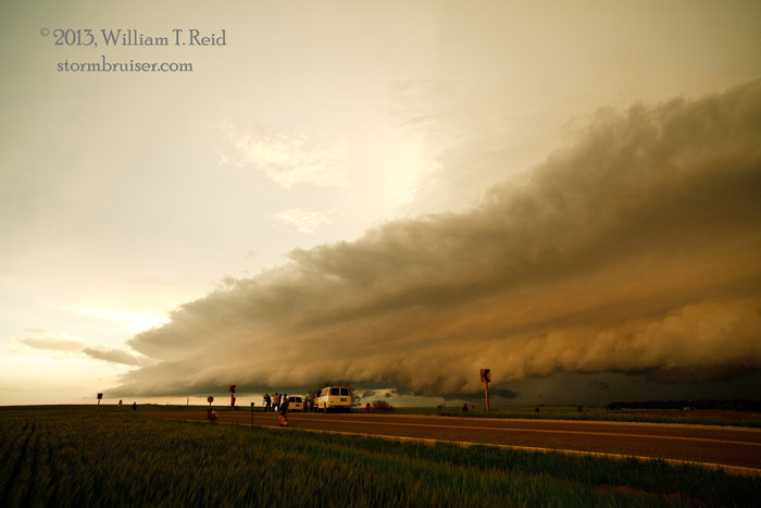
It looked like we were in business, as the storm developed a nice, large RFD cut as it lumbered to the east into juicy air. We jumped northward a mile or two from U.S. 36 onto the section road network, along with dozens of other chasers. This was beginning to be a circus of chasers, unfortunately. We continued eastward to try to stay ahead of the RFD gust front and the curtains of precipitation. The dirt roads were getting a little wet and the core was close, so we went back south to U.S. 36, and then east again to near the Smith/Jewell county line. The line of chase vehicles along U.S. 36 was ridiculous! From U.S. 36 near the county line, we stopped to look at the supercell to the north. It was now an HP beast, and the action area was wrapped-up with heavy rain. If there were a tornado with the storm at this time, we could not see it. Well, there WAS a tornado with the storm about this time — about 7 p.m. CDT, and it was a big one, about three miles NNE of Lebanon (or five miles north if us), according to the storm report by the NWS. A few chasers on dubious roads caught a glimpse of the tornado. The first two images below were taken at about 6:40 p.m., and the next two were at about 7:20 p.m. CDT.
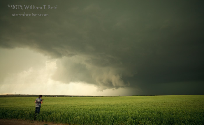
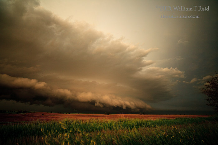
During the next hour or so, the HP supercell seemed to get wetter and wetter, and it was not very photogenic, either. I considered going after some of the other nearby convection, but it was wimpy. With sunset not far off, I went into relax/photography mode. We stopped along a jog in the road south of Courtland, KS, to shoot the back of the severe convection and an interesting outflow feature which moved towards us from the north. Our home for the night was Salina.
Leave a Reply
You must be logged in to post a comment.