My video of the beginning of the El Reno tornado HERE!
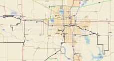
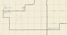
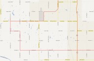
Maps of our chase route here, courtesy of Chris Gullikson:
posted on June 5, 2013, more video links at bottom
Friday, May 31, 2013, was the last chase day for the Tour 4 group. We had had a very busy and successful six chase days, but we were still missing the nice “cherry on top” tornado. We were in Ardmore, OK, and the outlook for severe weather and tornadoes looked pretty darn good later in the day, not too far away. In fact, it looked a little TOO good and a lot TOO close to areas in central Oklahoma which had recently been ravaged by tornadoes. The meteorological setup was classic — a powerful mid-level wave was over Oklahoma during the afternoon and evening, with 500 mb winds from the west at 50 to 60 knots. A surface triple-point low was located in southwest OK during the late afternoon. Northeast of the low, in central OK, low-level moisture was plentiful, with dew points in the low-to-mid 70s. Bright sunshine lit up the state by midday, and the cap was strong enough to hold back convection until late afternoon. Surface winds backed a bit from south to southeast in central Oklahoma during the afternoon. Shear and instability were looking super: the ingredients for a high-end event were in place. SPC issued a moderate risk for severe weather over central OK, and the tornado graphic showed a 15-percent hatched area. Chasers were in this same area on the previous day, it was the beginning of another weekend in late spring, and the prime chase target area appeared to be a no-brainer. All eyes were on the open farmland a county or two west to southwest of Oklahoma City.
Today seemed easy, but there was a sense of unease. I figure that by mid-afternoon a lot of chasers had —- maybe not a sinking feeling —- but a notion that something not-so-wonderful was in the making. What would we chasers be talking about at the end of the day? What might I wind up seeing through my camera lenses and viewfinders in the next several hours? Would everyone chase responsibly and smartly and get to bed safely later on? Just what WOULD transpire on Friday the 31st? It has been a couple of days now, and this is how the event unfolded for me.
I was looking forward to the weekend. I was almost finished directing Tour 4 for Tempest Tours, and I would get a week off to rest after Friday. I had been chasing and tour directing pretty much continuously since April 20th, and I was mentally and physically drained and fatigued and very ready for a break! It was fabulous that our last chase day would leave us really close to our base motel in Oklahoma City, it seemed. We didn’t have to worry about a long drive into the night and the next morning to get the guests back in time for afternoon flights on Saturday. The storm gods were not making things difficult this time around, logistically speaking…it seemed.
Our group gathered in my room at 10 a.m. at the Days Inn in Ardmore and I provided the weather briefing for the day. With us were Brian Morganti, Chuck Doswell, Chris Gullikson, Steve Pekich, Justin Pletsch, and about 15 guests. I told them that if storms didn’t go up too early in the afternoon, like they had on a couple of days on their tour, then the prospects for a high-end supercell and tornado were good. The only thing that was NOT looking good, from a chaser’s perspective, was that big storms could very well be moving into the populated areas around Oklahoma City on a Friday evening. Tornadic supercells…big metro area…traffic congestion…that is not my idea of storm chase fun.
Some in our group had found some breakfast prior to the briefing. I hadn’t eaten anything, as usual. Since we were only a couple of hours from where we needed to be later, I took the group to the Hamburger Inn in Ardmore for a late morning meal. I called them up first…
“Are you guys still serving breakfast?”
” YEP– until 11 a.m.!”
” Great! Can you handle about 20 people now?”
“Sure!”
“Okay — we’ll be there in ten minutes!”
When we got there, Chris opened the door and said “no way!” It looked like there was enough seating for about 12 people in this tiny joint! I didn’t care — I was hungry. Fortunately, there were only a few other patrons in there, and about 15 of us chased them out. The meal and service were awesome. It was one of the few nice, relaxing meals we were able to get on the tour.
From Ardmore we drifted west. A couple of birds along the highway flew up into the path of our lead van, and Steve smacked into one of them, leaving a cloud of feathers in the air for the two follow vans to observe. I told the folks in my van that whenever we hit a bird prior to storm initiation, it winds up being a big chase day. It never fails…it seems.
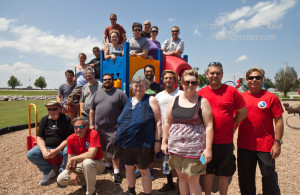
There wasn’t a big rush to get into position as we were so close already. We loitered in and around a convenience store at Waurika and at a park with a lake at Cyril. It was the perfect time for a group photo shot by the kids’ playground. It was mid-afternoon, and the sky and strato-cu clouds looked flat. Good, I thought. It was still a little too early for the show to begin. A cu field looked to be developing a bit to the northwest, out near Clinton, OK. I decided to continue north a little farther from Cyril. CAPE values were about 5000 to 5500 J/kg in central Oklahoma, the effective bulk shear was almost twice as much as is required for severe storms, and low-level winds were indeed backing in our vicinity. Yikes.
We went up 281 through Anadarko and Gracemont as a few cumulus clouds made some halfhearted attempts against the cap. I had Steve head east to Minco for one final pit stop for everyone. The clerks in the convenience store were interested in the severe weather and tornado threat for later in the day. I said that it would be a good idea to pay very close attention in the next several hours. Outside of the Minco store I held my handy-dandy Kestrel weather instrument up to the wind, and it indicated 89F air temperature and 78F dew point! A bit later, the dew point read a more reasonable 76F. You got the feeling that the atmosphere was getting ready go nuts. I picked a penny up off of the ground and mentioned to someone that this will be our lucky tornado penny for the chase day. I really wanted to get a tornado for the group, but that sense of unease lingered.
I found a decent open area west of Minco, and we watched radar and some cloud towers to our west. This was the crucial time of the day chase-wise. If you blow it here and wander off to a sucker storm, then the chase day could wind up “pants”. We don’t want that. A blip or two showed up on radar to our west, near Weatherford, perhaps. That was perfect — it was time to move.
I led the group up to Interstate 40 at El Reno, and we moseyed west on the “old road” just north of the Interstate to Calumet Road, and then another mile or two to the next north-south road. We went south a tad and stopped not too far north of I-40. I hate chasing near Interstate Highways, as it interrupts the local farm grid road network. And, I avoid using the Interstates on a chase, as on-and-off access is limited and you can’t turn around right away if you need to. Our little blips from 15 to 25 minutes ago were now explosive updrafts, and were warned for half-dollar-sized hail. Can you believe that clouds can make such large hailstones in such short order?! There looked to be three massive cumulonimbi to our west through northwest here, and three relatively rain-free storm bases were in view. Usually the southern-most one becomes dominant, and we were due east of the southern one. The storm bases were some 8 to 10 miles to our west and organizing fairly quickly. We just had to be patient and let them come to us. Don’t get antsy, Bill!
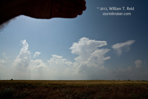
Image of the towering cumulus, west of Minco, was at 4:26 p.m. CDT, and of the storm bases to the west, south of Calumet, was at 5:03 p.m.
The southern-most cell was the dominant supercell, with a top of about 60,000 feet! Less than an hour earlier we were looking at diddly-squat, and now it was showtime! Deep moist convection had not initiated too early. The forecast was playing out perfectly, and we were exactly where we needed to be. There were a few chasers in our vicinity, but it wasn’t bad at all, yet, as far as that goes. In the back of my mind I was thinking — what do I need to do to make sure that my group doesn’t suddenly wind up in a bad spot with regard to safety? This storm was in an environment where very nasty stuff could ramp up quickly. I didn’t want any issues, headaches, or dilemmas! It began to rain as the base neared and the top of the updraft drifted overhead. We were in a good spot if the storm were to go tornadic, but the west winds aloft were shoving rain over and upon us. There was some lightning in cores to our northwest and north, but that wasn’t a problem where we were. The folks were lined up along a fence with their faces glued to the west. I think a tornado warning was issued about this time. I wanted to stay, but I wanted out of the rain. I was unsure if the section road that continued to our south, over and beyond the interstate, would be paved or not. The easy solution to our rain problem would be to drive south a few miles, but I was hesitant to test the dirt roads in the rain in front of this storm. Radar now showed a hail core not too far to our west-northwest and moving towards us. I had to make the move, so everyone got back into the vans and we went back east on the Interstate to reposition south and east of the cell. Some small hail hit us as we were leaving — good timing!
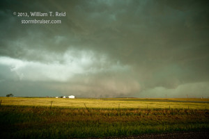
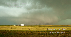
We had to go quite a bit farther east than I preferred on I-40. As far as I could tell from the myriad of maps and GPS mapping software that I had, the only way to get southeast of the storm base via paved roads was to go east eight miles on the Interstate to exit 123, on the southwest side of El Reno. This was about five miles farther east than I wanted to go! We finally got to exit 123/Country Club Rd. A paved road took us quickly south and west and south and west again to Reno-OKC St W, also known as E 1070 Rd. (in Canadian County). We passed the El Reno AP and continued west. The terrain out here was flat and practically treeless — perfect for viewing the storm! We stopped three miles west of the airport, along S Fort-Reno Rd., just north of E 1070 Rd. (and seven miles west of U.S. 81). It had taken us about 20 minutes to get here, and in the meantime a tornado had been reported with the supercell to our west-northwest. The action area and storm base were largely filled with precipitation, and we were unable to discern any tornado from our vantage point. “Great,” I muttered. Was this going to be another in a long list of ugly, tornado-hiding HP supercells for me this spring?! There was no way that I was going to go plunging into rainy and hail-filled areas to look for a tornado today, not that I do that ever! I was somewhat resigned to winding up with another non-tornado day, especially a few minutes later when a light west wind hit me in the face! What is this? Outflow already?! The messy rainy area was still a few miles to our west and WNW, and I was bewildered by the weak west breeze. But, the very innocuous storm base to our northwest was now behaving suspiciously. Hmmm…
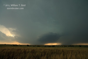
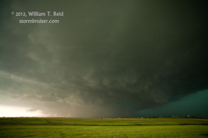
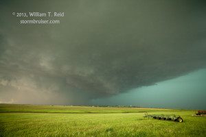
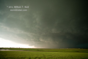
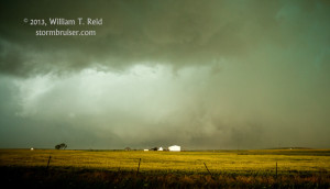
Image 4157 above, looking WNW at 5:53 p.m. CDT
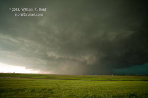
4158, looking NW, 5:54 p.m.
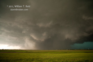
4159, looking W, 5:54 p.m.
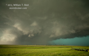
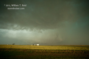
4161, looking W, 5:55 p.m.
4163, looking WNW, 5:57 p.m.
4164, looking NW, 5:58 p.m.
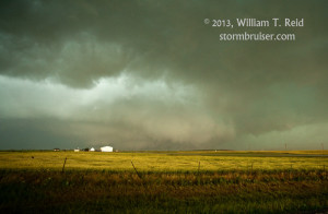
4166, looking W, 5:59 p.m.
In the views to the NW (e.g., image 4164, above), a tall and skinny water tower is visible on the right. On Google Maps satellite, this tower is visible just to the east of “Buena Vista Cemetery” (north of Reuter Road W, and east of S Heaston Rd. in Canadian County). I estimate that this tower was about 1.4 miles NNW of our storm-viewing location. All of these images were taken with the full-frame Canon 5D Mk II and a 21mm lens. This results in a fairly wide-angle image — the horizontal angular field is 80 degrees. Objects are closer than they appear! Note that in image 4158, to the northwest, there are no visible indications yet that something is in the works nearby in that direction. In 4158 and 4159, there is a hint of a wide-ish funnel cloud buried in the precipitation core. Though one was reported, I don’t know of any verified or confirmed tornadoes with this storm prior to the big El Reno tornado. In 4164, four minutes after 4158, there are indications that something is “afoot” towards the eastern side of the updraft base, east of the storm precip core.
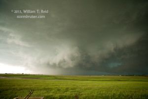
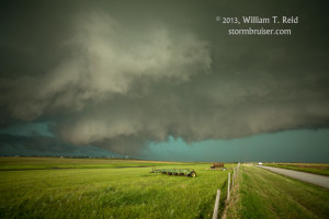
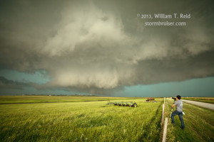
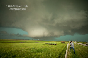
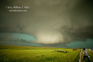
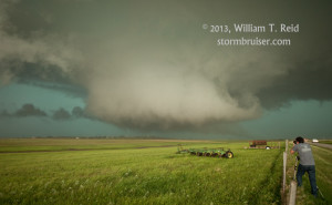
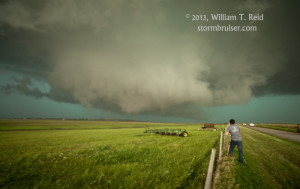
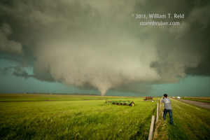
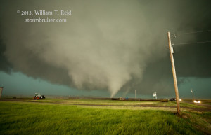
By 6:00 p.m., the nearby storm base on the leading edge of this supercell was changing fast. VERY FAST. VERY VERY VERY VERY FAST!!! There is some lowering of the base and some noticeable rotation now. Is this a tornado hand-off? Is this a new meso that is quickly cycling up? Is this west wind that is getting stronger here an RFD wind? The answers are all YES —- in a matter of two or three minutes, we were suddenly looking at a tremendous and large low-level circulation, just a mile or two to our north-northwest! This thing formed crazy fast, and it didn’t tease us long before going tornadic. Big fat funnels and big skinny funnels went up and down and appeared and disappeared beneath this merry-go-round wall cloud. It was mesmerizing. It was close! I held the 5D as steadily as I could as it rolled in HD video mode. The scene was surreal. Above the green, grassy countryside these gray/white tornadoes were dancing around beneath the whitish wall cloud, and then around and below this tremendous “mother” funnel cloud. It was multi-vortex city. Rain and wind was hitting us hard from the west now. Were there any other issues? Yes. The mother funnel cloud was coming right at us. UGH.
Image 4168 was at 6:00 p.m. CDT; 4170 at 6:01; 4171 and 4172 at 6:02; 4174, 4176, and 4177 at 6:03 p.m. All views are to the NNW to N. Tom Trott is in the foreground.
Image 4178 was taken about a quarter mile south of the original shooting location, at 6:04 p.m. CDT.
Our video shows the rapidly rotating wall cloud hovering just above that water tower to our north-northwest. The tornado spin-ups on the south side of the wall cloud were a little less than a mile distant. (The first tornado touched down at about 6:03 p.m.) Fortunately, the forward motion of the wall cloud/multi-vortex tornado was not too fast — maybe 25 mph to the SE or even the SSE. This was somewhat surprising, given the storm’s general motion to the east. We had to put more space between ourselves and this thing (oops, Chuck Doswell would call it a “process”). The guests (some reacting reluctantly and hesitantly!) were ordered back into the vans. I wanted to get at least a mile south — that should be enough space, I figured. We could get out again and watch! NOPE. The wet RFD was hitting us full force, with wind of about 50 – 60 mph and heavy rain. It was difficult to see and to stay on the gravel road, and Steve and Justin and Chris did a fabulous job of driving. We turned east on 15th St SW, but the tornado was still moving southeast and looked to be no more than a mile to our north. Funnels were now anchored to the ground more continuously, and strong wind and rain continued to blast us. It was no time to mess around near this thing! After one mile east, we dropped two miles south on S. Brandsley Road to SW 44th St. That gave us plenty of breathing room, and the wind was not as bad here. The tornado was to our NNE, was intermittently rain-wrapped, and was now moving mostly east compared to southeast. Good — we were getting close to running out of room to the south as we neared the Canadian River!
We continued another 4 or 5 miles east to U.S. 81 before stopping again. By this time, the tornado was a massive “meso-on-the-ground” beast, it seemed. It was perhaps four miles distant, and now moving more to the northeast, towards I-40 and the farmland southeast of El Reno. The tornado had passed very close to, if not over, El Reno AP, and it missed the main part of El Reno to the south by a few miles. Our group was able to step outside of the vehicles here at U.S. 81 for a minute or two to shoot video and to exhale a bit. (One guest dropped one of his cameras on the ground here, but we found it the next morning and the images on the card were still good!) What looked to be a giant and violent tornado was plowing eastward towards the western edge of Oklahoma City. Now that “unease” was transforming into a “sinking feeling.”
The five images above were from 6:22 to 6:23 p.m. CDT, looking NNE, from U.S. 81 and SW 44th St. This is two miles north of Union City, 5.5 miles south of I-40, and about five miles from the tornado, which is now moving more to the northeast. The large clear slot associated with the storm’s rear-flank downdraft (RFD) is very apparent between our location and the large tornado.
As the supercell storm continued east, we edged a mile back to the north and kept pace on its south side along SW 29th St. We motored south of Yukon and then towards the familiar streets on the west side of OKC, approaching our base motel on Meridian. It was difficult to determine just what the storm was doing — was there still a big tornado in there or not? We had wrapping precipitation blocking the view, and the cloud base was so low and dark, and now more and more trees in the way — heck — it was next to impossible to see what was going on. On an FM station, broadcasters were imploring those in the storm’s path to get to a safe shelter or to get out of the way somehow. At least once, the suggestion to drive south to get out of the way was given. I think this was a simulcast of a local TV station. This was not great advice, at least in hindsight. A new circulation was developing a little behind and to the south of the old, weakening tornado. People who would be driving south would now be driving into the path of a new, developing tornado. I turned south on MacArthur and went a mile or two to Airport Rd. and east, with the intent of diving south on I-44 as fast as possible just to get the heck out of Dodge! I didn’t want to be messing around with tornadic storms in the city. As we neared I-44, the southbound exit lanes from Airport Rd. were jammed to a halt! I couldn’t risk getting run over by the storm in this traffic jam, so we took the northbound lanes towards I-40. Radar did not indicate anything threatening up to I-40, only three miles away, thank goodness. At the interchange, the police had the lanes which continued north on I-44, to the north of I-40, BLOCKED! We had to go east —- not that that was a horrible direction to go at this point in time, but at this point in time the safest direction to go in order to avoid a tornado was north! The media and the police were actually directing motorists into increasingly vulnerable areas.
Our I-40 eastbound route was wide open, and there were nice elevated views of the supercell’s green HP core to the WSW. I thought about stopping on the interstate, as some other chasers were doing in the wide right shoulder, but I did not. I was basically in “get out of the way” mode now. I wanted to get into the hinterlands on the east side of Oklahoma City, where the population rapidly thins out and the roads would be traffic-free. HAH!
We continued past Tinker AFB on I-40 without delay, but then the red brake lights to our east appeared. Shoot! I did not want to be on a jammed freeway. A new couplet/supercell was indicated on radar to our west and was moving east, in addition to the one that was in the vicinity of Will Rogers AP and headed to Moore and Norman. We were threatened by this north storm, and needed to get out of the way. It was just about dark by now, and I exited quickly east of Tinker before winding up stopped on I-40. At first we had little problem getting south a mile or so — and then another horrible backup. It took us several minutes to get through a traffic signal. We went east, and wound up waiting about ten minutes to get through a 4-way stop sign. Some motorists went into the oncoming traffic lanes in order to get through the intersection more quickly. With the radio warning of the approaching tornado-warned supercell, we felt like sitting ducks! Fortunately, we had moved east far enough and fast enough (so far) to give us enough time to get through these traffic backups. After a couple more excruciating 4-way stop delays and another dive to the south, the dangerous part of the northern cell had passed by (close to I-40, near Newalla). We were near Lake Thunderbird, and now had to go back north to stay away from the southern cell. Some rain and hail and wind hit us as we bailed back north to I-40, but the storm core was not bad at all. It seemed as if we were safe, and we could relax!
Back on I-40 west, it was time to stop for a pit stop and some food, but was that going to be possible anywhere nearby? Dangerous conditions with high winds and flooding rains were still pummeling Oklahoma City! We found a large truck stop somehow — just what we needed! It was open and jammed with folks who were waiting out the storm. It was close to 9:30 p.m. and I had a difficult task: find 9 rooms for 13 people in a city on a Friday night that is in the midst of a tornado and flooding disaster, with softball tournaments and graduations and everything else that is scheduled and fills up motels here on a May 31st. Of course, there was nothing available anywhere nearby. I phoned the base motel — the Holiday Inn on Meridian — and they were full. I asked if the storm had been bad there, and they said not too bad. I called them a little later to see if there were cancellations — busy signal after busy signal. They had lost power after getting slammed again! There were no rooms in Edmund or Guthrie or Shawnee or Norman — half of the towns here had big-time tornado issues, past and present! Finally, I found enough rooms at Executive Inn in Lawton —- almost 90 miles to our southwest. Better than nothing…though I doubt that many executives wind up there. A better name might be “Execution Inn.”
Brian and Chuck and his group had booked rooms much earlier near the base motel in OKC — I wish I had done that — and they continued back west on I-40 to Meridian. All my group had to do now in order to get to Lawton was dodge and navigate through:
–downed trees and branches on the Interstate
–hail cores
–flooding on local streets
–a massive traffic jam on I-44 southbound (on the east side of the airport)
–blacked out areas of OKC with non-working traffic signals
–washed-out roads with water still running over them
–abandoned cars in and out of ditches
–lunatic and terrified drivers.
But this was almost fun —- we were giddy that we no longer had tornadic storms breathing down our necks! It took about two hours to get to Lawton, and by that time we didn’t care how lousy the motel was. Our wild and crazy and successful chase day was over. Later, however, the good feelings associated with intercepting a large tornado would subside as we learned of the deaths of several storm chasers who were overtaken by the El Reno tornado.
Below is a graphic prepared by Dave Lewison, showing the tornado track based on radar, and estimated forward speed of the tornado cyclone. Also show is Dave’s route for the storm intercept.
Spectacular video by Chris Gullikson of our Tempest Tours tornado intercept. Chris has a forward-looking GO-PRO camera running as the tornado develops to our NNW. As we flee towards the south, he turns on a second GO-PRO camera on top of the van that is pointing backwards, providing a tremendous, continued “look” at the developing tornado and tornado cyclone.
Second (conventional camcorder/non GoPro) video by Chris Gullikson.
Video by a chase team that stops just north of the Tempest lead van just as the tornadoes start forming. These guys hung in there a bit too long for comfort, but got great footage. Here is footage from the same team, different camcorder. Language is R-rated.
Great video by chaser Nick Nolte, near U.S. 81, with a great look at early structure and of the tornado at its widest.
Great video by chaser Bill Hark, much of it from El Reno AP, looking west at the developing tornado
Awesome video production of the El Reno chase by Skip Talbot
Impressive footage mostly from the north side of the El Reno tornado by Jeff and Kathy Piotrowski
Video animation of the SN (spotter network) icons relative to the El Reno tornado
Dan Robinson gets too close to the El Reno tornado
Initial stages of El Reno tornado, close up — yikes!
Info on the El Reno tornado, courtesy of the National Weather Service
Additional info and maps of the El Reno storm and other tornadoes on May 31, 2013 from the NWS
Storm summary by chaser Chris Kridler
Dave Chapman’s excellent chase summary with images
Notes on the storm by Jon Davies



Leave a Reply
You must be logged in to post a comment.