Our group began the day in Medicine Hat, AB, and forecast thinking was to drift west a little —- into moist north or northeasterly winds, in order to augment the low-level turning given very strong easterlies at 850 mb. Upper flow was from the S to SSE for the most part in extreme southeast AB. We went WSW about 45 miles to Bow Island and watched the sky and radar during the afternoon. By 5 p.m. strong towers went up to the east and southeast about 60 miles distant. I considered hanging around Bow Island, near the convergence zone for surface easterlies and northerlies, but quickly decided to bolt back towards Medicine Hat on Hwy 1 for the developing storms. Surface winds were turning more ENE to NE out that way, so perhaps a strong supercell might be able to produce a tornado.
As we neared Medicine Hat, there were a couple of strong cells with tall storm tops to choose from. We elected to go with the one farthest to the east, near the AB/SK border, in part because it seemed to have the better access to uncontaminated easterly and northeasterly inflow. With surface winds from the northeast, I figured that the best approach to the cell, for a look at its structure, at least, would be from the north, looking south. The storm was about 15 – 20 miles south of Hwy 1 and just west of the AB/SK border, so we took an unpaved road south from Hwy 1 (several miles east of Hwy 41). There looked to be a couple of big updrafts, but contrast and lighting were poor. I was trying to get a handle on which way these updrafts were moving, and trying to figure out where we should be with respect to the updraft base. Light to moderate rain was falling on us —- the mid-upper flow was carrying precip to the north, right overhead. So, the storm’s inflow was getting rained into to some extent. The cell(s) looked to be drifting very slowly to the west, so we contemplated waiting around (about 8 miles north of the base) for the storm to move more to our southwest. The thinking was that we would not be in as much rain then! Our gravel road network was pretty good, but it was all we had in order to get close to the base. With a heavy precip core moving left to right to our south, I wasn’t too excited about being on these gravel roads close to the updraft base.
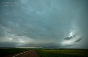
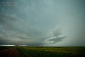
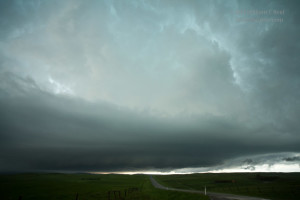
The cell shifted west enough to start giving us a look at structure, which was rather nice. The storm base was very low, CG lightning was frequent, and the supercell structure and associated appendages were in place. Again, this was looking to the SOUTH! The action area/shallow wall cloud portion was on the leading/west end, and this hovered just above some low hills that were maybe five miles to our south (Cypress Hills Provincial Park area, east of Elkwater). By now we had moved a few miles closer and were along unpaved route 515, about five miles east of Hwy 41.
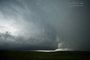
With light rain continuing on us as we gazed south, a smallish funnel cloud quickly appeared and stretched to the surface just behind the hills. It only lasted 10 or 20 seconds, and then it appeared again briefly. This was around 7:08 p.m. MDT. We could not determine for certain if this funnel reached the ground beneath it or not, but it behaved much like a weak and brief tornado might! I estimate that the funnel/possible tornado was about eight miles to our south. We were about 8 miles NNE of Elkwater Lake, so this event was likely a few miles east or southeast of Elkwater. (The funnel cloud occurred about the time of image 9913 below.)
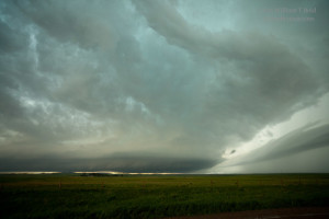
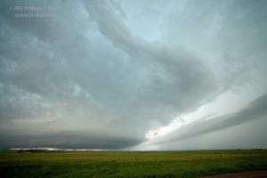
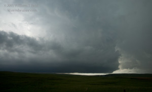
The action area continued to be “active”, and Chris and I wanted to get closer. Using the unpaved roads to go south was not an option: the storm core had just been through here. We headed west to Hwy 41, which was difficult enough for the five miles on the mushy gravel and dirt. Precip was again between us and the storm base, but starting to clear out to the west again. We went several miles south and had a good view of the horseshoe-shaped updraft base, clear slot, shallow wall cloud, etc., and for a minute or two it looked ready to try to tornado (again?), but it didn’t. This was to our southwest a couple of miles, and we were perhaps five miles north of Elkwater Lake. Large hail was on the ground here, and I measured one stone at 1.5 inches.
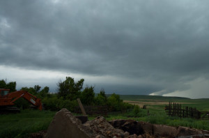
The terrain was hilly, and it was difficult to get good views of the landscape directly beneath the storm base. We decided to go a few miles back to the north for a better look, and we had some impressive structure to photograph to our SSW. Light rain continued and lightning struck a telephone pole that was only 40 yards away. The crack and blast were tremendous, and smoke drifted away from the pole! Yikes!
The paved road network was sparse here, and I was not getting back on the gravel roads. We decided to head back to Hwy 1 in order to get west and ahead of the supercell, but 15 minutes later, at Hwy 1, it was obvious that our storm was croaking. Nothing else looked worthy of chasing as things were getting linear and messy, so we headed east to Swift Current for the night.


Leave a Reply
You must be logged in to post a comment.