LINK to Chris Gullikson’s video of the Chugwater meso and Dix tornado
This was a very active and interesting chase day, and was the final chase day for Tour 7. We began in Torrington, WY, and enjoyed a late breakfast/early lunch in town. I felt that we were positioned quite nicely already — we just needed to be patient and watch the sky. SPC had a slight risk and 5% tornado outlook for much of E WY and the NE Panhandle. Here is a blurb from a mesoscale discussion for E WY by SPC issued at 2:30 p.m. MDT:
   THE SEVERE WEATHER THREAT FOR TORNADO WATCH 343 CONTINUES.

   SUMMARY...THE THREAT FOR LARGE HAIL...DAMAGING WIND AND ISOLATED
   TORNADOES PERSISTS ACROSS WW 343 WITH THE PRIMARY THREAT NEXT COUPLE
   HOURS EXPECTED FROM CNTRL THROUGH ERN WY.

   DISCUSSION...NUMEROUS THUNDERSTORMS CONTINUE DEVELOPING OVER THE
   MOUNTAINS FROM WCNTRL THROUGH SERN WY INCLUDING THE LARAMIE RANGE. A
   CORRIDOR OF RELATIVELY HIGHER INSTABILITY EXISTS FROM ECNTRL THROUGH
   SERN WY WHERE STRONG DIABATIC WARMING AND MOIST LOW-LEVEL UPSLOPE
   FLOW EXISTS SUPPORTING MLCAPE FROM 1000-1500 J/KG. STORMS WILL
   LIKELY PERSIST AS DISCRETE SUPERCELLS AND OCCASIONAL BOWING SEGMENTS
   NEXT COUPLE HOURS WITHIN A KINEMATIC ENVIRONMENT CHARACTERIZED BY
   VEERING LOW LEVEL WINDS AND 35-45 KT EFFECTIVE SHEAR.
My problem on this chase day was — how patient should I be? The tornado watch was issued very early in the afternoon, and I was a little reluctant to blast west towards the initial storm towers. Usually the best tornado threat is closer to dinnertime; and farther east, where low-level moisture is typically greater. It is also often prudent to be patient and to hang out well east of the initial development in a poor road network such as that between Torrington and Wheatland. If you loiter too long to the west and are not near a good, fast option to the east, it is easy to miss the main show. But, it was early afternoon, and sometimes it is a good idea to go for the “bird in hand”.
We drove west to Wheatland and got in front of a rotating updraft that was just southwest of town. As it drifted closer to U.S. 85, several miles south of Wheatland, a weak tornado developed. It didn’t have much of a condensation funnel, but a nice swirl of dust and debris persisted for a minute or two beneath the tight rotation in the updraft base above.
The updraft base continued eastward, about halfway between Wheatland and Chugwater. The road network here is poor, so we sat along Interstate 25 for about ten minutes and viewed the back end of the impressive updraft to our northeast.
I would have liked to have instantly transported myself directly in front of this supercell. But, now I was 15 miles north of my next decent east option, at Chugwater. It was looking like I might have messed up for not being more patient and staying farther east. Many chasers were lined up south of Torrington, awaiting this supercell’s arrival. All I could do was to head to Chugwater and go east on 313.
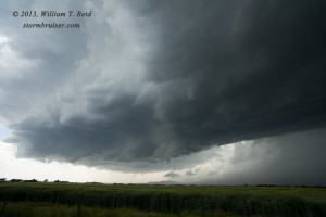
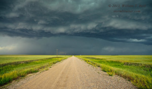
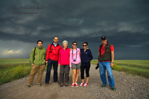
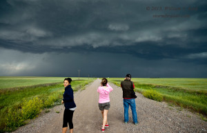
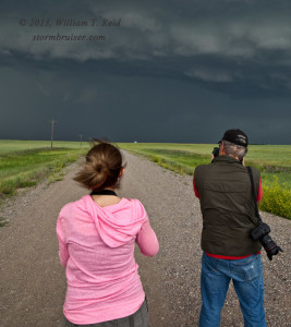
About five miles east of Chugwater, we stopped to check out a new storm that was going up not too far to our west. Hmmm…maybe this might work out! I forgot about the original storm that was about 20 miles to our northeast, and watched a nice, large, menacing storm base materialize just north of Highway 313 near the Platte/Goshen county line. We posed for some group photos, and edged north a few miles as a lowering developed.
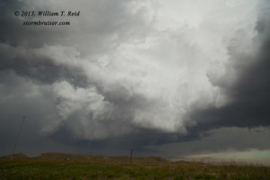
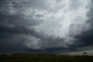
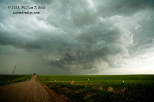
Our cell looked to be organizing some, and soon we were hit by strong and cool westerly RFD winds as rotation became much more apparent in a wall cloud to our north, and then NNE.
Wow — this things was ramping up very quickly, and we were the only chasers on this supercell, apparently!
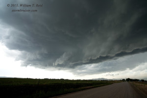
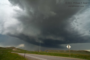
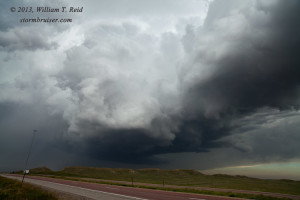
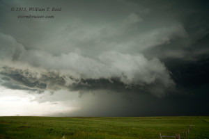
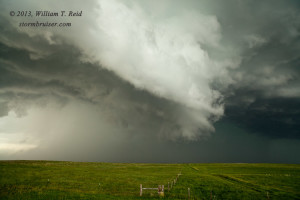
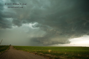
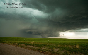
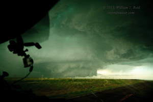
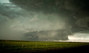
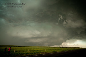
Our section-road network ran out to the east, and we had to go back south to 313 in order to head east again. Fortunately, or not, the storm was now moving to the ESE. An impressive, large and low-based meso/wall cloud was less than 4 or 5 miles to our northeast, and we had 313 to get us there in a hurry!
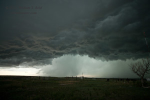
This thing looked ready to plant a big tornado, but it did not! As we approached the dropoff to the east (from flatlands to “off of the caprock”), we stopped to get out for a good look. The meso now appeared a little less “tight” and a bit weaker, perhaps. It is quite possible that a tornadic spin-up or two occurred beneath this large circulation — it was such a ground-hugging beast! But, we did not observe any tornadoes with it. Perhaps the relatively cold RFD helped to prevent tornado development this time.
We would have liked to have continued eastbound on 313, but now the storm was blocking our path. Given what we had just witnessed, there was no sense in blasting eastward through that strong meso and the probable big hail. We waited for about 10 minutes in a barrage of small hail and wind.
New, big storms went up to our south. It was around 5 p.m., with plenty of time remaining in this chase day. I needed to get in front of this new stuff. I needed to be somewhere north or northwest of Kimball, waiting for this activity to approach, but now I was waiting again for storms to clear away from our south option out of Lagrange, WY! We had a pit stop in Lagrange, and then edged southward into the precip area of a large thunderstorm. Fortunately, the hail didn’t get too large! We had to get down to Pine Bluffs and blast east on I-80 in order to get back into position. Radar showed a nice supercell drifting eastward into Nebraska, just north of I-80. I needed to be there NOW!
Fortunately, the cell did not seem to be making tornadoes as we hustled southward, on its western side. I was certain that I was missing some great structure, though. Finally, we got to I-80 and were able to squeeze by the storm’s southern edge. A lowering or two were apparent, but this storm was looking a little sickly and disorganized. Hmmph!
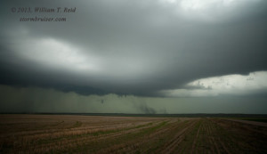
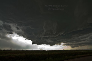
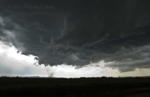
The photo above shows the “action area” from near Kimball. There really was no area where inflow and organization were coming together. The storm was a bit linear and outflowish — yuck. I figured that the chase day was about done, and that this was the Last Hurrah for the tour guests. We headed from a high point south of Kimball east on U.S. 30 several miles. I didn’t have much of a plan in mind, except to give the storm a little more room and to keep our options open.
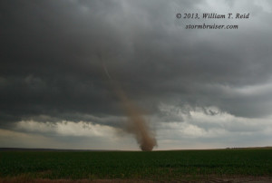
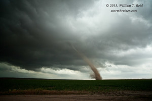
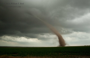
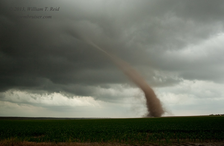
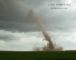
I elected to stop near Dix, NE, along a dirt road between U.S. 30 and the Interstate. Not too long after stopping, a strange smoke-like plume appeared to our ESE about two miles away, along the Interstate. See the first image below. That is weird! I got a picture of it, but then looked again to the north and northwest, where the main show was. However, that weird area of smoke to our ESE was soon a dusty circulation on the ground, on the north side of the Interstate! I really did not know what was happening —- this was occurring beneath a, uh, beneath practically nothing it seemed! Was this a big gustnado? I was a bit concerned that we might be in a little danger, and I had the group get into the van, but a few seconds later it seemed okay. We were watching a tornado in progress just a couple of miles away to our east!
I managed some stills (these are all with the 21mm lens) and some zoom-in footage with the camcorder. What a treat to wind up the tour! Our happy group watched the slender landspout-like tornado rope out and fizzle out, and I booked rooms in Greeley for the night. Youtube footage of the tornado by Chris and me here.
ttext
text

Leave a Reply
You must be logged in to post a comment.