
This chase day started early and was very active! But, first, here is a brief recap of the previous few days. Tour 9 started out of Denver on June 24, and we headed to south-central Nebraska. A slight risk covered most of Nebraska, but the cap was strong and the towers which went up from about Phillipsburg, KS, to Oxford, NE, did not amount to much. We ended the day in St. Paul, after watching some ho-hum elevated/LLJ storms west of there.
On June 25, a slight risk covered Iowa, with a large 5% tornado risk over much of the state in the 20Z outlook by SPC. We spent most of the afternoon in western Iowa, along I-80, watching cumulus fields bubble. The cap won out again, and Iowans were spared. I had a difficult time finding rooms for our group around Des Moines, and we wound up in Indianola, Iowa, for the night.
The prospects for June 26, were low, though a front was draped through Iowa and northern Missouri and storms were expected along it. We headed south on I-35 towards the IA/MO line, but exited quickly in Madison County when we saw the sign for the covered bridges. We visited three of the old bridges, and then had lunch in Winterset. After lunch, some tall storm towers drew us eastward, and we played with a junky cell or two near Grinnell, along I-80 east of Des Moines. This became tiresome, and there was little reason to stay with the cells, or to go after new ones in northeastern MO. I called it a chase and we spent the remainder of the day heading back west on U.S. 34 in southern Iowa in order to be better positioned for the following day, which was looking much better. We stopped in Red Oak for the night.


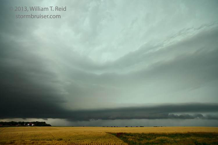
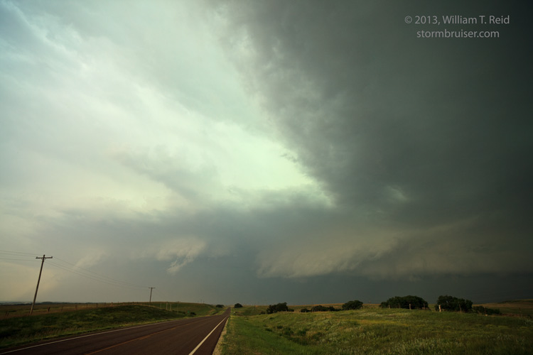
We had a good supercell day in store for us as we headed west out of Red Oak on the 27th. SPC showed a moderate risk in central Kansas, and we needed to get to the Salina, KS area. However, as we approached Beatrice, NE, in the late morning, a photogenic shelf cloud came into view.


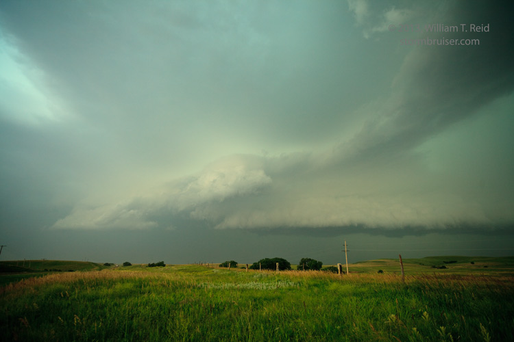
The shelf cloud quickly deteriorated as it moved along U.S. 136 near Beatrice. But, there was a good reason for this — a supercell was developing on the west side of the shelf cloud in central Jefferson County! This was an easy catch, and we moseyed south a bit to Diller, NE, to get a good look at it. There was a lot of CG lightning with the storm, and the structure was outstanding!
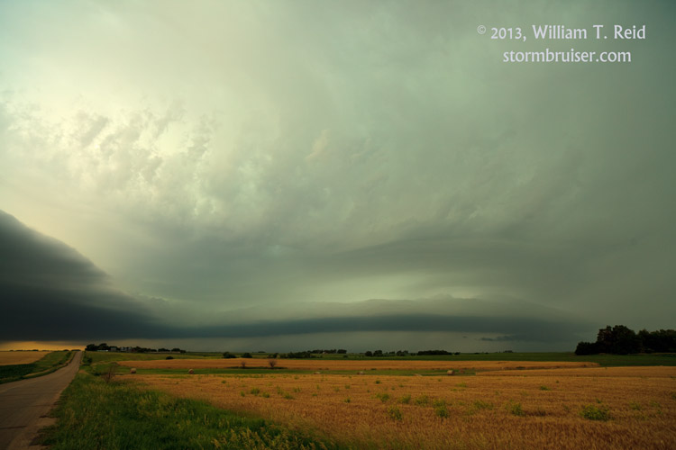
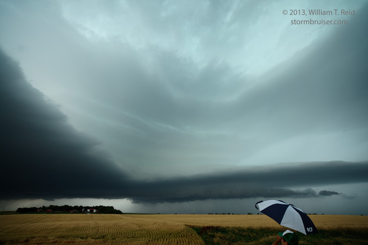
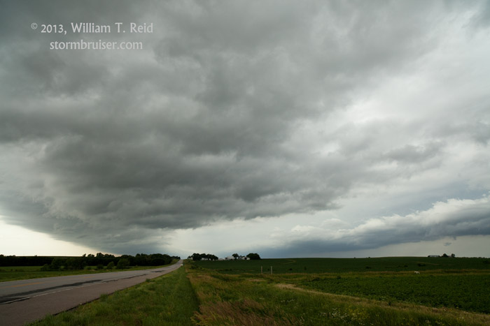
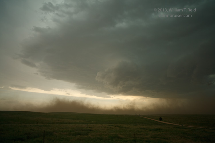
Our Diller storm was cool, but it did not appear to be a tornado-making candidate, and it was not in our target area. It was barely after noon, though! We abandoned the supercell and continued south and west towards Clay Center, KS. By now it was mid-afternoon, it was mostly sunny and very muggy, and storms were starting to pop to our west, around Mitchell County, KS. The dew point was in the upper 70s and CAPE values were extreme, over 5000 J/kg! The atmosphere was ready to explode! Unfortunately, we still had another 50 miles to go as an updraft exploded to our west. Finally, we got in front of the severe-warned supercell in the vicinity of Beverly, northwest of Salina. The storm’s base was low and the structure was fabulous, and CGs were frequent along our road, Highway 18. The storm was dropping to the south or SSE, and was certainly dropping baseball-sized hail or larger. These views are to the west.
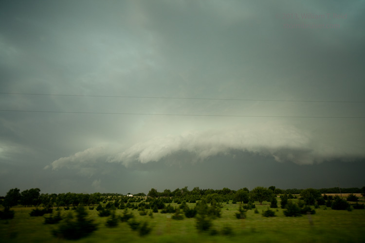
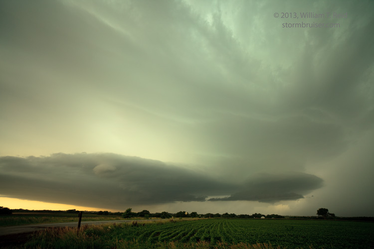
The storm was looking very “HP”, and we needed to drop south with it. We headed south out of Tescott to I-70, and then a few miles farther south. From here and eastward to I-135 near Salina, we watched the storm become very outflow dominant, with plenty of strong outflow winds and blowing dust.

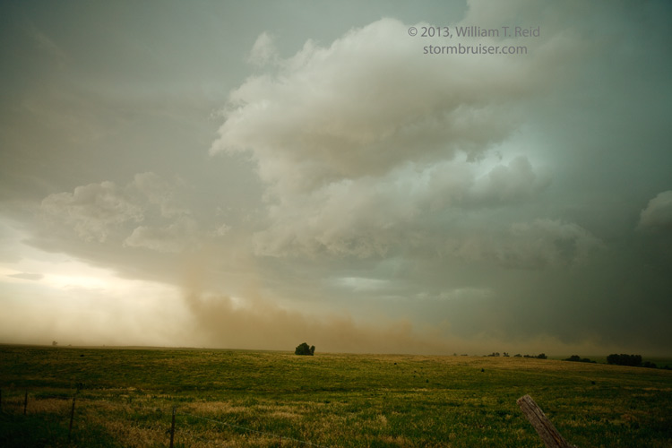
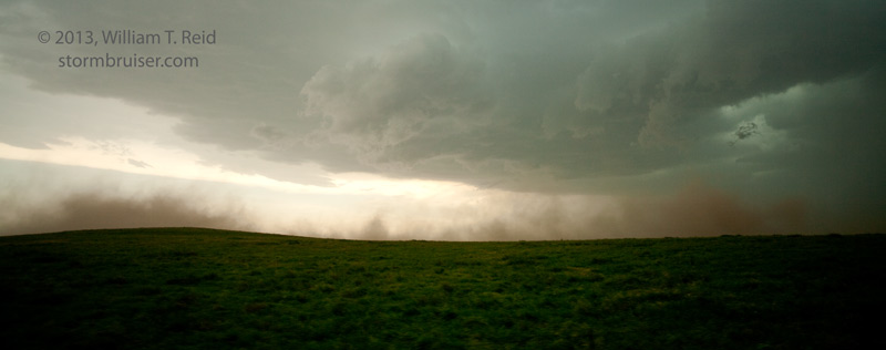
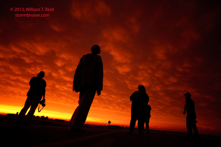
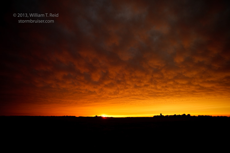
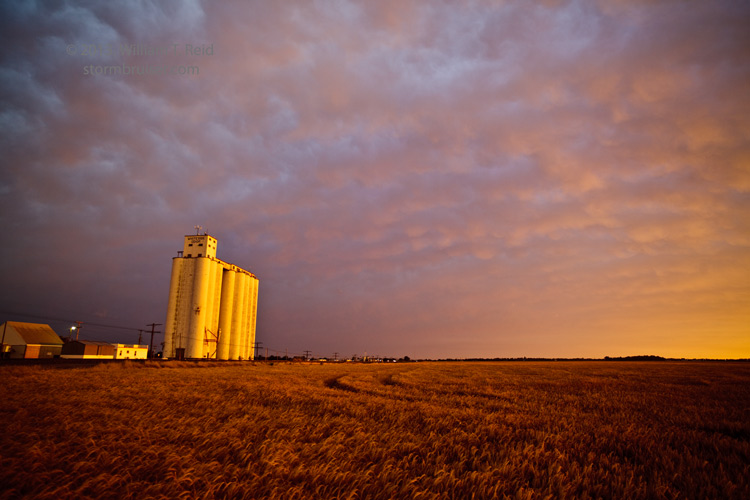
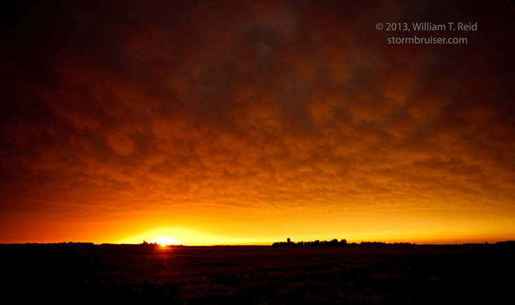
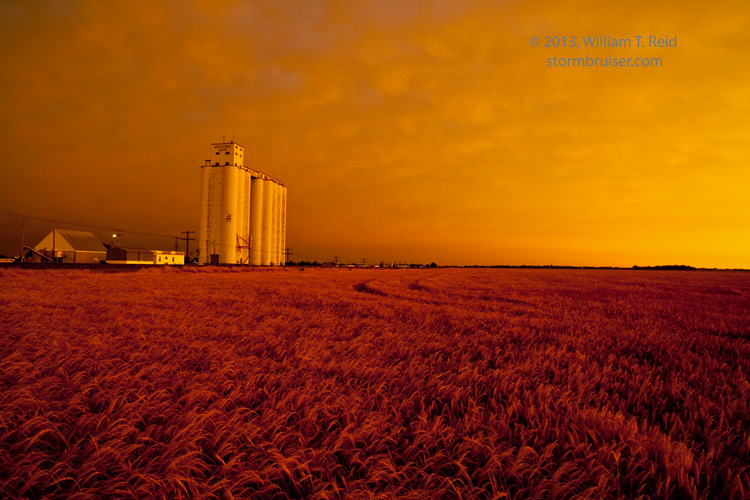
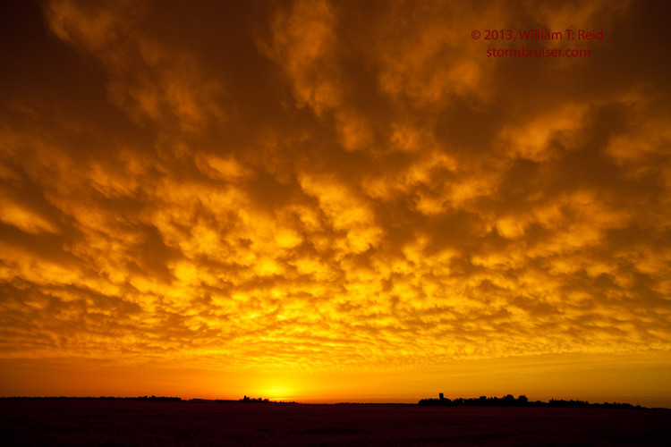
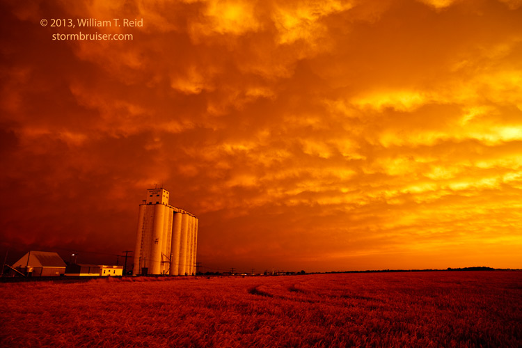
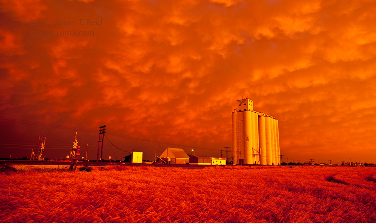
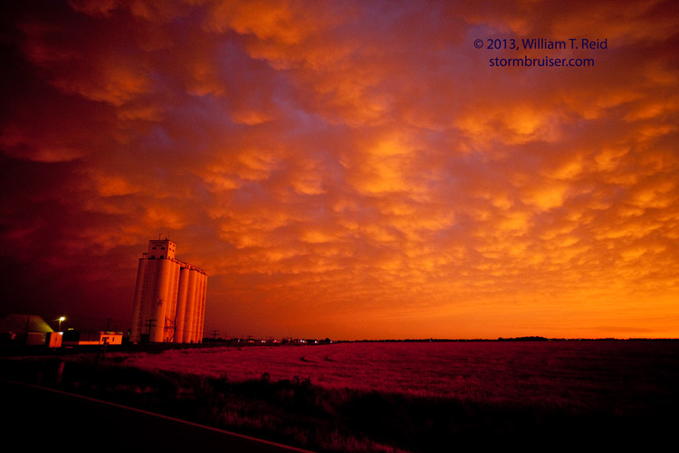
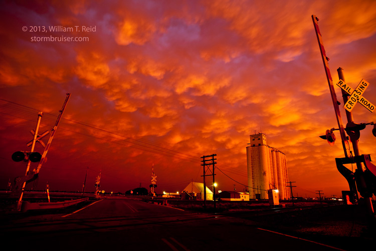
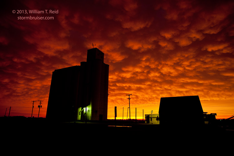
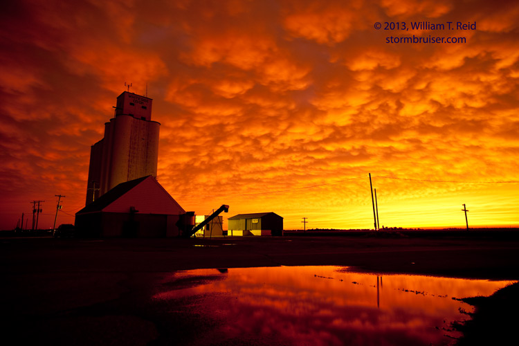
We dropped south on I-135, through a curtain of thick dust, and got back in front of the cell in McPherson. I elected to find a safe spot in town, and we let the storm pass overhead. We had some strong winds on the east side of McPherson, but the stronger winds were on the west side of town. There was little left to chase, so I called for rooms in Hutchinson, and we photographed the insane colors of sunset in the fields west of Hutchinson.


Leave a Reply
You must be logged in to post a comment.