

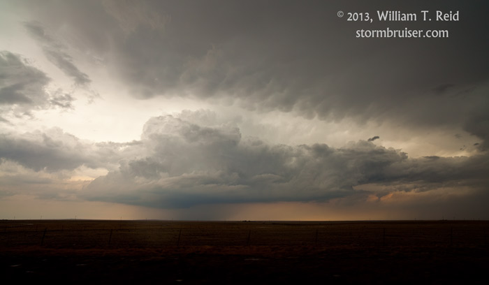
The target area for today was the Raton Mesa, or somewhere along the NM/CO border east of Trinidad. Moisture was adequate, and upper flow was just enough for a risk of severe weather. A slight risk was issued by SPC for the High Plains from about Colorado Springs southward to Hobbs. My brief blurb on Facebook, posted just after the chase:
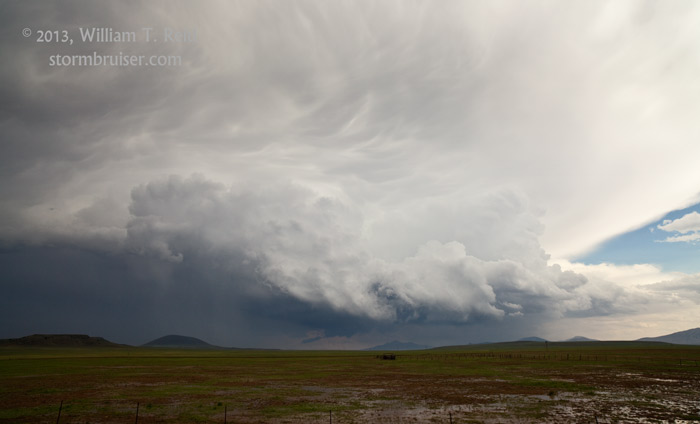
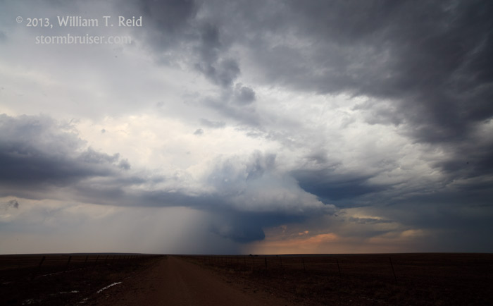
Sunday evening in Springer, NM…we observed a few nice rotating updrafts today in northeast NM. The best ones were near Capulin and north of Yates. Cells began training southward along Route 39, south of Abbott 5-10 miles, near the Colfax/Harding county line. Storm bases were very low and precip cores were heavy. There was widespread flooding in fields, ditches along the road were running full, and the highway was blocked by the sheriff due to flooding (after we had safely made it through northbound!). Today has been quite interesting, and I have a hunch that there will be more news of flooding in northeastern NM tonight.
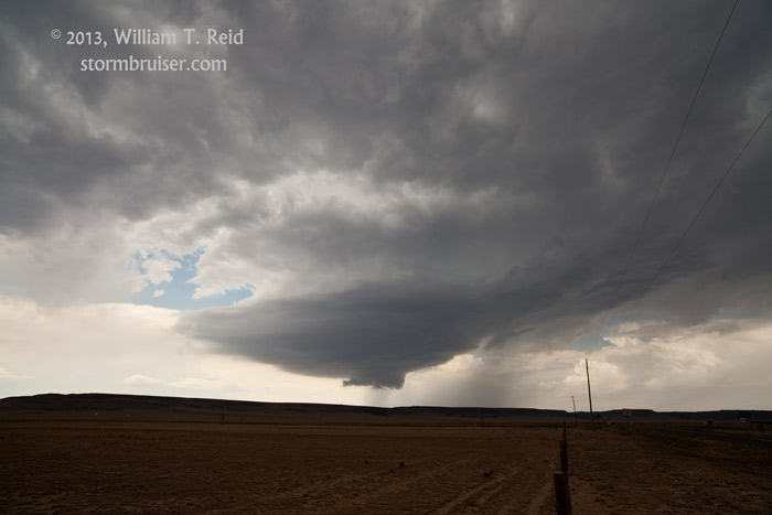
Our tour began the day in La Junta, and we killed some time during the afternoon at Model, CO. Eventually a very impressive and powerful updraft blossomed to our south. In order to get to it, we had to head southwest to Trinidad, south to Raton, and then east from there on U.S. 64. As we approached Capulin, a couple of rotating bases were in view to the south and the east.


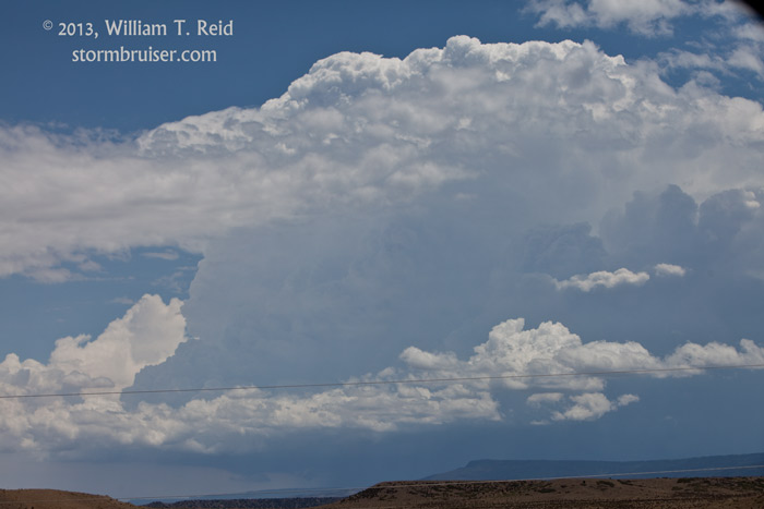
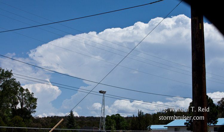
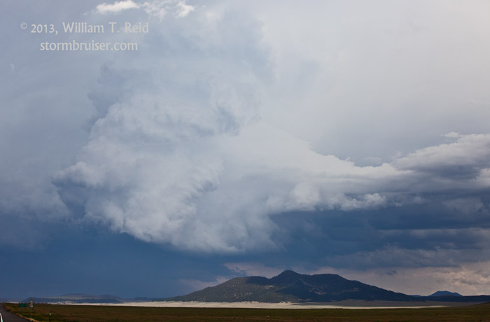
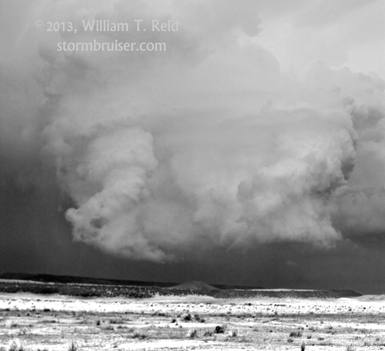


The cells were drifting slowly to the south. I wanted to be in front of the storm that was southwest of Capulin, but our road network was sparse. We dropped south at Grenville and scooted over to Gladstone. Our original storm, now to our west, was looking blah, but a new LP supercell was developing just northeast of Gladstone.
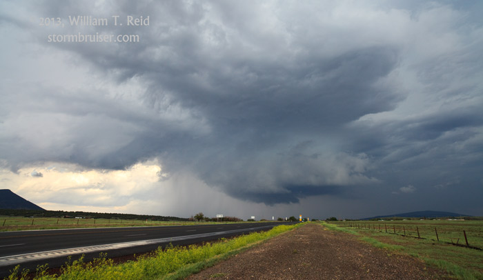
That LP storm held together for a while, and then dissipated near Yates. Another strong updraft went up near Roy, but by now the sky was overcast and the prospects for something special were slim. On our way north to Abbott from Roy, we were swamped by a big and wet blob which caused plenty of running water along the road and in the washes.


Leave a Reply
You must be logged in to post a comment.