Stormbruiser.com

William T. Reid

  • About
  • Video Links
  • Climate
  • Categories
    • Astronomy
    • Aurora/Northern Lights
    • Artsy
    • Airports (LAX and VNY)
    • Animal Day
    • Beach
    • BEST and MOST POPULAR
    • Chase Season Summary
    • Chasers and friends
    • Cumulonimbus
    • Death Valley
    • Desert
    • Desert/Mountains
    • Elevated photography
    • Eyesores
    • Fire
    • Flooding
    • Hurricane
    • Landscapes
    • Lightning
    • Local: Conejo Valley/San Fernando Valley
    • Mid and High Clouds
    • Nighttime photography
    • Old Stuff
    • Rainbows/Optical Phenomena
    • San Nicolas Island
    • Storm Video Sales
    • Stormy Skies
    • Stupid Bugs
    • Sunsets and Storms
    • Supercells
    • The City
    • Tornadoes
    • Unusual Clouds
    • Vegetation
    • Wind and Dust
    • Winter Weather
  • Contact
You are here: Home / 2013 / August 7, 2013 Cimarron County, OK supercells

August 7, 2013 Cimarron County, OK supercells

August 7, 2013 By Bill Leave a Comment

13Aug07_7185_Eva_OK


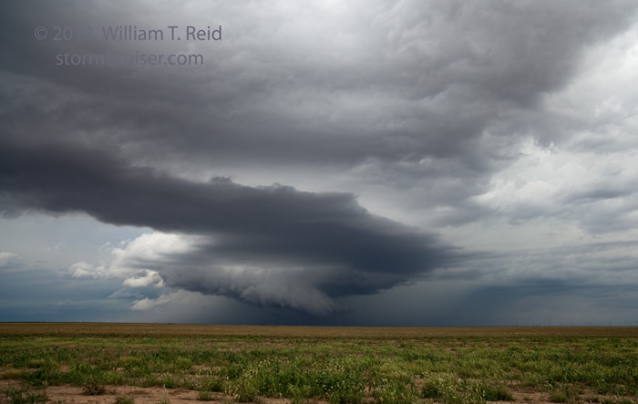
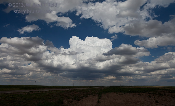
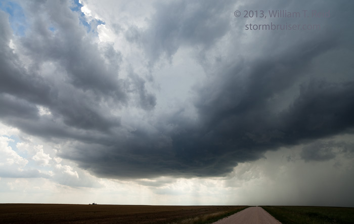
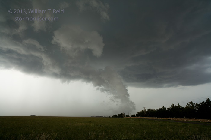
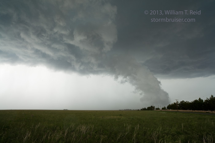
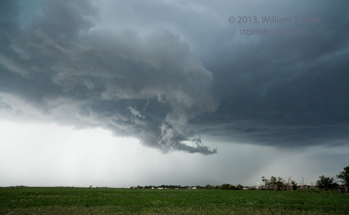
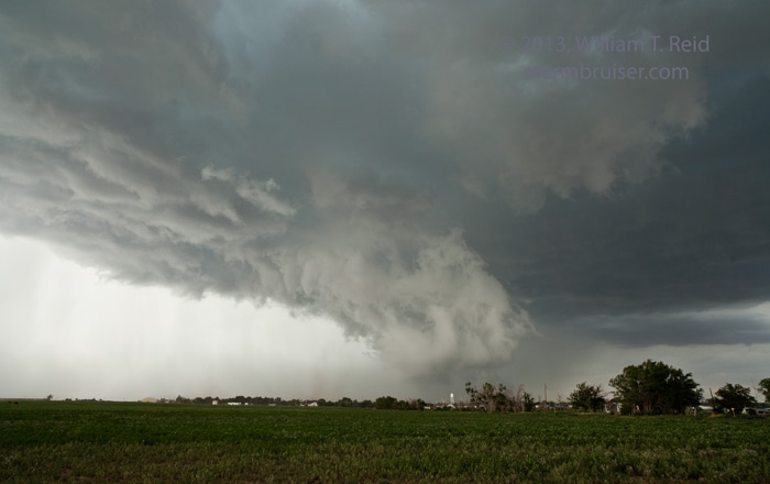
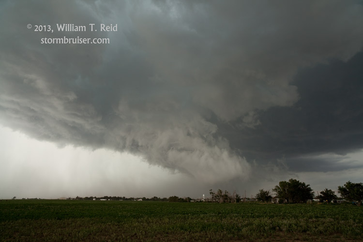
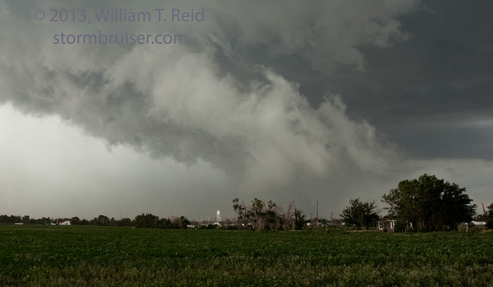
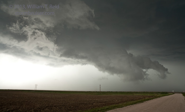
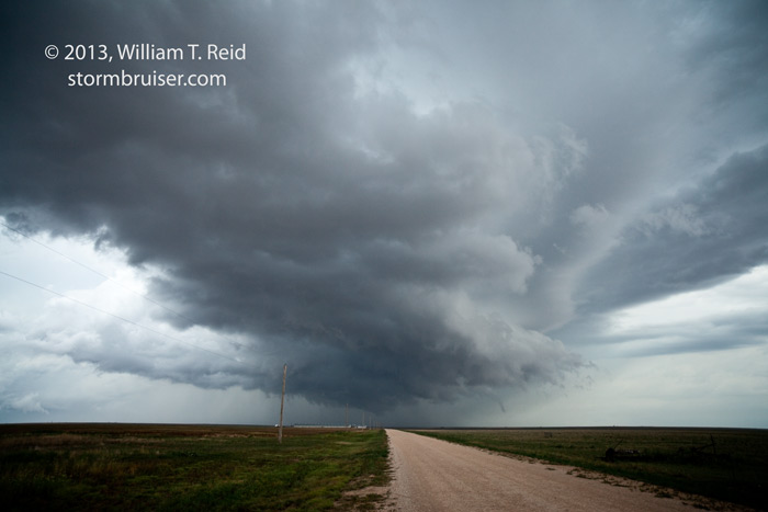
Our chase on August 7 began in Albuquerque, with a target in a SPC slight risk area in the western OK Panhandle.  The forecast worked out well, as a storm tower went up near Boise City around late afternoon as we approached from Clayton and Felt.  The storm took on some supercell characteristics, with a clear slot and a pronounced lowering or wall cloud as it slowly approached Boise City from west to east.  Though the lowering nearly reached the ground and was rotating some, cool outflow was undercutting the updraft and a bonafide tornado near Boise City could not be ascertained by us.  Later, we spoke to locals who said that a tornado had been spotted near or “north of the interchange”.  The cell cycled a couple of times, and again, was a bit outflowy and undercut as areas with low-level rotation descended.  We observed the “atomized rain” which is often associated with tornadic storms, but the storm was a teaser and not a tornado-producer.  It was nice being the only chasers on the storm, too!

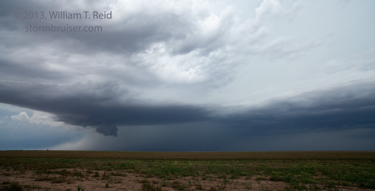
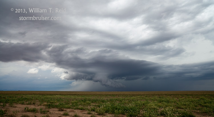
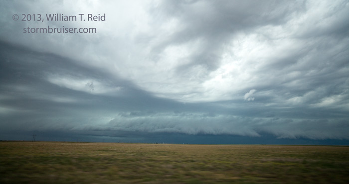
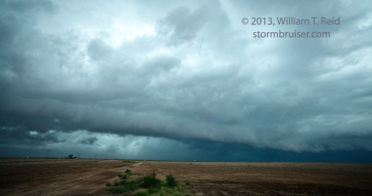
East of Boise City and Keyes, near Eva, the original storm wimped out but another one to the north had a good low-level look for 10 to 20 minutes.  This one weakened, and we drifted south and west near Eva for some late day shelf cloud structure.  Finally, we broke through to the west side of the storm at sunset to see a unique rainbow — see the rainbow entry for August 7 on SB.


13Aug07_7119_BoiseC_OK 13Aug07_7120_BoiseC_OK 13Aug07_7134_BoiseC_OK 13Aug07_7137_BoiseC_OK 13Aug07_7144_BoiseC_OK 13Aug07_7150_BoiseC_OK 13Aug07_7152_BoiseC_OK 13Aug07_7154_BoiseC_OK 13Aug07_7158_Eva_OK 13Aug07_7179_Eva_OK 13Aug07_7183_Keyes_OK 13Aug07_7188_Eva_OK 13Aug07_7190_Eva_OK 13Aug07_7193_Eva_OK

Filed Under: 2013, Supercells, Unusual Clouds

Leave a Reply

You must be logged in to post a comment.

Search

August 2013
S M T W T F S
 123
45678910
11121314151617
18192021222324
25262728293031
« Jul   Oct »

Categories

Archives

Copyright © 2025 stormbruiser.com · Log in