Stormbruiser.com

William T. Reid

  • About
  • Video Links
  • Climate
  • Categories
    • Astronomy
    • Aurora/Northern Lights
    • Artsy
    • Airports (LAX and VNY)
    • Animal Day
    • Beach
    • BEST and MOST POPULAR
    • Chase Season Summary
    • Chasers and friends
    • Cumulonimbus
    • Death Valley
    • Desert
    • Desert/Mountains
    • Elevated photography
    • Eyesores
    • Fire
    • Flooding
    • Hurricane
    • Landscapes
    • Lightning
    • Local: Conejo Valley/San Fernando Valley
    • Mid and High Clouds
    • Nighttime photography
    • Old Stuff
    • Rainbows/Optical Phenomena
    • San Nicolas Island
    • Storm Video Sales
    • Stormy Skies
    • Stupid Bugs
    • Sunsets and Storms
    • Supercells
    • The City
    • Tornadoes
    • Unusual Clouds
    • Vegetation
    • Wind and Dust
    • Winter Weather
  • Contact
You are here: Home / 2013 / August Monsoon Tour Pics

August Monsoon Tour Pics

August 7, 2013 By Bill Leave a Comment

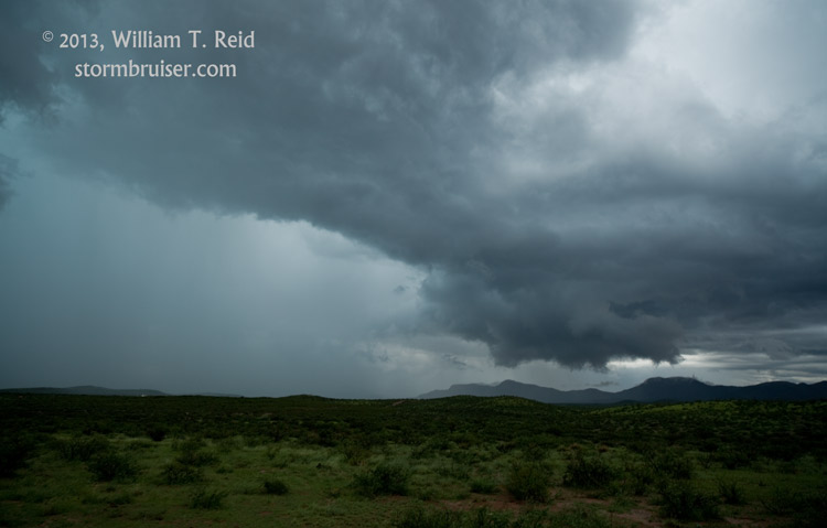
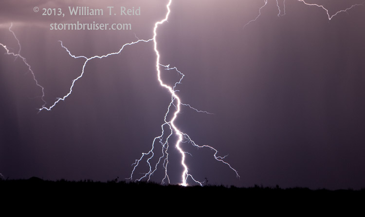
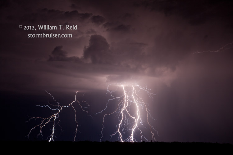
On Day Two of our “monsoon” chase tour, we went to the ends of the Earth, towards Douglas, AZ.  We found a strong cell with a lot of lightning in the mountains some 10-20 miles northeast of Douglas.  Here are a couple of images:


13Aug05_6990_Douglas_NM 13Aug05_7023_Douglas_AZ


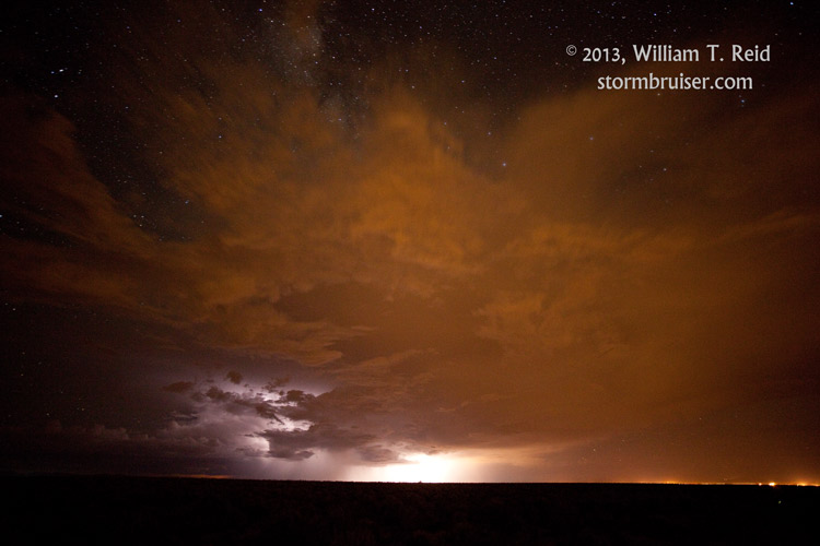
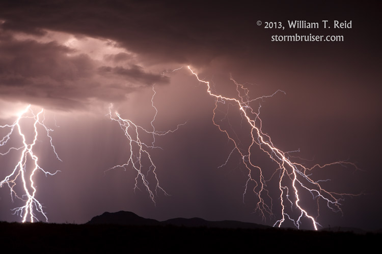
On Tuesday, Day 3, we drove all of the way from Douglas to Albuquerque, then west to Grants, back to Albuquerque (it was dark by now), and then south to between Belen and Socorro.  We were rewarded for our efforts with a fine CG lightning display to our south, over Socorro.


13Aug06_7052_Socorro_NM 13Aug06_7094_Socorro_NM 13Aug06_7101_Socorro_NM 13Aug06_7110_Socorro_NM


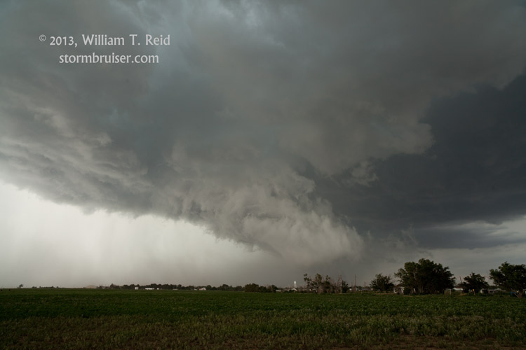
And on Wednesday, August 7, we headed northeast from Albuquerque to Clayton and Boise City for the slight risk area, where there was a decent chance for supercells.  We got on one as it blew up just to our east at around 4:30 p.m.  It moved slowly over Boise City, with wild motion on the lowerings beneath the updraft base, between the cool outflow and warm and moist inflow.  A couple of large lowerings looked like a little tornado-like, and had decent rotation, but we did not observe any touchdowns.


13Aug07_7152_BoiseC_OK 13Aug07_7183_Keyes_OK 13Aug07_7201_Keyes_OK


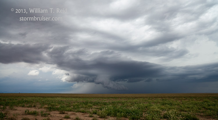
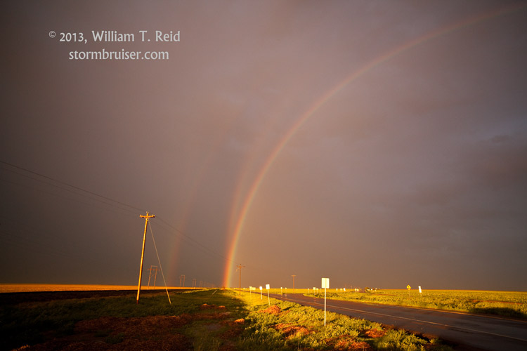
The first image of the three above is looking NNE on the west side of Boise City.  The rainbow was very odd — a double rainbow with a third one sticking out from the inner one.  I have never seen that before.

Filed Under: 2013, Cumulonimbus, Lightning

Leave a Reply

You must be logged in to post a comment.

Search

August 2013
S M T W T F S
 123
45678910
11121314151617
18192021222324
25262728293031
« Jul   Oct »

Categories

Archives

Copyright © 2025 stormbruiser.com · Log in