
I had all of Tuesday free to do as I pleased, so I headed to the Mojave Desert for some photography and a “weather fix.” A cold front was headed southward towards the region, and strong westerly winds were expected prior to the front during most of the daylight hours. However, I was more interested in “chasing the lenticulars.” Cold air at mid and upper levels was plunging southward through California with a potent trough of low pressure. More importantly for me, very strong westerly winds were forecast from 700 to 500 mb over the southern Sierra Nevada and Mojave Desert during the afternoon. These winds, combined with sufficient moisture at the mid-levels, would promote some mountain-wave effects downwind of the Sierra and Tehachapis, and the resulting upward and downward motions in the lee of the ranges can create some spectacular “standing lenticular altocumulus” cloud formations.
I get green with envy when I see other’s photographs of stunning lenticulars. I have managed to photograph numerous examples through the years, but I was still looking for a real jaw-dropping stunner. My mission on this chase day: photograph a triple, quadruple, quintulpe, whatever — a fabulous multi-stacked lenticular in the soft, colorful light of sunset at fairly close range with the wide-angle lens. And, it should not be too much to ask if the cloud were above some fabulously bleak and stark desert or desert-mountain scenery. Of course, there was also the chance that there would be no interesting clouds or lenticulars. The satellite loop suggested some wave clouds in the Owens Valley region and northwestern Mojave Desert by late morning, so I headed out. I was prepared to drive all of the way to Owens Lake, about 3.5 hours away. But, perhaps something worthwhile would develop an hour or so closer, near the Mojave or Edwards or Ridgecrest area.
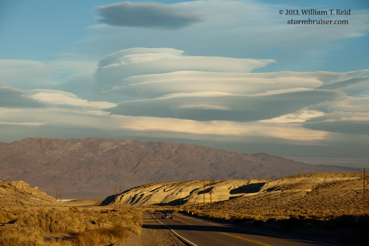
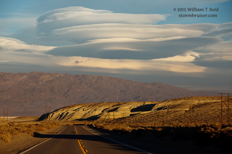
By 2 p.m. I was at Mojave, and some lenticulars were in view to the north —- great! These looked fairly decent, and mid-level winds would be increasing towards sunset and the environment for them would be getting better. The typical blanket of low clouds was covering the Tehachapis to the west.
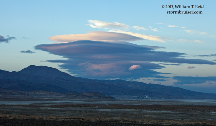
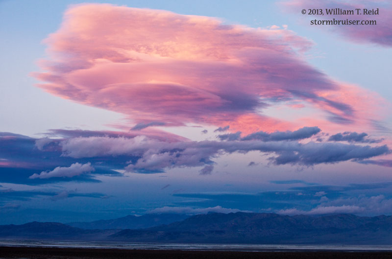
About 50 miles north of Mojave, near Pearsonville, two impressive lenticulars were in view. One was to the north, perhaps near Olancha and Owens Lake, and the other one was to my east-northeast, perhaps over the Panamint Valley. I got some images of these, and the one to the north seemed to struggle a little.
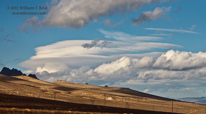


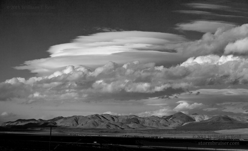
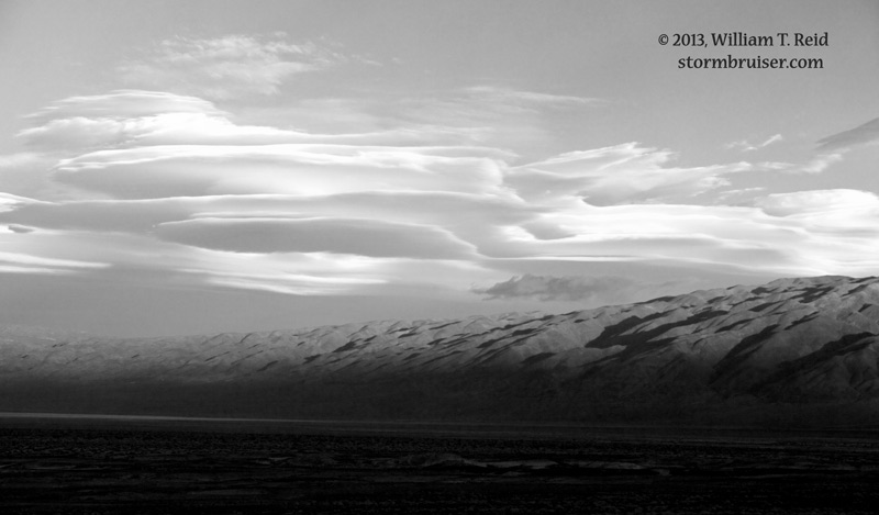
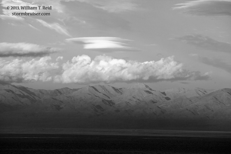
I had to decide which one of these to focus on for my sunset shots, and I elected to go for the one to the east. It looked more robust, and it might have been a little closer. I made my way through the town of Ridgecrest, and found myself in the nice and empty desert landscape between there and Trona. The lenticular that had drawn me eastward was becoming larger horizontally but less impressive vertically. Fortunately, another one to the more distant east looked really nice, and I stopped a couple of times on the west side of Poison Canyon to photograph it.
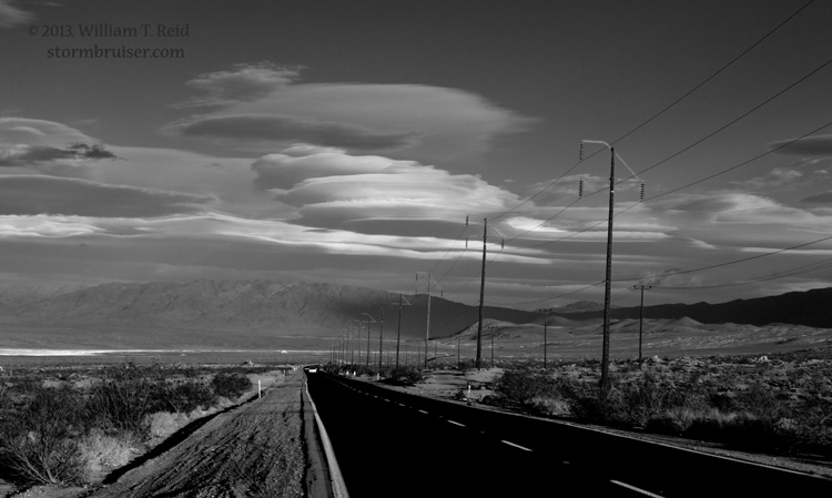
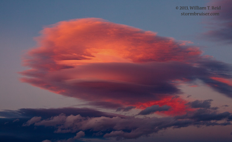
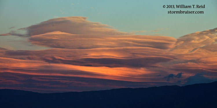
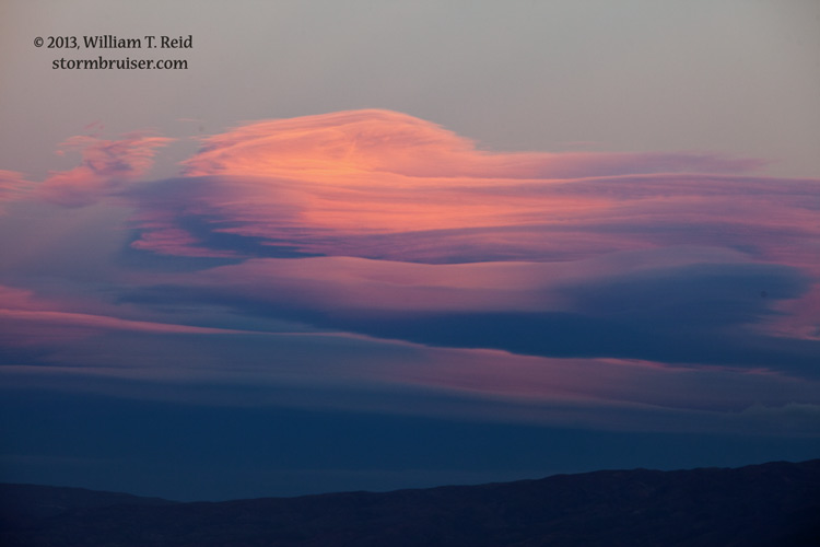
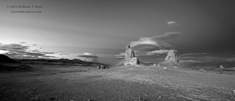
Sunset was less than an hour away now, and I wanted to be in a nice, open area with decent views in most directions. The Searles Valley, just 10 miles or so to the east, would work perfectly! And, the Trona Pinnacles were right there at the south end of the dry lake. I high-tailed it to the dirt road which leads to the pinnacles, and made my way for 6 bumpy miles to the pinnacles. These would provide some interesting foregrounds for some dramatic sky and landscape shots, and I had to hope that a pretty cloud or two might materialize nearby. The Trona Pinnacles are similar to the tufa towers at Mono Lake. They formed when a large freshwater lake partially filled the basin during the Ice Ages. One car was driving out as I neared, and I had the entire place to myself! I played around with the long lens and the 15mm lens, and a new lenticular developed not too far to my north, near Trona. The wind was blowing about 20-30 mph, and it was difficult at times to get steady images with exposure times of 1 to 5 seconds. My super-duper multi-stack lenticular did not emerge as hoped, but there was enough color and drama in the sky to keep me busy!
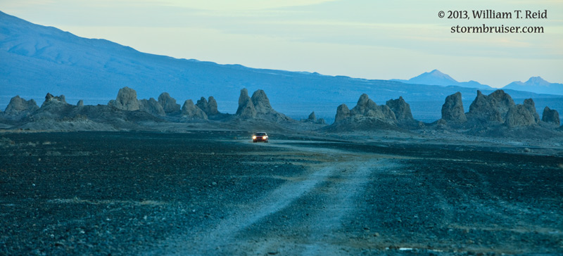
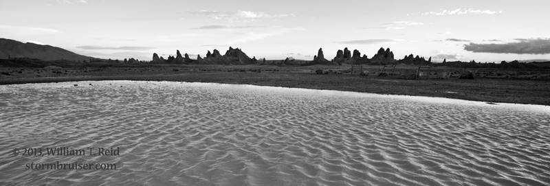


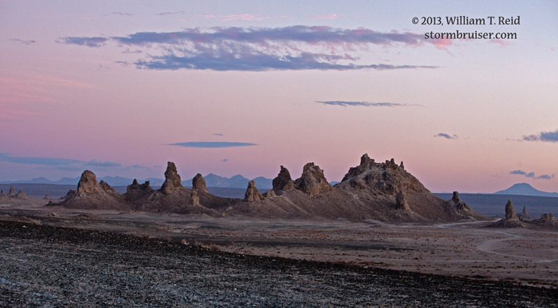
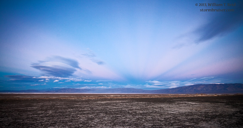
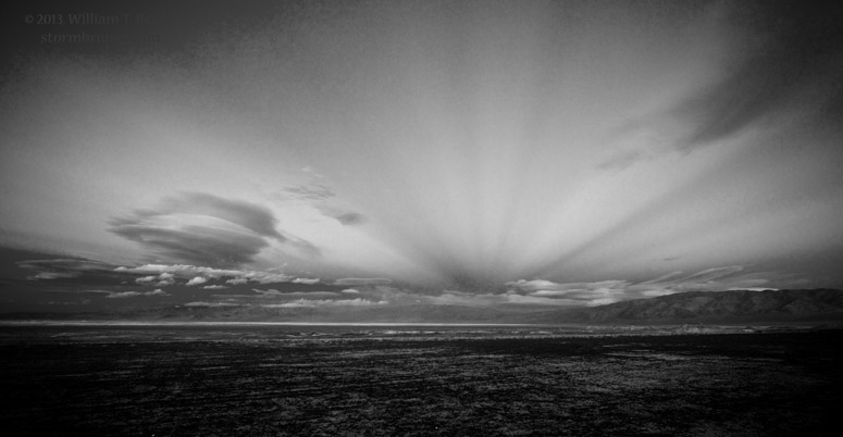
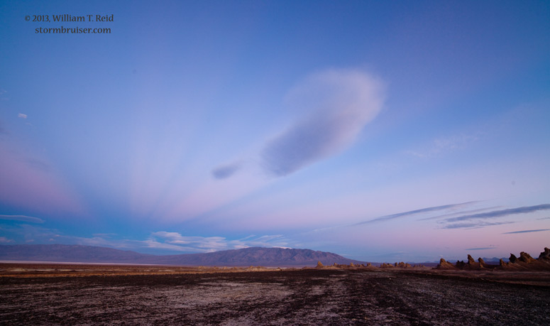


I admit that I did not notice the anti-crepuscular rays to the east until I looked at the photographs. Photoshop helped quite a bit to make these more prominent. The town of Trona can be seen in the distance in several of the images. It is about ten miles to the north, on the western “shore” of Searles Dry Lake. As the skies darkened I shifted to “night sky” mode: click here for these images.
Leave a Reply
You must be logged in to post a comment.