
The 2013 chase season was reasonably successful for me. As usual, there was a day or two where I would like to go back and change one decision. But, overall, my forecasting and chase decisions were pretty good, and I observed a good number of severe weather and supercells. As for tornadoes, the last half of May was active, while the last half of April, the first half of May, and most of June were very slow.
Unfortunately, the chaser community lost several chasers in the El Reno tornado of May 31. What had been the highlight of the year for me quickly turned very sour —- see my post for June 1.
Below are links to each chase day for 2013, with an image or two to provided as the highlight of the day, at least photographically.
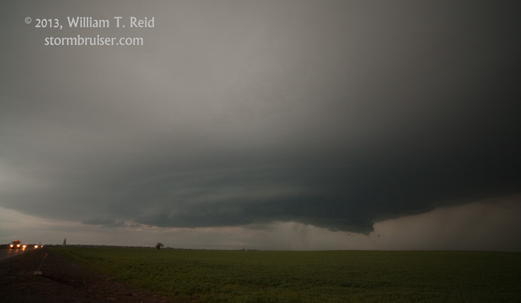
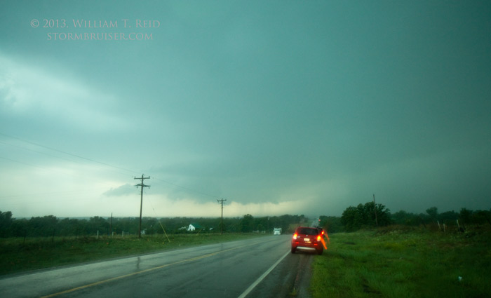
Several supercells near Frederick became ouflowish rather quickly, and the big kahuna supercell near Grandfield produced a tornado after dark, which is a misnomer.


April 22 Supercell near Alva, OK
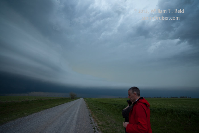
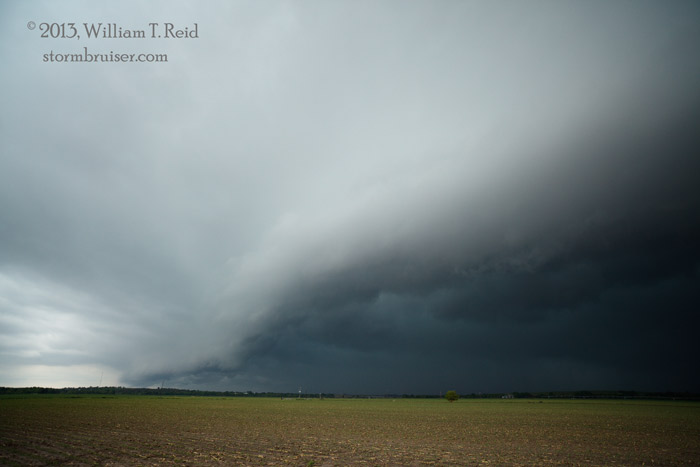
A supercell along the KS/OK border provided a hail barrage for the Tour 1 folks at Burlington, OK.


April 26 Elk City/Dill City OK supercell
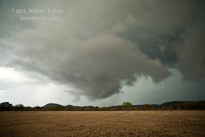
A nicely-sculpted supercell graced filled our camera lenses on this evening in west-central OK.


April 27 Rocksprings and Barksdale, TX severe storms
A couple of storms were sampled in the poor road network south of Junction and Ozona. These were primarily hailers, but they exhibited some supercell structure.


April 28 Sanderson, TX severe storm
We went to the ends of the earth, along the Rio Grande in the wastelands of southwest TX, to observe an impressive storm that produced large hail.


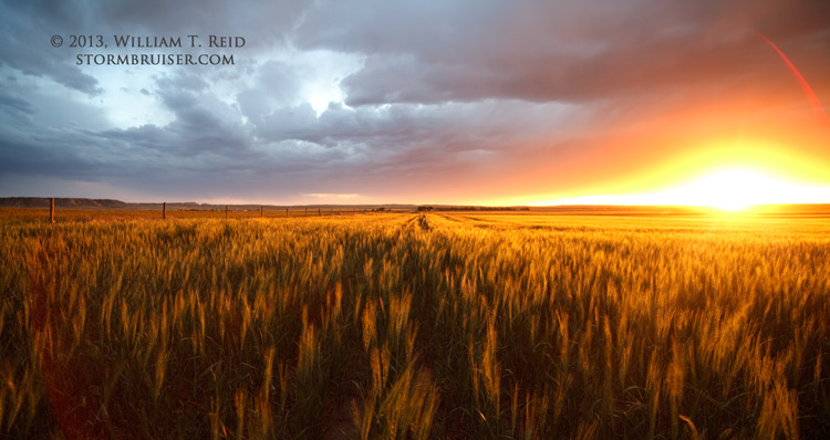
April 29 Fredericksburg, TX, fiery sunset
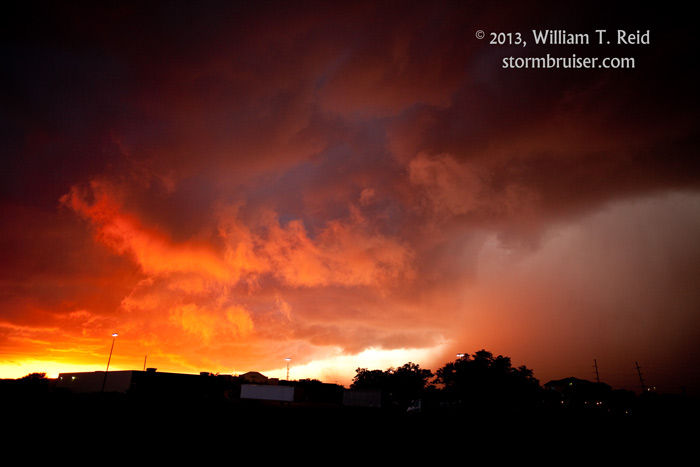
Upper flow was a little weak, but storms near Junction and Fredericksburg were not entirely uninteresting.


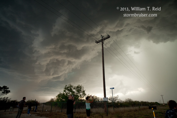
May 1 Spider lightning spectacular at Albany, TX
A tail-end cell got strong quickly during a pit stop in Albany, TX. The tour group got split up, with the east van winding up in 70 mph winds and the west van moving to a hilltop west of Albany for a great view of the electrified backside of the updraft region.


May 2 – 5 Four down days in the Big Bend region
A brutal cold front forced us down to the Rio Grande again to stay warm and to enjoy some scenery.


May 6 Portales/Lingo, NM supercell
A splendid, dusty High Plains supercell looked great at sunset near the NM/TX border.


Western Kansas made us happy on this day, thanks to this pretty supercell near Ness City.


May 8 Sitka and Protection, KS supercell and CGs near Hardtner, KS
A strongly rotating updraft near Sitka had an early demise, but we found a CG-happy cell along the OK/KS border at dusk.


May 9 Supercells from Ballinger to Mason to Fredericksburg, TX
HP supercells drew us well south into Texas.


After we watching a cell die as it approached the U.S./Mexico border, we recovered to intercept a nasty high-based hailstorm at Pearsall, TX, southwest of San Antonio.


May 14 Rankin, TX, severe storm
A severe storm appeared to be supercellular for a little while near Rankin and Barnhart, TX, southwest of San Angelo.


A strong supercell near Mineral Wells produced a fairly long-lived tornado at Millsap, TX.


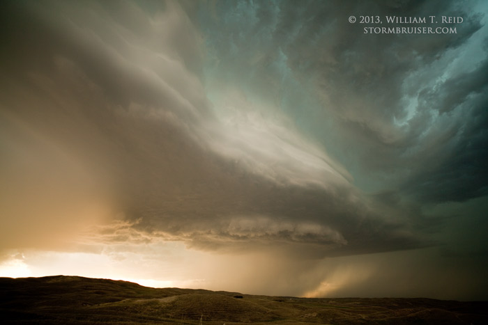
May 17 Nebraska Sandhills storms
It took a while, but some updrafts west of Hyannis started to spin nicely late in the day.


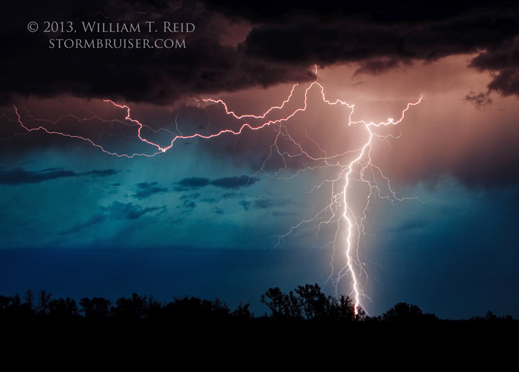
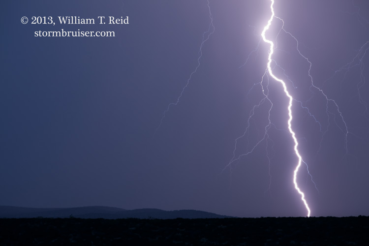
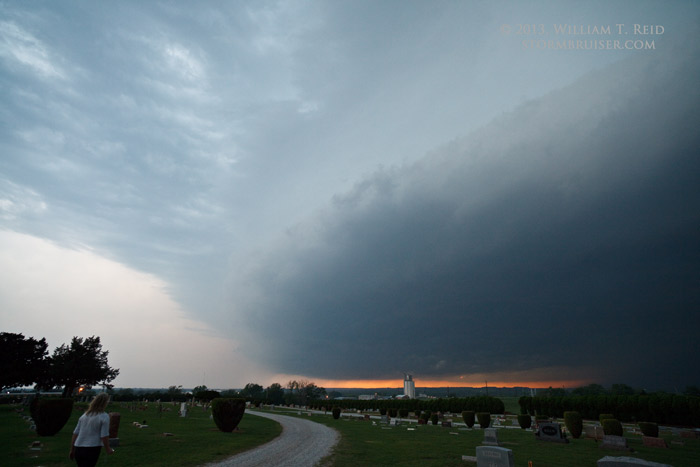
May 17 Nebraska Sandhills Supercell Lightning Spectacular!
A rotating updraft near Bingham, NE, drifted nearby and was issuing CGs at an amazing rate at dusk.


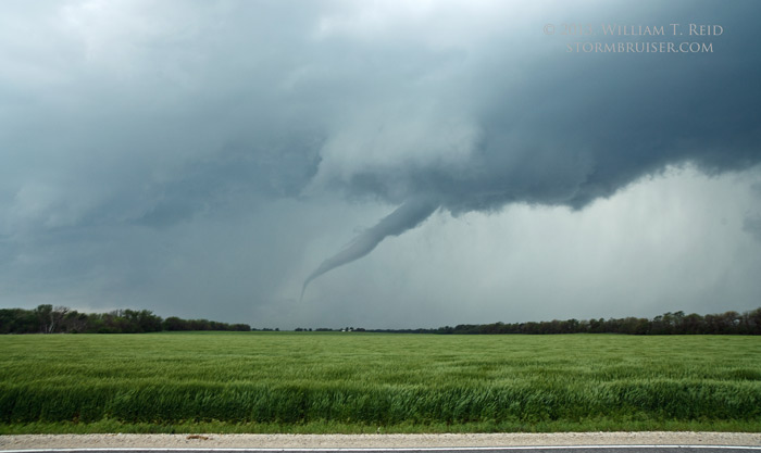
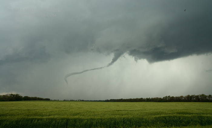
UGH.

A long and somewhat frustrating chase began with this nice tornado southwest of Wichita.

May 20 Southern Oklahoma supercells
We were on the storm just south of the Moore, OK, tornadic supercell, and wound up on a big storm near Saint Jo, TX.


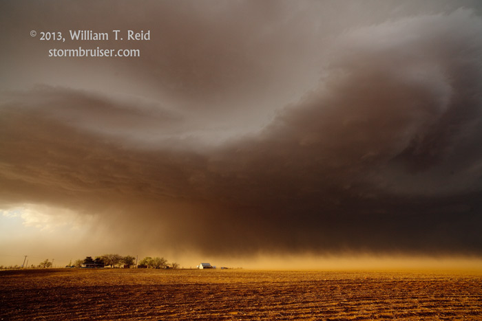
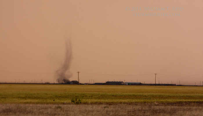
May 23 Floydada, TX landspout tornado and outflow-dominated high-based dust bomb
A supercell on the edge of the Caprock produced a couple of landspout tornadoes and wrapped up nicely, but became strongly outflowish.


May 25 Junky storms in central Nebraska
Some high-based updrafts rotated nicely, but looked moisture-starved, near Hazard, NE.


May 26 Spectacular Arcadia, NE, supercell
All of the air in central Nebraska wanted to go up inside this magnificent supercell updraft!


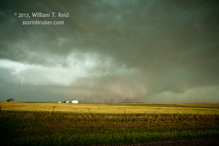
May 27 Smith County, KS, HP supercell
We watched this beast produce a weak spin-up near Smith Center, but the big tornado near Lebanon was rain-wrapped.


May 28 Haxtun/Julesburg, CO, supercell
A gorgeous high-based Colorado supercell was a structure feast for the eyes.


May 29 Howard County, NE, supercell
Southwest Nebraska storms became tiresome, and we made it east in time to see a tornado-warned storm near St. Paul. No, the town.


May 30 Elmore City, OK, HP supercell
The beast of the day was west-northwest of Ardmore, and at sunset we watched an updraft fizzle along the Red River.


Our tour group watched the El Reno tornado develop just a mile or two distant, and then it told us to get out of the way.


June 1 Strange, Surreal, and Sad
The last day prior to my one-week break wound up with very bad news: the deaths of Tim Samaras, Paul Samaras, and Carl Young.


June 9 Western Nebraska Northern Lights
We changed into our Milky Way-viewing clothes, and got a glimpse of the Northern Lights, north of Scottsbluff.


June 11 Nebraska Panhandle Supercell
This storm was tornado-warned for a while, and featured very nice structure, west of Alliance.


June 12 Northeastern Wyoming supercells
A couple of decent supercell were difficult to intercept.


June 13 Lame chase near Lame Deer, MT
A pretty sunset with some convection south of Gillette, WY, salvaged the day. A little.


June 14 Willard swine and Harrisburg sunset
The area from about Sterling, CO, to Kimball, NE was not in much of a mood for making decent storms.
June 15 Atwood, CO, supercell sunset
The backside of a supercell in northeastern CO was a playground of color at sunset.


June 18 Hilda/Medicine Hat, AB, colorful stormy sunset
We had to wait a long time for the nice colors at sunset — well into the evening — but it was worth the wait!


June 19 Elkwater, AB, supercell
This storm in the southeast corner of Alberta may have produced a tornado. We could not determine for certain!


June 21 Torrington, WY, supercell
A cell or two or three near Lingle and Torrington provided a few interesting moments, including a cow-nado.


June 22 Chugwater supercell and Dix, NE, tornado
Two tornadoes were observed today, but the meso-of-the-day east of Chugwater was rain-wrapped and we were unable to maintain position on it.


June 27 Diller and Beverly, KS, supercell
The strong supercells near Willow, NE, and near Salina, KS, were practically an afterthought after the wild sunset near Hutchinson.


June 28 Colorado High Plains, high-based supercell
Back to the high terrain, an afternoon cell near Vona, and lightning near Kiowa, CO…


June 29 Haswell, CO, supercells
These storms were high-based and a bit junky, but the sunset was cool!


June 30 Northeastern NM supercells
The Raton Mesa was the place to be on the final day of June!


Leave a Reply
You must be logged in to post a comment.