Stormbruiser.com

William T. Reid

  • About
  • Video Links
  • Climate
  • Categories
    • Astronomy
    • Aurora/Northern Lights
    • Artsy
    • Airports (LAX and VNY)
    • Animal Day
    • Beach
    • BEST and MOST POPULAR
    • Chase Season Summary
    • Chasers and friends
    • Cumulonimbus
    • Death Valley
    • Desert
    • Desert/Mountains
    • Elevated photography
    • Eyesores
    • Fire
    • Flooding
    • Hurricane
    • Landscapes
    • Lightning
    • Local: Conejo Valley/San Fernando Valley
    • Mid and High Clouds
    • Nighttime photography
    • Old Stuff
    • Rainbows/Optical Phenomena
    • San Nicolas Island
    • Storm Video Sales
    • Stormy Skies
    • Stupid Bugs
    • Sunsets and Storms
    • Supercells
    • The City
    • Tornadoes
    • Unusual Clouds
    • Vegetation
    • Wind and Dust
    • Winter Weather
  • Contact
You are here: Home / 2014 / May 2, 2014 Nebraska Panhandle hailer

May 2, 2014 Nebraska Panhandle hailer

May 2, 2014 By Bill Leave a Comment

140502_0362_Dalton_NE


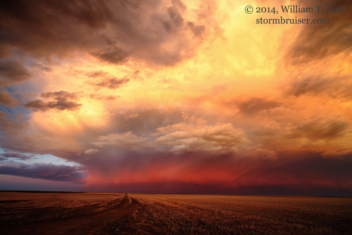
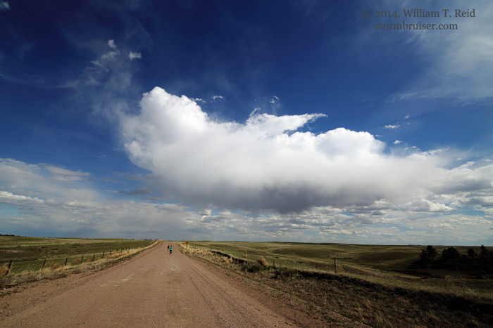
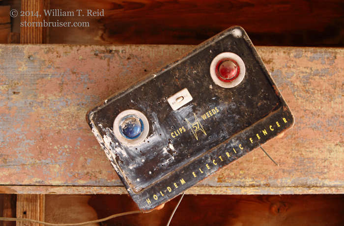
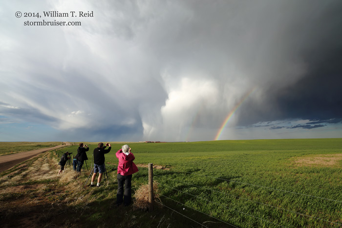
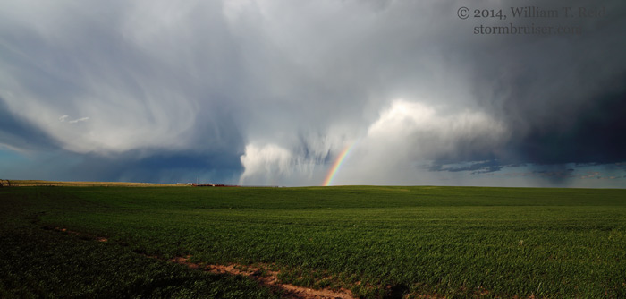
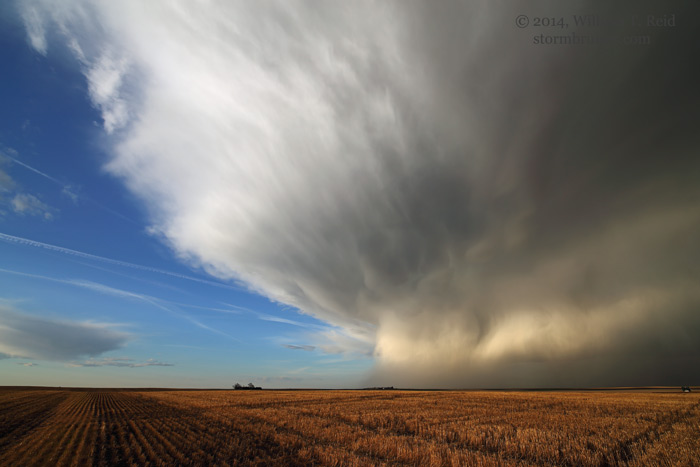
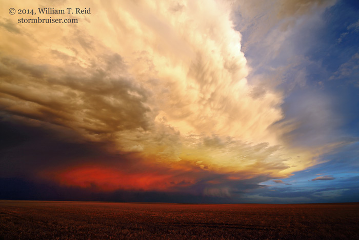
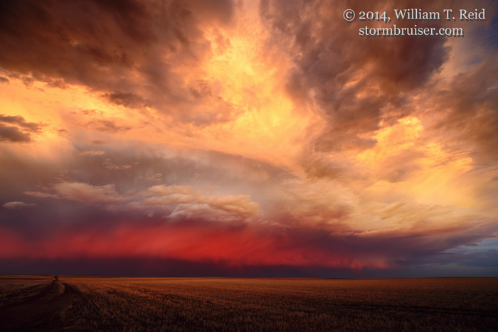
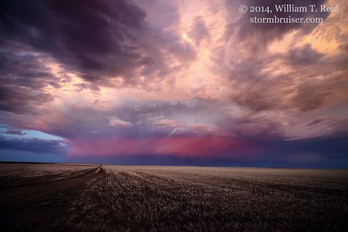
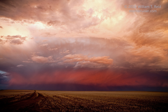
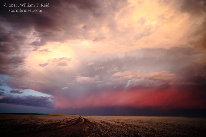
On May 2, there was a risk of thunderstorms along a front in the Nebraska Panhandle (SPC did not indicate a risk for severe weather).  Flow aloft was strong and from the northwest, but dew points were in the 30s.  Forecast CAPE values were nearly 500, though, so we held out a little hope for something interesting — maybe some lightning.  We watched a lot of really high-based convection spit out some virga bombs around Courthouse Rock, near Broadwater.  We drifted south just a little and photographed an abandoned farmstead while watching the cumulus clouds struggle overhead.  At about 6 p.m., a stronger and larger blob materialized to our north, and we watched it move to our north and northeast, from about 15 miles WNW of Dalton, NE.  It strengthened nicely and started to spit out the occasional CG.  The main show was the intriguing hail curtains and rainbow, though.  We chased it east past Dalton and watched the storm weaken, but it was a fun chase with plenty of pleasant surprises, including a hail roar, thunder, and fabulous High Plains light and color.


140502_0261_Broadwater_NE 140502_0245_Broadwater_NE 140502_0246_Broadwater_NE 140502_0248_Broadwater_NE 140502_0251_Broadwater_NE 140502_0258_Broadwater_NE


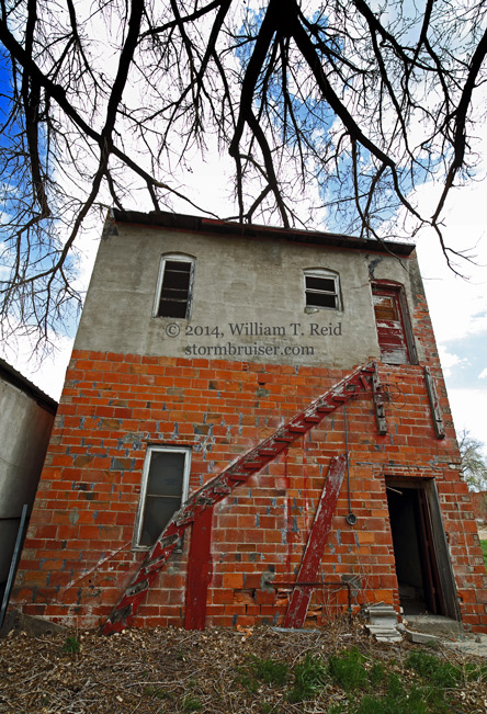
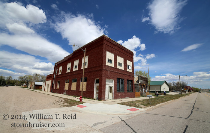
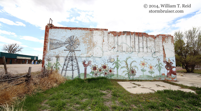
Images above from Broadwater, NE; below, somewhere in Banner County, I think!


140502_0278_Banner_NE 140502_0281_Banner_NE 140502_0288_Banner_NE 140502_0291_Banner_NE 140502_0270_Banner_NE 140502_9765_Dalton_NE


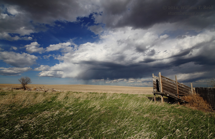
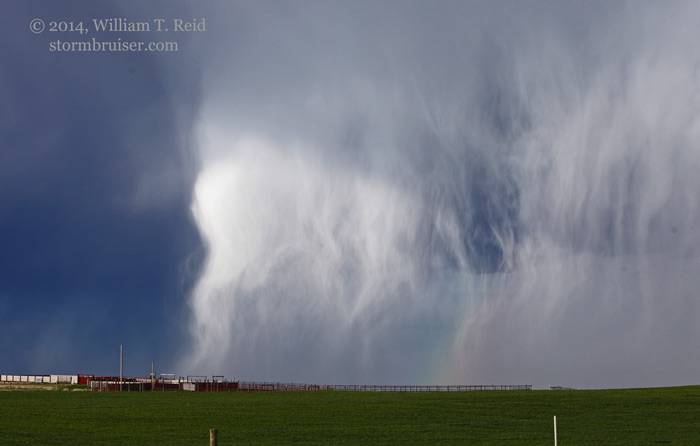
Below — high-based mega-virga bomb with hail shafts and rainbow some 20-25 miles WNW of Dalton, NE


140502_0307_Dalton_NE 140502_0311_Dalton_NE 140502_0317_Dalton_NE 140502_9770_Dalton_NE 140502_9779_Dalton_NE 140502_9773_Dalton_NE 140502_9781_Dalton_NE 140502_9787_Dalton_NE


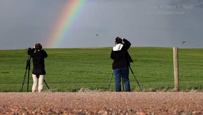
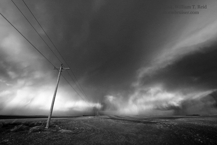
Below — near and east of Dalton


140502_0325b_Dalton_NE 140502_9793_Dalton_NE140502_0331_Dalton_NE 140502_0347_Dalton_NE 140502_0362_Dalton_NE 140502_0368_Dalton_NE 140502_0369_Dalton_NE 140502_9801_Dalton_NE 140502_9803_Dalton_NE


Filed Under: 2014, Cumulonimbus, Old Stuff, Rainbows/Optical Phenomena, Sunsets and Storms, Unusual Clouds

Leave a Reply

You must be logged in to post a comment.

Search

May 2014
S M T W T F S
 123
45678910
11121314151617
18192021222324
25262728293031
« Apr   Jun »

Categories

Archives

Copyright © 2025 stormbruiser.com · Log in