Stormbruiser.com

William T. Reid

  • About
  • Video Links
  • Climate
  • Categories
    • Astronomy
    • Aurora/Northern Lights
    • Artsy
    • Airports (LAX and VNY)
    • Animal Day
    • Beach
    • BEST and MOST POPULAR
    • Chase Season Summary
    • Chasers and friends
    • Cumulonimbus
    • Death Valley
    • Desert
    • Desert/Mountains
    • Elevated photography
    • Eyesores
    • Fire
    • Flooding
    • Hurricane
    • Landscapes
    • Lightning
    • Local: Conejo Valley/San Fernando Valley
    • Mid and High Clouds
    • Nighttime photography
    • Old Stuff
    • Rainbows/Optical Phenomena
    • San Nicolas Island
    • Storm Video Sales
    • Stormy Skies
    • Stupid Bugs
    • Sunsets and Storms
    • Supercells
    • The City
    • Tornadoes
    • Unusual Clouds
    • Vegetation
    • Wind and Dust
    • Winter Weather
  • Contact
You are here: Home / 2014 / May 6, 2014 Pine Bluffs, WY supercell

May 6, 2014 Pine Bluffs, WY supercell

May 6, 2014 By Bill Leave a Comment

140506_9893_Pine-Bluffs_WY


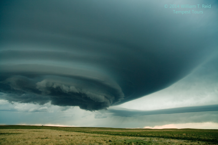
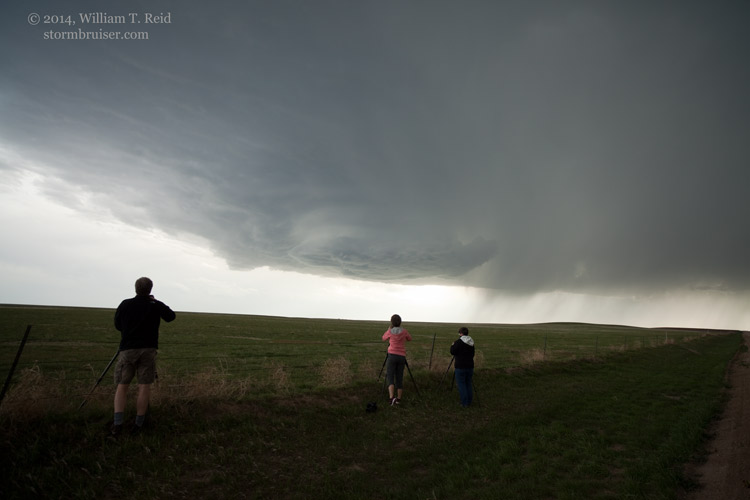
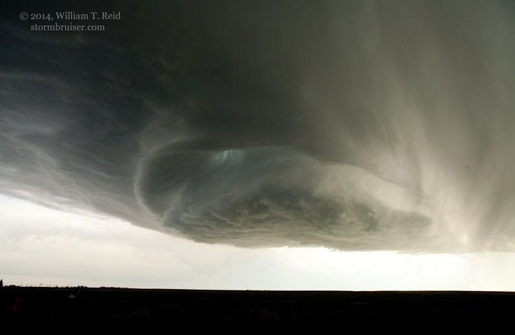
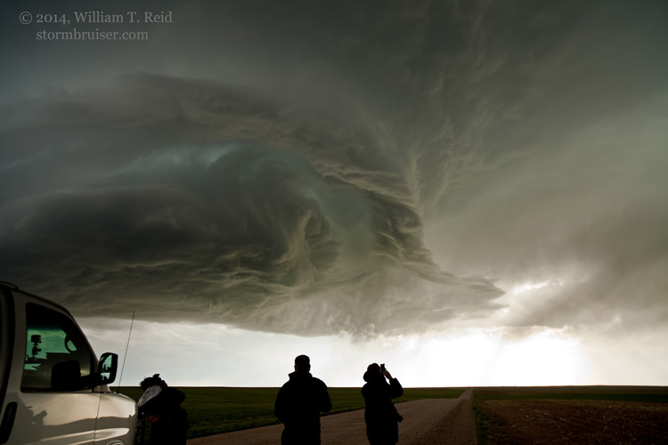
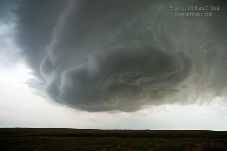
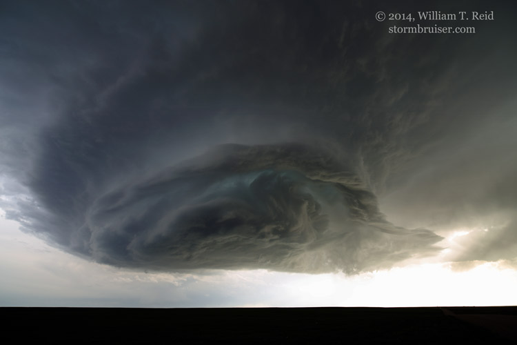
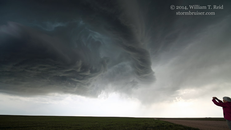
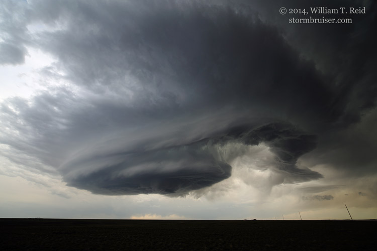
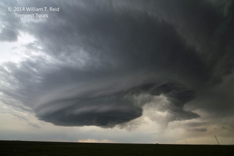
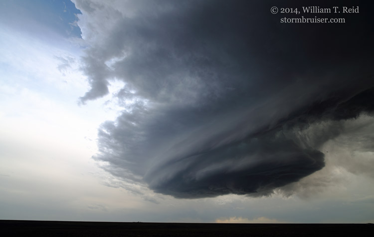
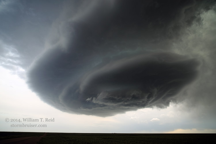
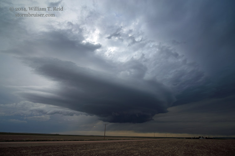
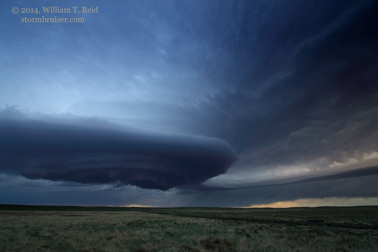
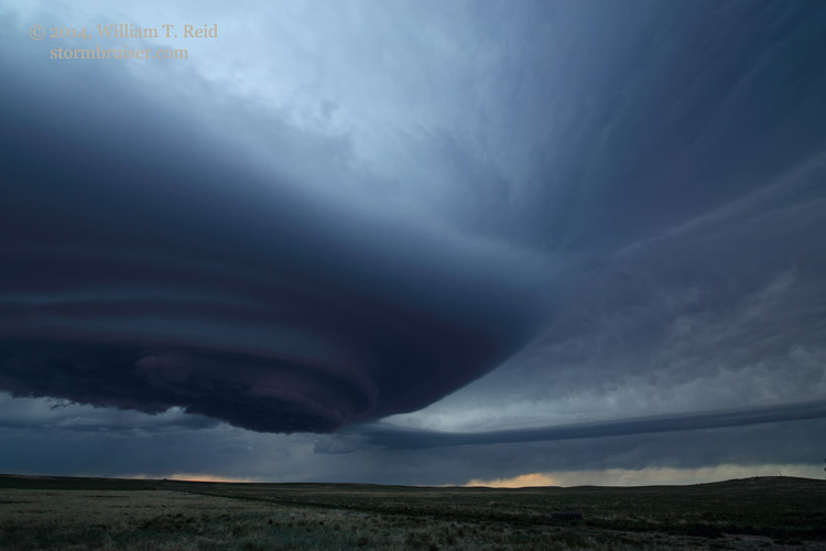
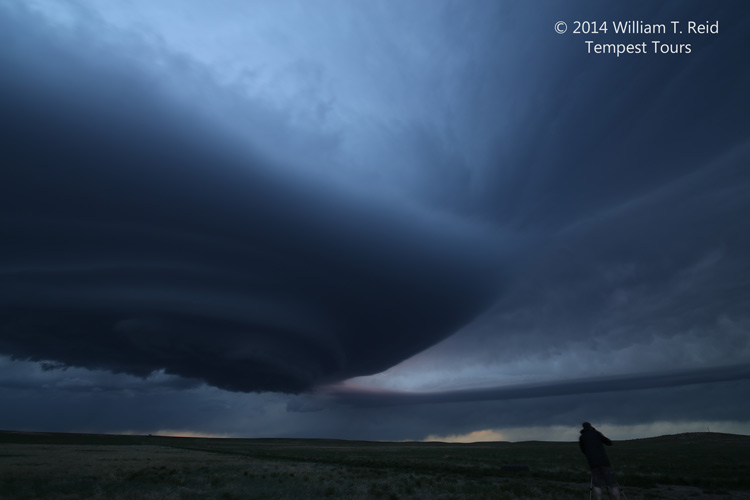
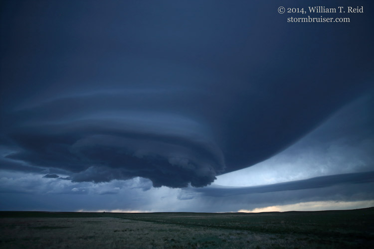
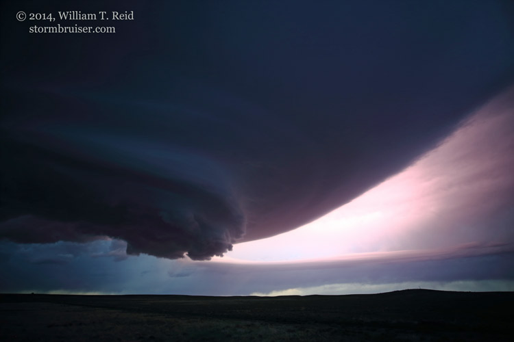
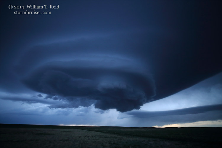
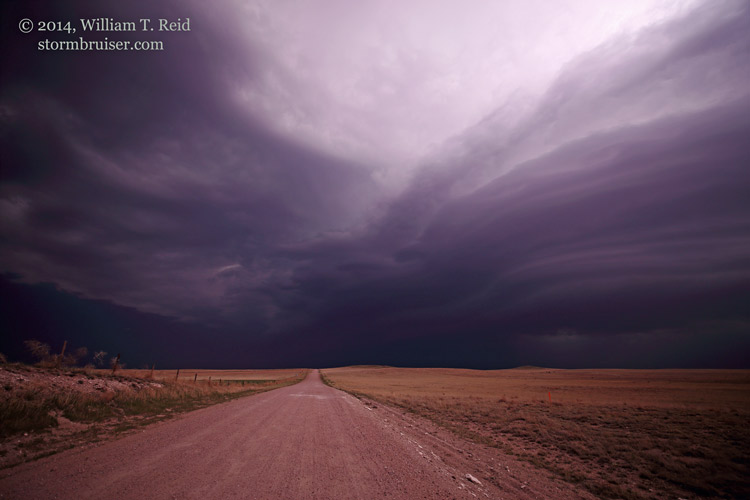
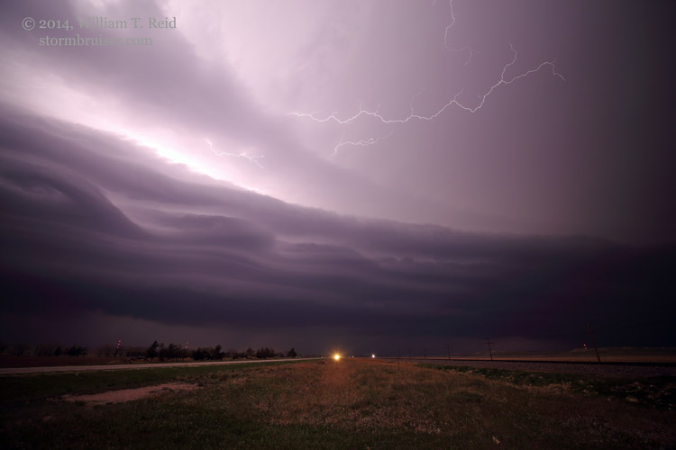
With moisture still in short supply on the High Plains, the prospects for a good storm seemed rather slim on May 6.  But, there was enough instability and shear for an isolated supercell.  SPC showed a “see text” for eastern WY and the NE Panhandle.  Our group began the day in Rapid City, and I had to consider the option of heading to the Red River (OK/TX) area for a decent-looking severe-weather setup on May 7th.  There was an “upslope” play, too, on the 7th, and the tornado risk looked a little better to me in CO versus OK/TX.  So, I decided to stick with the High Plains on the 6th and 7th.  During the afternoon we waited patiently around the Broadwater, NE, area, north of Sidney.  We drifted west towards the NE/WY border as a cumulus field perked up a bit in extreme southeastern WY.  Finally, a cell managed to get strong northeast of Cheyenne and north of Burns.  It quickly began to spin and we were treated to sensational updraft structure along the dirt road network in Laramie County.  No other chasers were around, and we had a front-row seat!  We stayed close to the supercell as it moved east into the Nebraska Panhandle, north of Bushnell.


140506_9854_Pine-Bluffs_WY 140506_9862_Pine-Bluffs_WY 140506_9866_Pine-Bluffs_WY 140506_9875_Pine-Bluffs_WY


140506_0396a_Pine-Bluffs_WY 140506_0400_Pine-Bluffs_WY 140506_0401_Pine-Bluffs_WY 140506_0402_Pine-Bluffs_WY 140506_0403a_Pine-Bluffs_WY 140506_0412_Pine-Bluffs_WY 140506_0413_Pine-Bluffs_WY 140506_0419_Bushnell_NE 140506_0430_Bushnell_NE 140506_0433_Pine-Bluffs_WY 140506_0436_Bushnell_NE 140506_0438_Bushnell_NE 140506_0442_Bushnell_NE


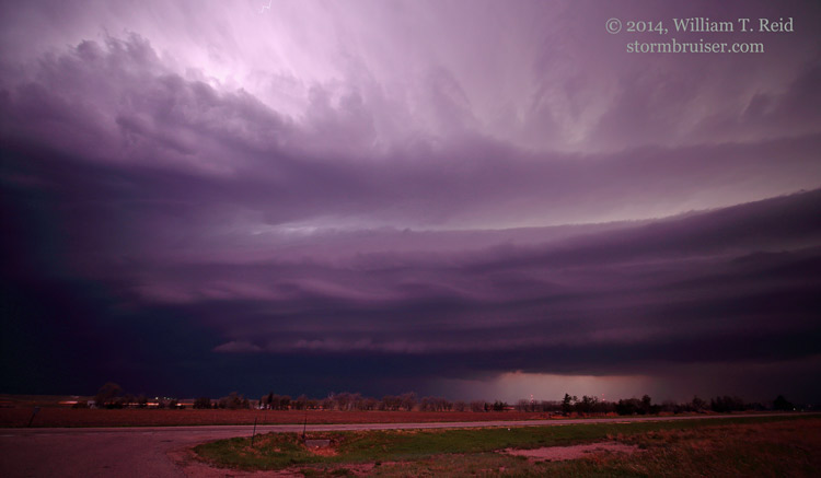
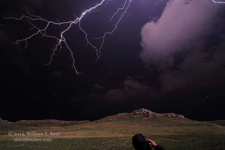
After dusk, we stuck around I-80 for additional storms west of Sidney.


140506_0493_Kimball_NE 140506_0503_Kimball_NE 140506_0511_Kimball_NE 140506_0553_Kimball_NE

Filed Under: 2014, Lightning, Nighttime photography, Supercells

Leave a Reply

You must be logged in to post a comment.

Search

May 2014
S M T W T F S
 123
45678910
11121314151617
18192021222324
25262728293031
« Apr   Jun »

Categories

Archives

Copyright © 2025 stormbruiser.com · Log in