May 7 was looking like an upper-end chase day as an upper-level disturbance moved out of the Desert Southwest and onto the Plains. SPC showed a slight risk for northeastern CO and the Red River area in southwestern OK and northwestern TX. Supercells and large hail were a good bet for both target areas, and SPC painted a conservative 5-percent tornado risk for both. I had decided the day prior, in western Nebraska, that I would play the High Plains upslope area instead of the Red River. Part of the reason for this was proximity, and I also liked the low-level easterly winds and low-level turning forecast for northeastern Colorado. Moisture and instability were better along the Red River, and low-level shear was better for the upslope play.
Our group had lunch in Sidney, NE, and then continued south towards the Palmer Divide in eastern Colorado. Convection initiated there, in the Limon area, somewhat early in the afternoon. Upper winds were carrying the cells to the NNE, and into the better instability and backed winds around Washington County. We continued past Sterling and into Akron, and stopped a few miles south of town to watch a large storm approach from the SSW.
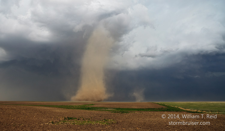
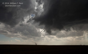
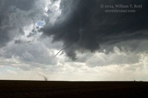
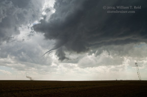
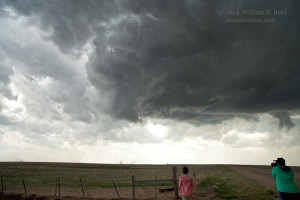
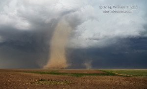
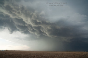
This developing supercell was in the vicinity of Last Chance and was dumping a lot of hail. The paved road network is sparse in Washington County, so I thought that sitting tight near Akron and waiting for the storm was the way to go. The storm began to get a good look with a shallow wall cloud, and we went another few miles south on 61. This put us about 8 or 9 miles south of Akron. The action area neared, and the storm did not exhibit a nice, big flat base with an obvious area of rotation, but a thin ropy funnel cloud materialized quickly and a prominent dust whirl was on the ground. A tornado was in progress just a couple of miles to our south! I was shooting wide angle (21mm) images:
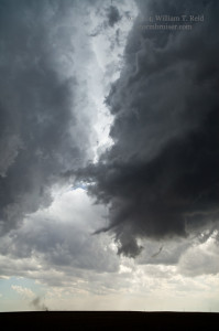
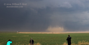
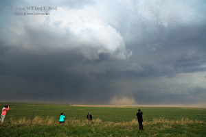
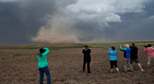
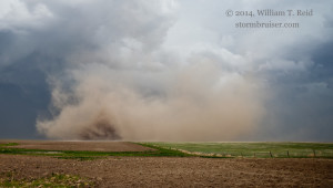
The tornado seemed to start out in “rope-out” mode, and it persisted for several minutes before dissipating. Another round base beneath a stout updraft loomed just to our east-northeast, and it soon was “tornadoing.” This one was a bigger and dustier tornado. The first image below shows the end phase of the tornado to our south, and the remainder are looking east to east-northeast towards the newer development.
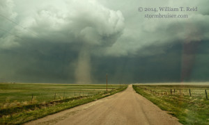
The dust-tube tornado was going to stick around for a while, so we hopped into the van and got closer. After a mile or two east and a couple of miles north, we were just south of it.
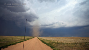
In the images above a second, smaller tornado can be seen behind the closer one. At this point in time, I tried to get some zoomed-in video of the close tornado with my old camcorder, but the camcorder was balking and would not record. You’ll just have to believe me when I say that the rotation near the ground in the nearby dusty tornado was quite impressive! This tornado sputtered after a couple of minutes, and I decided to head towards the other one behind it.
This third tornado was practically sitting on the road to our north. Another couple of chasers were on the road between us and the twister. Soon after we stopped, perhaps a half mile south of the tornado, the white “reverse” tail lights of the chase vehicles were illuminated. The vehicles, and the tornado, were coming right at us! I yelled at the guests to get back into the van, and Jim tried backing up some, but the outer fringe of the dissipating tornado was practically upon us. We had a bunch of dirt and tumbleweeds hit the left side of the van on winds of maybe 60 mph, and in an instant the winds were light again. The tornado was done.
We continued north a little and then east to Yuma, where another stout updraft teased us. But, it fizzled, and so did everything else nearby, and we were done chasing for the day. It was only 6 p.m. or so, and we headed to Ogallala to get closer to the next day’s target area —- the MN/IA border.
The tornadoes that we witnessed today in Washington County were not especially strong, and the dusty ones looked a bit like “landspout” tornadoes often appear. But, all of the tornadoes on this chase were true mesocyclone tornadoes. We were fortunate that the tornado show commenced right where we were waiting for the supercell, south and southeast of Akron. One or two spectacular supercells developed near the Red River in northwest TX on this day, but apparently tornadoes did not occur in that area.













Leave a Reply
You must be logged in to post a comment.