
Aurora, CO, “tornado” video by William Reid and by Bob Smith
Our chase hopes were on the high side today as shear and instability appeared more than adequate for a decent tornado threat in the Denver, CO, area, eastward to about Highway 71 in Morgan and Washington counties. SPC painted a 10-percent tornado bulls-eye near Denver. Here is the wording from SPC on the 1630Z outlook:
...CO/WY...
   TODAY WILL SEE ANOTHER ROUND OF ISOLATED SUPERCELL THUNDERSTORMS
   OVER NORTHEAST CO AND SOUTHEAST WY.  SOUTHEASTERLY LOW LEVEL WIND
   FIELDS APPEAR MORE FAVORABLE THAN YESTERDAY FOR MORE SUSTAINED
   ROTATING UPDRAFTS.  ALSO...EASTERLY/SOUTHEASTERLY LOW LEVEL WINDS
   OVER EASTERN CO WILL HELP TO STRENGTHEN THE DCVZ WHERE A LOCALLY
   ENHANCED RISK OF TORNADOES IS EXPECTED TODAY.  VERY LARGE HAIL AND
   DAMAGING WINDS WILL ALSO BE POSSIBLE.
From Goodland, KS, we motored west to Limon for a quick lunch, and then continued west on I-70 to Byers and the eastern edge of Denver. Strong updrafts were already exploding by about 1:20 p.m. MDT! It was a good thing that we were already in position. A healthy storm was to our southwest, towards Littleton, and was moving to the northeast. I elected to brave the midday traffic congestion and to dive into the urban area. Bob and Rook steered the group southward on E-470 on the east side of Aurora, and I tried to figure out where an adequate viewing spot might be. In addition, I was also trying to squeeze in a really quick pit stop for a few guests, as it is a good idea to to do this prior to getting into the heat of the chase. After about four miles, we exited at E-470 at Jewell and headed west into Aurora. We managed a really fast pit stop at a fast food joint near Buckley and E Iliff, and then our eyes were drawn to the northwest, where a new storm had suddenly developed. (I don’t think this was the same storm as the one that we had originally been targeting, near Littleton.)
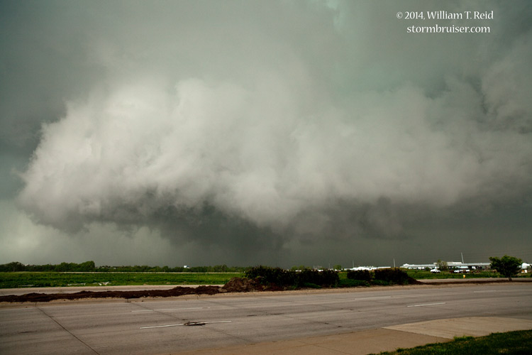
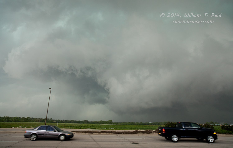
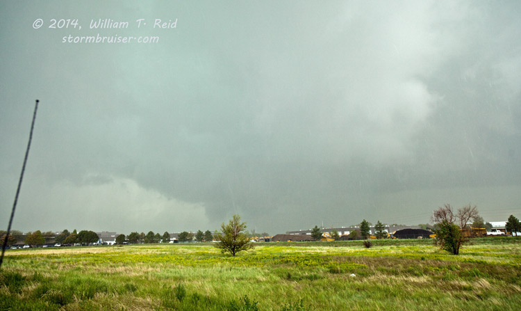
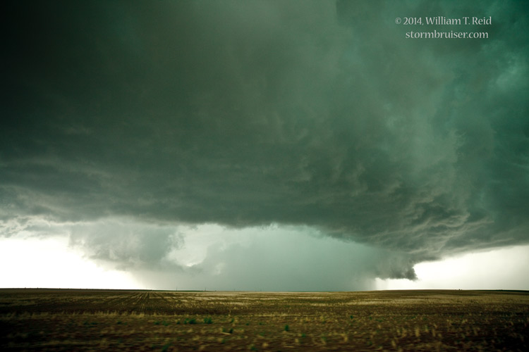
A very menacing and LOW lowering was in the works beneath this developing supercell. The action area was perhaps only five miles away, and all we had to do was to head north on Buckley to get into position. With each mile north, back towards I-70, it looked more and more like this wall cloud was serious about dropping a tornado on Aurora, Colorado. Our street changed names from Buckley to Airport Rd around Mississippi. These two images were taken along S Airport Road near 6th Avenue (at 1:56 p.m. MDT) and then at E Colfax (at 1:58 p.m.). The view is to the northwest.
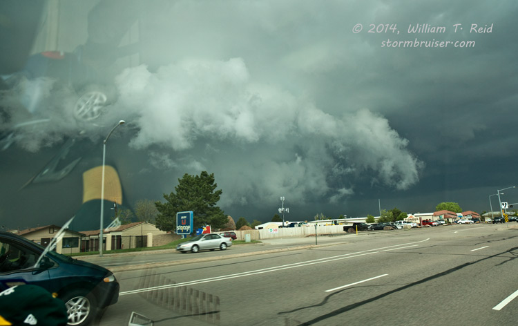
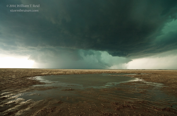
I needed to stop fairly soon as I didn’t want to be directly in the path of this feature. Fortunately, the view to the west opened up nicely as we drove into a less-developed area. We stopped in a parking lot along Airport Road, just south of Smith Road, and had a chance to get out and watch the developing and rotating wall cloud to our west-northwest. The images below were taken from 2:00 p.m. to 2:03 p.m. MDT.
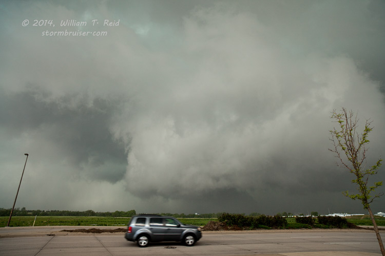

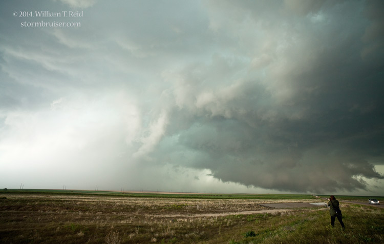
For a few moments at least, it appeared that a funnel cloud was threatening to “touch down” and that a decent-sized tornado was imminent. A tornado was reported with this storm in this area, but I can not say that I definitely observed a tornado during this time frame. This youtube clip shows some of my video while parked at this spot along Airport Road, and this link is to great GoPro footage of the event by Tempest driver Bob Smith.
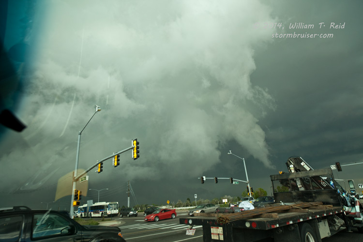
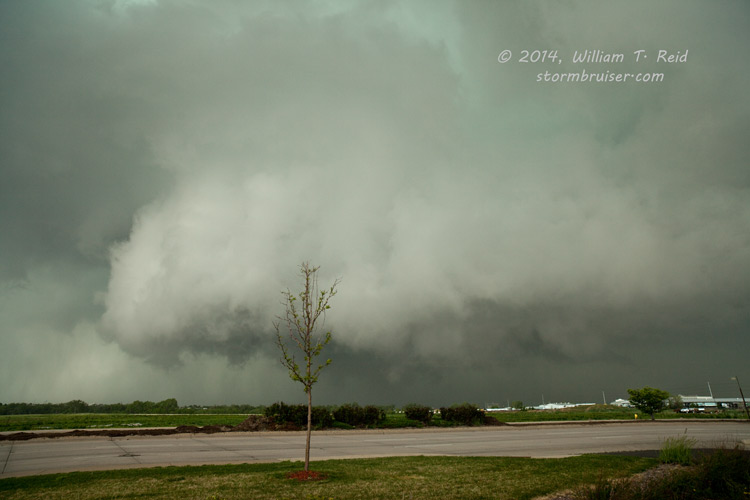
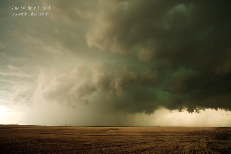
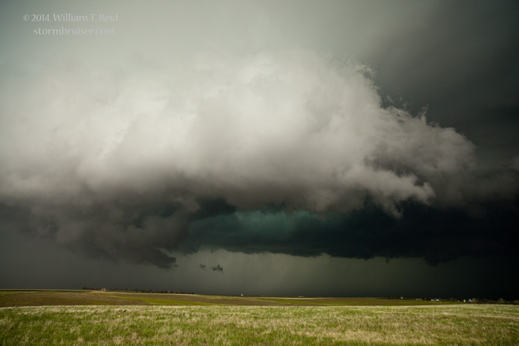
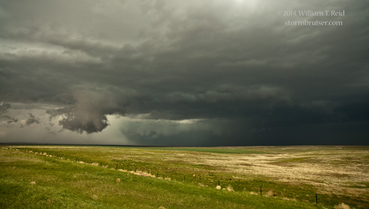
We started to be impacted by some wrap-around rain and RFD winds as the area of broad rotation moved more to our north-northwest. We scooted east to near Tower Road and stopped again. This view to the northwest was at 2:06 – 2:07 p.m., and it shows a very large and suspicious lowering with rain-wrapping developing. All of these images are with the full-frame Canon 5D with a 21mm wide-angle lens, so the action was quite a bit closer than the pictures might suggest! By this time, this action area was likely just north of I-70, near Pena Blvd.

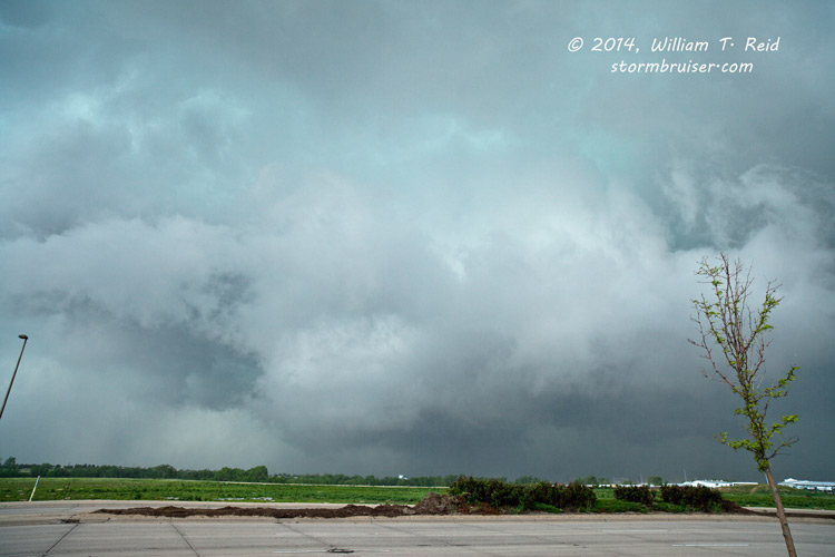
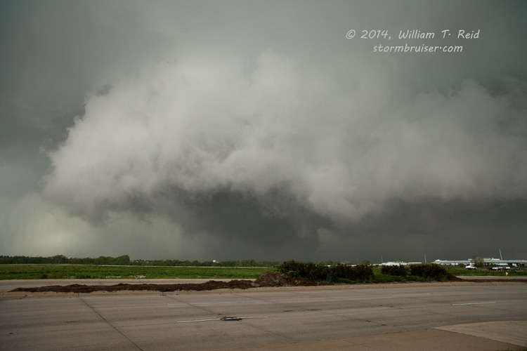
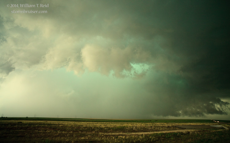
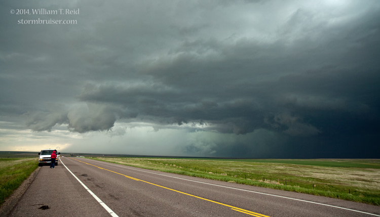
From this point it seemed a bit too dangerous and ill-advised to try to stay close to the potentially tornadic area, especially with the increasingly HP (high precipitation) nature of the storm. We got a bit east of the storm and had good looks at the structure and precipitation-filled low-level features. If there was tornadic activity with the storm, it was not obvious from our viewing positions. The images below were from 2:40 to 3:00 p.m. in the DIA area.
The supercell continued to the east, towards Watkins and then Byers. By this time, the chaser crowd had increased to ridiculous levels. The line of chasers along U.S. 36 east of Byers was unreal. The action area of the storm was just north of U.S. 36, and was moving to the east. Another low-level wrap-up ensued, and then precipitation wrapped around. A tornado was reported by some, but again our group was unable to discern a tornado for certain. The storm got messier and a bit less interesting as it dragged the crowd east towards Last Chance, and it was time to break off the chase. We dropped south to I-70 and watched a couple of other new areas of convection, but these did not impress. I found some rooms for the group in Stratton.


Leave a Reply
You must be logged in to post a comment.