On Monday, June 16, our two-van group (with drivers Rob Petitt and Bob Conzemius) awoke in Loup City, NE. We had driven here from northwest Kansas on the day prior in order to be well-positioned for Monday’s chase. The prospects for tornadoes appeared to be quite good as we perused the weather maps on the ceiling of the Frederick Hotel in Loup City. Forecast instability and shear values were very high for much of eastern NE, and SPC had a moderate risk and a 10-percent “hatched” tornado graphic. However, it was not entirely clear when and where storms might initiate this day. Should we head farther west to the dry line, around Custer County? Or should we play along I-80, where instability was even higher and convergence was tremendous? Or should we hang out around Loup City and see how things evolved into the early afternoon? I had a very tenuous grasp on how the day might play out and on where I should be. One thing that I DID know is that I had no strong inclination and no solid reason to drive off in any particular direction late this morning. The skies over Loup City and much of central and eastern NE were cloudy to mostly cloudy, and winds were very juicy and from the southeast. There was an outflow boundary from nighttime convection in the area, but it wasn’t easy to detect on the surface charts and satellite images.
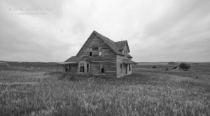
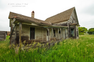
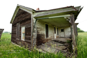
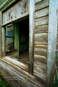
I felt safe heading north a little to Ord for lunch, and on the way we spent some time at an abandoned house along Highway 70, just south of the “Blizzard of 1888” historical marker…
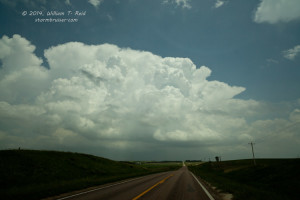
On potentially big days like this I usually do a quick fast-food lunch, but it was only 12:15 p.m., so the entire group sat down at Calamity Janes restaurant in Ord. The service was fairly fast, fortunately, and we were there for only an hour. From Ord I decided to head east. The skies were clearing and it was getting warm and really humid. Dew points were close to 74F. And handful of cumulus clouds were getting that perky look…did storms want to form already in central Nebraska? It was WAY too early, not even 2 p.m. If storms went up nearby, they might start moving to the northeast quickly given the strong southwesterly winds aloft. It seemed like a good idea to hedge eastward to lessen the chances of getting behind any early, strong activity.
As we headed east from Ord to Scotia and Greeley, we observed impressive storm tower development to our east, about 20-25 miles distant. At the time I wasn’t sure if these towers would ultimately be the storms that we wanted to be on. They were booking along to the northeast at about 35-40 mph, and I doubted that we would even be able to catch them. Darn —- we were a little out of position and playing catch-up, exactly what I did NOT want to have happen! If these were able to become big supercells, though, I knew that they would likely be tornadic. The environment just ahead of them in the Norfolk area was sickeningly ripe for tornado development. So, we pressed on, and hoped that the cells would slow down and that we could get into position.
I had Rob and Bob take our group east on 56 from Greeley to Cedar Rapids and St. Edward. A big, new updraft went up to our east as we headed east from St. Edward, and this one was catch-able. Still, it was moving northeast at about 30 mph, and our road network was not particularly cooperative.
After a brief and aborted attempt to continue east on a wet dirt road to Platte Center, we headed north to Lindsay and east to Highway 81. By now the storm was severe-warned and was above Madison, some ten miles to our north. The RFD cut was massive, and the low base was getting that “pregnant, I want to produce a big tornado RIGHT NOW” look to it. From the intersection of 81 and 91 I could have headed north towards Madison and the updraft base, and I probably should have, but the action area was really close to Madison and I didn’t want to get involved with that just yet near a town. So, we continued east on 91 some 12 miles to Route 57 north. On our way east, we could see what looked like a tornado developing back to our north-northwest, about ten miles away. The base was very low and the developing tornado was significant.
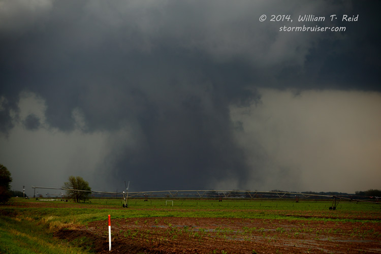
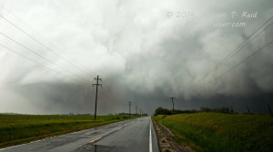
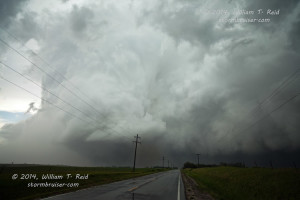
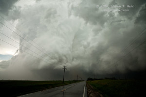
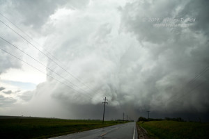
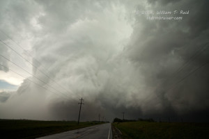
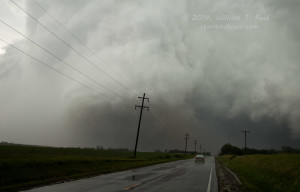
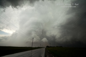
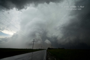
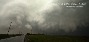
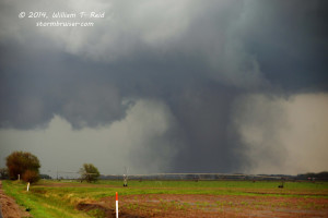
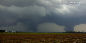
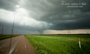
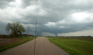
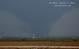
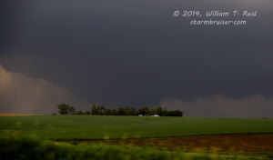
The storm continued tornadic and was moving northeast at about 35 mph as we came up on its SSE and S side, in the Stanton area. We had occasional glimpses of the tornado as we crested hills, and then we would go for a minute or two in the low spots without a view. This was quite aggravating! Fortunately, the tornado was going to miss Stanton on its north side by several miles. We made it through Stanton (at 3:56 p.m. CDT), crested a hill north of town, and had a massive and wildly rotating barrel updraft filling our windshields. These are looking north from south of Stanton and while in Stanton:
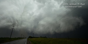
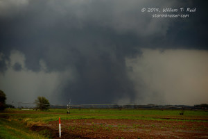
This thing was maybe 2-3 miles wide and was, for all practical purposes, on the ground! We stopped a mile or two north of Stanton for several minutes, shot stills and video, and watched it drift off to our north along Highway 57. The motion in this tornado cyclone was absolutely insane, and on occasion there were smaller, slender, slinky tornado funnels sticking out of it horizontally. Apparently at least one farm house was destroyed by this tornado north of Stanton. Visually, the lighting and contrast beneath the low storm base was very poor, and it was difficult to really see what was going on near ground level a couple of miles to our north. Was there a massive and violent wedge tornado in there? Apparently there was, and I kind of assumed that there was, but it was not obvious. The contrast is enhanced a little in some of the images below to bring out the Stanton tornado. These are views to the north along Highway 57:
The images above are wide-angle views with the “full-frame” camera and 21mm lens. My camera time stamp shows 3:58 to 4:03 p.m. CDT for these, and that should be good to within a minute or two.
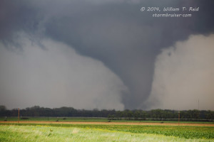
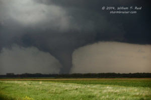
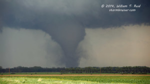
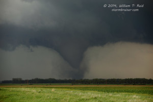
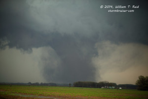
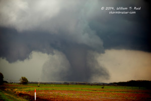
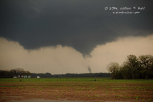
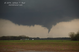
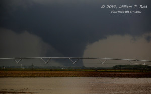
So, the obvious move next would be to continue north to stay with the “Stanton” tornado, right?! Well, maybe, but as this tornado moved off to our north, beyond U.S. 275, another funnel and area of rotation quickly materialized to our east a few miles. A new meso was quickly developing, and I knew that another tornado was imminent. We backtracked southward to Stanton, and then headed east-northeast on a gravel road. This road was wet, but drive-able, and it headed directly to Pilger. A large, black tornado was now in progress to our east as we moved east-northeast. It was perhaps about five miles away, and I wanted to get a lot closer, but we could only safely go about 45-50 mph on this wet, mushy gravel road. This thing was big and bad and VERY visible, with no rain wrapping around it! We made a brief stop to allow the guests to get out for some photos, and continued another mile or so. During this time, a second tornado was developing behind the first one, and it soon became just as large and dangerous as the “lead” tornado! I managed to get a little video and a still or two of both tornadoes in progress at the same time. We stopped again, and watched the tornadoes continue to move away from us to our east-northeast. The small town of Pilger, about 5 miles away, was hit while we were along this gravel road, but we did not know that at the time.
The images above were from about 4:07 to 4:23 p.m. CDT.
We had to keep moving in order to stay relatively close, but we were stopped a few miles short of Pilger due to water flowing off of a field and across our gravel road. (The final two images in the series above were from this location.) We backtracked a little, scooted up to 275 eastbound, and neared Pilger. Someone on the ham radio said that there was a propane leak in Pilger, and we realized that the town had just been struck by one of the two large tornadoes. Pilger is a half mile south of 275, and as we passed northeast of the town, we looked back to the southwest to see the swath of destruction right through the middle of it. Debris was in the fields and sheet metal was wrapped around the utility poles that were still standing along 275. A cattle yard just to the north of 275 was heavily damaged and the cattle were scattered about. I didn’t think that we would be able to catch up to the tornado again, but we managed to. East of Wisner we could see one large tornado to our north, about 8 to 10 miles away.
Highway 9 northbound led us to Pender and Emerson. Along this stretch, the tornado became heavily rain-wrapped and disappeared from our view.
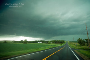
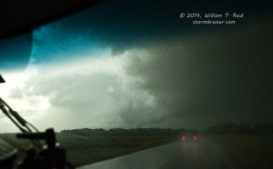
After a quick pit-stop at a park in Emerson (the convenience store was closed due to the nearby tornado!), we continued northeast on 35 to Hubbard. The storm was much smaller now, and surface winds were more from the south instead of the southeast. Nevertheless, a small and brief tornado developed just a mile or so to our north as we cleared Hubbard. The spin-up dissipated as we piled out of the vehicles. This action area wrapped in rain a bit, and was unable to produce again. Fortunately for Sioux City, just up the road, the supercell weakened quickly and considerably. Our tornado chase for this day was over…but it was only 6 p.m.! We headed west to some undercut but ominous-looking stuff between Yankton and Vermillion, and then caught a rainy mess moving northeast through Cedar County, Nebraska. This led us back to our motel in Vermillion.
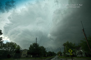
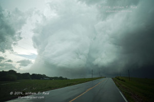
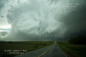
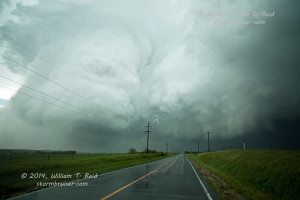
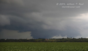
The cell outside of Vermillion looked ominous, but this large lowered area was not rotating:
Wow — the action got going very quickly for us right after lunch on this chase day! We were somewhat fortunate to be relatively close to the updraft base when the tornadic supercell started to produce between Madison and Stanton. If lunch had lasted a little too long, or if I had dawdled in Ord too long, then we might not have made it to Stanton County in time. There was a nice storm on the dry line near Custer County late in the day, but it was not a big tornado-maker. The Stanton, Pilger, and Wakefield, NE, tornadoes were rated EF4. Two perished in Pilger.
Victor Gensini’s chase account
Tornado tracks and ratings, northeastern Nebraska, June 16, 2014

Leave a Reply
You must be logged in to post a comment.