

My daily chase summaries for the year 2014 have been completed, and now it is time for a little summary of the chase season. This page is kind of a one-stop shopping place to peruse some of my better images and storm intercepts for 2014, and to easily surf to the dates and chases which might interest you.
Keep in mind that my chase season on the Plains is just for May and June, so any events that occur outside of those months are not relevant to this summary! The year 2014 was fairly slow and rather poor for storm chasers on the Great Plains. Fortunately, a few days salvaged the season with good-sized, long-lived tornadoes. For me, these were May 7 in northeastern Colorado, June 16 in northeastern Nebraska, and June 18 in eastern South Dakota. I missed a couple of decent storm and tornado days on the tour turn-around periods, as usual, but such are the pitfalls and trade-offs of being a storm-chase tour director. And, as usual, there were a couple of days on which I chased and on which there was a pretty darn-good storm or tornado which I missed. But, in general, I thought that my decision-making and forecasting in 2014 were pretty good. There are no days which leave a really sour taste in my mouth!
As has been the case for the majority of chase seasons for the past ten years, the Southern Plains chase season was relatively slow. The Texas and Oklahoma Panhandles, west Texas, Oklahoma and Kansas did not have many good tornado chase days. Chasers with chase vacations in May had to endure a couple of long down periods due to cold fronts which swept the low-level moisture out. I found myself most often on the High Plains during May and June, especially in and around the Nebraska Panhandle. About a dozen of my chase days were in or very close to the Nebraska Panhandle. There were a few nice supercell days in eastern Colorado and west Texas. There were several chase days in eastern New Mexico and eastern Wyoming. I missed a big chase day in southeastern Nebraska on May 11th, but the storm of the day was HP and not particularly photogenic. I missed a day with great supercell structure near Roswell, NM (June 7).
Most noteworthy might be the states in which I did NOT chase during all of May and June! I did not set foot in Montana, North Dakota, Missouri, Arkansas, or Louisiana. I was in Iowa and Minnesota for only one chase. And, I only saw two storms while in Oklahoma — both junky storms near in the Panhandle along the border of Colorado and Kansas. I saw a distant landspout-type tornado near Smith Center, KS, on June 14. But, this season, Kansas was generally just another big state to drive through in order to get to a better target area.
If it sounds like chase season 2014 was rather lame, then I would not disagree! If you like tornadoes, then check out my entries for May 7, June 16 and June 18. (When it rains, it pours —- our tour group observed more than one tornado in progress at the same time with the same storm on each of those days!) We saw EF4 tornadoes in Nebraska and South Dakota, including the killer tornado at Pilger, NE. On May 21 it looked like we might have a major tornado in an urban area —- Aurora, Colorado. But, the strongly rotating wall cloud above the city produced little more than brief funnel clouds and perhaps a brief and weak tornado. That certainly was good news for the locals!
There were not a lot of really good lightning photography opportunities. The exceptions were May 20 near Burlington, CO, and June 21 near Ogallala, NE. There were a few really nice surprise days where we may have been the only chasers on a great storm. Two of these days were during Tour 2 in western Nebraska and southeastern Wyoming (May 2 and May 6). Another one of these was on May 22, north of Amarillo, as we were just south of a threatening storm base with plenty of dusty inflow.
Thanks to Martin Lisius at Tempest Tours headquarters in Arlington, Texas, for allowing me to work my dream job every spring! A big thanks to my great friends who help me run the tours successfully. And, thanks to all of my new and old friends who sign up to sit in the white vans and allow me to share my storm chasing and photography passion with them.
This down day was spent in western Kansas.


May 2 Nebraska Panhandle Hailer
A high-based storm near Dalton, NE, was quite photogenic.

May 3 to 5, waiting for moisture on the High Plains
Little weather to chase as we roam the empty parts of the Central High Plains…


May 6, Spaceship updraft in Wyoming!
A beautiful LP supercell was a visual treat east of Cheyenne, Wy.


May 7 Tornadoes in Washington County, Colorado
Good tornado days were few in May and June, but this was one of them, in my favorite chase county!


May 10 Supercells in Southeastern Kansas
A number of storms rotated hard a few counties east of Wichita, Kansas, on this day.

May 11 to May 17 Quiet Time on the Plains
Cold air invaded the Plains and we had to wait a week for good air to return.


May 18 Nebraska Panhandle Storms
We had a distant look at a very nice LP in Wyoming, and then played catch-up with a supercell near Alliance, Nebraska.


May 19 Southern Nebraska Panhandle Supercell
After some waffling on a batch of perky cumulus near North Platte, we made it back west to a pretty updraft near Sunol.


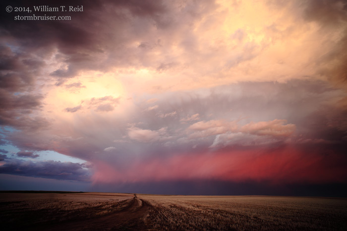
May 20 Eastern Colorado Supercell
This storm was gorgeous from the east side, the south side, and the west side!


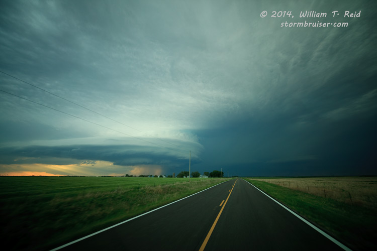
May 21 Aurora, Colorado Tornadic Supercell
We had a large and menacing and rotating wall cloud coming at us in Aurora!


May 22 Texas Panhandle Dusty Funnel
A storm near Etter and Cactus got really serious for about ten minutes.


May 24 Carlsbad, New Mexico HP Supercell
A healthy storm developed near sunset upon our arrival after a really long drive from OKC.


May 25 Eddy and Lea counties Supercell, New Mexico
Another pretty supercell spun hard for us east of Carlsbad.


A couple of big Texas beasts kept us busy from about Seminole to Big Spring to Garden City.


May 27 San Saba, Texas, Supercell
A chase in the hills between San Angelo and Austin yielded another Texas supercell


May 29 and 30 High Plains storms
Fun chases in remote countrysides


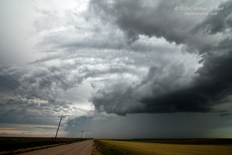
June 1 Meade County, Kansas, Supercell
An impressive storm in southwestern Kansas sported a wall cloud for a little while.

June 3 and 4 Western Nebraska storms
Western Nebraska was a frequent target area for the tour group in 2014.

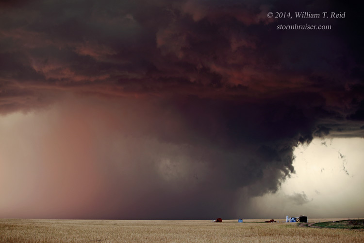
June 5 Haswell, Colorado, Supercell
A big, lone, dust-gulping supercell had its way with the empty Plains of southeastern Colorado.


June 6 Stormy Sunset Skies north of Guymon, Oklahoma
We were close to getting to the Trinidad tornado…and close to something near Lamar…but no cigar.


June 7 Matador, Texas, Supercell
A nice, big and isolated updraft trekked from about Floydada to Matador and Dumont.


June 8 Sunset Squall Through Endee and Glenrio, New Mexico
Fantastic light and color accompanied this non-severe storm along the TX/NM border.


June 10 Devils Tower, Wyoming, Supercell
A decent storm approached Devils Tower but weakened when we neared.


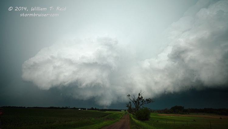
June 13 Chadron, Nebraska, Supercell
A nicely-sculpted updraft in the Panhandle looked great late in the day.


June 14 Smith County, Kansas, Supercell
A distant landspout, a nearby supercell, extremely strong outflow and tornado sirens blaring, all crammed into one active chase day in northwestern Kansas!

Too late for class but not too late for pictures, near Amherst, Nebraska, on a reposition day.


June 16 Stanton and Pilger, Nebraska, Tornadoes
The atmosphere was quite content to make tornadoes in northeastern Nebraska on this chase day.


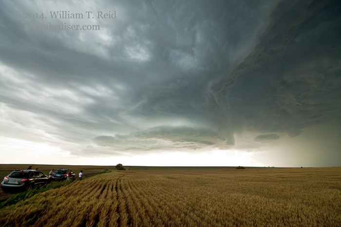
June 17 Butte County, SD Supercell
A massive supercell in extreme western South Dakota was reluctant to budge eastward towards a road!


June 18 Woonsocket, South Dakota, Tornadoes
Multiple tornadoes were spawned by a few strongly rotating updrafts in eastern South Dakota.


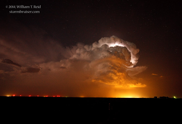
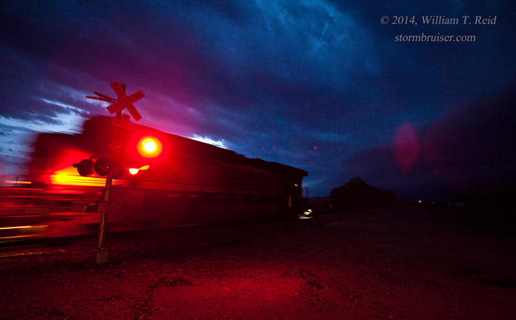
Very photogenic lightning and sunset colors graced our CCDs north of Ogallala, Nebraska.


June 22 Goodland, Kansas, area storms
Guess what? There were storms in Kansas today!

June 23 Anton, Colorado, area storms
Anton survived these marginally strong storm cells.


June 24 Left-movers on the Colorado High Plains
Left-split updrafts seemed to dominate today and during much of this chase tour.


June 25 WY/NE/SD Triple-point Storms
We are talking the triple-point of the states, not a surface weather-map triple point.


June 26 Nebraska Panhandle Storms
A decent lightning show developed from Chimney Rock to Ogallala this evening.


An updraft looked supercellular briefly, and then congealed with other cells.


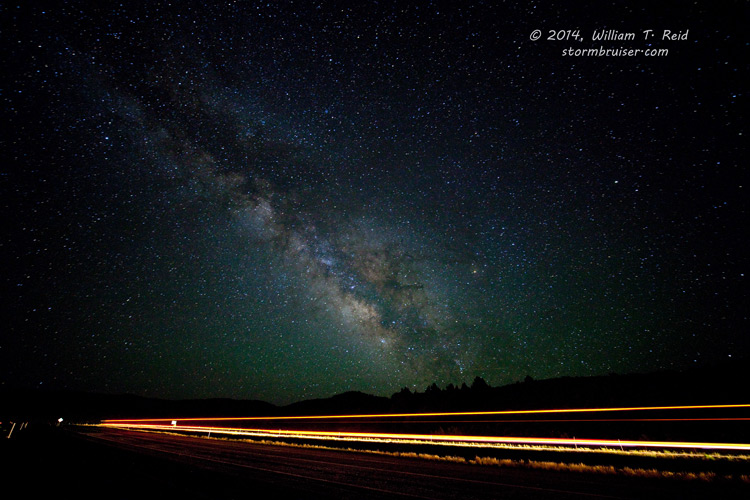
What was that “cloudy-looking stuff” above me along I-70?!
Leave a Reply
You must be logged in to post a comment.