After several days of chasing generally junky High Plains storms due to poor moisture and instability, we finally had a fairly decent chase setup on May 4th. We had to get ourselves down from the Oklahoma Panhandle and into southwest Texas, though. SPC liked the area from about Hobbs, NM, to Sanderson, TX, near the Rio Grande. I liked it, too! Storms developed a little on the early side, near Pecos, while we were making our way south in the vicinity of Hobbs. This discussion by SPC sets the stage nicely:
 MESOSCALE DISCUSSION 0498
   NWS STORM PREDICTION CENTER NORMAN OK
   0128 PM CDT MON MAY 04 2015

   AREAS AFFECTED...PARTS OF SERN NM/W TX

   CONCERNING...SEVERE POTENTIAL...WATCH LIKELY

   VALID 041828Z - 042000Z

   PROBABILITY OF WATCH ISSUANCE...80 PERCENT

   SUMMARY...SCATTERED THUNDERSTORMS...INCLUDING A FEW SUPERCELLS...ARE
   EXPECTED TO DEVELOP THIS AFTERNOON. VERY LARGE HAIL...LOCALLY
   DAMAGING WINDS...AND A TORNADO OR TWO ARE POSSIBLE. WATCH ISSUANCE
   IS LIKELY FOR AT LEAST PART OF THE AREA BY 19-20Z.

   DISCUSSION...DESTABILIZATION IS UNDERWAY ACROSS PARTS OF SERN NM
   INTO W TX...AS MOIST LOW-LEVEL SELY FLOW COMBINES WITH MODERATE
   DIURNAL HEATING ACROSS THE REGION. AS LARGE-SCALE ASCENT CONTINUES
   TO SLOWLY INCREASE AHEAD OF A STRONG UPPER TROUGH OVER THE
   SOUTHWEST...THUNDERSTORM COVERAGE WILL INCREASE THIS
   AFTERNOON...INITIALLY OVER THE HIGH TERRAIN AND THEN SPREADING
   SLOWLY EWD WITH TIME.

   BY MID-AFTERNOON...MODERATELY STEEP MIDLEVEL LAPSE RATES /AS
   DEPICTED IN THE 18Z MAF SOUNDING/ IN COMBINATION WITH INCREASING
   LOW-LEVEL MOISTURE WILL RESULT IN MLCAPE VALUES OF 1000-1500
   J/KG...WITH 2000+ J/KG POSSIBLE ACROSS PARTS OF W TX WHERE STRONGER
   HEATING IS OCCURRING. WHILE MIDLEVEL FLOW IS NOT PARTICULARLY
   STRONG...SELY LOW-LEVEL FLOW VEERING TO SWLY FLOW ALOFT WILL YIELD
   WIND PROFILES FAVORABLE FOR SUPERCELL DEVELOPMENT. VERY LARGE HAIL
   WILL LIKELY BE THE PRIMARY THREAT...BUT A TORNADO OR TWO WILL ALSO
   BE POSSIBLE...ESPECIALLY WITH ANY REMAINING DISCRETE CELLS ACROSS W
   TX LATE THIS AFTERNOON/EARLY EVENING WHEN LOW-LEVEL SHEAR WILL BEGIN
   TO INCREASE. GIVEN THESE THREATS...WATCH ISSUANCE WILL LIKELY BE
   REQUIRED IN THE 19-20Z TIMEFRAME.

   ..DEAN/HART.. 05/04/2015
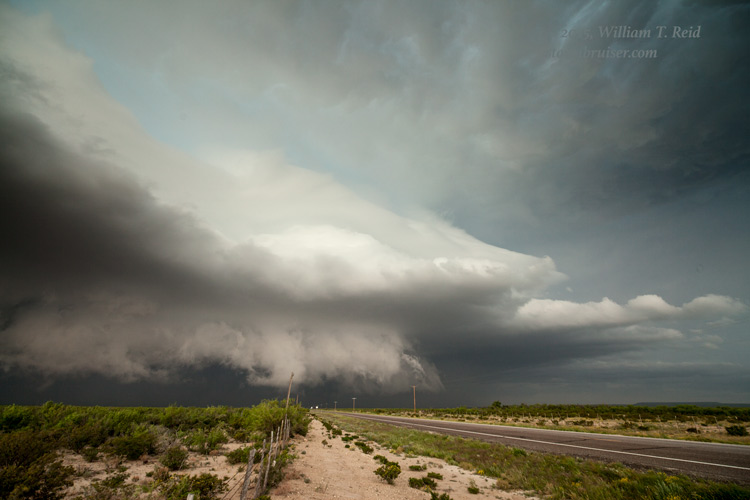
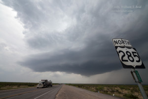
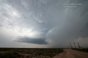
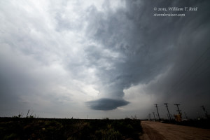
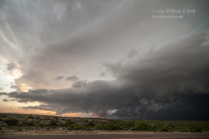
A tornado watch was issued shortly after this mesoscale discussion went out. We passed a cell near Hobbs that was electrically active and difficult to ignore, but I wanted to be farther to the south, in the better air. Near Wink, I had to choose between a developing cell to our west and a bigger beast to the southwest. Most chasers had their eyes on the supercell that was slowly moving east along Interstate 10, west of Fort Stockton. But I wanted to give the one that was in western Loving County a chance. We quickly found ourselves south of the storm base along U.S. 285, west of Mentone. This supercell looked like a decent tornado candidate for 10 minutes or so, but as it drifted to the ENE, north of Mentone, it began to shrivel up and weaken.
It was not difficult to figure out what to do next. We blasted down to Fort Stockton to get in front of the big HP beast which was swallowing up traffic along Interstate 10. We made it to the town before the storm and squeezed in a pit stop and fuel fill-up.
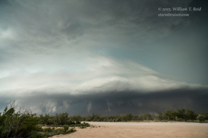
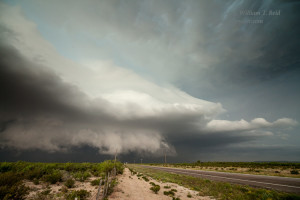
The Fort Stockton supercell tracked over the town as we watched on the south side along 285. Hail with the storm was copious, with stone diameters to 2.5 inches. We stayed out of that! The storm had plenty of scary lowerings and splendid structure, but was perhaps a tad too out-flowy for a tornado. We went back into Fort Stockton after the storm had cleared, and had to navigate through flooded streets. It was getting dark by this time, and time to check into the motel after a long and interesting chase day.





Leave a Reply
You must be logged in to post a comment.