
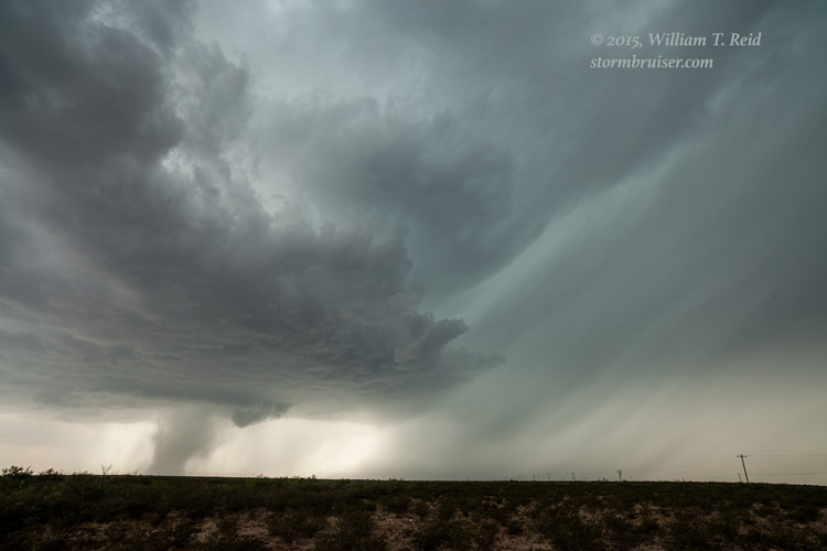
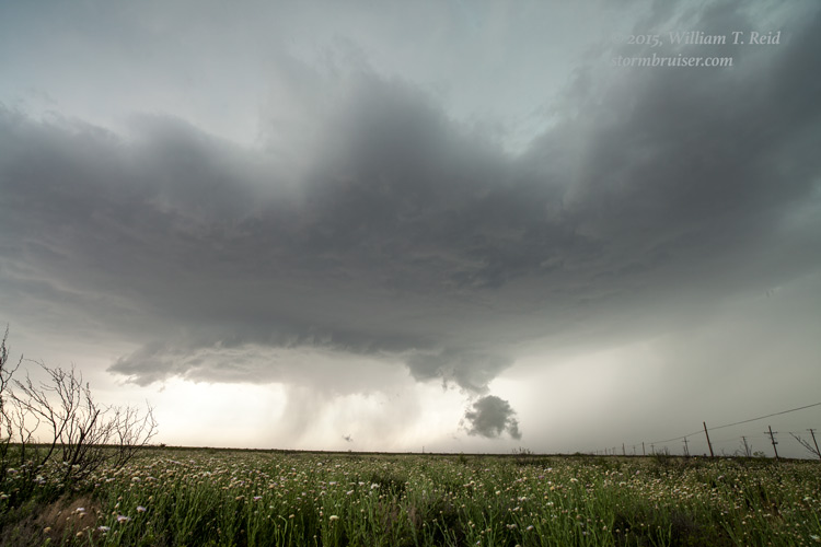
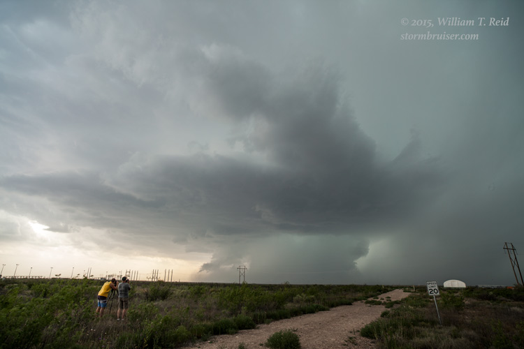
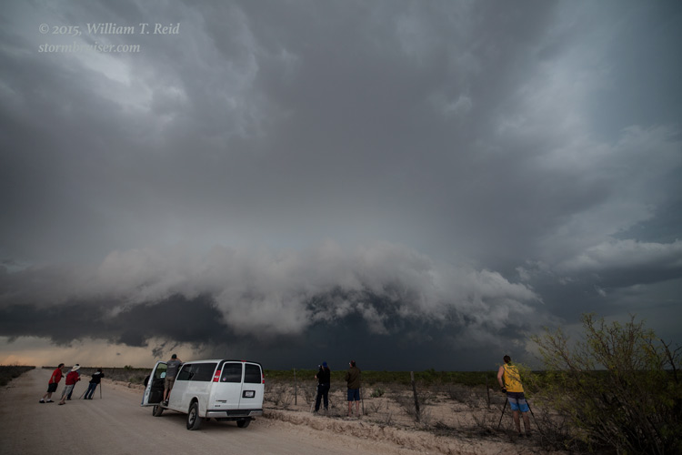
Our chase tour group began this day in Amarillo, TX. The previous day had been a “down” day — we repositioned from Dodge City to the Texas Panhandle. Prospects on the 18th looked decent in southwest Texas, especially south of I-20. A big storm was developing near Pecos as we maneuvered down from Monahans. With a sketchy road network and a slow-moving supercell, I had to figure out which road would provide the best look at the storm. That seemed to be FM 1450, between Pecos and Coyanosa. This worked out pretty well. We were able to drive up to the precipitation area about halfway between the two towns, and were afforded a good look at the structure and storm base to the southwest and west-southwest.
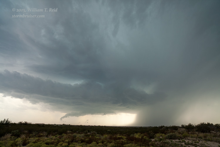


We were at this location for quite a while. I wasn’t going to try the unpaved road network around here with a big supercell nearby, so we watched patiently as the storm organized a bit more and drifted in our direction. Precipitation and lightning became a nuisance and we backed off to the east a couple of miles.


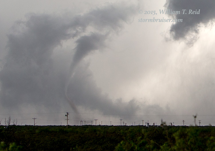
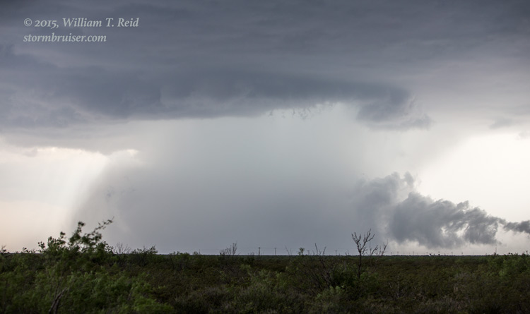
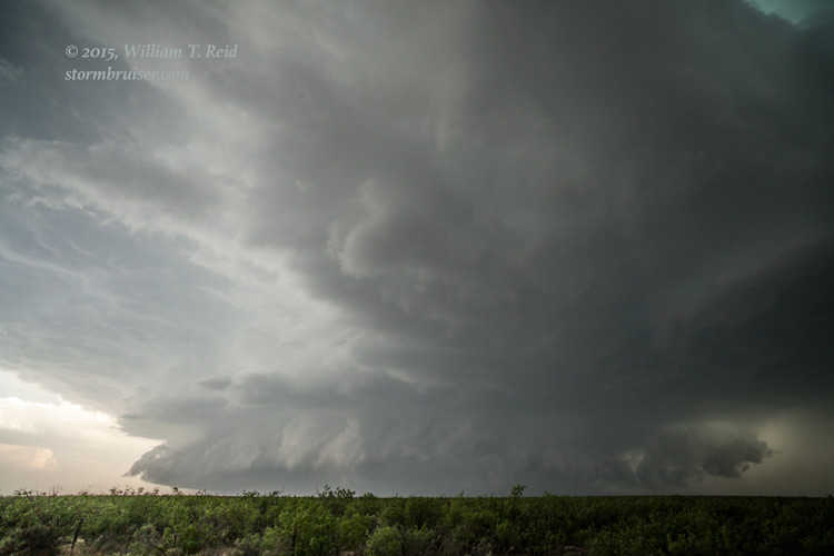
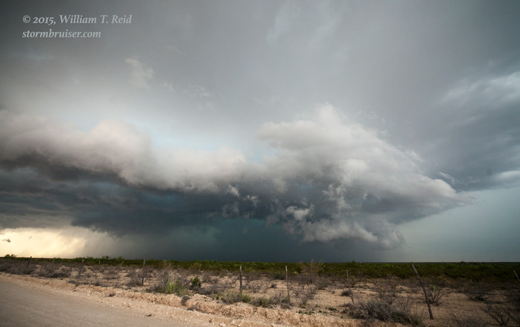
The storm got serious at low levels and suddenly a large, fat tail cloud was surging towards the base from the north. The tail cloud was indicative of a strong low-level inflow jet, presumably. This inflow jet was surging from the forward-flank precipitation region towards a new heavy precipitation shaft beneath the storm base. See how the precipitation core beneath the storm base grew in the images above. The tail cloud quickly spiraled up towards the storm base and a tornado developed nearby. There was a “disconnect” visually between the cloud base and the tornado — it was very odd and something I had not witnessed before. I am not sure if the tornado and the “vertically tilting” tail cloud were actually connected or not. There might have been a connection without a visible condensation connection. The images seem to suggest that the tornado kind of materialized a short distance from the cloud base “funnel.”


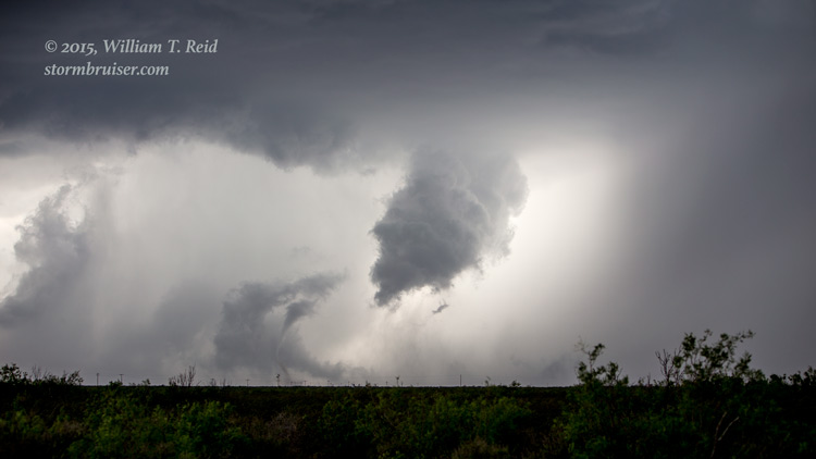
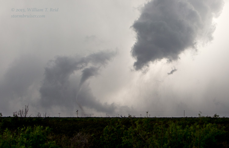


This tornado lasted just a minute or two and was maybe 6 to 8 miles distant.
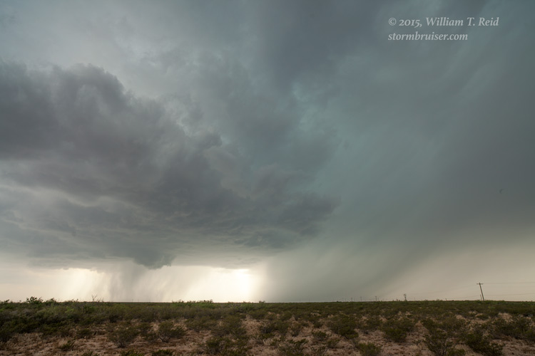
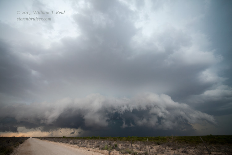
The supercell continued to drift to the east, and chased us closer to Coyanosa. It didn’t show us any other tornadoes, and it gradually grew into a big HP beast.

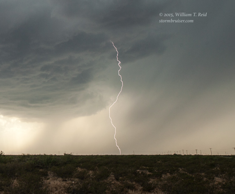
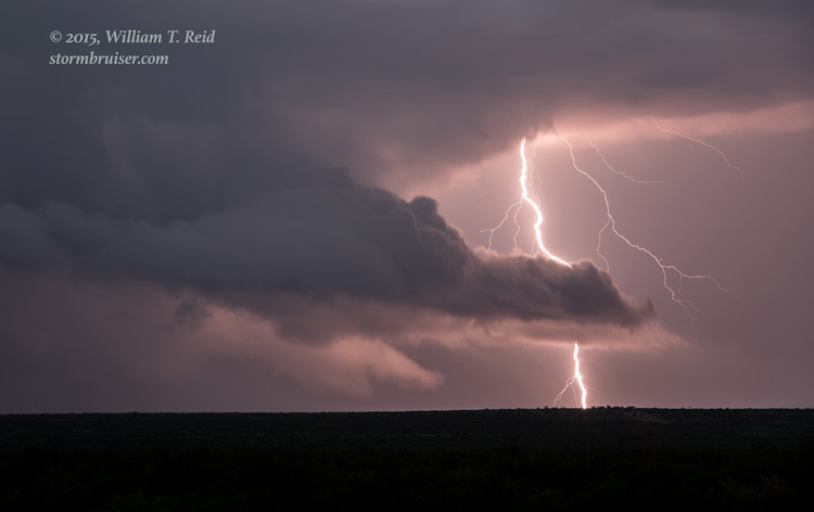
Towards sunset we had some lightning to shoot beneath a newer supercell, also near Coyanosa. Our home for the night —- Fort Stockton.


Leave a Reply
You must be logged in to post a comment.