This was the fourth chase day for Tempest Tours/Tour 4. We had had a couple of decent supercell days already, but we were still looking for a nice tornado. Today would be the day for that! Steve, Rook, the guests and I began the day in Clinton, OK, with the eastern Texas Panhandle in our target hairs. This would make for an easy drive! The guests were delighted to be dropped off between and Arbys and Taco Mayo in Woodward, OK, for lunch. I went to Taco Mayo, and, let me tell you, it is no Taco Bueno.
Let’s take a look at the weather setup with the help of the SPC archive discussions. I wish I could recall every word recited by me in the morning weather briefing to the group…did anybody record that? The 1630Z Day One outlook by SPC noted plentiful low-level moisture return to the High Plains with forecast CAPE values of 2000 to 3500 J/kg. Flow at 500 mb was a bit weak, but strong enough for severe storms given the backed flow near the surface. An “enhanced” slight risk was drawn from about Goodland, KS, to Childress, TX. A five-percent tornado risk filled most of this ellipse.
  ...CNTRL HIGH PLAINS INTO OK/TX THIS AFTERNOON INTO TONIGHT...

   STRENGTHENING SLY LOW-LEVEL FLOW WILL INDUCE THE NWD FLUX OF AN
   INCREASINGLY MOIST BOUNDARY-LAYER FROM THE SRN INTO CNTRL HIGH
   PLAINS TODAY.  THIS PROCESS WILL OCCUR BENEATH A STEEP MID-LEVEL
   LAPSE RATE PLUME...YIELDING AFTERNOON MLCAPE RANGING FROM 1000-2000
   J/KG OVER ERN CO/KS TO 2500-3500+ J/KG OVER WRN PARTS OF OK/TX.

   WHILE SPECIFIC DETAILS REGARDING CONVECTIVE EVOLUTION STILL REMAIN
   SOMEWHAT UNCERTAIN...THE NWD-MOVING SYNOPTIC FRONT...HIGH PLAINS LEE
   TROUGH/DRYLINE...AND PRE-EXISTING OUTFLOW BOUNDARIES /NAMELY OVER OK
   AND TX/ WILL ALL BE POSSIBLE FOCI FOR STORM INITIATION THIS
   AFTERNOON.  SIMILAR TO TUESDAY...MID-LEVEL WINDS WILL NOT BE
   PARTICULARLY STRONG /I.E. 20-30 KT AT 500 MB/.  BUT...GIVEN THE
   SLY/SELY LOW-LEVEL FLOW REGIME...FORECAST HODOGRAPHS EXHIBIT
   CONSIDERABLE VEERING WITH HEIGHT WITH SUFFICIENT VERTICAL SHEAR TO
   SUPPORT SUPERCELL MORPHOLOGIES AS THE INITIAL STORM MODE.  LARGE
   HAIL WILL BE THE PRIMARY HAZARD...THOUGH A COUPLE OF TORNADOES ARE
   ALSO POSSIBLE.
From Woodward we headed west-southwest to the Texas border. I felt fairly confident of my target area in the vicinity of Canadian, TX. The axis of highest theta-e values was across the northeastern Texas Panhandle, and good moisture convergence was here, too. Skies were nice and clear and a cumulus field was developing right where I wanted it to be —- west and northwest of Canadian. SPC issued a mesoscale discussion for the eastern TX Panhandle shortly after 2 p.m. CDT:
MESOSCALE DISCUSSION 0809
   NWS STORM PREDICTION CENTER NORMAN OK
   0213 PM CDT WED MAY 27 2015

   AREAS AFFECTED...WRN TX/OK PANHANDLES...WRN OK

   CONCERNING...SEVERE POTENTIAL...WATCH LIKELY

   VALID 271913Z - 272045Z

   PROBABILITY OF WATCH ISSUANCE...80 PERCENT

   SUMMARY...CONVECTIVE INITIATION IS EXPECTED OVER THE REGION SHORTLY
   WITH VERY LARGE HAIL...DAMAGING WINDS...AND POSSIBLY A TORNADO
   POSSIBLE. WW WILL BE ISSUED SOON.

   DISCUSSION...VISIBLE SATELLITE IMAGERY SHOWS A LINE OF CU DEVELOPING
   FROM JUST W OF PYX SWD TO SW OF PPA IN THE FAR NW TX PANHANDLE. THIS
   CU APPEARS TO BE DEVELOPING WITHIN AN AREA OF SURFACE CONVERGENCE OF
   A WEAK MOISTURE GRADIENT. TEMPERATURES IN THE LOW TO MID
   80S...DEWPOINTS IN THE MID 60S...AND STEEP MID-LEVEL LAPSE RATES ARE
   CONTRIBUTING TO MODERATE TO STRONG INSTABILITY WITH RECENT
   MESOANALYSIS ESTIMATING MLCAPE OVER 2500 J PER KG. OVERALL KINEMATIC
   ENVIRONMENT IS FAVORABLE FOR SUPERCELLS WITH EFFECTIVE BULK SHEAR
   VALUES OVER 40 KT. WITH SUPERCELLS EXPECTED...A WW WILL LIKELY BE
   NEEDED SOON TO COVER THE POTENTIAL SVR THREAT.

   ..MOSIER/MEAD.. 05/27/2015
It was obvious that instability and shear were fabulous. I had a couple of concerns, though. It was still early in the afternoon, and often “early shows” wind up “big duds” as too much high-based convection gets messy really quickly. There wasn’t much I could do about that — we would just have to wait and see. My other concern was the topography. The cumulus field straddled the dreaded Canadian River valley, where roads are few. I was really hoping that the good storms would steer clear of the river.
We found a convenience store in Canadian for the obligatory post-lunch pit stop. As we climbed back into the vans, tall storm towers and short anvils were already shading the town. It was Showtime already! And, to my dismay, the big updraft that we needed to watch was planted right on top of the river to the west of town. I prayed that it would move north onto the Caprock!
We could have hung out on a high spot along U.S. 83 in the vicinity of Canadian to watch the development well to the west, but I was eager to get closer. U.S. 83 makes a sharp jog to the west (and then northwest) north of town, so we took that for perhaps 7 miles or so. This put us NE to NNE of the updraft base — a good spot to watch the updraft but a bad spot with regard to precipitation and lightning threat.
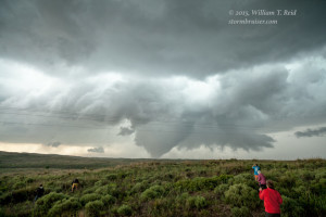
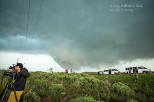
Our group lined up along a fence at the top of a hill and trained a good number of camera lenses towards the new storm. In occasional light rain, we watched the base organize and a wall cloud form. It wasn’t taking long at all for this thing to get down to business! I was praying again, though — praying that lightning would not strike the group. There wasn’t much lightning yet, fortunately.
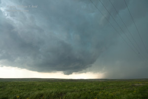
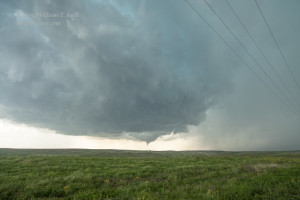
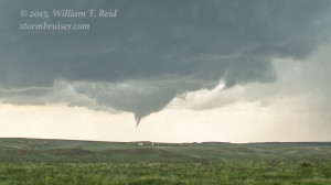
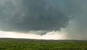
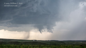
And, yes, we witnessed a brief tornado with the supercell! I wish there were some roads near this thing! The storm was practically stationary, so it looked like we were stuck “chasing” a storm from the same spot. We could see a pronounced clear slot continue to cut into the storm base, and a second brief tornado teased us.
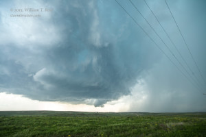
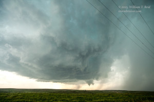
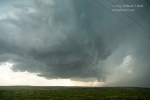
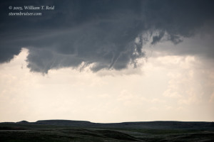
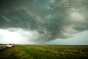
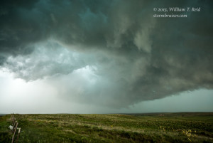
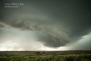
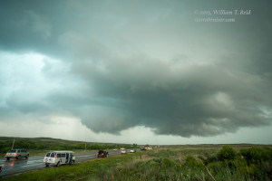
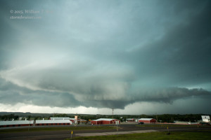
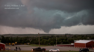
And, if my camera clock can be believed, it was not even 2:30 in the afternoon yet! It appeared that a big and bad and isolated Texas Panhandle tornadic supercell was cranking up, and every chaser in the land knew where to go. U.S. 83 northwest of Canadian started to fill with chase vehicles. The storm took a tornado hiatus, however. The base began to trudge towards the northeast at 5 mph at the most, and we had a good look at storm base structure, the RFD cut, the precipitation-filled action area and wall cloud, etc. The images below were taken from about 2:30 to 3:50 p.m. CDT, looking southwest and then west and west-northwest. The storm base was just northeast of U.S. 83, and just northwest of Canadian, by 3:50 p.m.
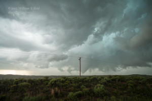
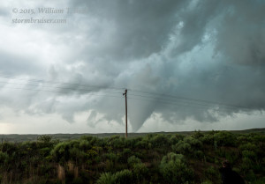
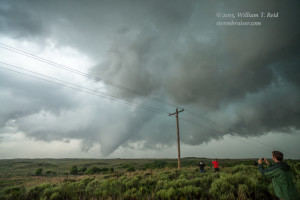
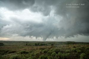
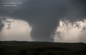
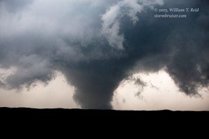
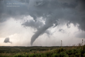
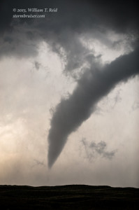
By now we were along U.S. 60, perhaps two miles NNE of its junction with U.S. 83. The storm base was pretty close, finally, just to our WNW. I wasn’t thrilled with the sketchy road network and being so close to a dangerous storm, but we did have a quick route to the south towards Canadian if we needed it. I elected to back off a little to the south as an area of interest neared. As we drove, a large funnel cloud began its descent to the ground to our west! We had not gone a quarter mile when we stopped to check it out. I have never seen guests exit the van and run up to a roadside fence so quickly.
I was nervous about the proximity of the tornado and that big telephone pole bugged me, so we went another tenth of a mile south to another hilltop. This place looked relatively safe, and the tornado did not seem to be making any move to the east. In fact, it might have been drifting to the west! We were able to watch the show and take plenty of pictures and video from the fence along U.S. 60, only three or four miles north of Canadian.
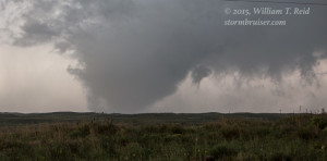
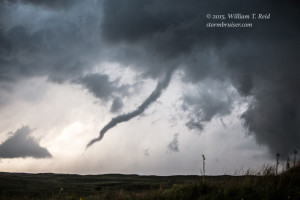
The tornado was in progress from about 3:55 to 4:08 p.m. CDT, according to my time stamps. It stayed pretty much in the same spot from our perspective, it seemed. Wow — that was nice! A nicely-contrasted tornado that we could comfortably watch from the same spot without any rain or wind — I’ll take that any chase day!
Our tornadic supercell looked ready to produce again — right up the road, less than a mile away. As the tornado to our west roped out, a very ominous bowl-shaped wall cloud hovered above the scrubland to our NNE.
To my amazement, this feature did NOT persist. It fizzled, and the supercell seemed to go into a less-organized mode for a while. We went back into Canadian for a pit stop for the group, but nothing at all was open. The town had gone into “underground” mode due to the nearby tornado activity. New lowered areas to the west deserved attention, and dozens of chase vehicles were scurrying around town and dozens were perched along the hilltops in town in order to get a look at the storm base. After perhaps another 20-30 minutes, another tornado or two materialized to the west, right over the river valley. These events were fairly brief, and it looked like the tornadoes were drifting to the south.
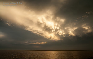
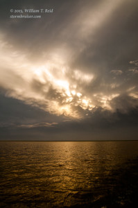
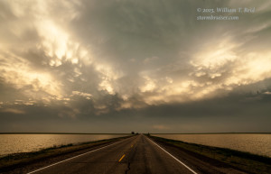
Thereafter, the severe storm was looking more linear both visually and on radar. It appeared that its tornadic phase was behind it, and I figured it was time to check out something else. We headed southwest down to Pampa, found a pit stop place, and then headed south to some newer storms. Not far from Pampa, we stopped for some pretty sunset shots, along a highway which split a flooded field. Rains in the region had been phenomenal during May, and the number of flooded areas on the Caprock was astounding.
From here we continued south to check out a tornado-warned storm that was moving east from the Happy vicinity, but darkness came quickly and the Happy storm did not hold together as hoped. We made our way to Borger for the night.















Leave a Reply
You must be logged in to post a comment.