
Today was the second chase day for Tour 5, with Tempest guides Chuck Doswell, Woody Watson and Tom Trott. We observed a pretty supercell or two on the previous evening along the KS/CO border near Kanorado, and today we left Holyoke and motored north towards the Nebraska Panhandle and the western Dakotas. SPC wasn’t too gung-ho on tornado prospects, and their slight risk was north of I-90 in western SD. Still, I thought we had a good chance of a supercell in the Black Hills region, and possibly farther south near Chadron and Crawford in Nebraska. Getting to western ND would be a stretch. SPC seemed to favor that area, but I saw no reason to blast that far north.
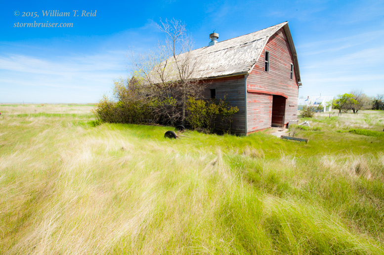
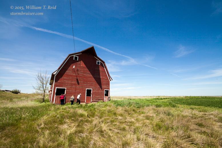
We had a leisurely lunch in Alliance and killed some time at an abandoned farm near Hemingford.
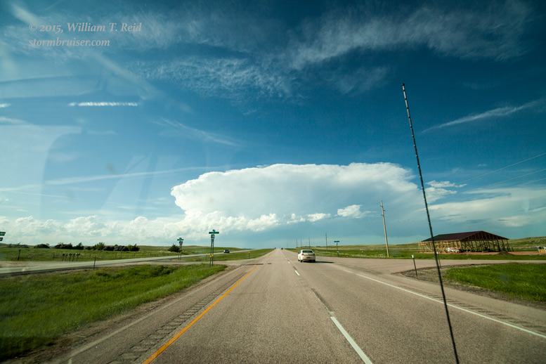
From here conditions looked better to the north, and eventually we were on Highway 79 on the east side of the Black Hills. An impressive storm tower was going up on the north side of the hills! SPC issued a mesoscale discussion for the extreme western Dakotas:
MESOSCALE DISCUSSION 0857
   NWS STORM PREDICTION CENTER NORMAN OK
   0341 PM CDT MON JUN 01 2015

   AREAS AFFECTED...ERN MT THROUGH WRN SD...WRN ND AND NERN WY

   CONCERNING...SEVERE POTENTIAL...WATCH POSSIBLE

   VALID 012041Z - 012245Z

   PROBABILITY OF WATCH ISSUANCE...40 PERCENT

   SUMMARY...WIDELY SCATTERED STORMS ARE EXPECTED TO DEVELOP OVER THE
   NRN HIGH PLAINS INCLUDING ERN MT THROUGH THE WRN DAKOTAS INTO NERN
   WY. THE MAIN THREATS WILL BE ISOLATED DAMAGING WIND AND LARGE HAIL.

   DISCUSSION...LATE THIS AFTERNOON THE WARM SECTOR CONTINUES TO
   DESTABILIZE OVER THE NRN PLAINS WHERE AXIS OF 1000-2000 J/KG MLCAPE
   IS INDICATED BY LATEST OBJECTIVE ANALYSIS. VISIBLE IMAGERY SHOWS
   CUMULUS FORMING ALONG A COLD FRONT LOCATED OVER NERN MT AS WELL AS
   ALONG A LEE TROUGH ACROSS WRN ND AS WELL AS THE BLACK HILLS OF SD.
   DESPITE WEAK FORCING ALOFT ASSOCIATED WITH LOW-AMPLITUDE SHORTWAVE
   RIDGING...ONLY A MODEST CAP IS IN PLACE THAT HAS BEEN FURTHER
   WEAKENED BY STRONG SFC HEATING AND MIXING AS EVIDENCED ON THE
   GLASGOW SPECIAL 19Z RAOB. ISOLATED TO WIDELY SCATTERED THUNDERSTORMS
   SHOULD INITIATE BY 22Z AND SPREAD EWD THROUGH THE WARM SECTOR.
   VERTICAL SHEAR FROM 25-35 KT WILL SUPPORT MULTICELLS AND POSSIBLY
   SOME MARGINAL SUPERCELL STRUCTURES. STORMS WILL CONTINUE THROUGH THE
   NRN PLAINS INTO THE EARLY-MIDDLE EVENING...POSSIBLY EVOLVING INTO
   CLUSTERS SUPPORTED BY A STRENGTHENING SLY LLJ.

   ..DIAL/MEAD.. 06/01/2015
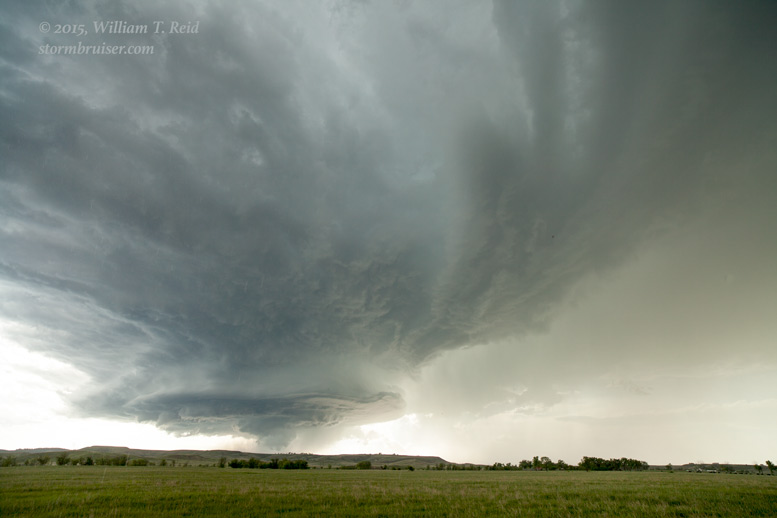
Despite the relative down-playing of the potential by SPC (“some marginal supercell structures”), the moisture, instability, and shear appeared to be pretty good where that nice storm tower was developing. It was a little northwest of Rapid City and south of Sturgis. Here are a couple of views on the approach from the south.
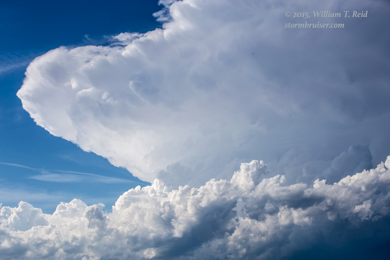
The updraft of the storm was not moving eastward very fast — less than 10 mph. We had an easy time getting east of the storm base, but it looked like the cell might wind up moving over Rapid City. I hate dealing with severe storms and cities at the same time.
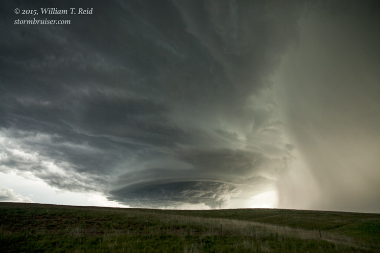
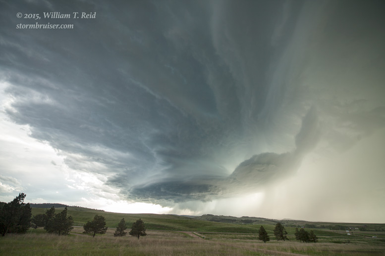
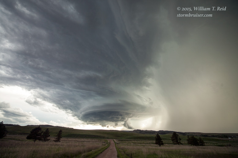
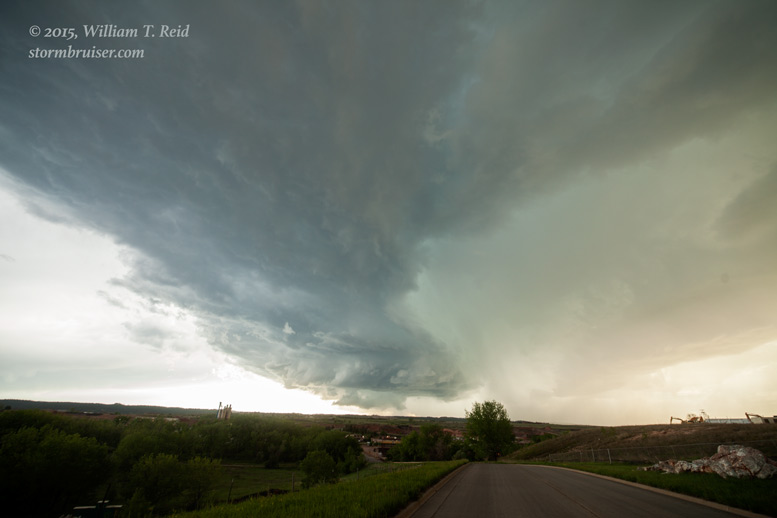
We wound up a few miles north of downtown Rapid City, north of I-90 a couple of miles, I think. This was a great spot in an open area with a good view of the sculpted storm updraft!
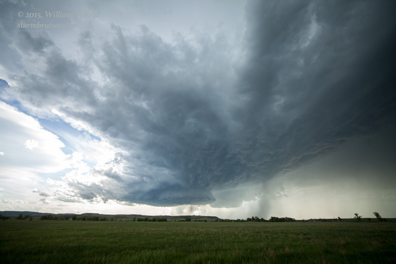

A blob of precipitation descended from the storm base, and some nice lowerings developed. As a clear slot cut into the base, we thought that a tornado might take shape, but one did not materialize.
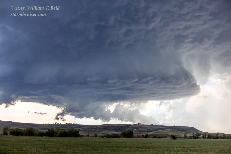

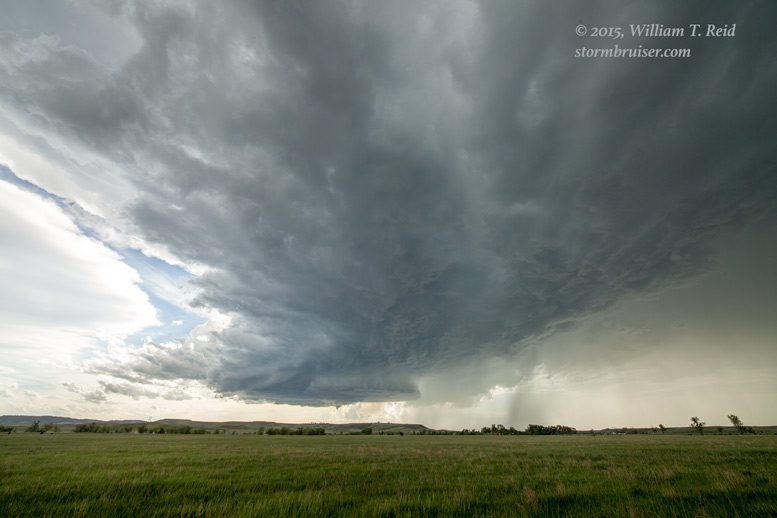
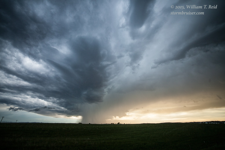
Since the storm base was moving so slowly and since the storm looked like it might want to “tornado,” I figured that we should try to get a little closer. The problem was that the storm was over the north edge of the Black Hills, and was dropping big hail onto I-90, northwest of Rapid City. A 4.5-inch hailstone was reported at Piedmont, along I-90! I didn’t want to mess around on the Interstate or get mired on a road in the hills and the trees, so about the best I could do was drive about three miles farther west and stop again. We were still east of the storm base with a great view of the structure! The supercell was drifting to the south or south-southeast now at about 3 mph, but it wasn’t too long before we were getting a little rain and hail with some nearby lightning strikes. I wish we could have stayed at this spot a little longer.


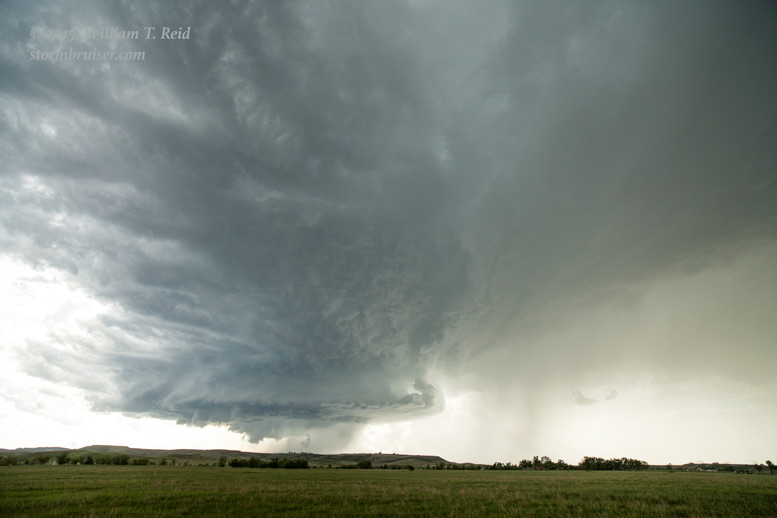
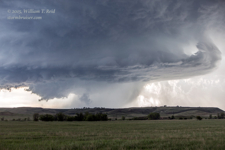
The lowerings continued to tease us. By this time I believe the storm was tornado-warned. Here are some shots with the long lens:


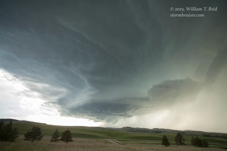
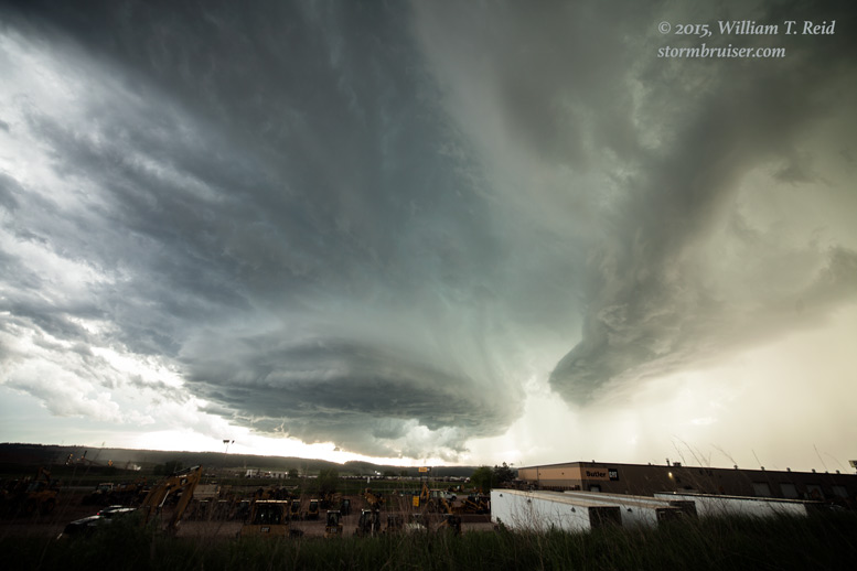
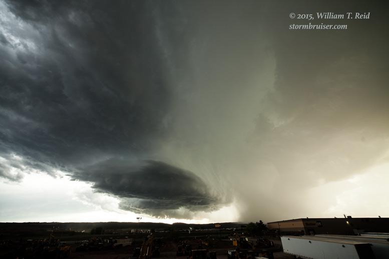
The supercell was drifting to the west side of Rapid City, so we were forced to head south into town and to look for a decent spot with a good view. I found one with a bunch of large equipment in the foreground! Note the development of the large precipitation shaft near the base.

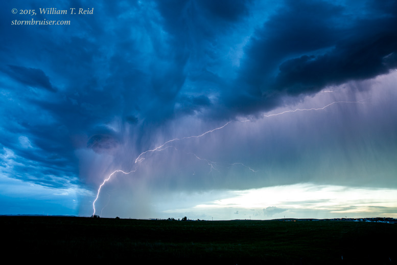
The storm appeared to be weakening a little by this time, and I wanted to get out of town and find a prettier view. We headed a little southeast and set up on a hilltop on the southeast side of town. The storm continued to weaken slowly, and lightning was not particularly frequent by this time. After the show was over a little after sunset, we headed back south to Chadron for the night.
Leave a Reply
You must be logged in to post a comment.