Our group began in Torrington, WY, with a somewhat wide swath of territory to consider, from the upslope play on the Palmer Divide of CO to a warm front in NW KS to the KS/NE border farther east. I told the group that we would head south and east and I would figure it out during the late morning. As we neared Sidney, NE, the eastern play was looking quite nice, with impressive instability and wind profiles, with good convergence along the front in the vicinity of Phillipsburg, KS, by mid-afternoon. The models were suggesting big storms around there, and on the Palmer Divide near Limon, too. I typically choose the upslope play when I have a choice, and especially when I am already so far west to begin with. But, there were other logistical parts to this day — we were with Martin and Kim, who were filming the tour and who needed to be back home in Arlington, TX, the next day. And, we were meeting up with Chris Gullikson, who was driving out from Kansas City. Chris would take over the tour-director duties from me on the following day as I had to fly back home to L.A. on the weekend (out of Denver). The east play would make it a bit easier for them.
So, it seemed logical to go for the setup near the KS/NE border near Alma and Phillipsburg. We raced eastward on I-80 and dropped south through Holdredge. Upon arrival in Phillipsburg, plenty of chasers were hanging out and watching a towering cumulus struggle against the cap. We played catch with the football at a park, and the sky was getting clearer and clearer as 6 p.m. neared. It was time for drastic action, as it appeared that the expected convection in this area was not going to materialize, at least in the next hour or two, despite the strong convergence just to the southwest.
We drove west on 36 towards some new storm development near Benkelman, NE. This cell was slow to go up, but finally hit 50,000 feet. It looked small on radar and was drifting to the north, and was 90 miles away. We continued to the west, and fortunately a new updraft went up to our due west, over Atwood, KS, and was only 40 miles away. About this time we were hearing the reports of many photogenic and slow-moving tornadoes to the west of Limon. That news did not make me particularly happy! But, for some reason, a chaser is not able to be in two different places at the same time. That just may be the most aggravating part of storm chasing.
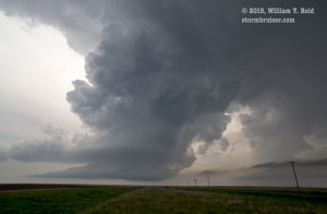
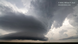
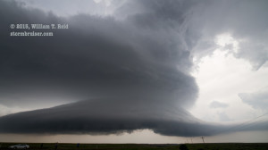
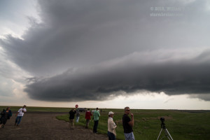
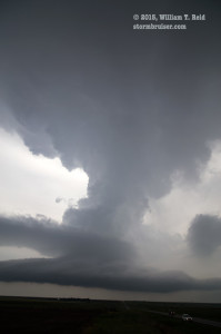
The Atwood supercell was absolutely tremendous! It sat right on top of U.S. 36 and drifted to the east. We were on a hilltop with the perfect view, and I am sure that the time lapse will look very cool! As the base approached, we were getting some one-inch hail and the RFD made a surge, with some fast downward cloud movement just a few miles to the west. A tornado was not forthcoming, and we blasted east a few miles to stay safe and to get another view. To my dismay, the updraft was shriveling very quickly! UGH! The surface winds were rather cool and from the northeast. The supercell could not survive in this area any longer.
We went east to Oberlin and south to some newer updrafts. These looked good northwest of Selden, but were still somewhat young. I saw other new updrafts to the east of here, towards Allison, and I liked the environment towards that area a little better. We were back into warm air and ESE-erly winds, too, with dew points back near 70F. While we headed east, a wall cloud developed on a tail-end cell just to our southeast. And, the updraft near Selden to our west was getting a very good look structure-wise as it became truly surface-based. We stopped to watch the wall cloud struggle to our southeast, and soon it became obvious that we needed to go back west the 12 miles to the Selden storm.
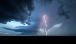
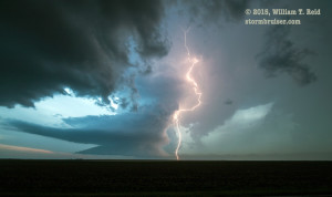
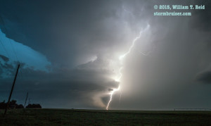
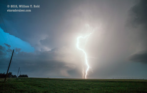
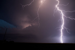
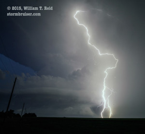
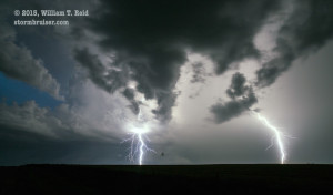
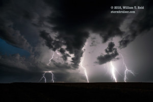
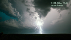
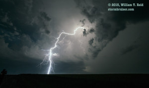
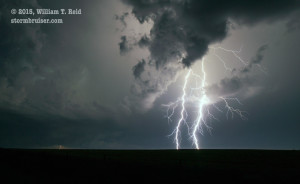
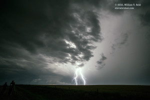
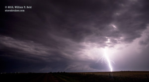
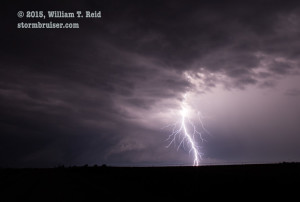
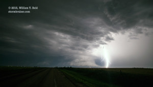
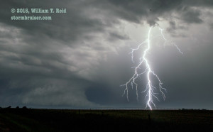
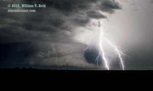
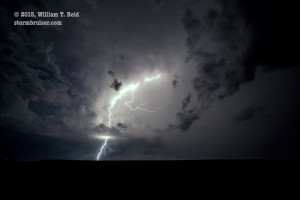
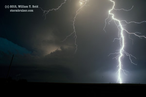
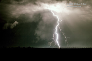
This one was also an absolute beast, with a low blocky wall cloud and to-die-for structure, not too dissimilar to the recent Atwood storm. As dusk approached we stopped about 7 miles east of the Selden storm and watched it put on the “long CG bolts out of the cloud top” show of all shows! Every 5 to 10 seconds there would be a phenomenal cloud-to-ground lightning discharge right along the corkscrew updraft to our west, and photographing these was not difficult! I managed dozens of some of the best CG/structure/dusk images of my life in those 20 minutes east of Selden. By the way — it seemed that there were a number of birds flying around between my camera and the storm!
The storm did not tornado before darkness fell. It drifted south and we continued to stay with it and to practice our lightning photography. Though we were disappointed to miss the tornado-fest near Limon and Simla in Colorado, I would have to rate June 4, 2015, very high on my list of best storm structure and photographic lightning chases.
On Friday, June 5, I followed the tour westward to the Byers, CO, area where a tornado-warned cell beckoned. This supercell was rather messy and non-tornadic as it crossed I-70 there. I had to break off from the group and head to the airport as the activity to the east cranked up.











Leave a Reply
You must be logged in to post a comment.