
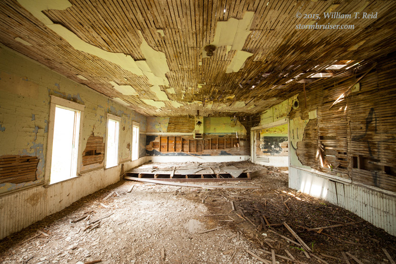
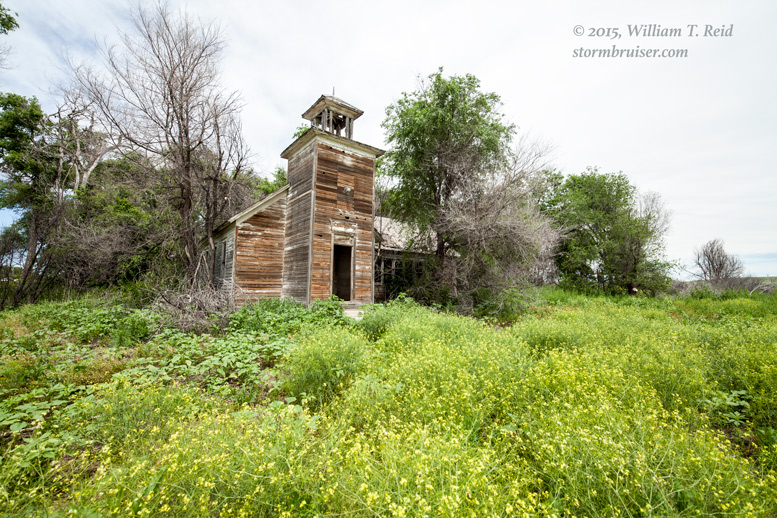
This chase day began in Guernsey, WY, and we targeted areas to the ESE from about Scottsbluff to North Platte. After our pizza lunch in Torrington, we continued into Nebraska and killed some time at an abandoned school near Bayard, NE.
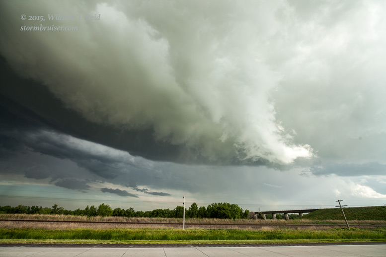
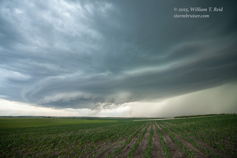
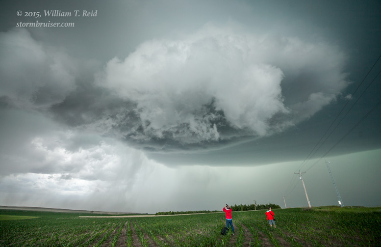
A perky cumulus field drew us eastward towards Ogallala, and a tornado watch was issued for much of western Nebraska. We did a quick pit stop at Sutherland, and then sauntered back to the west a few miles to observe a strong updraft to the north. A prominent clear slot cut in to the base and a wall cloud teased us.
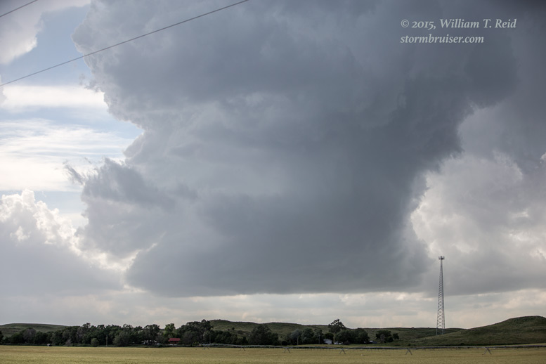
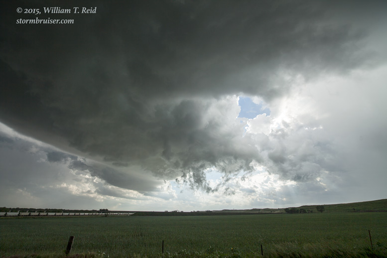
We allowed the storm base to move overhead, and along U.S. 30, three miles west of Sutherland, a funnel cloud developed no more than a half mile away. I thought that we might get a spectacular front-row show right then and there, but there was no apparent circulation on the ground beneath the funnel cloud.
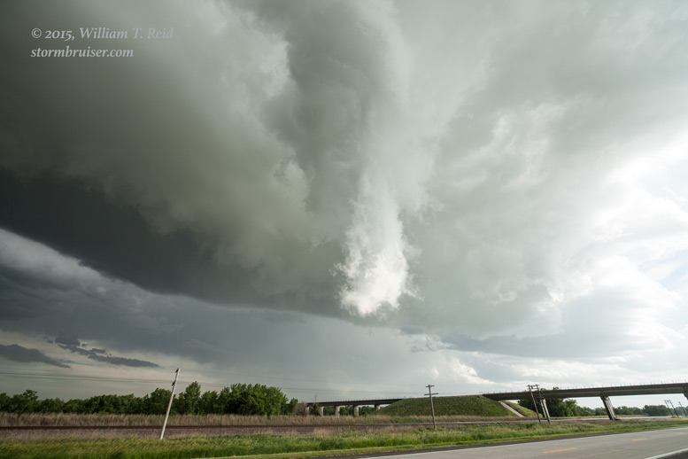
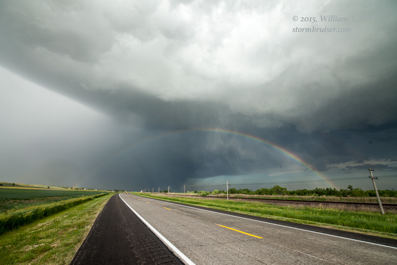
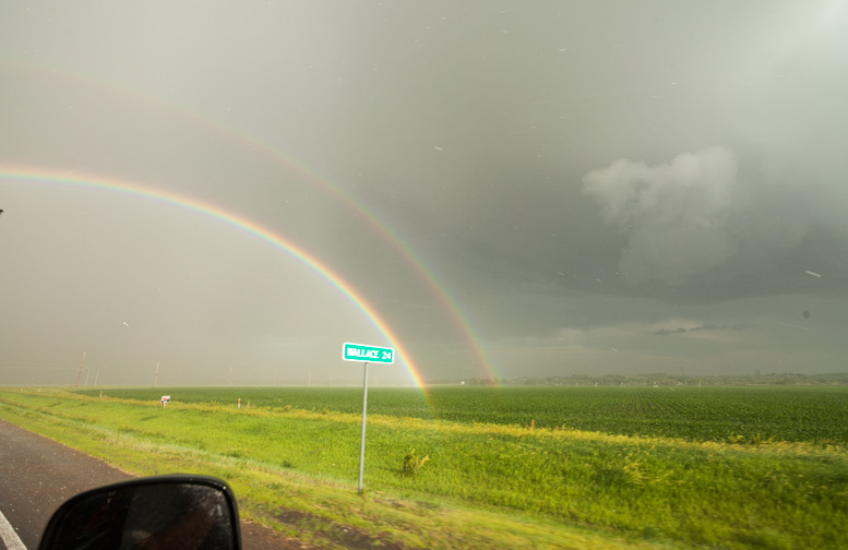
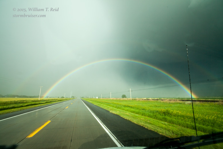
The storm was moving to the ESE and its hail core was over I-80, just east of Sutherland. I decided to drop south from Sutherland to Wallace. A nice double rainbow framed the hail core to our east.
This supercell was strong and isolated and I thought that we might be rewarded with a tornado. SPC issued a new mesoscale discussion for our area, too:
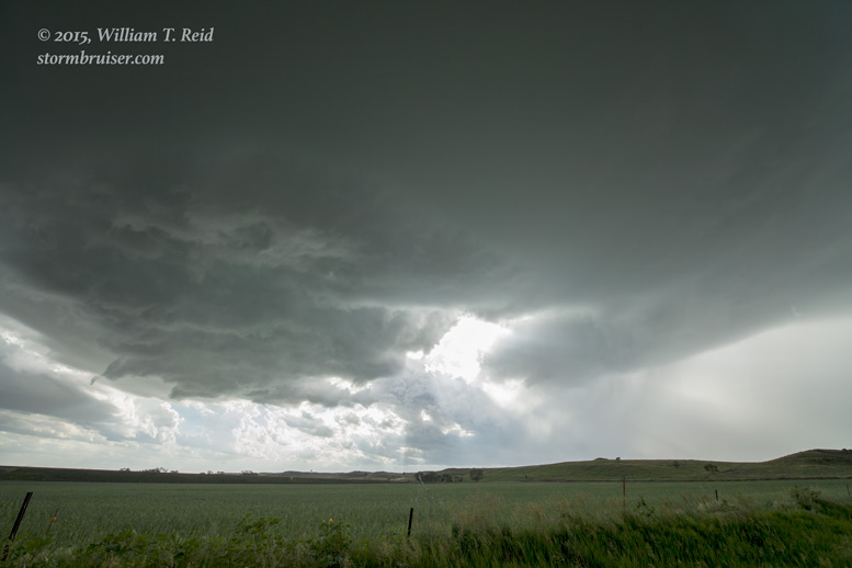
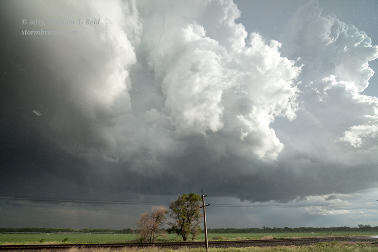
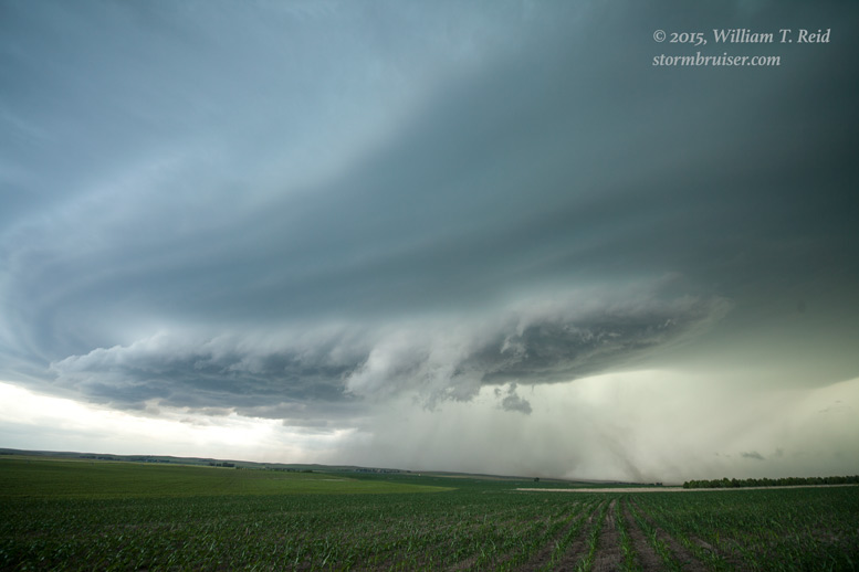
Perhaps 45 minutes later we were south of the updraft base again. This was about 12 miles east of Wallace, looking north (below).
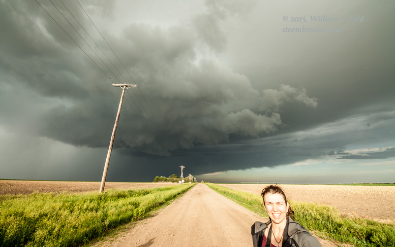
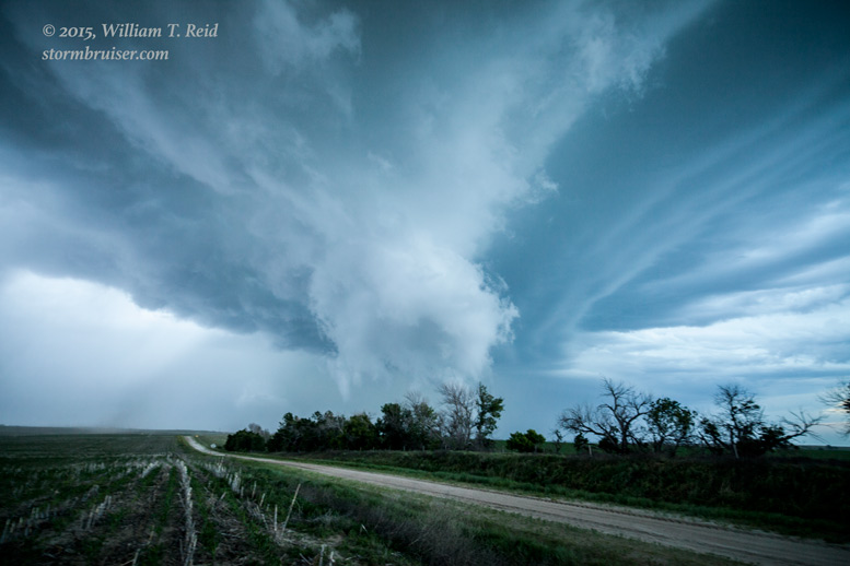
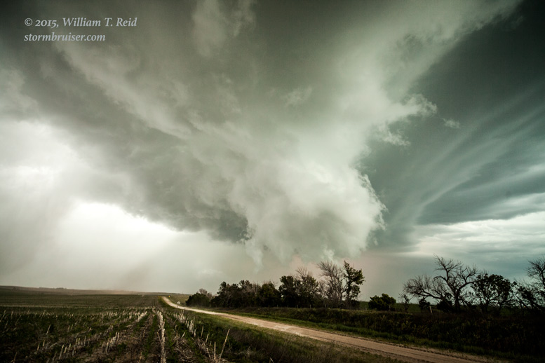
The storm seemed to be going downhill in intensity at this point, unfortunately. But, there was enough daylight remaining to check out the new storm back to our west, west of Wallace:
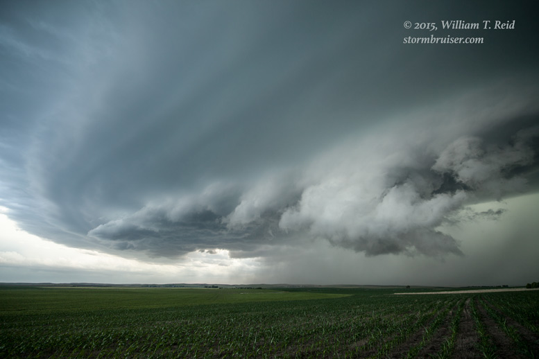
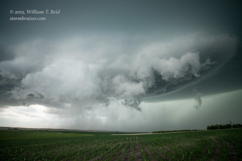
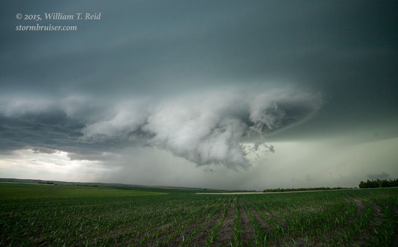
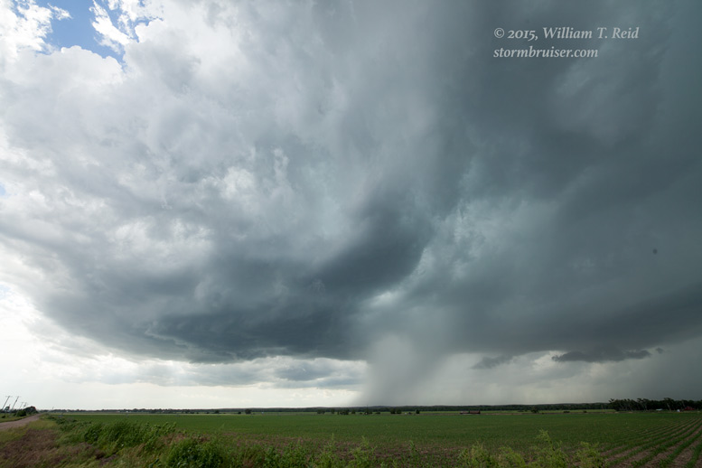
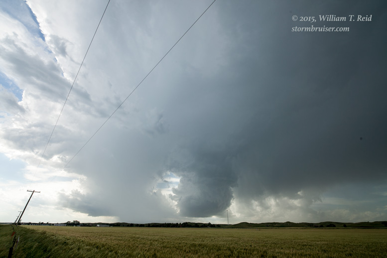
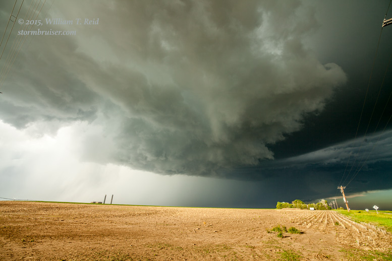
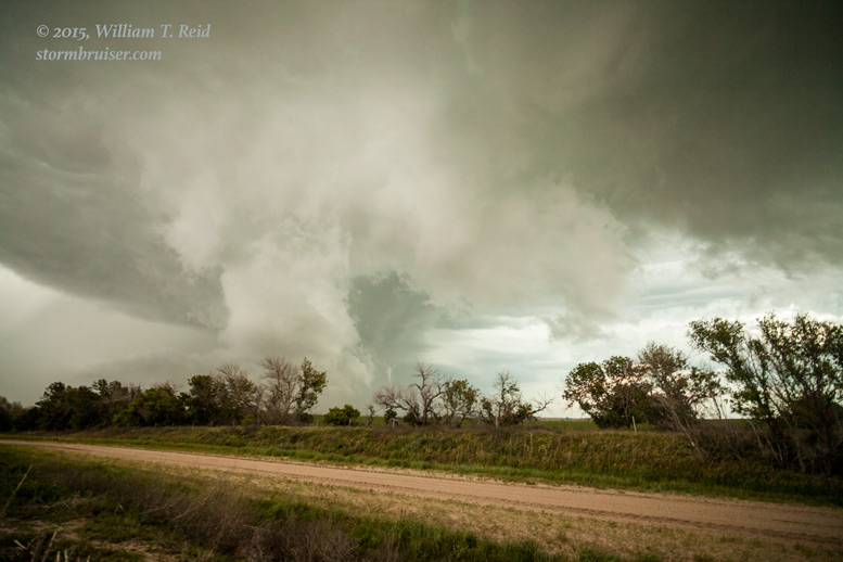
The images above were taken a few miles south of Wallace and the view is to the northwest. A beautiful wall cloud took shape with this supercell, and moved just to our north. Rotation with the wall cloud was pretty good, but again there was no tornado. The supercell continued to our southeast as the skies grew darker, with RFD winds, dusty outflow, scary lowerings, yet no tornado:
As darkness descended upon the Nebraska prairie, we allowed the supercell to drift away to our southeast. We had to dodge other severe cells on our way back to Ogallala for the night.
Leave a Reply
You must be logged in to post a comment.