

June 20 was the arrival day for Tour 7 — whoohoo! The day began with me looking for the keys to one of the vans. I could not find them, and there was no replacement set. Pretty cool, huh! This is the perfect way to impress the new guests. Fortunately, the locksmith made us a replacement during the guest orientation and we made our way out of Denver around noon. (I found the keys a week or two later —- they were in the pockets of my shorts, in the suitcase.)
There was good potential this day for a nice supercell moving out of eastern Wyoming, so the group motored north through Cheyenne to Lusk. By this time there was already a strong cell in progress to our NNW. SPC pondered a watch issuance:
The storm was moving right along to the east or ESE, and would be crossing U.S. 85 to our north, about 20 miles south of Newcastle. We stopped a short ways north of the 18/85 junction to observe.

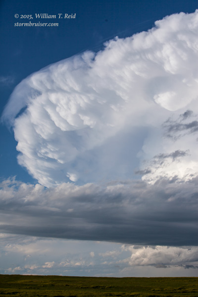

This supercell was quite nice and very isolated! It dropped 2.5-inch hail south of Newcastle and in Falls River County, SD. We stayed with it as it skirted the south end of the Black Hills, north of Edgemont, where it sported a wall cloud for a bit. The BIG problem, though, was that it was moving to the east-southeast at close to 45 mph! In the road network we had available, that meant that it was next to impossible to stay with the storm, and the stops made to view it were very short. From Edgemont we utilized some unpaved roads to Ardmore and eastward. Here is a look to the north or NNE along those lonely roads.
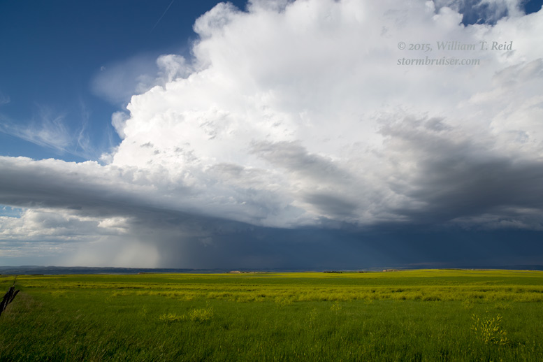
And here is the view from Highway 385 near the SD/NE border.


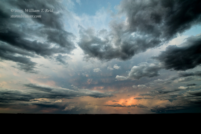
SPC issued another mesoscale discussion for the storm near sunset as it continued into Nebraska.
We were woefully out of position and behind the storm by now, and gave up on it a little east of Chadron. This chase was a bit frustrating. No, it was A LOT frustrating. We intercepted a fabulous supercell, but, due to its fast forward motion and the sketchy road network, we weren’t able to maintain good position and we weren’t able to stay close to it. The good news is that it drew us up to Chadron for the night. The next day looked to have some very good tornado potential near the SD/ND border, we were more than halfway there now, and I was not going to lose the keys again.
Leave a Reply
You must be logged in to post a comment.