

Supercell and tornado prospects were not too shabby this day over southern Iowa, so we got out of Mobridge a little earlier than normal and made our way east and south. By 20Z, SPC had increased the tornado risk to 10 percent along I-80 in Iowa. I just had to figure out WHERE to be along I-80. It was not particularly obvious. An “enhanced” slight risk was posted for southeastern Iowa, but I didn’t think that I needed to sail beyond Des Moines. Instability and shear values were excellent along a front near the Interstate in the vicinity of Avoca, about 40 miles northeast of Council Bluffs. Moisture convergence was strong, too, in this area, and by mid-afternoon some cumulus clouds were nearby. These were battling a very strong cap, however, and no storms could get going. The skies near Avoca had a bit of a “dead” look to it as some coolish air on the north side of the front sagged through. Hmmm. I led the group south about 18 miles to Oakland, IA, where the really warm and humid air resided. There were cumulus fields to monitor in extreme southeastern Nebraska and to our south, along the Missouri border. Not much was happening near us, though, and I was thinking “Iowa bust” as the clock ticked past 6 p.m.
As I pondered my existence and the meaning of life at Oakland (I was not able to determine if there was any “there” there) someone asked if I was going to chase the new towers that were going up to our north. Geez, I guess I was parked facing the wrong direction. Very robust storm towers were erupting about 15 miles north of I-80. It is time to chase!
We made our way back north through Avoca and a big storm was warned as it neared Harlan, just up the road. Heck, we were in FAT CITY as this would be an easy intercept, and most chasers were much farther east. It looked like I knew what I was doing! But ——– but the low-level air north of the Interstate was still a little bit cool and stable. This strong updraft near Harlan was likely NOT fully surface-based. The low-level shear was awesome, though, and as we pulled up to the south side of Harlan it looked for all the world like the town was in a heap of trouble as the wicked storm base loomed.


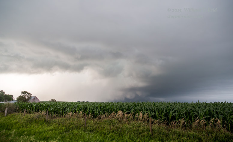

A tornado was reported with this supercell, but we did not see it. The images above show a prominent clear slot, menacing wall clouds, and precipitation-wrapped areas where something might be happening! This was from about Harlan to the Elk Horn area. The storm was moving to the ESE, and near I-80 we were southwest of the base. I elected to try to get in better position in front of the supercell, but we got mired in Atlantic by road closures and construction. What should have taken 5 minutes took about 15 minutes, it seemed, and I was not happy! The good news, I suppose, was that the storm remained on the cool side of the boundary. Despite off-the-chart supercell and tornado parameter numbers here, it was not able to produce tornadoes, and we were not missing much as we stuggled in Atlantic and east of there to Wiota.
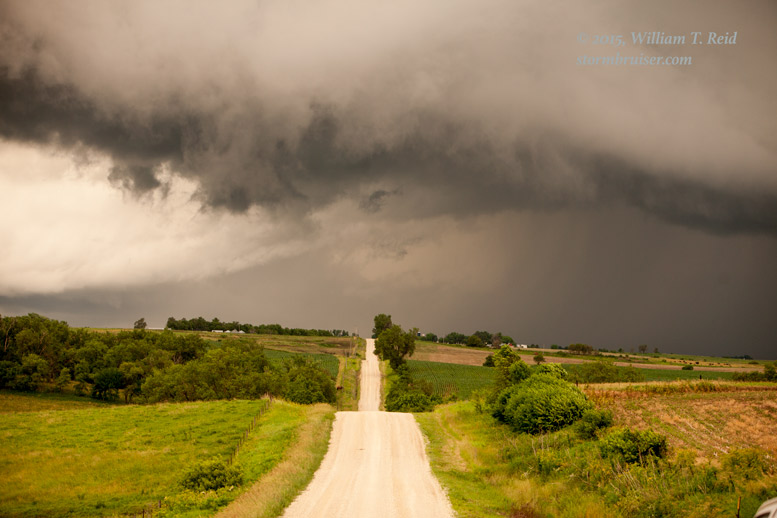
We stopped just short of Fontanelle, I believe, and watched the storm move off to the east-southeast. It was near sunset and our tornado hopes had been dashed. Near Bridgewater, we stopped for a while on a hill to shoot additional storms to the north in the nice and soft evening light.


Leave a Reply
You must be logged in to post a comment.