
The daily chase accounts have been posted, so it is happy chase season summary time! I worked as the tour director for Tempest Tours for tours 2 through 7, which was from about April 29 through June 27. However, I had to fly back home to California on three different occasions to work weekend shifts for my “real” job as a weather observer at Point Mugu. Throw in a couple more days off in June during Tour 6, and I figure I was in chase mode with the tour group for about 45 days this past spring. On about 35 of these days there was something worthwhile happening in the troposphere on the Great Plains to observe.
The weather pattern on the Great Plains during May and June of 2015 was fairly active. Whereas many recent seasons have been plagued by drought and parched landscapes in the Southern Plains and High Plains, this spring was the opposite, as moisture was plentiful in most areas south of I-80. Much of Texas and Oklahoma endured flooding rains in May. The High Plains of eastern Colorado were wet and green by the end of May and through June. The mosquitoes were very happy and quite prolific nearly everywhere we headed! There were no prolonged “down” periods at all due to plunging cold fronts or wayward upper lows or storm-squelching upper highs. That is always good news for a tour director, and each tour had plenty of active chase days.
Though the pattern was rather active and severe storms were not difficult to find nearly every day, the pattern was not one which promoted high-end tornado outbreaks on the Plains. There were a handful of days with a lot of tornadoes, primarily in May, but highly photogenic, long-track and long-lived tornadic supercells were generally absent.
Personally, I had a typical chase season with regard to tornado intercepts and chase success. I witnessed a number of great tornadoes that nearly no other chasers saw, and I missed a few that were seemingly surrounded by hundreds of chasers! There were the usual “heartbreak” days on which I did not wind up on a storm that I could have been on, such as June 4 when we were in northwestern Kansas and not on the Simla, CO, tornado machine. But that is always going to happen a few times when you chase for most of two months every year. I managed to stay out of large and damaging hail again —- in 15 years of directing the tours, there have only been 3 or 4 instances in which large hail has severely damaged the vans and cracked the windshields. As for stunning storm structure, I think the season was a bit of a dud. Maybe I was jinxed a little on the timing of the tours and my “off” weekends.
Geographically, the chase season was interesting. (Keep in mind that this summary applies to only May and June, and the last two days of April.) Of course, I have a High Plains bias and I usually choose to chase on the higher terrain when there is a “coin-flip” toss between, say, eastern CO and eastern NE. But I think I can count on one hand the number of times that I led the tour group east of about U.S. 77 (which runs from Fort Worth to Oklahoma City to Wichita to Omaha). Wait a sec — I reviewed my chase logs, and I can count on one FINGER the number of times that I chased east of U.S. 77, and that was a chase to western Iowa on June 24! Also, the Northern Plains were not very active at all, at least on the days that I could chase. I was in ND on only two days. We chased in SD on just five days, all in western SD and all in June. At no time did I venture into MT, MN, MO, AR, or LA. Yes, it was a great chase season for those of us who dread the notion of chasing in the trees. Amazingly, though I chased in TX on 9 days in May, I chased on only one day in NM (not counting one day when we cut through southeast NM on one chase into west TX!). When not in TX, the bulk of the chase days were in eastern CO and adjacent areas — western KS and western NE, and southeastern WY.
My tornado intercepts were in TX, NM, SD and NE. Amazingly, I saw no tornadoes in OK or KS, or in the central/eastern portions of NE and SD. This is the heart of tornado alley.
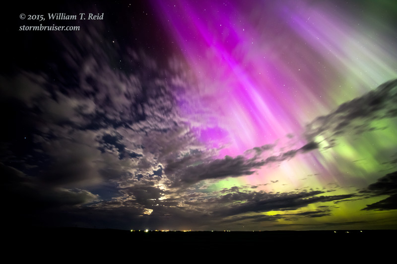
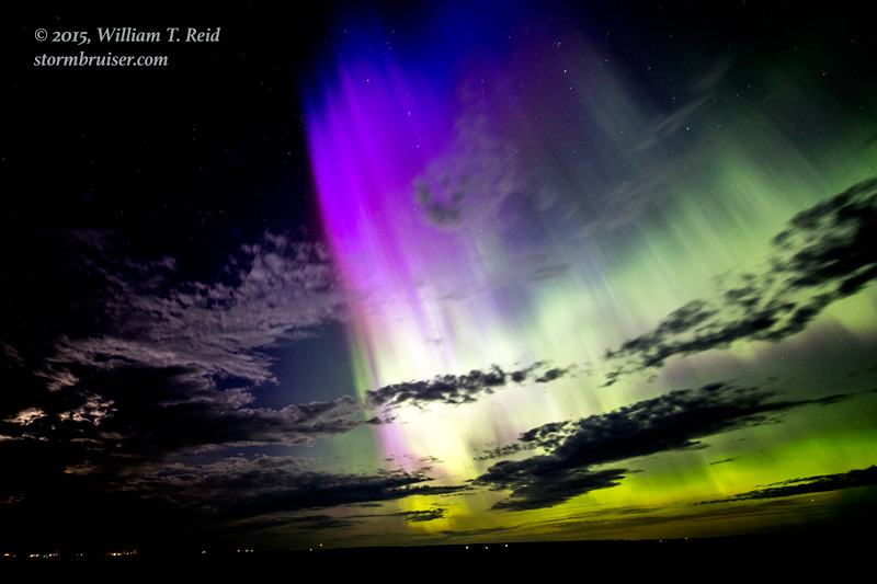
One other day worth noting was June 22, a down day with no storms to target. We stayed along the SD/ND border and went out late evening to view the Northern Lights, which were forecast to be especially prominent this night. We were NOT disappointed!
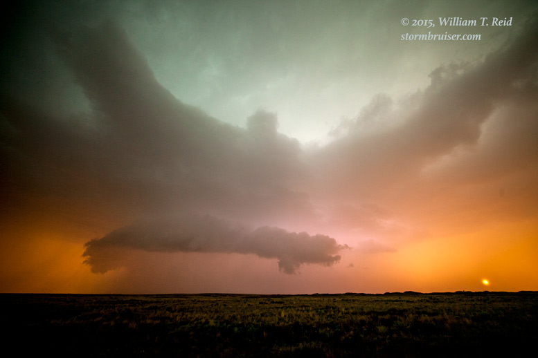
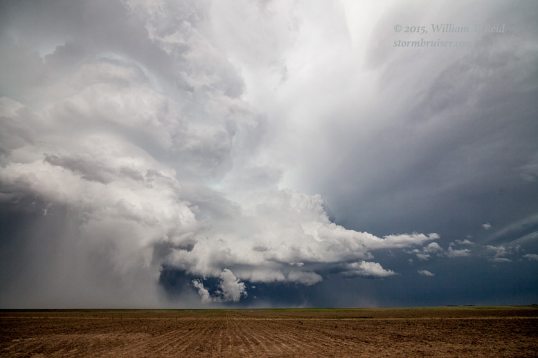
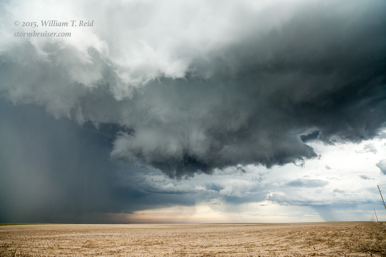
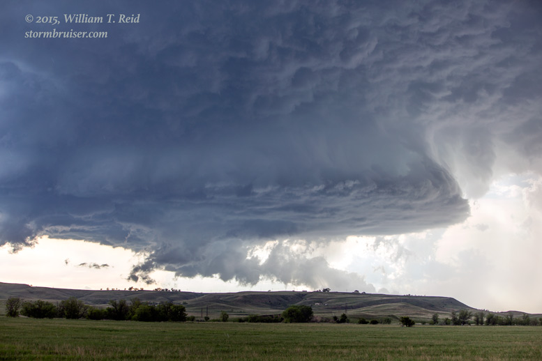
Click on the links here for the April, May and June chases. Below are links and images for selected individual chase days which featured a significant intercept and/or an especially pretty photographic opportunity.
May 4 Fort Stockton TX supercell — Two supercells today: a little LP in Loving County and an HP beast in Pecos County.
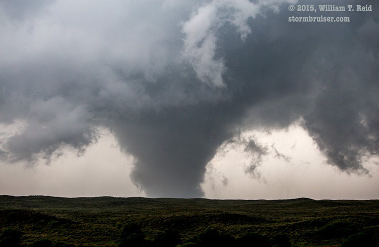
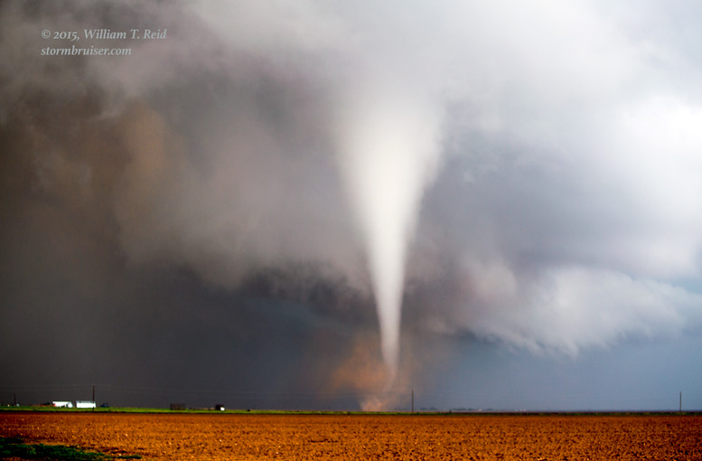
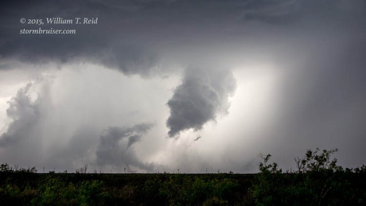
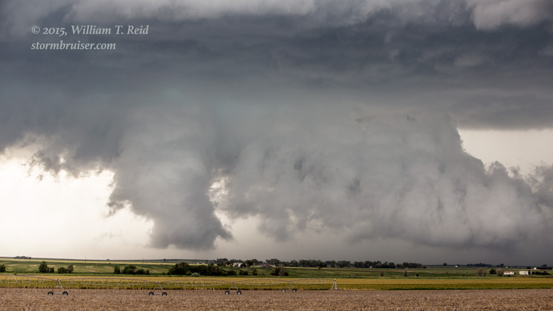
May 5 Luther and Ralls TX tornadoes — a huge chase day for the tour group with a close look at two tornadic supercells
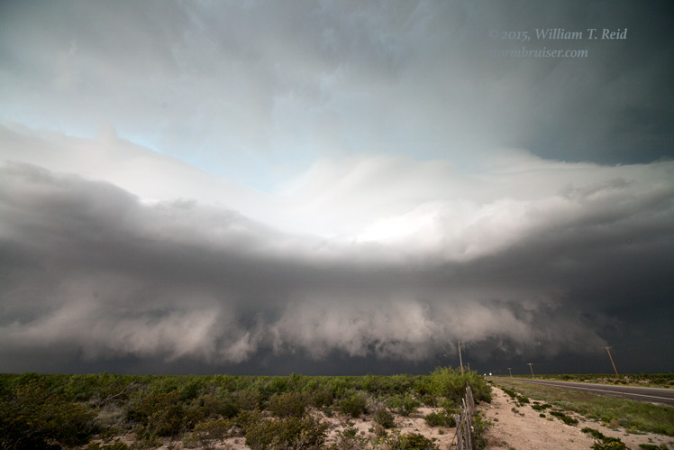
May 6 Throckmorton TX supercell — a massive, slow-moving tornadic beast narrowly missed Throckmorton at night.
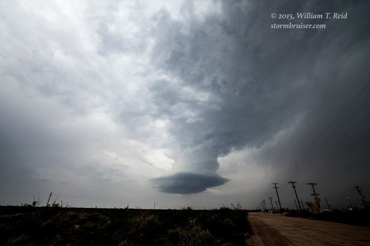
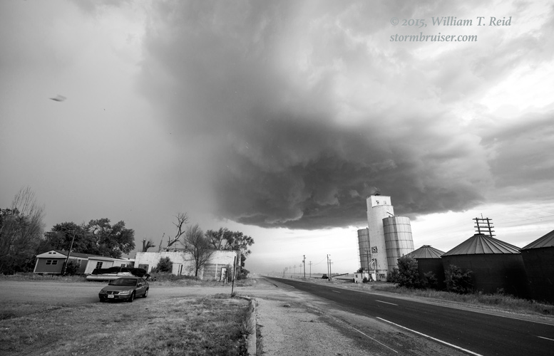
May 14 Syracuse KS LP supercell — pretty LP storm in western Kansas
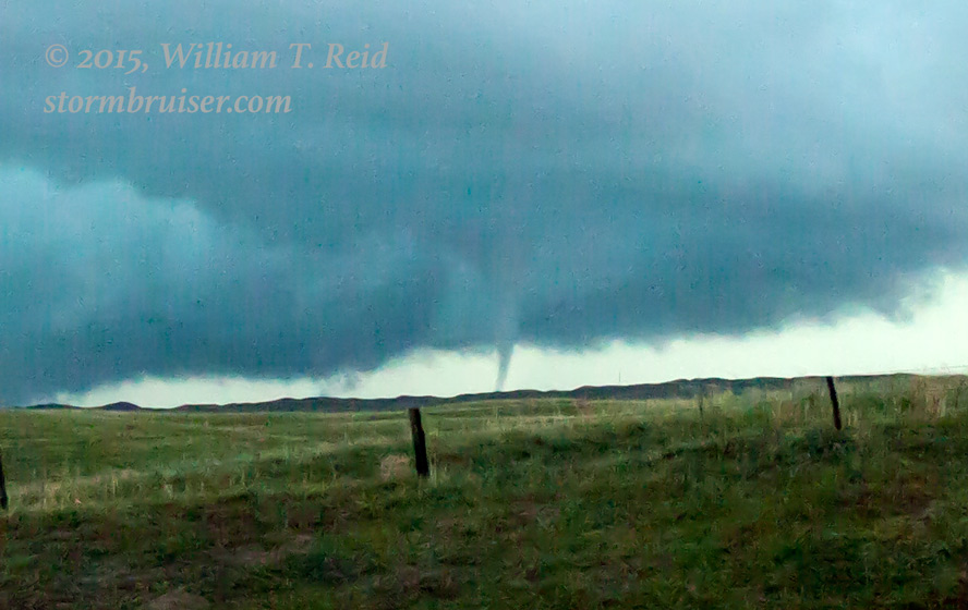
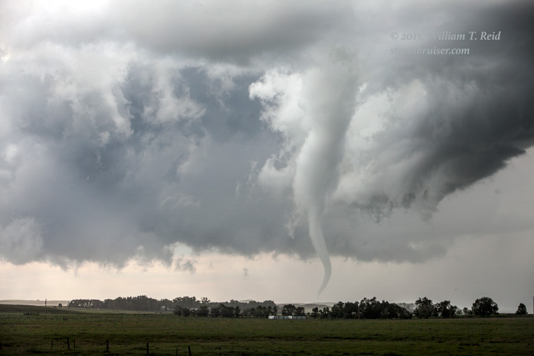
May 15 Cherry County NE tornado — late day tornado or two over the Sand Hills of northwestern Nebraska
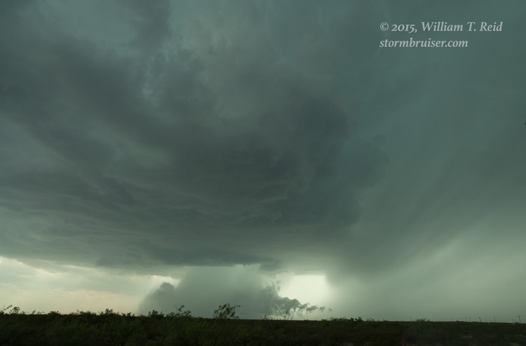
May 18 Pecos TX tornadic supercell — A developing HP beast of a supercell briefly went tornadic over the bunny rabbits of southwest TX
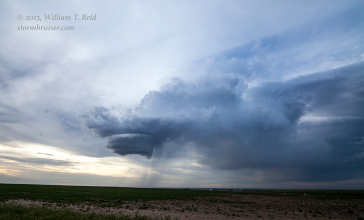
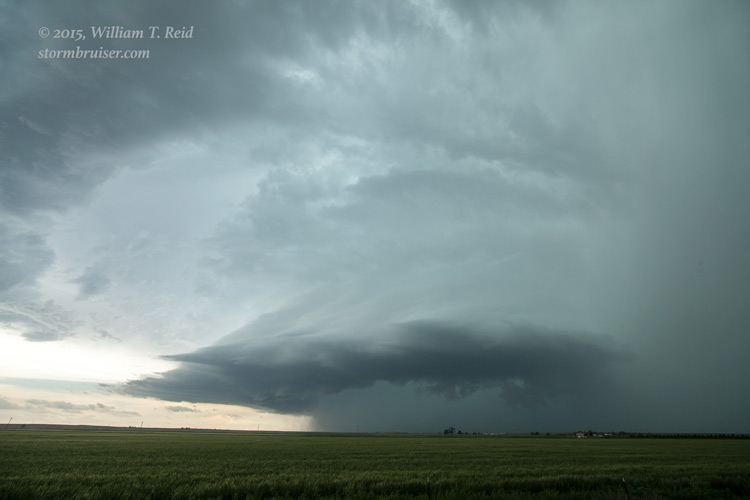
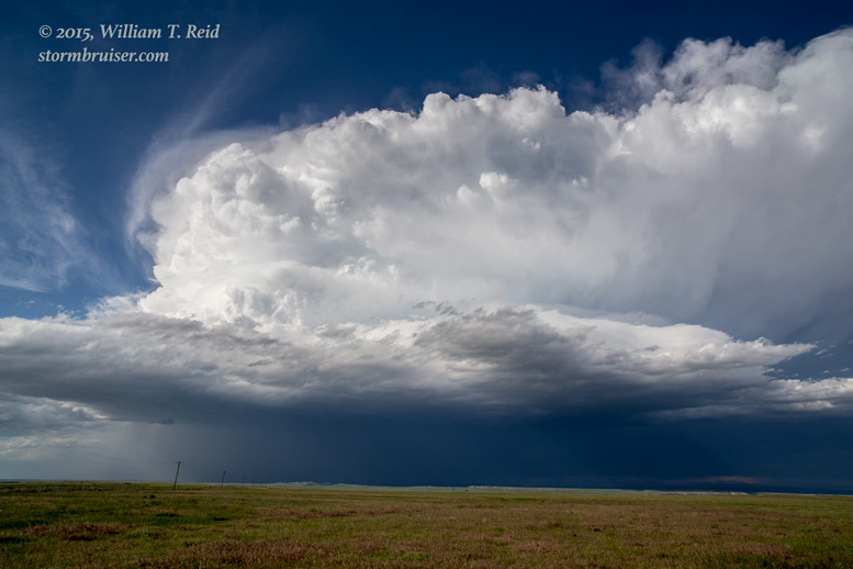
May 24 Lamar CO supercell — an HP supercell pummels the flat plains of southeastern CO
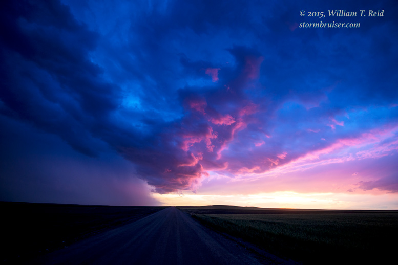
May 26 western OK severe storms — just missed a nice tornado at Hydro but had a pretty sunset instead!

May 27 Canadian TX tornadoes — this storm had a hankering for putting down photogenic twisters
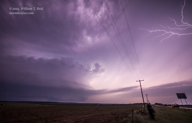
May 28 Dallam County storms — active day culminating in a nice lightning show
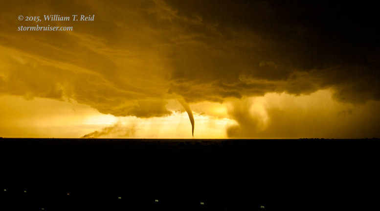
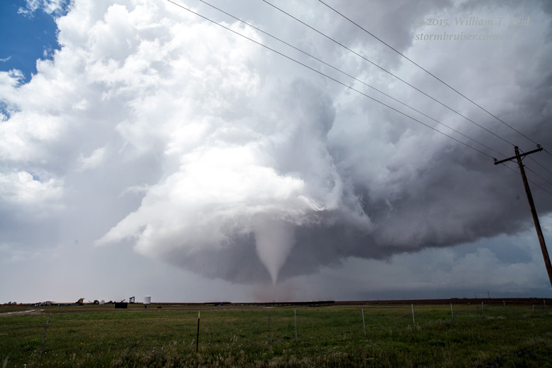
May 29 Tornadic supercell in east-central NM — with a very pretty tornado near Milnesand!
May 31 Kanorado supercell — almost got a tornado nearby out of this one
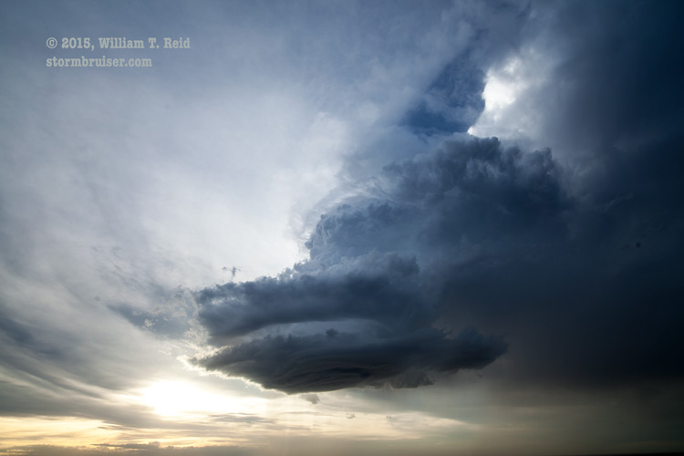
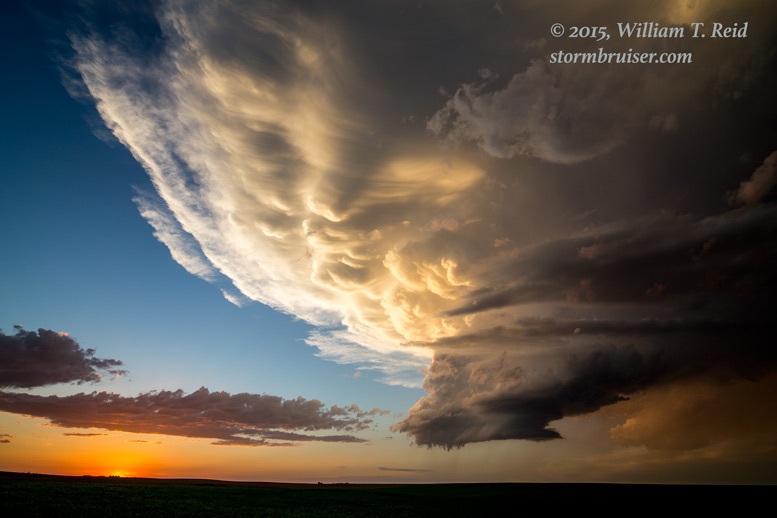
June 1 Rapid City supercell — some of the nicest structure of the season
June 2 Nebraska Panhandle supercells — plenty of good stuff on this day!
June 3 eastern WY supercell — a late day storm produced a fake-nado in the dark
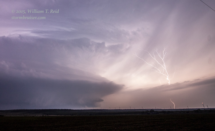
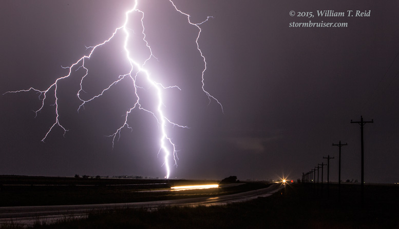
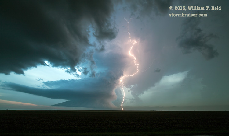
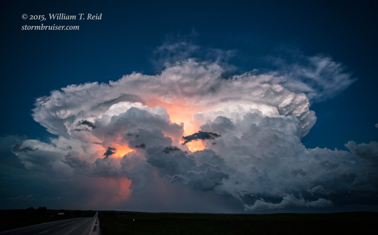
June 4 northwestern KS supercell — magnificent supercell and lightning display at dusk.
June 9 northeastern CO structures — no storms = looking for old stuff
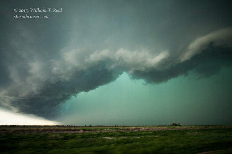
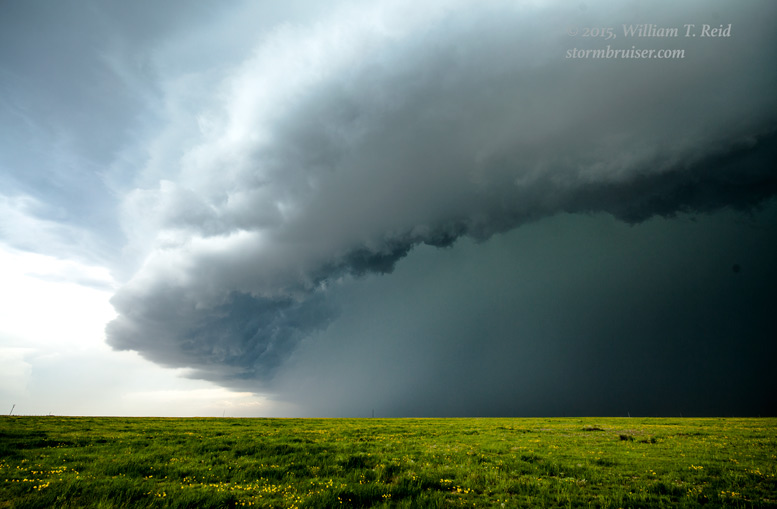
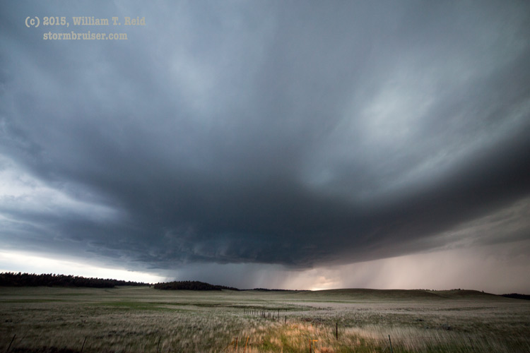
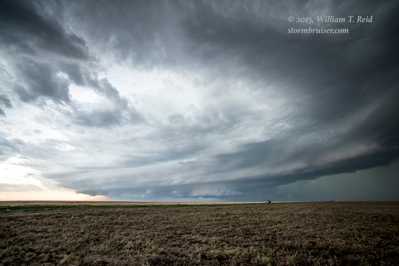
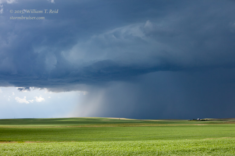
June 11 southeastern CO supercells — a couple of beasts above great chase country!
June 16 western NE supercells — nice structure near Sutherland, and an almost tornado
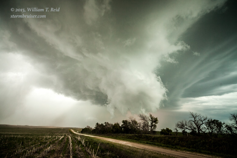
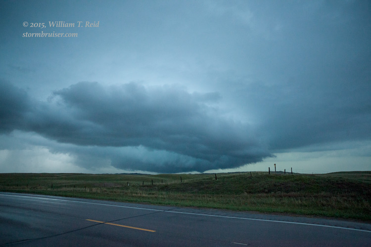
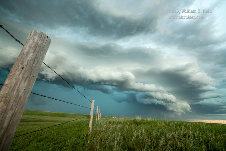
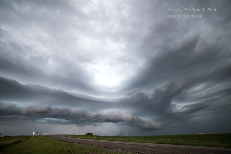
June 17 western SD supercells — very pretty storm development above spectacular chase terrain
June 20 WY/SD/NE long-track supercell — that was moving WAY too fast
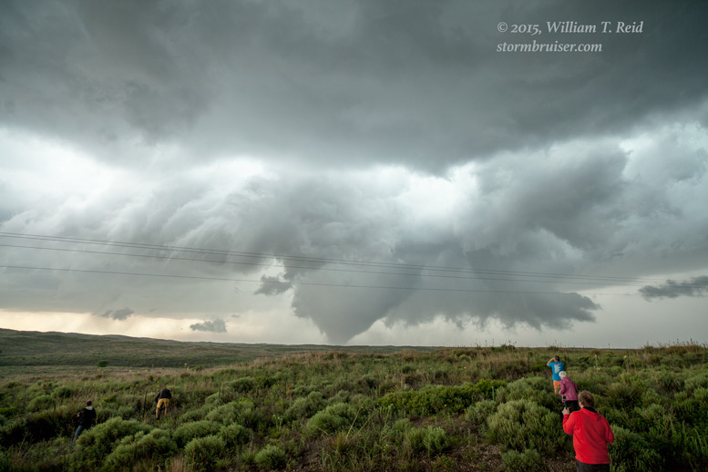
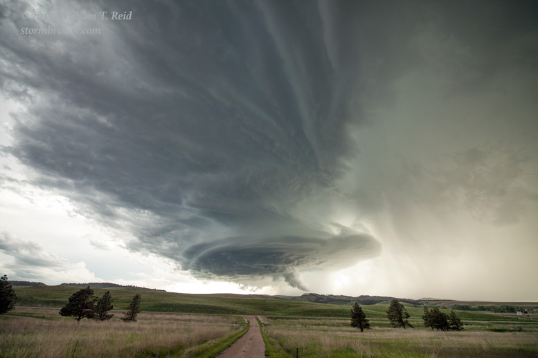
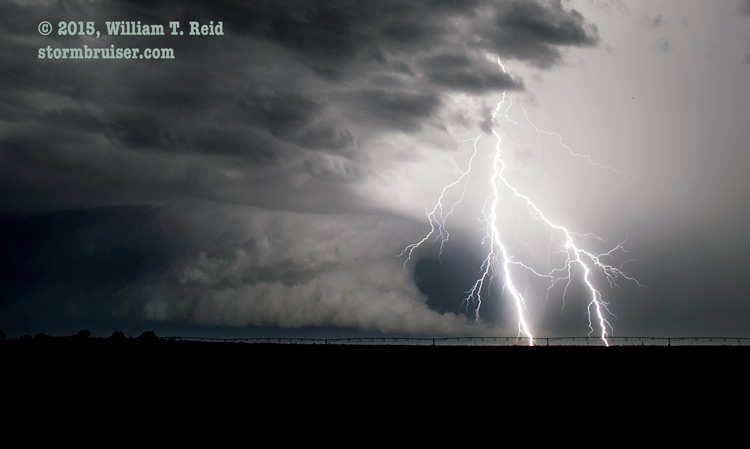
June 21 tornadic supercell in northwestern SD — FAT CITY!
June 22 Northern Lights near Lemmon, SD — one of the highlights of the chase season!
June 23 southwestern ND storms — plus group photos!
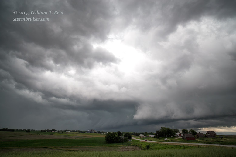
June 24 western Iowa supercell — tornado sirens but no tornado
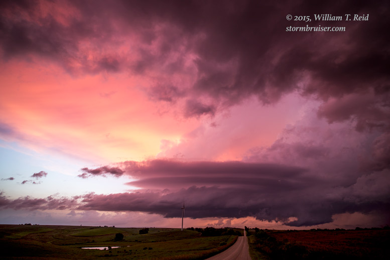
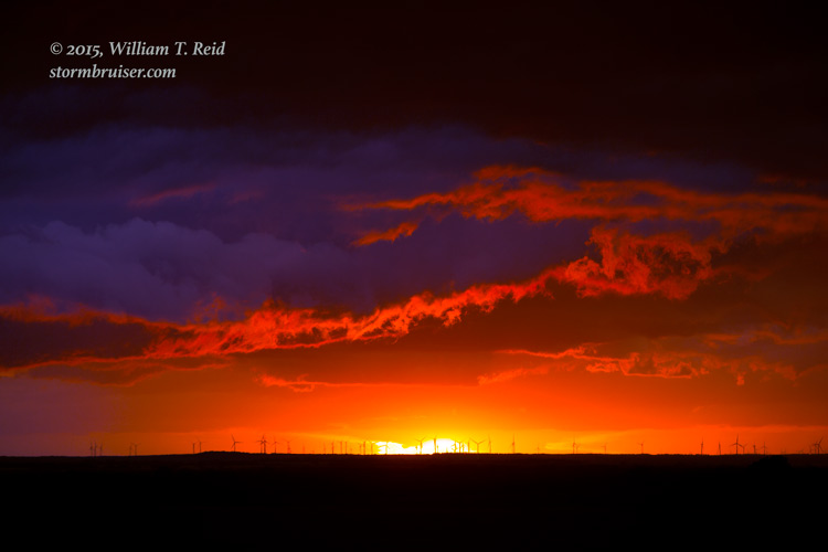
June 25 western Nebraska storms — great sunset colors
VickiB says
Gorgeous pictures. I am so looking forward to doing the High Plains tour in 2017.