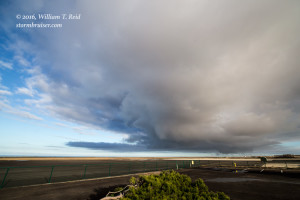
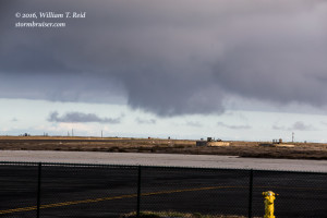
A weak front came through SoCal this morning, and a weak surface low lingered offshore during the afternoon. San Nicolas Island was near the low’s center, and weak winds from about noon to 3 p.m. switched from NE to SE to SW and then NW. By 3 p.m. convection was developing over the island, thanks in part to some sunshine on the land. A cumulonimbus cloud provided a light shower, and as the cell drifted to the east, a persistent and shallow wall cloud was beneath the cloud base. I was ready with the long lens in case a waterspout developed, but one did not. The updraft fizzled at 4 p.m. There was no thunder with the somewhat low-topped cell, but it is nice to be able to observe some convection and some structure when one is at work at the airport!


Leave a Reply
You must be logged in to post a comment.