

Start, Oakley, KS; end Russell, KS; 296 miles; lunch Jimmy Johns at Hays
Tornado potential looked good today from western OK northward into much of central KS. SPC splashed a nice, big 10-percent hatched tornado area from about Hays to Altus, and then trimmed back on the northern part a bit for the 20Z outlook. As it turned out, the day was a huge bust tornado-wise for chasers who targeted OK and the southern half of central KS. Our group started the day in good shape, at Oakley in northwest KS. After a look at the models, I saw little reason to venture down south towards Dodge City and Woodward or Altus. Shear and instability looked more than adequate for tornadic supercells just a couple of counties to our east.
SPC Day 1 Convective Outlook (20Z)
spc-mesoscale-discussion-557 W and C KS/3:20 p.m. CDT
spc-mesoscale-discussion-560 C KS/6:30 p.m. CDT
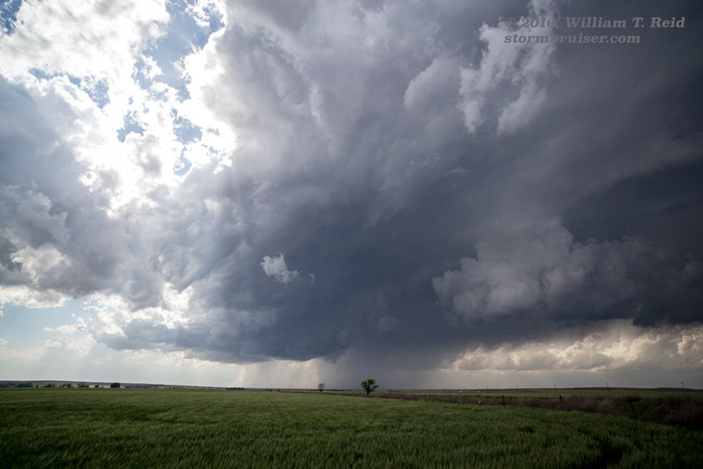
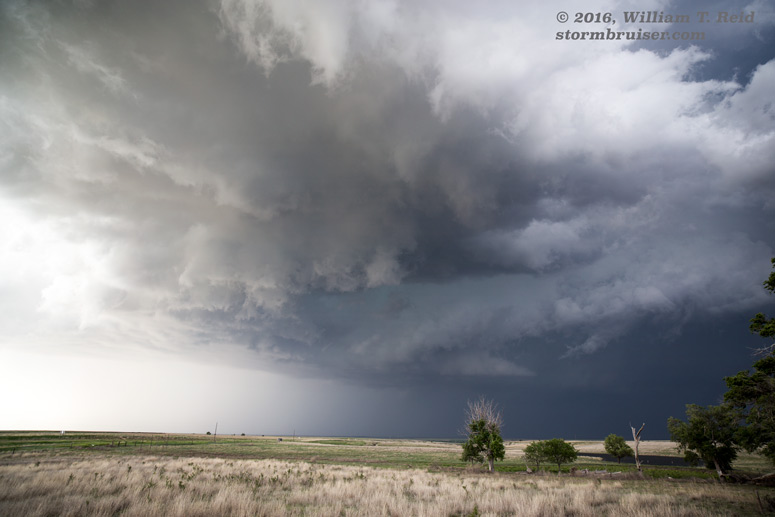
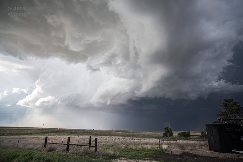
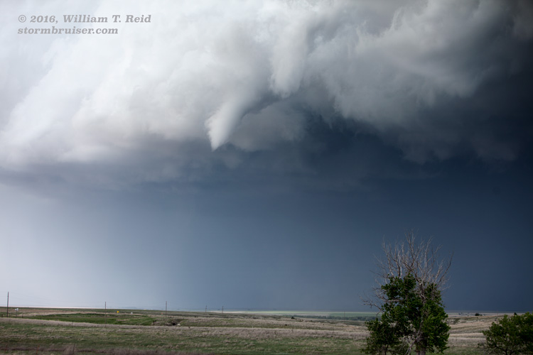
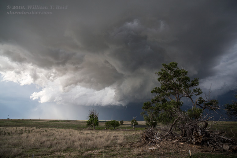
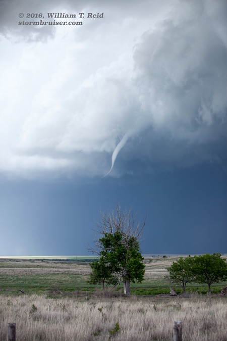
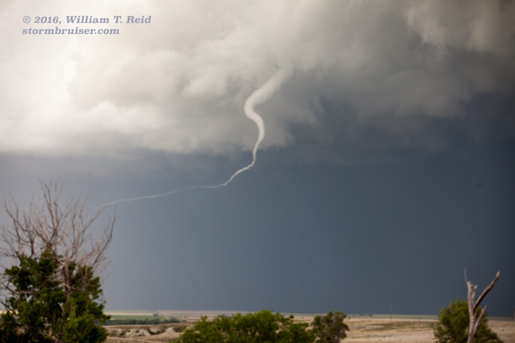
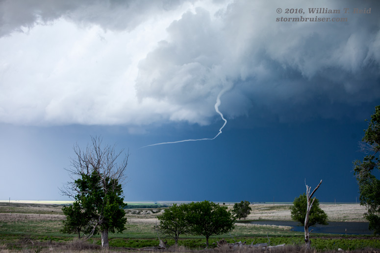
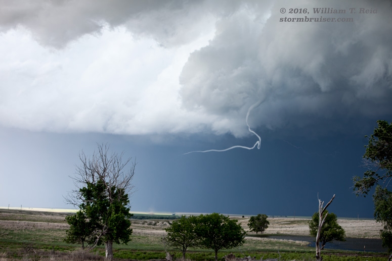
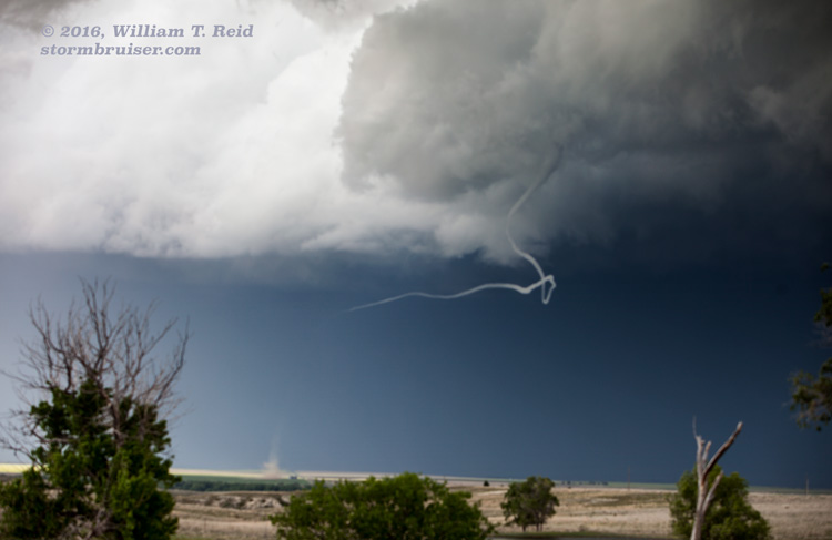
We headed to Hays for lunch, and then sagged southward a little to wait for development. Storm towers developed to our west and southwest, and we watched from the Ness City vicinity. We stayed east of these as they dragged us NNE-ward. We stopped along U.S. 283, north of Ransom and south of Cedar Bluffs Reservoir, in southern Trego County. A cell to our west looked to have some decent organization, but was overall just ho-hum. Other updrafts were screaming skyward about ten miles to our east. The atmosphere was exploding in that direction. The base of the storm to our west continued to our northwest, and appeared rather benign. But a skinny funnel cloud emerged, and a small dust whirl kicked up! This was a really slinky and skinny and ropy tornado. The ground contact was well-removed from the area of the cloud base from which the funnel emanated. This tornado was perhaps 7 miles distant, west of U.S. 283 and Cedar Bluffs Reservoir, and 5 miles SSW of Trego Center at 6:07 p.m. CDT, according to the SPC log. It persisted for several minutes.
From here we scooted northward to I-70, and then east towards Hays to try to get into position on the newer cells to our east. There seemed to be a lot of storms now, and it was getting a bit messy. We went north before getting to Hays (in western Ellis County) to check out a storm base. It looked good but it got away from us. Our nice road went to wet and muddy, and we had to turn around. This storm went on to produce a tornado or two northwest of Catharine and Emmeran, not too far to our east, also in Ellis County.
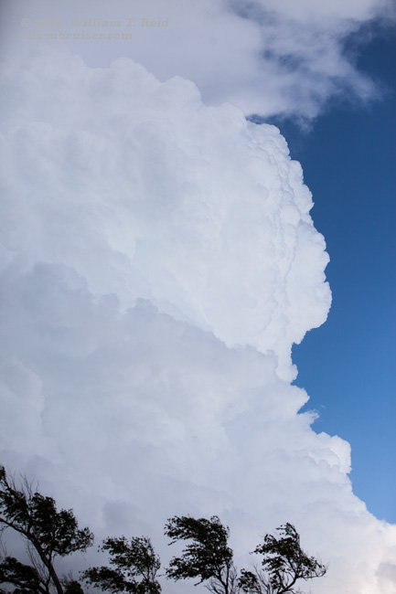
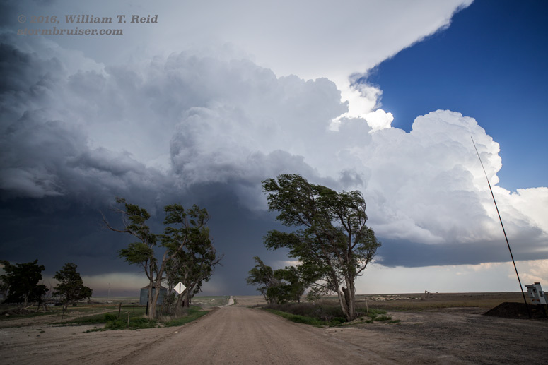
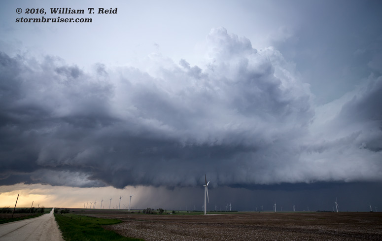
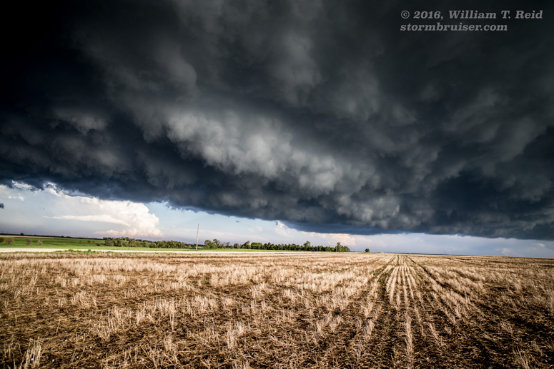
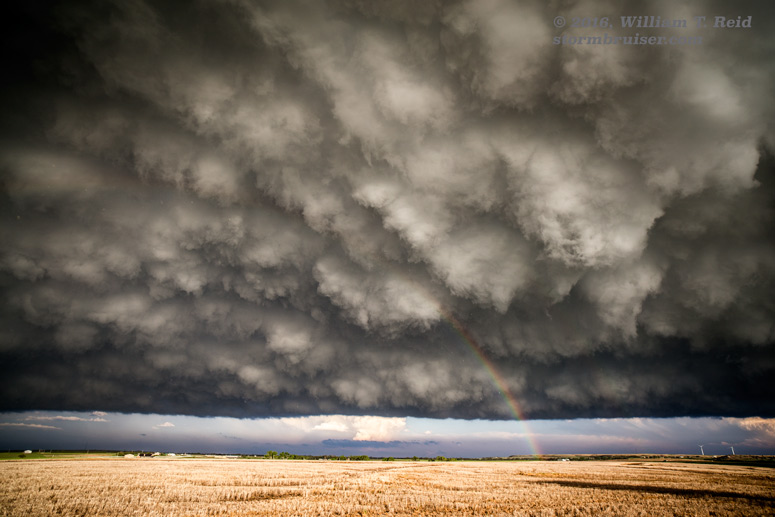
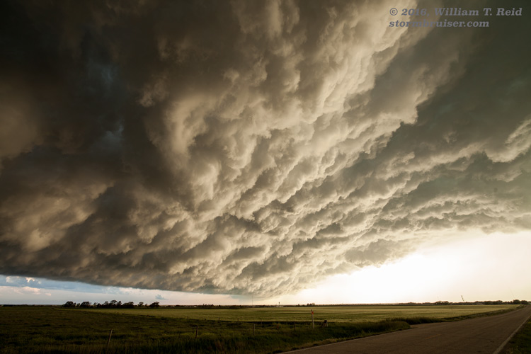
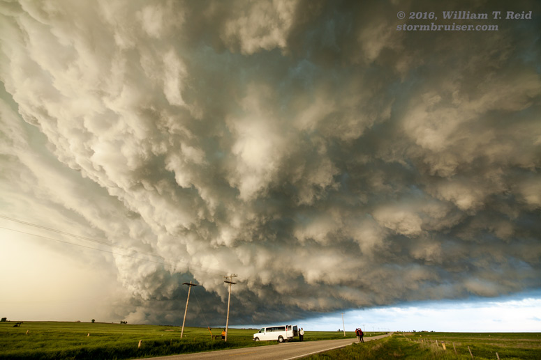
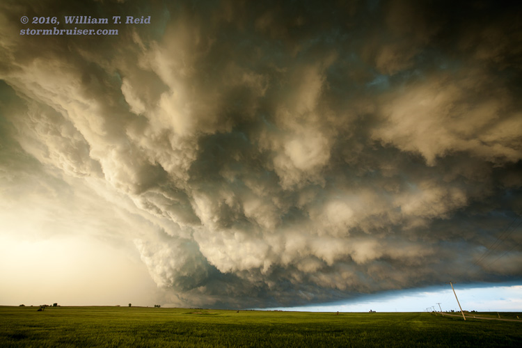
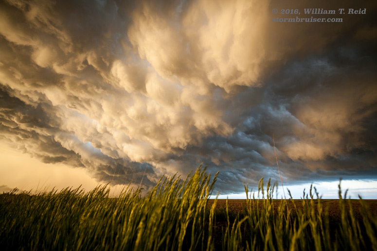
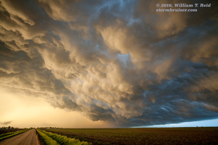
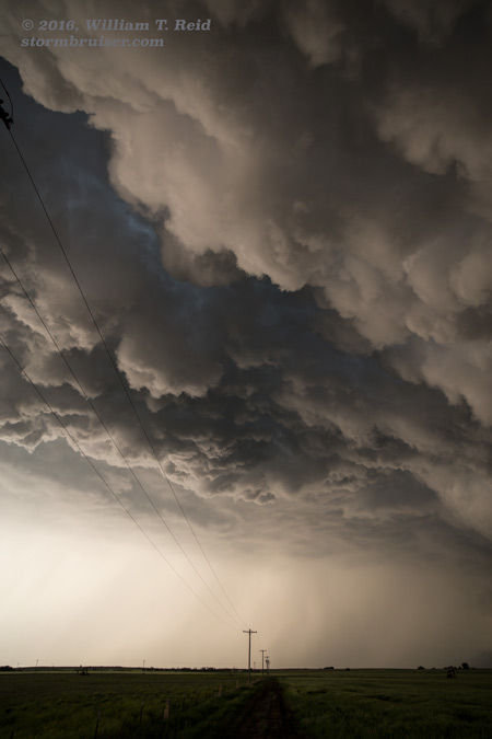
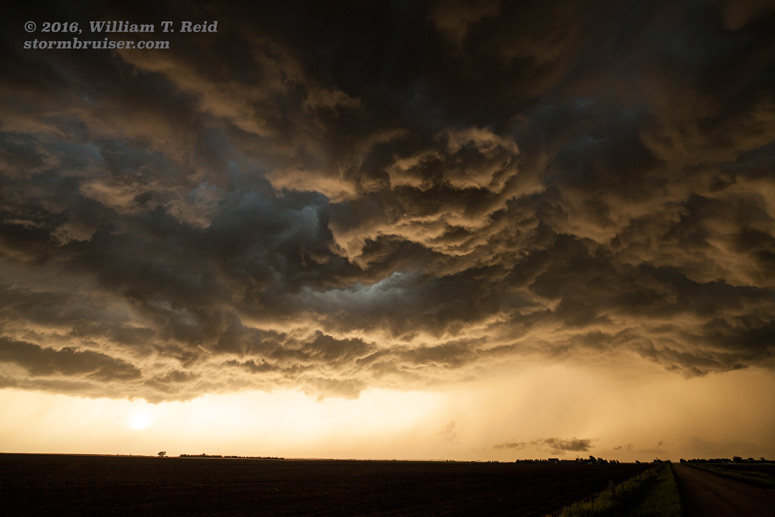
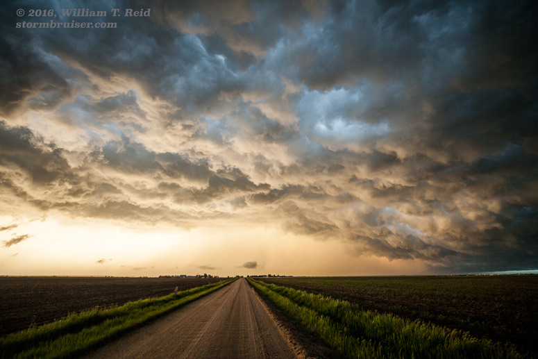
The big show was becoming the look of the sky. The back end of these storms had a wicked and turbulent look, and the wide-angle lens came in quite handy! We hurried east to Victoria to shoot the storm at sunset.
This link from NWS Hastings has some additional details on this day’s severe weather, including a radar loop. I was not able to find any other tornado pictures online from KS from May 8.
Leave a Reply
You must be logged in to post a comment.