
Start, Russell, KS; end, Belleville, KS; 360 miles; lunch at Salina
I targeted eastern KS today—and I was not sure exactly where in eastern KS. We headed to Salina from Russell for lunch and I tried to figure it out! The Oklahoma target was looking better on tornado ingredients than Kansas, but it was 5-6 hours distant and it looked like a chase into the trees down there.
spc-mesoscale-discussion-567 (OK)
spc-mesoscale-discussion-568 (KS)
After lunch I decided on playing in the backed surface winds in north-central KS. Instability was very good and 500 flow was mediocre at best. The initial activity was not too far from Salina. Several storm towers developed and moved to the NNE. None of these became strong or well-organized, though. Another storm looked nice and more isolated to our west. We headed west on 18 to Lincoln, and 20 miles beyond. But the thing sputtered. Back to the east we went, back to the somewhat strong and not-too impressive stuff to the east. Route 18 took us to Junction City, and we were in some rain with generally ho-hum storms nearby. The day was looking like a bust, but there was still an hour or two of daylight remaining, and there was still some good air lurking to our east. Press on!
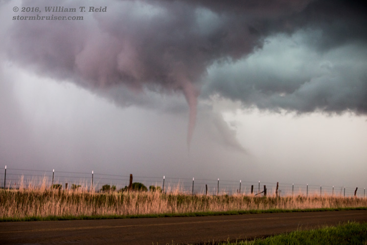
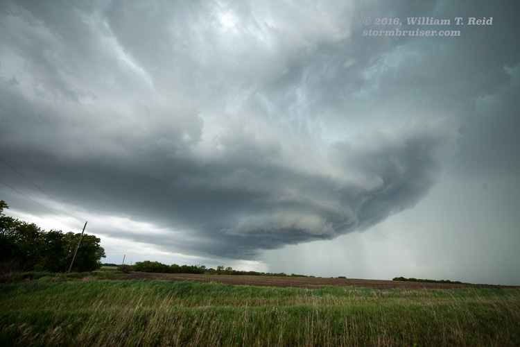
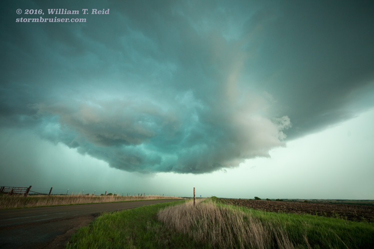
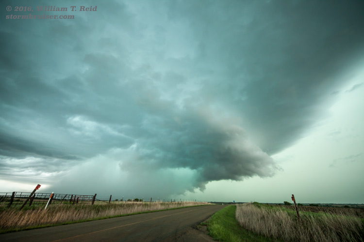
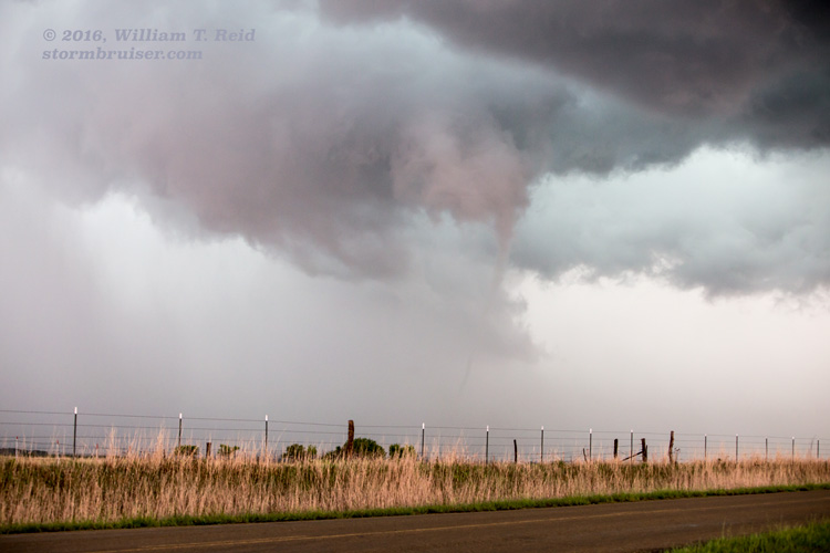
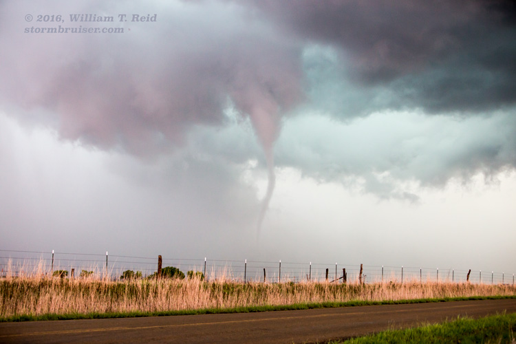
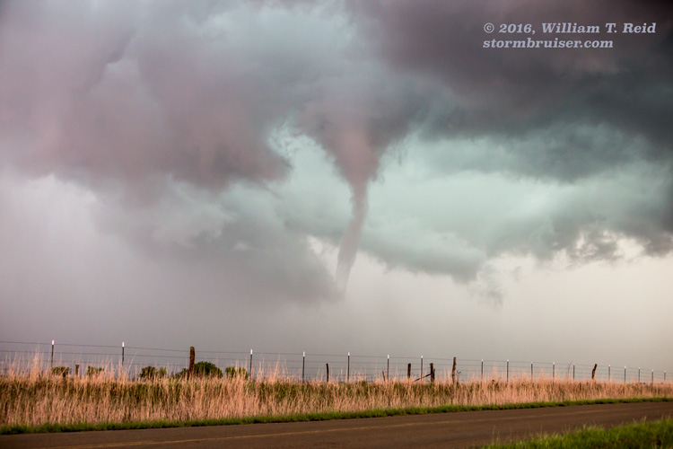
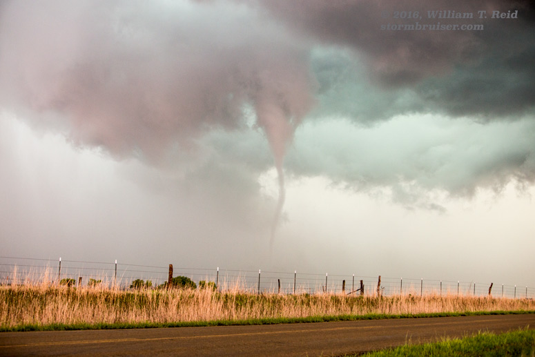
Finally, a fairly-isolated cell just north of Junction City started to get a better look. Heck, I was in this area because there WAS the chance for supercells and even tornadoes — why shouldn’t this storm start to get its act together?! The Junction City cell gradually attained a nice “spaceship” updraft appearance. It headed to the NNW and stalled a bit near Green, KS, east-northeast of Clay Center. A two-to-three minute tornado (6:40 to 6:42 p.m. CDT) occurred to our NNW, about five miles north of Green, in Clay County. That made it three days in a row with tornadoes for us — woohoo!
After the tornado, the storm went more HP, and other nearby storms were interfering a bit. The show was over, and it was time to find a home for the night. Somehow we managed to witness the only tornado reported in Kansas on this chase day.
Leave a Reply
You must be logged in to post a comment.